Newbie
July 2019 - Jul 31, 2019 14:12:02 GMT
|
Post by titus on Jul 31, 2019 6:56:30 GMT
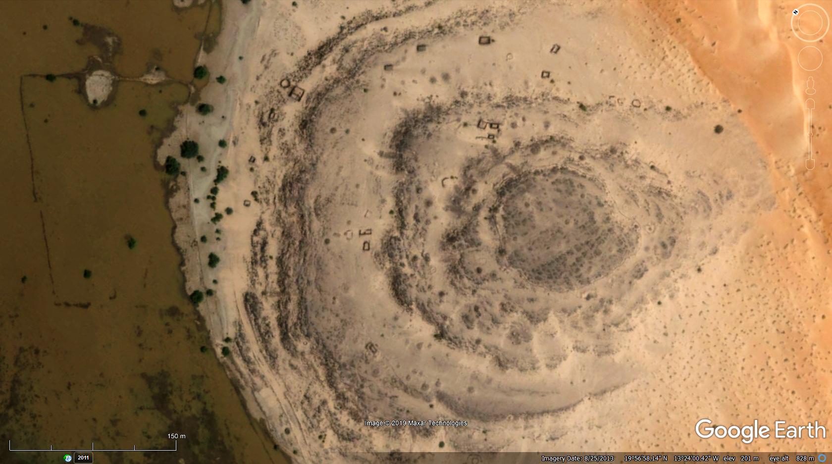
Found this randomly while looking around in the Mauritanian desert. Looks like the ruins of something... If you zoom down into the crater feature you'll see ruins of buildings and the remains of some kind of wall to the west. Looked around for info on the area but couldn't find anything. earth.google.com/web/@19.94902338,-13.40005497,204.72599822a,845.36724314d,35y,0h,15.09543013t,360r |
|
Trusted Member
account is disabled
“ Google Maps | Google Sky | Google Mars „
|
Post by ET_Explorer on Jul 31, 2019 9:12:34 GMT
|
|
Master Cartographer
April 2015 - Nov 29, 2024 19:51:05 GMT
|
Post by syzygy on Aug 1, 2019 21:35:17 GMT
Hi and welcome titus ! Nice spotting of abandoned sheperd huts and further herding facilities, also dark spots of burial mounds around there! But most interesting for me is that great, round geological structure where all this ancient, pastoral scenery takes place. Pity, until tomorrow I cannot check for more on a desktop - Google Earth...! ... Ideally checking Google Earth Community layer (and other GE Pro layers) is a precondition of posting a kmz placemark, thus also you might start with that!... (: ****************** EDIT: I have checked: no further info at site available by GE layers.  ... However also I have spotted some operating farmsteads nearby, at >>19°56'42.68"N, 13°25'42.61"W<<  operating farmsteads - Mauritania.kmz operating farmsteads - Mauritania.kmz (716 B) *** Some more related from the board, You might also find interesting: Ghost TownsAncient african stone structuresAncient saudi stone structuresMounds of (the) Earth |
|
Junior Member
June 2015 - Jul 7, 2024 14:35:49 GMT
|
Post by smask on Nov 17, 2019 10:56:00 GMT
Hi and welcome titus ! Nice spotting of abandoned sheperd huts and further herding facilities, also dark spots of burial mounds around there! But most interesting for me is that great, round geological structure where all this ancient, pastoral scenery takes place. Pity, until tomorrow I cannot check for more on a desktop - Google Earth...! ... Ideally checking Google Earth Community layer (and other GE Pro layers) is a precondition of posting a kmz placemark, thus also you might start with that!... (: ****************** EDIT: I have checked: no further info at site available by GE layers. 
|
|
Full Member
January 2020 - Jan 5, 2024 10:40:59 GMT
|
Post by leong on Jan 18, 2020 10:46:33 GMT
Indeed similar to the Pichat structure, probably both are a a deeply eroded, almost circular, dome in the bedrock. The rock was domed up there for some reason.
|
|


 To Google Earth Community Forums
