Master Cartographer
April 2015 - Nov 21, 2024 8:06:11 GMT
|
Post by syzygy on Mar 3, 2017 12:19:38 GMT
A tumulus (plural tumuli) is a mound of earth and/or stones raised over a grave or graves. Tumuli are also known as barrows, burial mounds or kurgans, and may be found throughout much of the world. /wikipedia/An example site: Gamla Uppsala, Sweden  source: wikimedia commons by OlofE source: wikimedia commons by OlofEAfter some cleaning ups I will not wait longer to share my collection, keeps growing from the start of my Google Earth Community membership. At the beginning it was only about the mounds in the Carpathian basin -where easier I could find also names of the mounds-, but once I have caught sight of plenty of them in Ukraine. Since the search has got various directions. Formerly all the additional informations, credit and acknowledgements, source studies and descriptions, stories for adopted subfolders and color legends could be found in the original oGEC forum thread but at once, on a sad day of 2019 the site has been removed by Google and all these additional informations were lost, as it seems forever... Some things important to know before download kmz content:-All placemarks were set to a proper aerial imagery date for best visibility of mounds especially which are remaining only as patterns in soil or vegetation color (soilmarks, cropmarks) but in many cases you need to set time-slider manually because of the continuous imagery updates on GE.-All placemarks are sorted into folders by global regions of today's countries and into subfolders by many other -not scientific- classifications as: - Blue triangles are placemarks with some kind of photo- or written reference given. These are set to StreetView or have image links in description or just simply near photo layer content. - Dim white triangles mark flattened mounds, existing by now only as soilmarks or cropmarks on satellite/arerial imagery. In Hungary subfolder another subgroup also signed with this, faded white mark: those have been positioned by use of old maps and have no visible realizations on GE interface. - Purple marks sorted into 'best picks' subfolders -new feature I have started to use in Romania- are to sign the most interesting sites or best examples of groups (rows, chains, fields) of mounds. - All the other color and type placemarks sign various types of funerary monuments, some of these are from different collecting phases and/or adaptations from other collectors cited in kmz content. E.g.: In the Kazakhstan folder I introduced 'square', 'circle' and 'star' placemarks for special types of funerary monuments - the so called ' dumbbells' and another structure I have dubbed 'Kazakh crescents' after their analogues from the Sahara.(!) Now I know, these are the so called ' Kurgans with whiskers' - a special type of burial monuments of the region. The 'star' placemarks are to sign other rare, "exotic" erathen structures as the Turgay triradial swastika and other so called 'steppe geoglyphs'. -Not only by these, latter mentioned groups, but by all mounds you should to try a click on placemark in the hope of getting more information (e.g. alternative name, personal notes, sources,...). - All the content is off as default. - WARNING! - Big kmz file with high number of placemarks. To avoid any malfunction (crash or freeze) after download, better check content folder by folder! *** Recent stage of updates (Main folder structure and placemark content): - Western Europe: Italy (5), Germany (17), Austria (72), France (15), Belgium (14), Holland (60), Denmark (72), Sweden (5), Norway (15), Ireland (6), Wales (2), England (77), Spain (19), Portugal (3)
- Eastern Europe: Hungary (1419), Poland (18), Czech Republic (6), Croatia (9), Serbia (135), Albania (2), Greece (49), Bulgaria (2487), Romania (2249), Moldova (399), Ukraine (6975), Belarus (4), Slovakia (7)
- Mid East: Russia(8706), Kazakhstan(10.805), Turkey(201), Israel(3), Tajikistan(31), Uzbekistan(189), Kyrgyzstan(1253), Azerbaijan(432), Iran(47), Georgia(43), Armenia(26), Afghanistan(52), Turkmenistan(59), Iraq(19), Bahrain(1)
- Far East: South Korea (32), Mongolia (2853), China (2886), Vietnam (1), Japan (2)
- Transatlantic: USA (51), Canada (3)
- South America: Peru (38)
- Africa: Morocco(26), Algeria(15), Ethiopia(2), Niger(1) - only a few examples - Check Ancient African Stone Structures thread for more!
Updates coming frequently, warning-reply only if some bigger changes or extra occurs. *** Recent Sum of Placemarks: 41.922 (That means much more individual mounds as high number of placemarks are to sign "groups", "chains", "fields", "duos", "trios", etc. of mounds.) Placemarks counter credit: kml2xls converterKMZ download: >>> Mounds of the Earth.kmz (3.05 MB) Burial mounds database for Google Earth in kmz format attached. 41.000+ placemarks, representing hundreds of thousands of individual mound-burials from around the World. This is produce of 20 years collecting work for my part. Hosting and sharing always been happened on the every-time "Live" GE Community Boards, which is now self-sponsored.If You make good use of this dataset, please donate our community! Thank You!
|
*** Related from board: all archaeo threads by archaeo, Aerial Arcaeology by me Related from oGEC: (All have been erased from the web by Google in April 2019) Placemark-thousands of The Megalithic Portal guide to 25000+ ancient sites worldwide by Andy Megalithic Neolithic sites in Arabia and East Africa by KenGrok Neolithic Monuments of the Sahara by KenGrok Historical Atlas of Eurasia by RWFG
Art of the steppe nomads by Villaman The frozen tombs of the Altai by Belizarius North American Archaeology 2013 by deansnow Thanks, g
|
|
Junior Member
October 2015 - Oct 31, 2024 19:10:15 GMT
|
Post by JacobBogle on Mar 12, 2017 8:03:23 GMT
Very nice collection. I'd like to contribute. Here's my file on every large burial mound, cemetery, and mass grave I found in North Korea. There are 992 sites, the vast majority are large burial mounds. This is based off a larger map of the country that I've also shared on the GEC Forum, you can find it here. I hope it's helpful. NK Burial Mounds.kmz (63.36 KB) |
|
Master Cartographer
April 2015 - Nov 21, 2024 8:06:11 GMT
|
Post by syzygy on Mar 13, 2017 10:33:32 GMT
Hey Jacob! Thanks! Impressive amount of work you did right there on North Korea! Have checked already your AccessDPRK files and, well: hats off! Also thank you for your contribution and valuable subfolder attached. After some filtration, editing and with proper reference given I shall integrate it some day into my collection. Keep up the good work! best, g |
|
Master Cartographer
April 2015 - Nov 21, 2024 8:06:11 GMT
|
Post by syzygy on Mar 20, 2017 10:35:58 GMT
Have already known, also have marked before the "kurgan-row" next to Zalaszántó (on the left side of the image below), but only now have found some studies that shed light on the whole barrow field of 288 tumuli. sources (hungarian/PDF format): epa.oszk.hu.pdf *** geo.info.hu.pdf
In attached folder you will find the above map as an overlay. -- Zalasznt tumuli - map folder.kmz (1 KB) |
|
Master Cartographer
April 2015 - Nov 21, 2024 8:06:11 GMT
|
Post by syzygy on Apr 18, 2017 14:18:58 GMT
Today's updates:- New placemark color appeared: Purple marks sorted into 'best picks' subfolders are to sign the most interesting sites or best examples of groups (rows, chains, fields) of mounds. (some examples -so far- can be found in Romania, several others in Bulgaria, six in Russia, two in Germany one in Moldova and one in Ukraine) One of the most breathtaking clusters I have recently found in Romania: 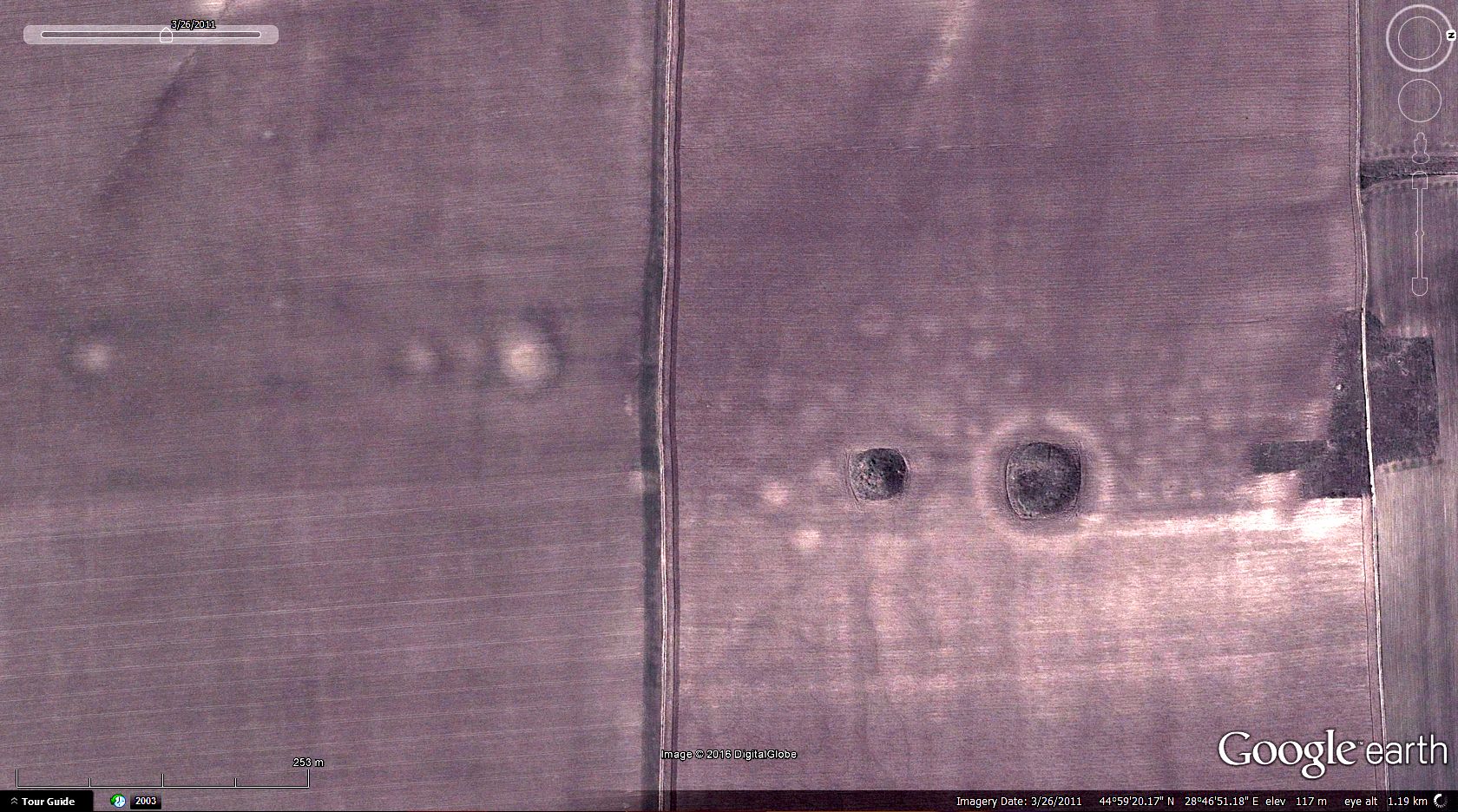 >> 44.990007, 28.781776<< (GE imagery date: 3/2011) -All sites (can be found on wiki-pages) got their placemarks in Austria. Most of the marks are equipped with some kind of image sources. (no StreetView, poor photo- or other GE layer content in Austria)  -Some additions around W Europe (Ireland, or Germany to mention). -Filling the canvas of Eastern Europe continuing...
|
|
Master Cartographer
April 2015 - Nov 21, 2024 8:06:11 GMT
|
Post by syzygy on May 16, 2017 12:35:38 GMT
Hi all! Sure, have let some unmarked, however with circa 2500 placemarks I thought to finish further search in Bulgaria:  It was a really exciting work, with hundreds of better than better sites, so here -besides doing an update alert- let's see a selection from 'Best Picks' folder of the country: 43° 5'11.22"N, 27°29'8.45"E - compact group of mounds (existing ones and some ploughed away): 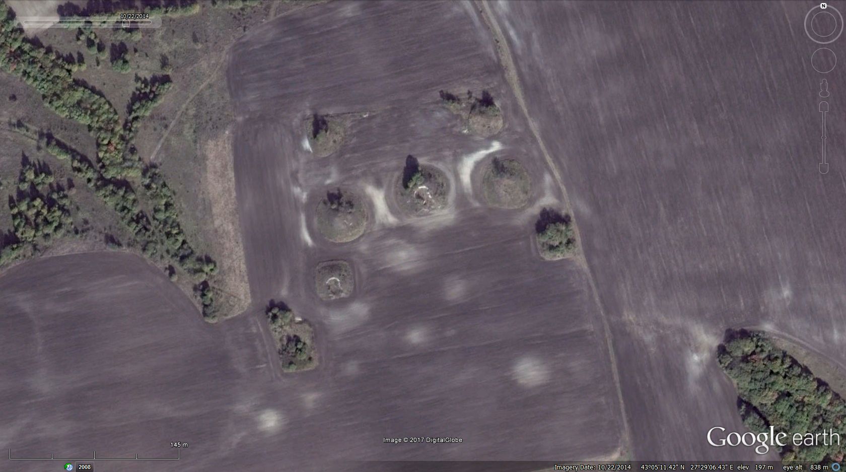 43°19'18.50"N, 26°57'44.43"E - group with square alignment on its middle section. the whole group forms a 'wavy' triangle. -notice three other members of the group as lighter, round patches in soil colour! also someone seem has thrown a burning cigarette..(: 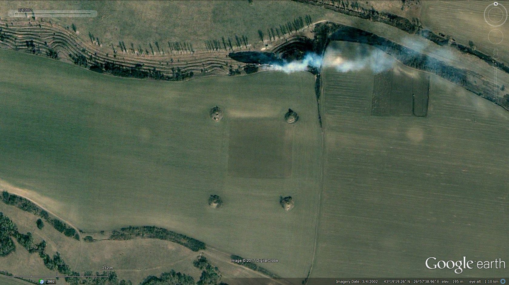 43°41'16.29"N, 28°17'11.54"E - field of one-time mounds (check soil pattern all around): 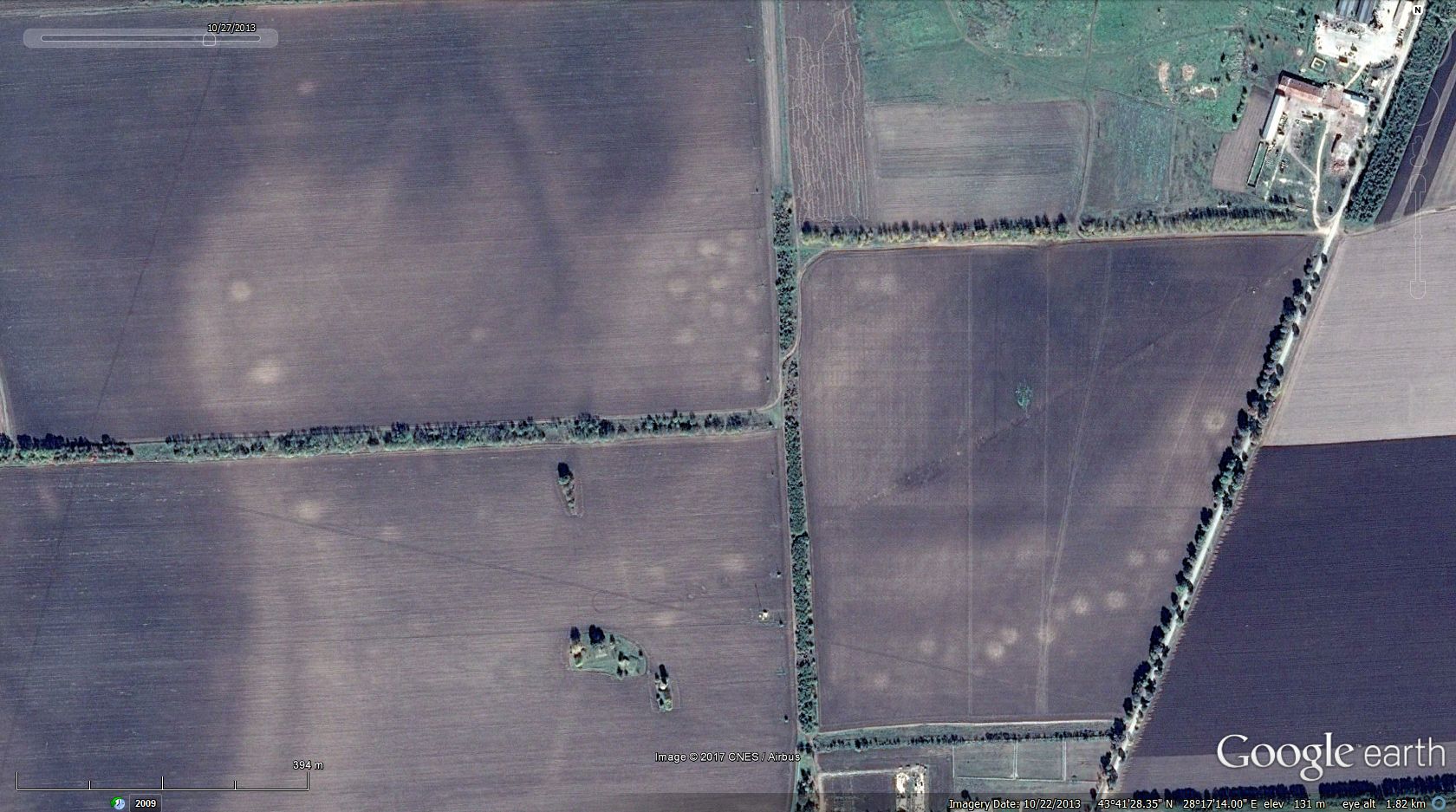 42°39'54.10"N, 26°49'54.32"E - another good example of a compact group:  See you! g |
|
Master Cartographer
April 2015 - Nov 21, 2024 8:06:11 GMT
|
Post by syzygy on Aug 2, 2017 14:02:04 GMT
Over 4700 placemarks by now and I have a feeling that this beautiful country will never be finished so: After browsing through tons of maps and articles and stared at the monitor seeking mounds on GE imagery until teardrop for months, I will not wait longer to share some 'Best Picks' from Russia. kurgan field:  complex chain system of mounds:  mound cemetery partly submerged:  huge field of 40-50 mounds:  swarm of smaller mounds within a kurgan field:  burial mounds hidden in the swamp:  circle of mounds: 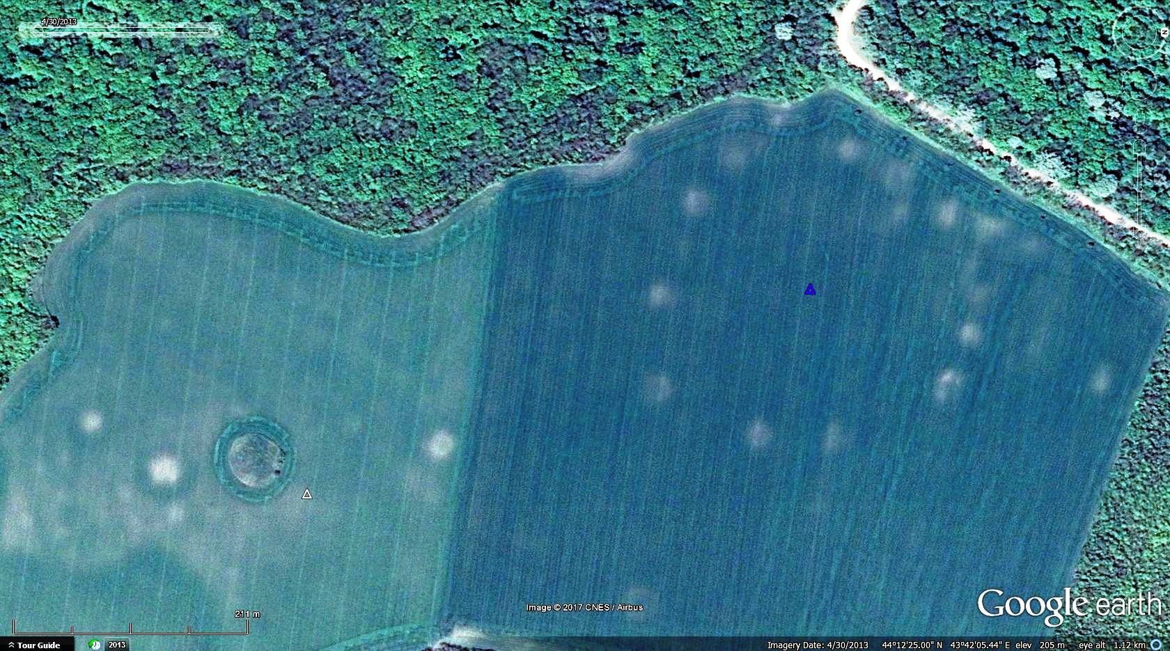 As have said; Russia is not done at all. Stay tuned for further updates! |
|
Master Cartographer
April 2015 - Nov 21, 2024 8:06:11 GMT
|
Post by syzygy on Sept 1, 2017 6:55:48 GMT
As I have passed some 4400 placemarks in Ukraine, country's 'Best picks' subfolder enriched also with sites, where square shaped soil pattern can be seen on imagery next to mounds. Side lenghts are vary from 50 to 150 (200) meters. (some examples):  . 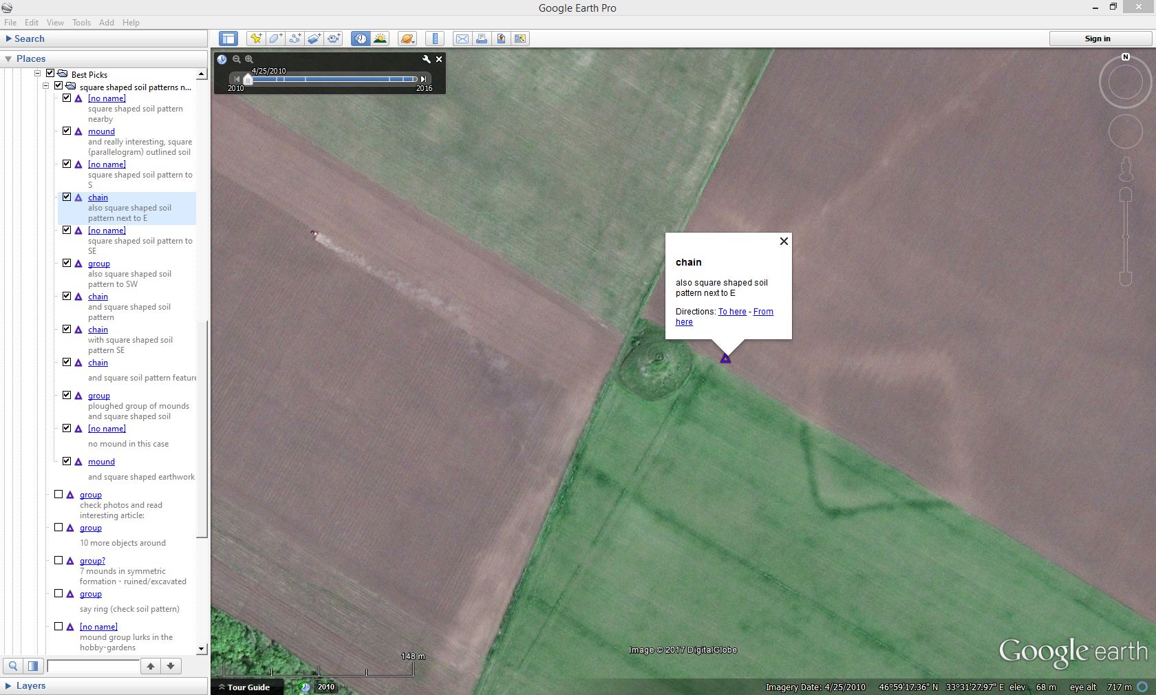 .  Only yesterday have bumped into this one, where not only a "ghost feature", but a real, 3D, square shaped earthwork exsists next to a mound:  Would this be the explanation for all cases and at one time all the "ghosts" were such water reservoirs (or not sure what)? If yes then why all these seem to be so misplaced, misshapen and different? And why always next to mounds? (21 examples in attached kmz folder:) square shaped objects next to mounds.kmz (2.98 KB) (This kmz attachment is part of the main file attached to original post and taking place in subfolder: Eastern Europe/Ukraine/Best Picks.) |
|
Junior Member
October 2015 - Oct 31, 2024 19:10:15 GMT
|
Post by JacobBogle on Sept 24, 2017 6:56:13 GMT
While working on my Fortress Earth project, I came across this apparent mound in a small village in Georgia. It also lies less than 8 km east of the ancient city of Nokalakevi. Abedati Mound.kmz (803 B) |
|
Master Cartographer
April 2015 - Nov 21, 2024 8:06:11 GMT
|
Post by syzygy on Sept 25, 2017 10:34:37 GMT
Hey Jaco! Funny coincidence, yesterday one of my favorite bass guitarists called Jaco Pastorius (on record), today you with the same given-name have made my day!(: 3 more sites nearby I have added to yours and the Georgia folder has been born! Thank you showing me another direction with your valuable placemark again! *** EDIT: by last update Georgia has 20 placemarks, also 'Best Picks' folder where you can find a site with question mark. check thousands of small earthen mounds NE, E, SE and S of Machatia ( 41°26'32.64"N, 43°31'30.38"E ) as far as I remember,have seen such mound cemeteries in your DPRK file. need your opinion, whether this can be that kind of burial field too? -hope these are not only piles of straw...(: *** (updated kmz file attached to original post) |
|
Junior Member
October 2015 - Oct 31, 2024 19:10:15 GMT
|
Post by JacobBogle on Sept 27, 2017 5:19:09 GMT
Those very much look like burial mounds. I did a little bit of extra research, and Georgia seems to have several clusters of kurgans, many are well over 2,000 years old!
|
|
Master Cartographer
April 2015 - Nov 21, 2024 8:06:11 GMT
|
Post by syzygy on Sept 27, 2017 8:11:01 GMT
it was so annoying, that no photo layer content seemed to show these features, so tried to find similar locations around and finally have found something. still not the best, but check photo layer nearby my blue triangle some 15 kilometers SSE of the purple one in question, and try two closest 360 Cities photo spheres. (updated kmz file attached to original post) so, earthen mounds for sure, but still strange: many infos on the web about underground villages, cyclopean stone structures, forts- and monastery ruins, but nothing I can dig up that would explain these large step mound cemeteries... *** meanwhile have found several more similar sites in Armenia ... (reply post subject row edited, Armenia subfolder added to updated kmz file, attached to original post) |
|
Master Cartographer
April 2015 - Nov 21, 2024 8:06:11 GMT
|
Post by syzygy on Dec 6, 2017 9:00:16 GMT
older Country folder, but just have found another good browsing direction by the lower streams of river Ural, also another question by me occured, so decided to make this Kazakh-update post and ask for some expertise. example from the lower Ural river region:  48°50'13.58"N, 51°41'34.92"E also more nice examples of classic Kurgan fields and -rows  52°43'11.96"N, 76°26'29.16"E and other interesting sites in 'BestPicks' subfolder are available: donut shaped earthwork, probably an original 3D version of the ones I have spotted thousands of kilometers away. secondary burials can be noticed on the top of feature.  42°59'45.48"N, 72°48'21.13"E many smaller 10-15 meters diameter circles I have found by many locations. probably just adobe production sites, but I would need some expertise by these.  48°46'10.13"N, 52°56'10.21"E Placemarks for these and for many more you find, downloading file attached to original post. |
|
Master Cartographer
April 2015 - Nov 21, 2024 8:06:11 GMT
|
Post by syzygy on Dec 14, 2017 14:49:07 GMT
Recent find of mine from Kazakhstan is probably the most spectacular pattern of mounds I can look up in my 'Best picks' selection of 2017: "Burial Art" Full size screenshot Full size screenshotLocation: 47°36'52.36"N, 83°33'40.70"ELet me wish happy holidays and the very best for the new year with this screenie to all nGEC board members around this thread!See You next year! g |
|
March 2015 - May 1, 2023 4:20:37 GMT
|
Post by diane9247 on Dec 16, 2017 10:12:46 GMT
That is, indeed, an large number of mounds in one place, syzygy. You've done an impressive amount of work on finding these! Is there any information about the significance of the different sizes in, for instance, Kazakhstan?
Merry Christmas, Happy Hanukkah and Happy New Year to you and everyone in the community!
|
|
Master Cartographer
April 2015 - Nov 21, 2024 8:06:11 GMT
|
Post by syzygy on Dec 18, 2017 8:57:14 GMT
That is, indeed, an large number of mounds in one place ... not because it is the most numerous cluster of mounds, but its shape, the pattern that made this my favorite of the year. ... Is there any information about the significance of the different sizes in, for instance, Kazakhstan? on the vast eurasian steppe zone, cultures followed each other since ancient times (scythians, huns, sarmathians, sauromathians, kipchaks, and so on, only the good old Lord and well educated historians know how many groups of people with mound burials). size differences can occure both from same culture's burial (a big leader got bigger kurgan than a smaller noble of the same group of people), also from different cultures, when for example smaller cumanian mounds take place next to- or integrated into a -for example- scythian burial site with its bigger kurgans, besides in many cases we see secondary or third-, fourth-, ... usage of a burial site even up till our days. (e.g. new-age cemetery on kurgan-tops or tell-hills) I am not a scholar anyway and by the exception of one-two sources I know nothing about the origin of the thousands of the sites I visually identify on aerial imagery. must not be a coincidence that archaeologists spend 5 years at university and work through a life to be able to identify creators of different types of mounds. I have already contacted numerous local (and not local) archaeologists, but all these seem to be so tight-lipped and busy, that I could not earn much info this way. (also true, I have no such amount of time in one that I could do a try to dig up some notable) after I have finished to placemark all mounds around the world (never), the second round will be to sort placemarks to more scientific cathegories than only "image source", "no image source" and "best picks"!(: |
|
Master Cartographer
April 2015 - Nov 21, 2024 8:06:11 GMT
|
Post by syzygy on Jan 12, 2018 13:05:14 GMT
for a first browse-through of Mongolia here you are 307 placemarks by date of this posting. 3 favorites from 'Best Picks' folder: 1. Burial field with great patterns (square, circle, barred circles):  48°29'52.80"N, 88°57'43.16"E 2. Children's hill (sacred place) 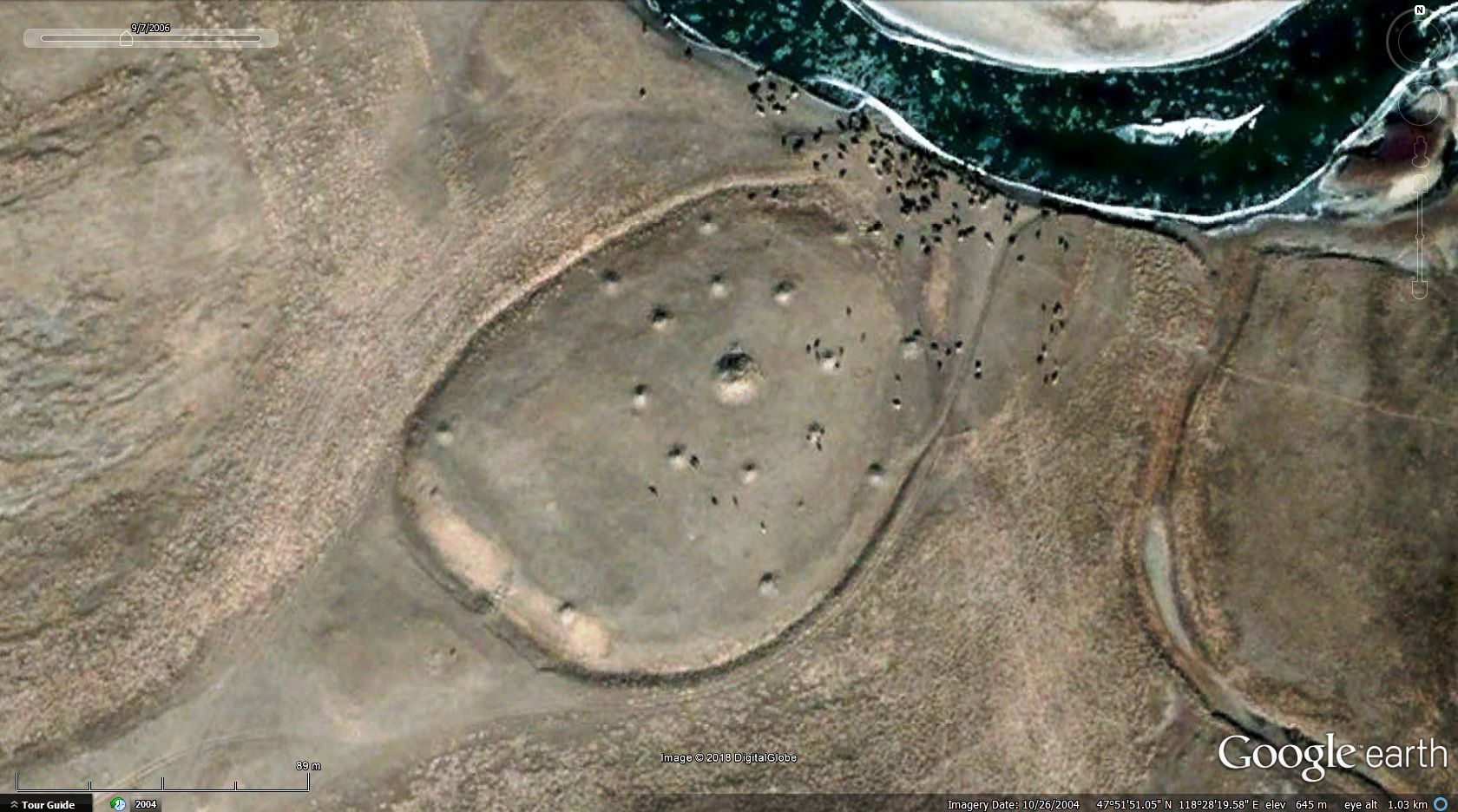 47°51'52.21"N, 118°28'21.59"E 3. Kurgan with interesting pattern (additional mound cemetery?) around: 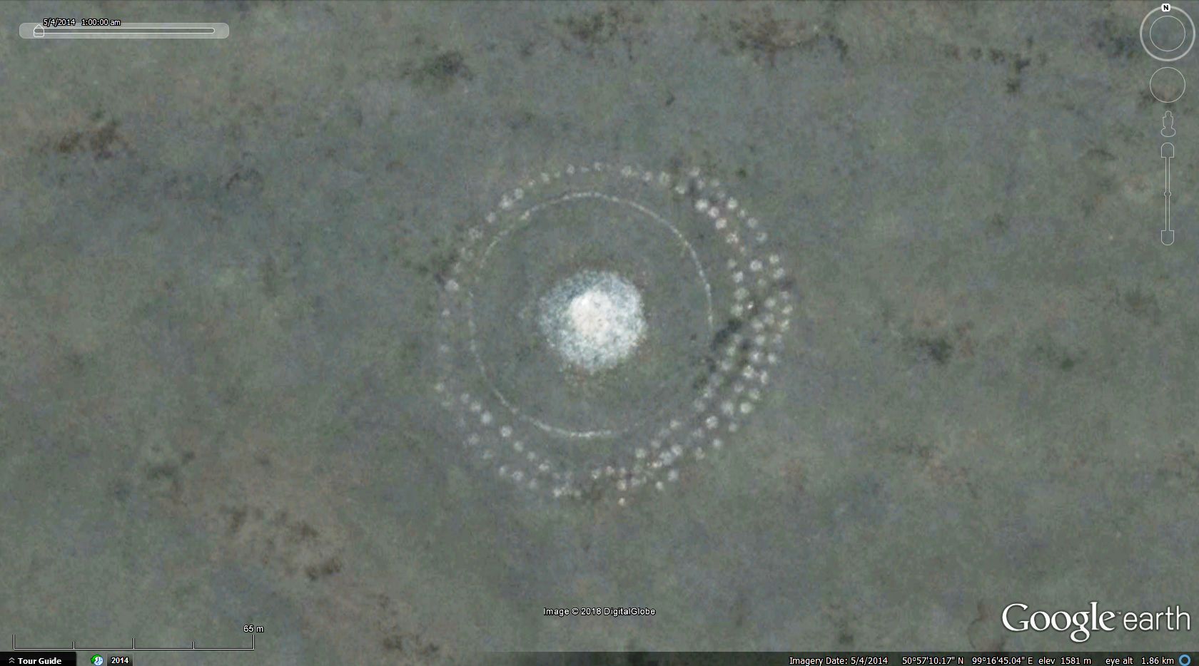 50°57'11.90"N, 99°16'45.87"E have found other similar sites to this one and one of the biggest questions about this update is that: what are these smaller features around? -my best bet in brackets above. |
|
Master Cartographer
April 2015 - Nov 21, 2024 8:06:11 GMT
|
Post by syzygy on Jan 22, 2018 12:56:39 GMT
Once I have done a try, but by the exception of the Xanadu site and another from Tibet it seemed, I could not find more in that huge country... Some days ago as I have entered China (by Google Earth) from western directon, at the Tian Shan mountains I could not believe my eyes: Every kinds and formations of burial mounds everywhere! 3 sites (site details!) from 'Best Picks' subfolder: long chains of burial mounds:  42°52'34.30"N, 80°40'48.90"E kurgan row with rectangular shaped member:  42°41'17.10"N, 80°33'15.28"E detail of large scale burial field with kurgans equipped with barred circle features:  43°16'7.46"N, 82°31'8.07"E I will not leave these valleys for a while I think... Best! g |
|
Master Cartographer
April 2015 - Nov 21, 2024 8:06:11 GMT
|
Post by syzygy on Feb 2, 2018 12:38:21 GMT
after have sticked 1000+ placemarks this week, I just cannot stand not to post a selection from Kyrgyzstan before the weekend. also other countries (check OP: "Recent Update Directions") were updated by some 15-20 marks, but the main change is the some 1000 sites from The country of 50 clans: 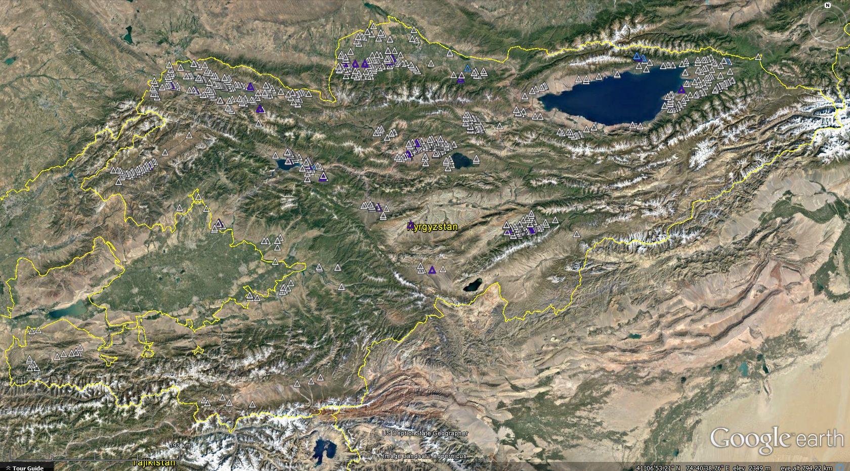 with this update we have: nice patterns aligned to nature:  long, long rows: 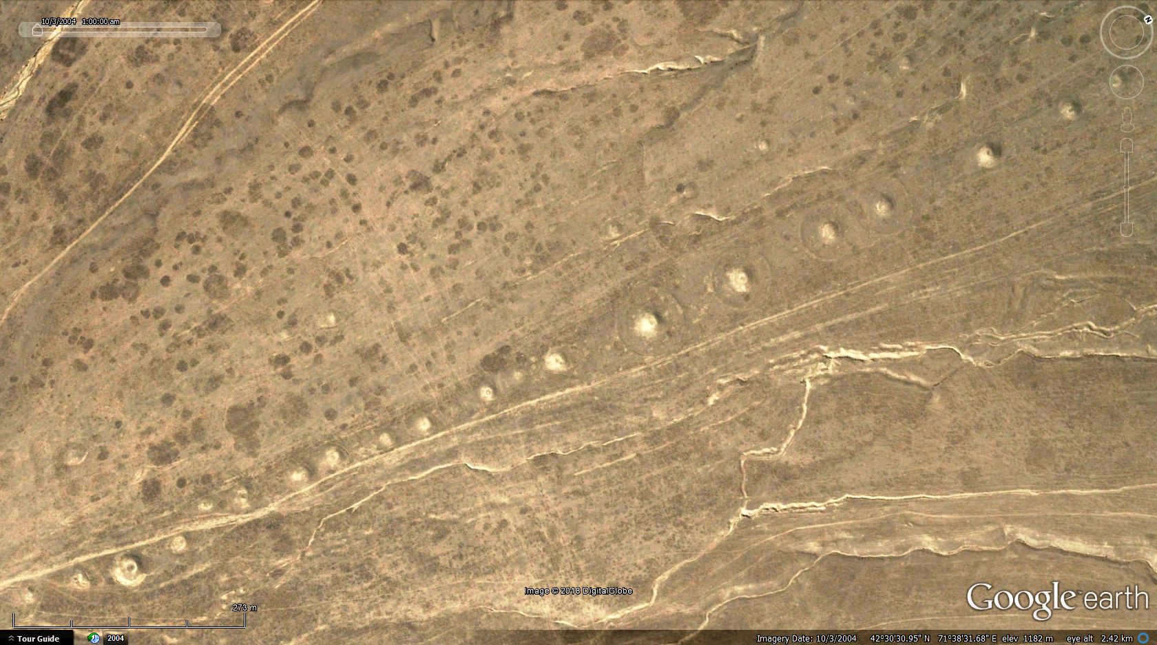 vast burial fields with chains of kurgans:  >>41.91634,74.45726<<  examples for secondary burials on kurgan bodies: 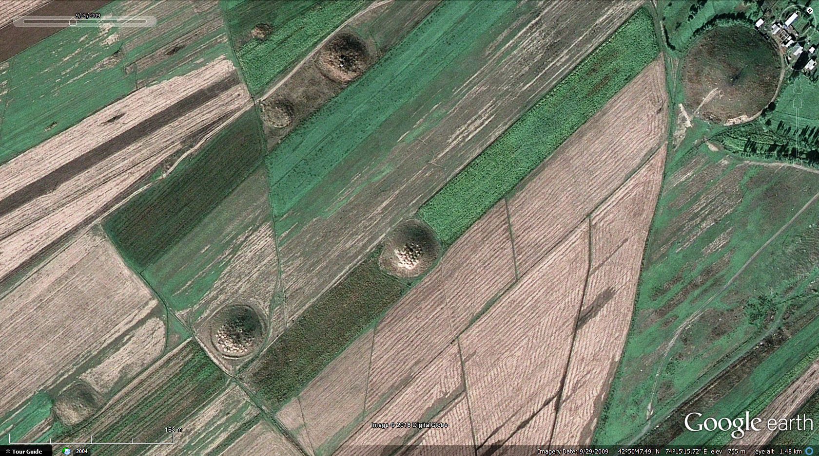 examples for mounds under destruction of human (periodically submerged mound field by the shores of artificial water reservoir):  and an example for mounds under destruction of nature (mound bodies being slowly eaten by natural erosion): 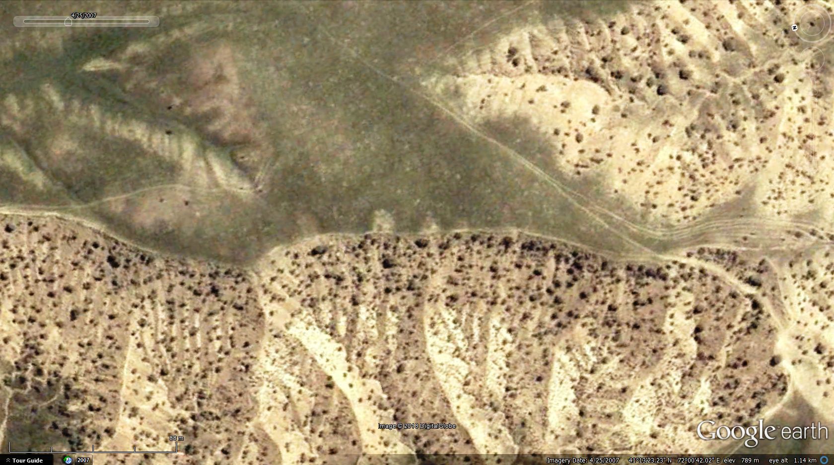 and not only the archaeological treasures, but the beautiful landscape; the lakes and mountains that made this one a favorite country of mine from the Mid East region. best, and have a nice weekend! g |
|
|
|
Post by spacecowboy2006 on Feb 3, 2018 5:34:02 GMT
When I visited Cahokia Mounds in Illinois, just east of Saint Louis, MO, my one overwhelming thought was, "Man thats a lot of piling on!" I was also amazed by the level of sofistication those people had in their culture, on display in the museum.
|
|
Master Cartographer
April 2015 - Nov 21, 2024 8:06:11 GMT
|
Post by syzygy on Feb 5, 2018 9:07:14 GMT
when we speak about (ancient) history, more archaeology one cannot forget the (suspectable) very big difference of thoughts and feelings, those people had in their very different times.
todays' men cannot imagine what worship could be existed for a person who got such burial, besides must not forget, in many cases these big mounds (and other burial monuments) were built by slaves.
those times, the 'word given' had value, but one word was enough to terminate human lives.
they have sophisticated art, developed science so as detailed methods for war and kill.
they needed to have, one should say. -and now?
still we need to have, only no value of the 'word given', no worship for no one, no interest for arts and science, just the money for being able to keep consuming.
who cares whether they or anyone get a kurgan in the end or just being thrown into the cesspit. -not all the same? -they say. -there is nothing after the end.
one of the bigest differences I think, that ancient people rated pre- and after-life much higher than their (expectably) short lives. -and they had much more faith than volition we have today.
...
sorry if tone of reply was written in a somewhat bitter mood!
sad (cultural, behavioral) tendencies I see around me and most sad to face situation in elementary schools:
"There are no bad children, only bad parents." -old saying states, but hey, then how many bad people around?! ... ):
...none deserves a kurgan anyways...(:
|
|
|
|
Post by spacecowboy2006 on Feb 6, 2018 23:24:41 GMT
I know. And people now are totally disconnected from nature.
|
|
Master Cartographer
April 2015 - Nov 21, 2024 8:06:11 GMT
|
Post by syzygy on Feb 7, 2018 7:50:06 GMT
...people now are totally disconnected from nature. ...and each other as well. sad, that the more think the most effective way to keep contact and know nature can be realized through smart devices... ...the more I feel myself within a world by Asimov... |
|
Master Cartographer
April 2015 - Nov 21, 2024 8:06:11 GMT
|
Post by syzygy on Apr 26, 2018 14:14:01 GMT
nothing has changed since last update, only I would like to share some interesting details about one site, based on a study from 2013, I have just found.  Two Scythian, Iron-age kurgans surrounded by dozens of round-ditched Sarmathian burials become visible on magnetogram. (Felsőzsolca, Hungary) /Ongai Kettős-halom (48° 7'4.21"N, 20°52'54.90"E)/ source: www.okeonga.hu/documents/om/zsolcahalmok.pdf (hun.) |
|
Master Gamer
April 2018 - Nov 20, 2024 20:32:38 GMT
|
Post by willi1 on May 30, 2018 14:19:43 GMT
In the vicinity of Pisa (Italy), only in 1994 a tumulus from the first quarter of the seventh century BC was discovered and exposed. The burial mound was baptized "Tumulo del Principe Etrusco" and is the oldest monument in the Pisa area.
|
|
Master Cartographer
April 2015 - Nov 21, 2024 8:06:11 GMT
|
Post by syzygy on May 30, 2018 14:39:01 GMT
Thanks a lot willi1! Now we have 2 tumuli from Italy! (:
OP and its kmz attachment updated!
|
|
Master Gamer
April 2018 - Nov 20, 2024 20:32:38 GMT
|
Post by willi1 on May 30, 2018 19:06:37 GMT
In Krakow (Poland) there are also mounds from different times. 1. Kościuszko Mound: 36 m high, 1820-1823 piled up in honor of the Polish national hero Tadeusz Kościuszko 2. Krakus Mound: 16 m high on the natural Lasoty Hill, is generally considered the tomb of the legendary founder of Krakow King Krak and his sons, built in the 7th century AD on a prehistoric burial mound of Celtic origin from the 2nd-1 , Century BC 3. Wanda Mound: 14 m high, probably erected in the 7th century as the burial mound of the daughter Wanda of the legendary ruler Krak 4. Piłsudski's Mound: 35 m high, 1934-1937 piled up in honor of the Polish national hero Marshal Józef Piłsudski
Kościuszko Mound
Krakus Mound Wanda Mound Piłsudski's Mound
Attachments:Krakow Mounds.kmz (987 B)
|
|
Master Gamer
April 2018 - Nov 20, 2024 20:32:38 GMT
|
Post by willi1 on Jun 9, 2018 12:17:36 GMT
The Tumulo di Montecalvario (Castellina In Chianti, Italy) has a diameter of about 50 meters and consists of four underground tombs with main chamber and side cells. Already in the 16th century he was known and was plundered. Rediscovered and excavated in 1915. The sparse finds allowed the hill to date to the end of the 7th century BC. It is a tomb of an Etruscan ruling family, as was concluded from the finds.
|
|
Master Cartographer
April 2015 - Nov 21, 2024 8:06:11 GMT
|
Post by syzygy on Jun 11, 2018 14:10:38 GMT
... tomb of an Etruscan ruling family,...] thanks other example of Etruscan burials and your other contributions as well! always have found interesting the level of similarity between Hungarian and Etruscan runic symbols with such different sound values. |
|
Master Gamer
April 2018 - Nov 20, 2024 20:32:38 GMT
|
Post by willi1 on Sept 14, 2018 18:32:45 GMT
The Herstappetombe is a Gallo-Roman burial mound southwest of Herstappe in the province of Limburg in Belgium. The tumulus has a diameter of 32 meters and a height of 8 meters. In 1895 the tumulus was examined by F. Huybrigts and found the hill empty. However, traces of earlier excavations were discovered, probably the drilling of French soldiers in the 17th century.
|
|


 .
. .
.


