Master Cartographer
April 2015 - Nov 4, 2024 15:15:52 GMT
|
Post by syzygy on Feb 14, 2022 8:38:59 GMT
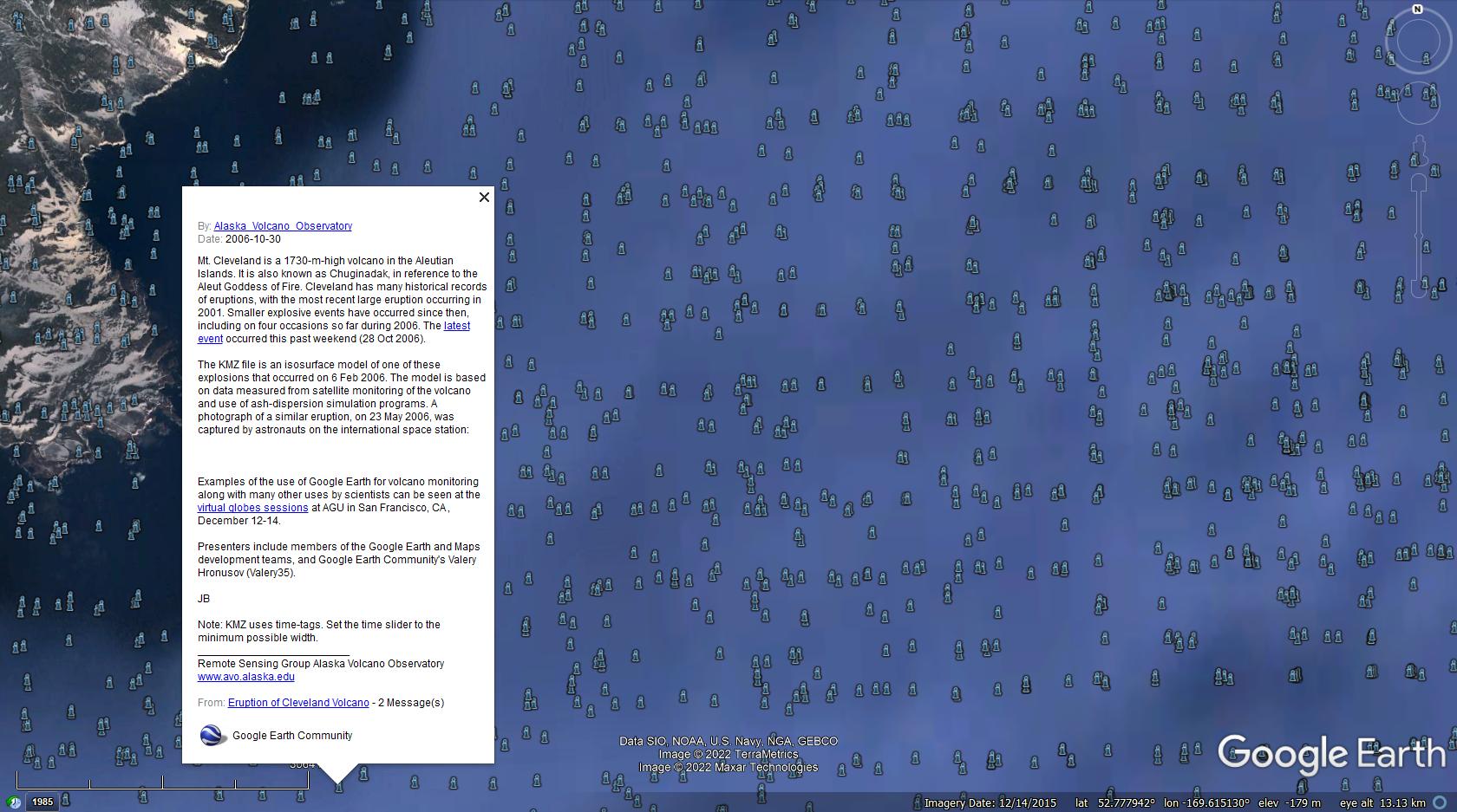
While searching for an old anwser around the Aleutian Islands, suddenly I have find myself in a thick cloud of GEC layer marks, all coming from the same oGEC post about Mt. Cleveland 2006 eruption. Turn GE/Gallery/GEC layer on after downloading kmz: Blue i flood.kmz (763 B)  Reading description turns out that these are spatial points of a 3D iso-surface model that somehow got into layers... Well, if there are more such examples when poligonal elements are displayed as clusters of their breakpoints in GE layers, then this is something that could have been a compelling argument by to stop public GE layer-building. However I am not sure if it were a general GEC layer glitch - I think this was because in this case a polygon kmz was posted to a "Layer-forum" (..nature-science-moderated..) and not to "3D models" subforum where it would have stayed without going to layers. (?) Was not it solved in the old system to avoid such annoying data displays to occure? May tek or someone else from the old staff could tell some closer on this... |
|
Wizard
March 2015 - Oct 14, 2024 15:03:31 GMT
|
Post by tek on Feb 18, 2022 21:28:18 GMT
Google wanted everything to be layered. No problem there. It was the moderators who used their discretions. But in this specific case, it looks like the fact that the collection is a timeline collection misguided a moderator.  |
|


