Master Cartographer
April 2015 - Nov 23, 2024 9:19:49 GMT
|
Post by syzygy on Apr 7, 2020 7:06:45 GMT
EDIT:
original thread title: geoglyph? land-art? symbol? - Algeria______________________________________________ Recent spottings from Algeria (Also as another ' whadda heck' on GE.) Geoglyphs of an ancient symbol, does it sign something, aviation marks or scars of some geo-survey method? Still I have no idea... *Important note of the editor:All the ZoomEarth links you find in this forum thread are now outdated. - In kmz content all these are changed to BingMaps links with good resolution satellite imagery for all sites. 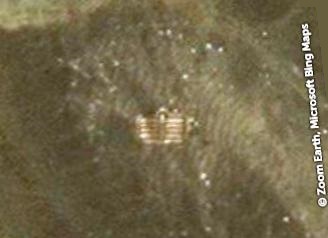 ZoomEarth link ZoomEarth link - (good resolution on GE as well) example II.:  ZoomEarth link ZoomEarth link - (no good resolution on GE by this) example III.: 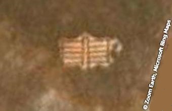 ZoomEarth link ZoomEarth link - (no good resolution on GE by this) Recent stage of updates: 12 sites (plus 1 "beta" structure and line, pointing to Mecca) Desert mosques by Emedi - Immidir Plateau A....kmz (2.92 KB) Any explanation? (sorry if already been shared; ... somehow looks familiar to me...) Thanks! G ... EDIT by Explanation: - these are desert mosques built by Emedi, a lonely touareg in the last 40-50 years. (check this post in the thread for details!)
|
|
Junior Member
September 2015 - Feb 7, 2022 16:28:59 GMT
|
Post by siggi on Apr 10, 2020 21:11:32 GMT
I am guessing it has something to do with water. All locations are close to seasonal rivers/wadis, although I don't know why some are on the slope and others seem to be almost in the plains.
I don't ask how you always find these mysterious places... :-)
|
|
Master Cartographer
April 2015 - Nov 23, 2024 9:19:49 GMT
|
Post by syzygy on Apr 13, 2020 10:45:26 GMT
Hi siggi master! Really I do not know how far these are related to water, but the more I think "P" shapes on the upper right of these "symbols" are close ralatives of that "PPP" on the top of this something not far. Pity, until tomorrow I cannot take a look at all these positions on GE to search other clues and features, but won't be sad if you will be the first! (; ... ...I don't ask how you always find these mysterious places... If you'd ask then my answer would be something like: "It's not enough staring at GoogleEarth 24hrs/day, also in every moment of your search you have to feel the need to find-, in every millisecond you have to be ready to spot something - or something else!" - just check my avatar...! (; ... Update 2020.04.14.: 3 more "symbol" sites from the same geological unit attached to OP! To follow screenshot-listing of the "symbol" sites: example IV.:  (good resolution only on ZE imagery) example V.: 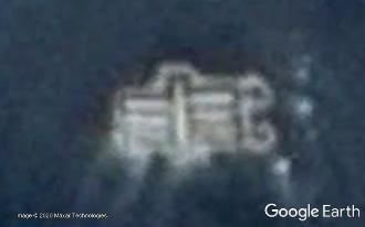 (good visibility also on GE) example VI:: 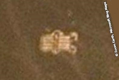 (good resolution only on ZE imagery) ... Update 2020.04.14.: example VII: 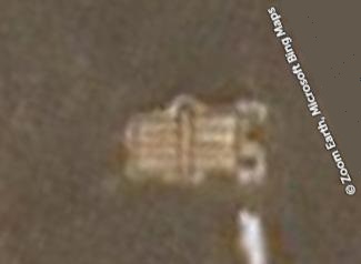 ZoomEarth link ZoomEarth link (low resolution GE imagery) example VIII.:  ZoomEarth link ZoomEarth link (low resolution GE imagery) I see, what you mean siggi; these are from areas with similar characteristics as well ...still I am not closer to the solution. - No map references, no search results, no image-search results so far... (even my "P" concept seems to fail) |
|
Trusted Member
Master Gamer
April 2015 - Sept 6, 2023 12:33:10 GMT
|
Post by bridgeplayer on Apr 21, 2020 21:33:55 GMT
It’s on a river bank. I doubt that you could get there by boat. The river doesn’t look navigable, but a helicopter could land there.
My imagination ran amuck and saw a book in it:
|
|
Master Cartographer
April 2015 - Nov 23, 2024 9:19:49 GMT
|
Post by syzygy on Apr 22, 2020 8:05:28 GMT
Hi BP, thanks for thoughts! - Nice one with the book-analogy!(: Well, at this stage of research, trying to summarize what we know about these (8 sites at the moment): -these are roughly 6X12 meters stone structures with circa 1-1,5 meters wide clean bands and half-circle attachments on one of the short sides,
-each one is oriented to two directions - 2 are aligned to NW and 6 to NE regardless to local surface profiles,
-6 are placed on high-banks or drainage basins, but one is on a local hilltop and another one can be found on a plateau,
-each one is situated on "easy-to-spot" places, close to Wadis (I have edited kmz and have changed placemark view settings to a 3D view for each site.)
-these are seem to me as old, but not that ancient stone structures.In my cross-post to F&G willi1 has mentioned his concept of temporary corrals and a probable better grass yield within the frames, but still I think that these are not functional structures, rather navigational, geological, religious or other sort of signs or symbols. Simply beacuse I think these are too small to be functional, also there are no traces of human (or wildlife) activity around them. No wells, no oases, no huts or other buildings, no roads or paths nowhere... only these lonely symbols made of dark, volcanic rocks... |
|
March 2015 - May 1, 2023 4:20:37 GMT
|
Post by diane9247 on Apr 27, 2020 11:18:50 GMT
Syzygy, my hunch, too, is that they have some religious purpose and like you, I see them as old, rather than ancient or pre-historical. Since I have almost no knowledge of Muslim symbolism, this is where my hunch ends. A very small clue shows that the local people use whitewash to paint the upper parts of some buildings. That is far from anything I would call evidence of anything, though. See my file below. Where is Ken Grok when we need him!  His many placemarks in the same area are dated 2009 and the white symbols must not have been visible in that imagery, or he would have seen them. There has been a lot of human activity in the region, as shown by photos of 4WD vehicles, among other things. How odd that no one has photographed these strange items...but, they haven't photographed the stone crescents, either. They seem to be placed randomly, but maybe there was some "system." This is exactly the kind of thing that used to drive several of us crazy for months in the oGEC! I'm going to try some searches. Why not, I'm cooped up all by myself these days. Photo clue Amguid.kmz (806 B) |
|
Master Cartographer
April 2015 - Nov 23, 2024 9:19:49 GMT
|
Post by syzygy on Apr 27, 2020 13:03:36 GMT
...This is exactly the kind of thing that used to drive several of us crazy for months in the oGEC! ... Hallo...! Here I am...! And cannot be more crazy...! (: So glad you have joined thread to take these words from me, also that you do your try to soothe my aching curiosity! Yesterday I have got in contact with the WGE to make it a post also there and..., and now I plan to let it for a while. ... Nope, ... I do not think these have anything to do with whitewash or any additional coloring - only dark colored volcanic rocks are aligned on lighter colored bedrock surface as I think. |
|
Master Cartographer
April 2015 - Nov 23, 2024 9:19:49 GMT
|
Post by syzygy on Apr 28, 2020 6:28:34 GMT
9th piece, I have found right now is unique in it's N-S orientation - ... probably these have nothing to do with orientations...? 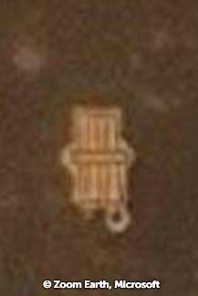 ZE link ZE link (also good resolution on GE) The 10th is a two-ring featured, NE-SW oriented one. (I keep this kmz subfolder structure until better concept)  ZE link ZE link (also good resolution on GE) Also have spotted this one, I have dubbed "beta": 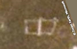 ZE link ZE link (also good resolution on GE) Dimensions (and orientation) pretty well fit however it is not more than a sketch of the discussed structures. Ending(?) let me introduce symbol XI., ZE link ZE link (also good resolution on GE) and symbol XII.:  ZE link ZE link (also good resolution on GE) Dimensions perfectly fit the others', orientation is some NNE-SSW by these latter two. (still I keep kmz subfolder structure for an unknown reason...) --- updated kmz file attached to original post. --- edit:...Where is Ken Grok when we need him!  His many placemarks in the same area are dated 2009 and the white symbols must not have been visible in that imagery, or he would have seen them. ...; I have forgotten to respond, that Ken Grok yet was been around so there was hi-res imagery also that time at some of the symbol locations, only these are looking dots of natural abrasion from an eye-altitude, where his stone monuments are still clearly visible.  (check symbol IX. and nearby crescent monuments on GMaps at different zoom levels for example.) My first spotting was due to a lucky "over-zoom" with the mouse-wheel.
|
|
Trusted Member
Master Gamer and Scrutiniser
April 2015 - Nov 23, 2024 7:47:19 GMT
|
Post by krenek on May 1, 2020 5:56:10 GMT
Now it is your turn > HEREi searched (of course), even in arabic (that i do not speak), with no really interesting results... though, i found out that (french) soldiers sometimes created such "things"... |
|
Master Cartographer
April 2015 - Nov 23, 2024 9:19:49 GMT
|
Post by syzygy on May 5, 2020 8:27:03 GMT
Something at last! - Unsatisfactory explanation, but photo of "symbol IX." and some guessing about function in a Sahara Overland Travelogue on Immidir plateau, Algeria I have just found: Well, guy sniffs places of worship, but admits that these were unknown for him before, so still we must not reject our other concepts of origin and function. Travelogue also confirms my suspicion about geographical distribution of these - they have found such only around here, on the Immidir Plateau aka the ‘Monts du Mouydir’. The whole region is full of " gueltas for which the Immidir is best known" - now we know it too. |
|
Master Cartographer
April 2015 - Nov 23, 2024 9:19:49 GMT
|
Post by syzygy on May 12, 2020 21:51:47 GMT
Solving time(?) - Full explanation in next post(!) However my spottings from the Immidir Plateau are more complex structures, I am pretty sure, these are the same function desert mosques as this one shared on Twitter by Walid Ziani: 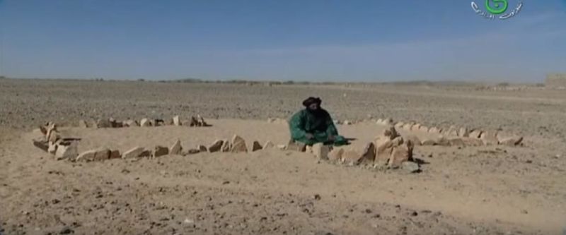 " In remote regions of the Sahara desert in extreme south of Algeria, they don't have mosques, instead they have a "tamesguada", a formation of rocks that resemble a mosque, with an opening for the door and a curved section for the qebla. " - as can be read as comment of the editor. ("quebla" = Qibla; "The qibla is the direction of the building Ka'bah in the Sacred Mosque, Mecca, Saudi Arabia.") Same structure, "desert mosque" labelled GE photo I also just have spotted at >>25.7436801,10.5728756<<, Libya(!) So, directions of the mentioned parts of the structures are tend to point to Mecca (check kmz line feature), however explanation for the side-structures and inner-grid of the ones around Immidir Plateau still is missing...! *** Thread title edited, updated kmz file attached to original post. |
|
Master Cartographer
April 2015 - Nov 23, 2024 9:19:49 GMT
|
Post by syzygy on Jun 15, 2020 6:14:51 GMT
Few months ago I have got in contact with Mr. Yves Gauthier, french Sahara archaeologist, who wrote me this great story and full explanation in a recent e-mail reply:
Mistery solved, thread title edited. - That was all folks!
|
|
