Master Cartographer
April 2015 - Nov 29, 2024 19:51:05 GMT
|
Post by syzygy on Jan 25, 2018 13:37:19 GMT
another common collection, another thread by chance, here in OP my first spot: Yangykala, Turkmenistan:As Turkmenistan subfolder in my mounds collection gets bigger, the more often I seem to bump into other sites of interest. Here an example just as a pair of my quite recent post: Colorful Rocks of Shekelmes Bay, Kazakhstan. Not that misterious, but enable GE Photo layer and check many great Panoramio shots (until available) of this natural wonder too:  Panoramio photo Panoramio photo: "natural beauty" by vegezioYangykala Canyon.kmz (759 B) 40°27'27.15"N, 54°42'38.92"E |
|
|
|
Post by spacecowboy2006 on Jan 25, 2018 18:35:31 GMT
|
|
Master Cartographer
April 2015 - Nov 29, 2024 19:51:05 GMT
|
Post by syzygy on Jan 26, 2018 7:25:48 GMT
not only the colors, but the texture and shapes that made me to post that Turkmene canyon. thanks for other nice example of colorful rock formations! ... ..as this next one from china:  Panoramio shot Panoramio shot: "昌吉努尔加“鸟人15”峡谷" by uni-corncheck more cool pano-shots around >>43°48'2.84"N, 87° 2'55.28"E<< in most cases one quite can be sure, only based on aeriel view:  colorful canyon China.kmz colorful canyon China.kmz (959 B) |
|
March 2015 - May 1, 2023 4:20:37 GMT
|
Post by diane9247 on Feb 1, 2018 6:13:12 GMT
Painted Hills Oregon.kmz (1.09 KB)My contribution to this colorful geology thread: the Painted Hills of Oregon.  Photo PhotoI've seen this beautiful place myself and many photos have too much added saturation. This one has realistic late-afternoon color. The area was an ancient river floodplain and is a portion of the John Day Fossil Beds National Monument north of the tiny town of Mitchell, Oregon. The Painted Hills were in the zone of totality for the 2017 solar eclipse, so it was crowded with campers from all around the country and even some from Europe, who no doubt had the full Wild West experience.
|
|
Master Cartographer
April 2015 - Nov 29, 2024 19:51:05 GMT
|
Post by syzygy on Feb 1, 2018 7:08:39 GMT
hi and thank you joining this "thread by chance" with this nice example from Oregon! can it be I have already heard about that in a previous contrib. by you? perhaps in one of our 'forgotten' photo threads? -in the ' seasons of GEC' or ' members photography' threads? probably that I have dug up links will make me do some 'bump' replies!(: best! g |
|
March 2015 - May 1, 2023 4:20:37 GMT
|
Post by diane9247 on Feb 1, 2018 7:19:39 GMT
No, it has never occurred to me to post about it before!  |
|
Master Cartographer
April 2015 - Nov 29, 2024 19:51:05 GMT
|
Post by syzygy on Feb 6, 2018 10:57:30 GMT
amongst its singing dunes and its archaeological features Altyn-Emel National Park in Kazakhstan also can be proud of the colors of Ak-Tau (Aktau, Aktay) mountain. 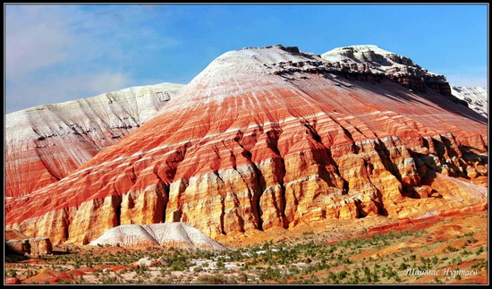 Photo by: Taimas Nurtaev"...The park was organized on April 10, 1996. The purpose of the park is to preserve the unique natural complex, archaeological, historical and cultural monuments, rare and endangered plants and animal species, the development of ecotourism. The total protected area of the park is 520.2 thousand hectares. The most interesting attractions of the park: “The Singing Dune” (1.5 km long sand dune), clay mountains of Aktau and volcanic mountains of Katutau..:" source: aboutkazakhstan.com"...prominent feature of the area are the Aktay mountains. The Aktay mountains are also referred to as the "lunar mountains" on account of their particular colors..." source: wikipediaAk-Tau Mountains.kmz (836 B) (some 60 dead Panoramio shots around placemark..., though worth to check GE (PC) Photo- and Gallery/Wikiloc layers and take a zoomed-out lookaround for further credit.) *** off topic:also I attach here placemark for The Singing Dunes: The Singing Dunes.kmz (831 B) |
|
Master Cartographer
April 2015 - Nov 29, 2024 19:51:05 GMT
|
Post by syzygy on Feb 7, 2018 8:24:03 GMT
"Kyzyl Chin (Kyzyl-Chan, Kyzyl-Shin) river, natural boundary; dr.tursk. kysyl – gorge, gorge; alt. chin / shyn – a deep ditch between two steep mountains. Kyzyl Chin – a deep ditch in a gorge, a gorge. And yet, it is not known since when it was customary to call this place – Mars. Landscapes here are strikingly different from others. The outlets of colored clay paint the slopes in the most unexpected colors. From purple, through all shades of red and green to almost white. With the expressed desire and skill, one can try to find beautiful crystals of smoky quartz or other minerals. In terms of photography, the best coverage here comes at dawn. There is a reason to get up early.) ... scene called "Mars 2": 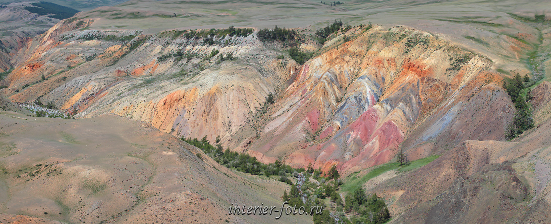 Great images from photo source: interier-foto.ru/kyzyl-chin/ Great images from photo source: interier-foto.ru/kyzyl-chin/... The tour is not limited to a trip to Mars. Along the way, several photo-pauses, Scythian and Turkic barrows, Bronze Age balbas and rock carvings are required." More great images on text source page: camp-altai.ru/en/kyzylchin/... Somewhere I have also read that this is the multicolored soil of mercury occurence. Kyzyl Chin.kmz (1.37 KB) |
|
Junior Member
August 2015 - Nov 27, 2024 15:55:33 GMT
|
Post by Chriusha on Feb 8, 2018 15:03:10 GMT
|
|
Master Cartographer
April 2015 - Nov 29, 2024 19:51:05 GMT
|
Post by syzygy on Feb 8, 2018 15:20:00 GMT
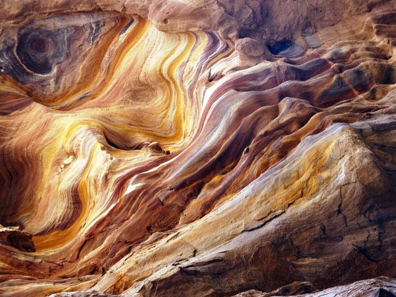
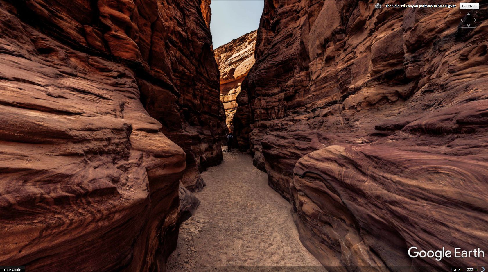
well, red is a color and this one is full of red, so can be called colorful. (: okay, its not only red if you look close enough: 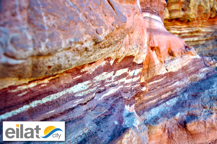 more images and article from source more images and article from source: eilat.city/en/tours/the-red-canyonthanks for contribution! g |
|
Master Cartographer
April 2015 - Nov 29, 2024 19:51:05 GMT
|
Post by syzygy on Feb 21, 2018 12:57:47 GMT
|
|
|
|
Post by spacecowboy2006 on Feb 21, 2018 15:42:04 GMT
North America's Grand Canyon is known for its changing colors depending on the angle of the sun and clouds. images |
|
Master Cartographer
April 2015 - Nov 29, 2024 19:51:05 GMT
|
Post by syzygy on Apr 5, 2018 7:46:58 GMT
|
|
Master Cartographer
April 2015 - Nov 29, 2024 19:51:05 GMT
|
Post by syzygy on Jul 26, 2018 7:21:15 GMT
|
|
Master Cartographer
April 2015 - Nov 29, 2024 19:51:05 GMT
|
Post by syzygy on Jul 26, 2018 7:44:56 GMT
|
|
Master Cartographer
April 2015 - Nov 29, 2024 19:51:05 GMT
|
Post by syzygy on Jan 16, 2019 12:47:02 GMT
80 kilometers (50 miles) North of the Wucaiwan formation another great Yadan landform can be found. Two GE Photo layer examples:   Yadan landform.kmz Yadan landform.kmz (764 B) 45.872726°, 89.002886° |
|
Master Cartographer
April 2015 - Nov 29, 2024 19:51:05 GMT
|
Post by syzygy on Jan 16, 2019 13:53:23 GMT
and if we consider white as a color, then check the Akkergeshen Plateau  Akkergeshen Plateau.kmz Akkergeshen Plateau.kmz (737 B) 47.289218°, 54.400645° also check your GE photo layer at the Canyon of Aktolagay, some 50 kilometers (30 miles) to East! |
|
Master Cartographer
April 2015 - Nov 29, 2024 19:51:05 GMT
|
Post by syzygy on Apr 30, 2020 10:45:26 GMT
Rainbow Sediment Stratum, Oued Metlili Ghardaia, Algeria:  image source image sourcePlacemark at the only relevant GE Photo - check Photo layer after opening kmz file in Google Earth (desktop). (Placemark probably off target.) Oued Metlili Ghardaia Algeria.kmz (847 B) |
|


