Trusted Member
account is disabled
“ Google Maps | Google Sky | Google Mars „
|
Post by ET_Explorer on Jan 30, 2017 15:45:51 GMT
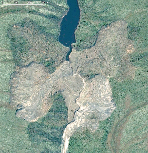
Batagaika crater is what geologists call a thermokarst depression —cave-ins which results when the permafrost melts. The Batagaika crater, in the Sakha Republic in Russia, started to form in the 1960s after a chunk of forest was cleared for industrial use, triggering a series of catastrophic geologic and environmental events. The vegetation provides insulation that keeps the ground cool. Once that was removed, the summer heat was able to penetrate deeper into the ground causing the permafrost to melt, and the area began to slump. The crater has been growing ever since, becoming bigger and bigger with each passing year as the climate continues to change. Source What Is Thermokarst? Wikipedia Batagaika Crater Siberia.kmz (1.22 KB) 
|
|
Full Member
Cartographer
May 2015 - Oct 21, 2024 18:35:52 GMT
“ Fellow Royal Canadian Geographical Society „
|
Post by jeanthie on Feb 1, 2017 21:49:59 GMT
That is a fascinating thermokarst feature. When I followed your KMZ. I happen to have my Panoramio on and there are a number of spectacular pictures by Денис Б www.panoramio.com/user/6935257?with_photo_id=118326360 It is interesting to see the cover of Larix trees, very uniform, yellowing and loosing their needles in the fall.   |
|
Full Member
Cartographer
May 2015 - Oct 21, 2024 18:35:52 GMT
“ Fellow Royal Canadian Geographical Society „
|
Post by jeanthie on Feb 4, 2017 0:48:45 GMT
|
|


