Newbie
January 2024 - Jan 18, 2024 16:00:56 GMT
|
Post by familyhistoryfan on Jan 18, 2024 15:52:42 GMT
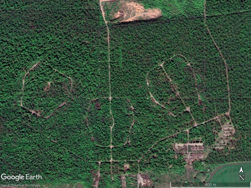
While researching my family history, I ran across this forest preserve that my great-uncle helped plant in the early 1900s (northwest of Mariupol, Ukraine, and directly southwest of the town of Nikolske) as part of an alternative-service program for military objectors. My curiosity was drawn to the odd pattern (road/wall?) within it featuring three loops, all identical though oddly, vaguely skull-shaped, arranged in such a way as to resemble eyes and nose, with a rectangular shape to the south that looks like a mouth, and a diverted road that looks like a chin. Then there's the rectangular clearing above, with striated edges and who knows what activity going on. At first I thought it might have something to do with the Russian occupation forces (forest would provide great cover in an otherwise open, flat setting), but timelapse shows the face has been there for a long time, and the rectangle was cleared around 2019. What on earth could those loops be? Some of this could also be the ruins of the original camp barracks, if the buildings weren't situated where the little hamlet of Lisne is now (forming the "ear" on the right side of the image). There is no streetview available. Curiosity is killing me! Hoping someone with more experience looking at this stuff could help.  Ideas?? 
![]() |
|
Master Gamer
April 2018 - Nov 22, 2024 20:28:01 GMT
|
Post by willi1 on Jan 22, 2024 21:12:34 GMT
Unfortunately your pictures are incorrect. My opinion: These are military antenna fields from the Soviet era. Similar see here 47.161361° 37.268339°
|
|


