Trusted Member
Master Gamer
April 2015 - May 1, 2024 21:40:05 GMT
|
Post by hhgygy on Jan 30, 2023 14:19:07 GMT
|
|
Master Cartographer
April 2015 - May 1, 2024 6:58:50 GMT
|
Post by syzygy on Jan 31, 2023 19:07:36 GMT
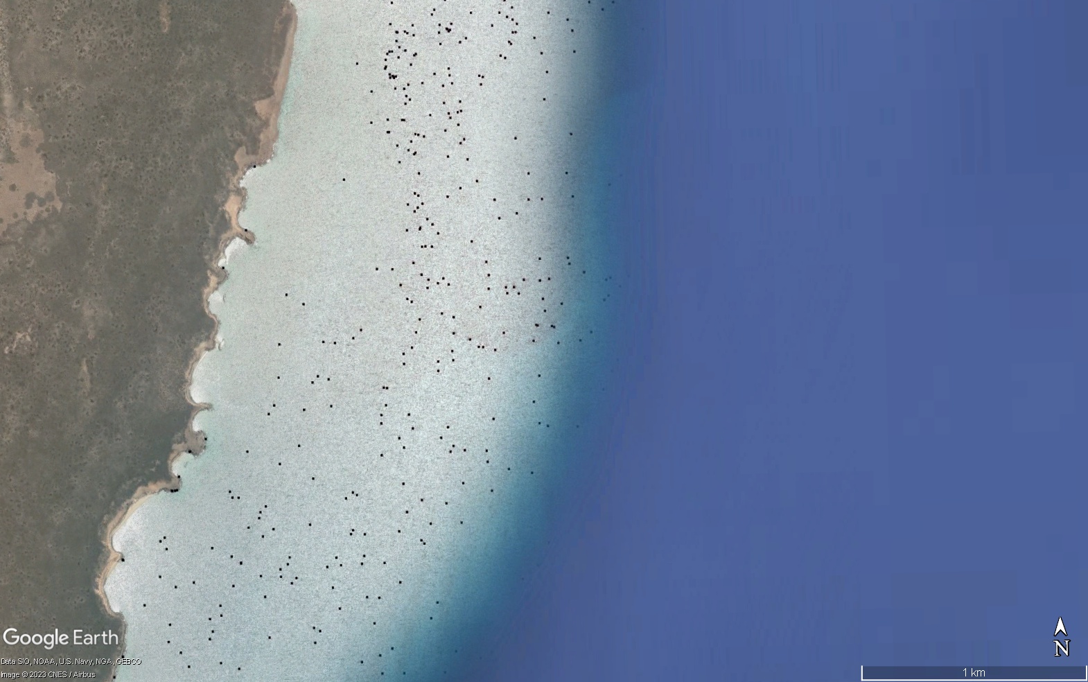
Imagery glitch(?)
|
|
Trusted Member
Master Gamer
April 2015 - May 1, 2024 21:40:05 GMT
|
Post by hhgygy on Jan 31, 2023 19:17:59 GMT
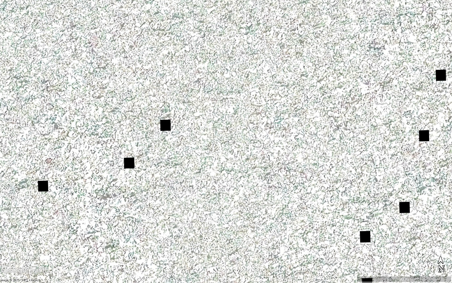
That's clear but still strange with these black squares scattered around. |
|
Full Member
January 2020 - Jan 5, 2024 10:40:59 GMT
|
Post by leong on Apr 9, 2023 12:01:15 GMT
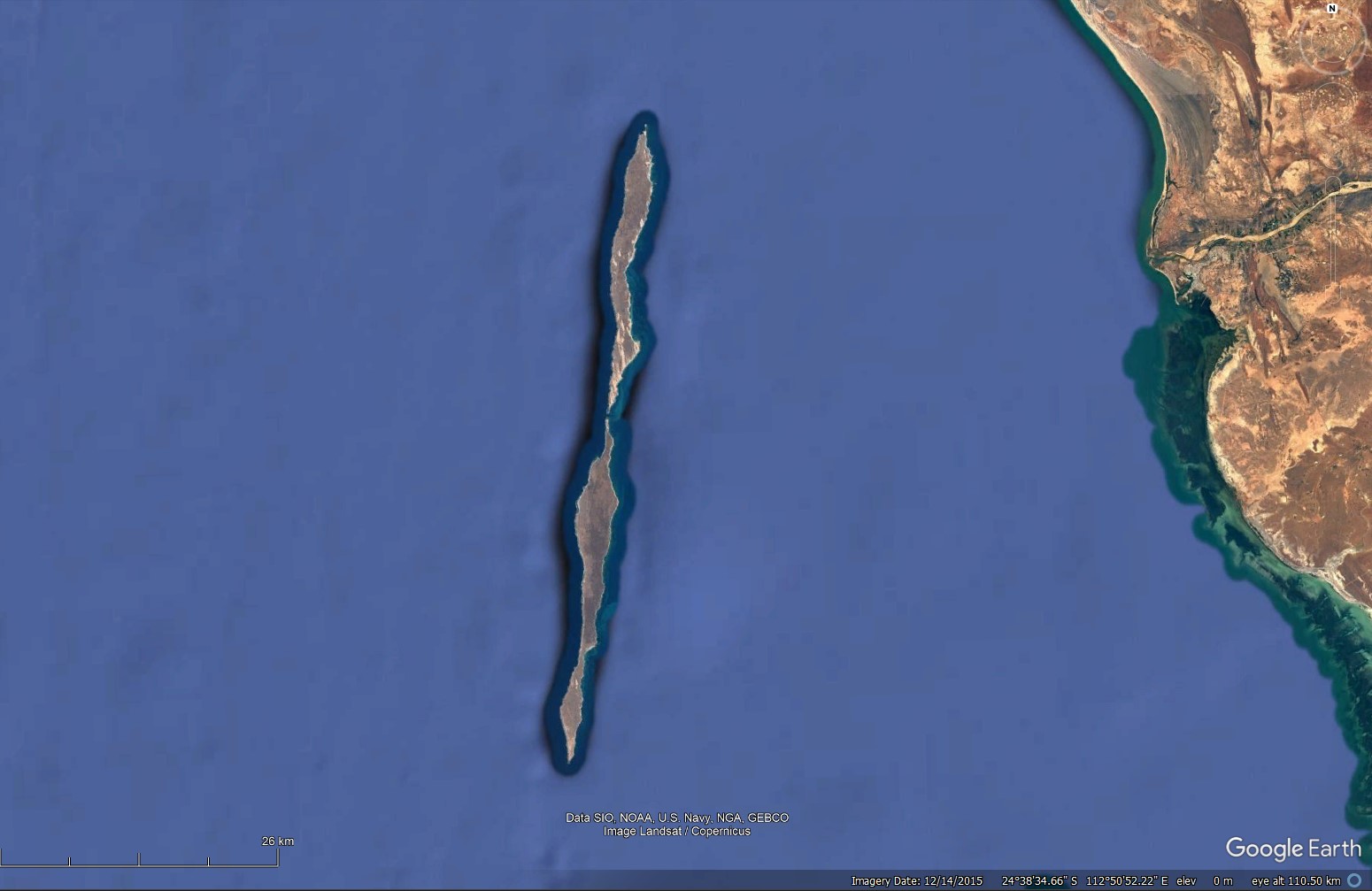
Its Dorre Island, Western Australia.
Its the next island north of Dirk Hartog Island, which was discovered by Dirk Hartog, 25 October 1616 ,
and the place where a french man claimed Western Australia (to no lasting effect..) in 1772, one of a few attempts by the French to claim and colonise parts of Australia
A little south is the island group Houtman Abrolhos, where the new (at the time) Dutch East India company flagship Batavia wrecked 4 June 1629, and some of the crew committed attrocities while the boss was away (the lifeboat going to Batavia, capital of the Dutch East Indies, to bring rescuers )
|
|
Full Member
January 2020 - Jan 5, 2024 10:40:59 GMT
|
Post by leong on Apr 9, 2023 12:15:25 GMT
So what the white looks like is an attempt to to represent ocean surface (waves) in grey scale, it is false colour, it is not a true colour ... the ocean there is blue in the true colour images.
The west of the island shows the breakers in grey scale , which when I click back to the last older image, is blue with breakers right there, which is to be expected, as its open ocean to the west.
But it shows very few black squares, which means the technique mostly worked to the west.
To the east of the island, you see noise, and lots of black squares, which suggest the lack of waves, due to the shelter provides by the islands, caused a post processing algorithm grief, and it put a black square when it gave up. While I say its noise to the east, I see that there are some patches close to shore that seem to show some shapes and these reveal themselves to be reefs and bombora. The shallow patch creates a higher wave above it... and so the wave is able to be shown there.
Google Earth may not have been knowingly involved in loading this data, they may have inadvertently imported it with a large mass of true colour imagery.
|
|
Junior Member
May 2023 - Mar 12, 2024 0:26:44 GMT
“ Usually searching airports for funny mishaps. „
|
Post by planes on May 14, 2023 22:10:25 GMT
I counted all the squares and i think i got around 10,000 to 15,000 black squares, I kinda regret counting them all.
|
|