Junior Member
July 2022 - Jul 25, 2022 1:19:35 GMT
“ The past is made up of legends and myths „
|
Post by ancientdelta on Jul 14, 2022 4:28:50 GMT
Hello there! I had lots and lots of markers in the Danakil depression zone, which I deleted. Why? Well... because the whole region is completely filled up with structures. 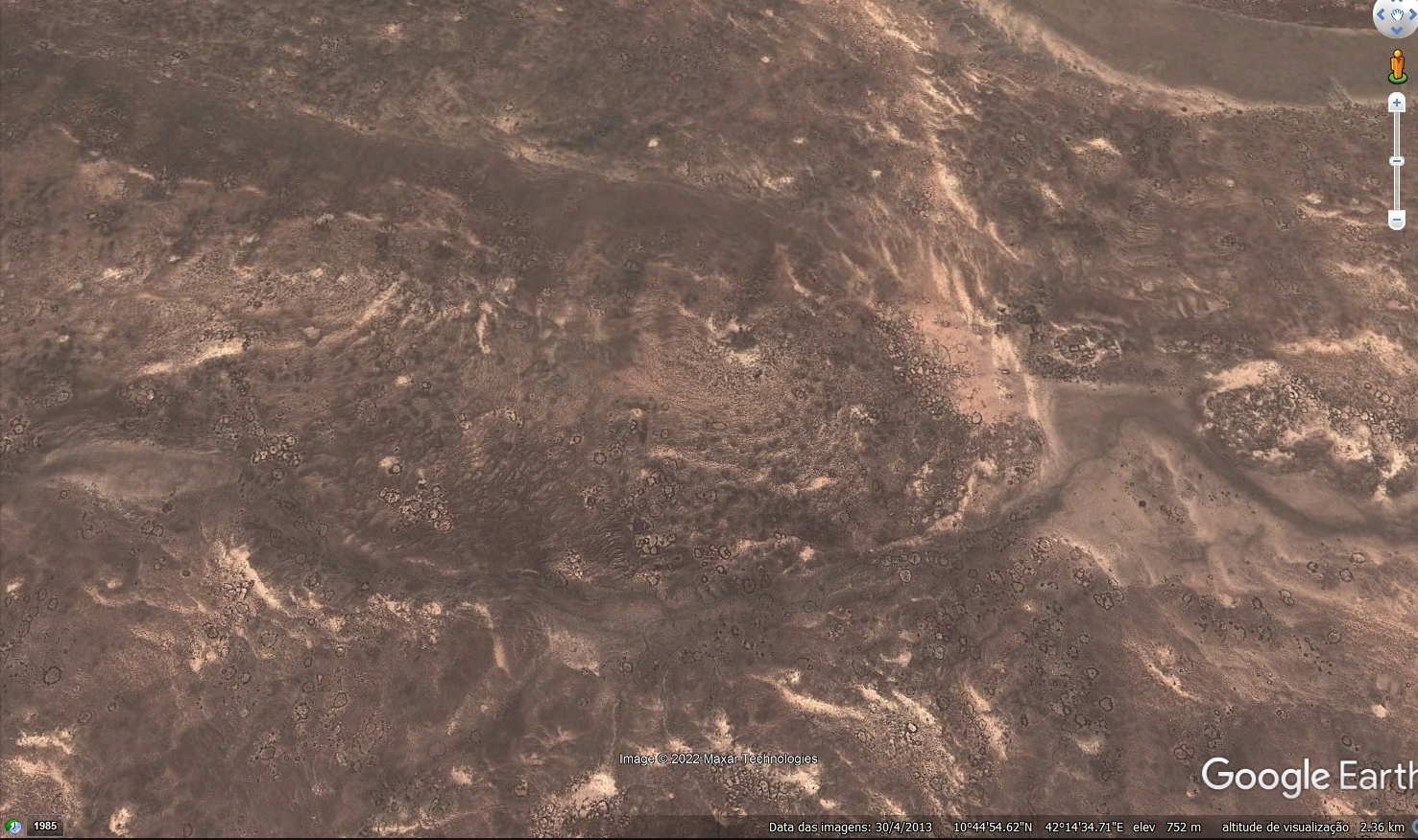 Anywhere you zoom in you'll find these. Millions and millions of dwellings, circular tombs, squares, etc, etc. It appears that these were islands, it doesn't make much sense that these people would settle there if that was already the hottest place on earth. What I find curious is that throughout the whole region and even in many other african regions, people flocked to volcanic places, immediatly I thought about volcanic lakes, which are surely a blessing! Like the Azorean ones! Bear with me, my mind has spent a lot of time researching about a few fields of science so it can be able to connect a few dots here and there. This region is probably the "Land of Punt", it matches all geographical kemetic accounts... but that's not my job, but I'll put that out anyway lol Of all structures, there's one in specific that seems to have had some sort of religious purpose, or maybe it was a sport, or a tomb, or... we need to go there and check it out! This is it 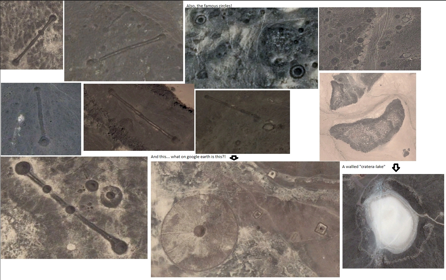 Excuse me the Paint job... it's easier! The extension of these are astounding, as it is shown in the next pictures 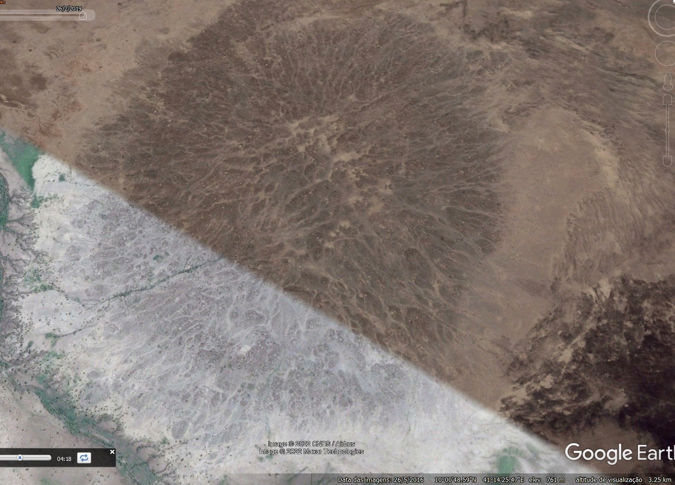 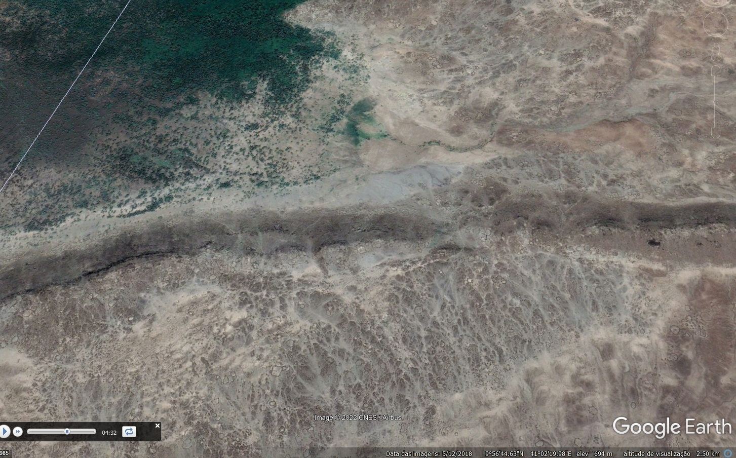 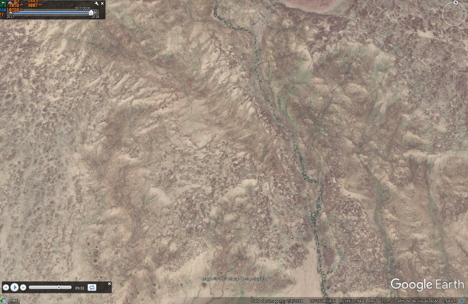 I'll save the words for... they're not enough. And the video is ending too lol 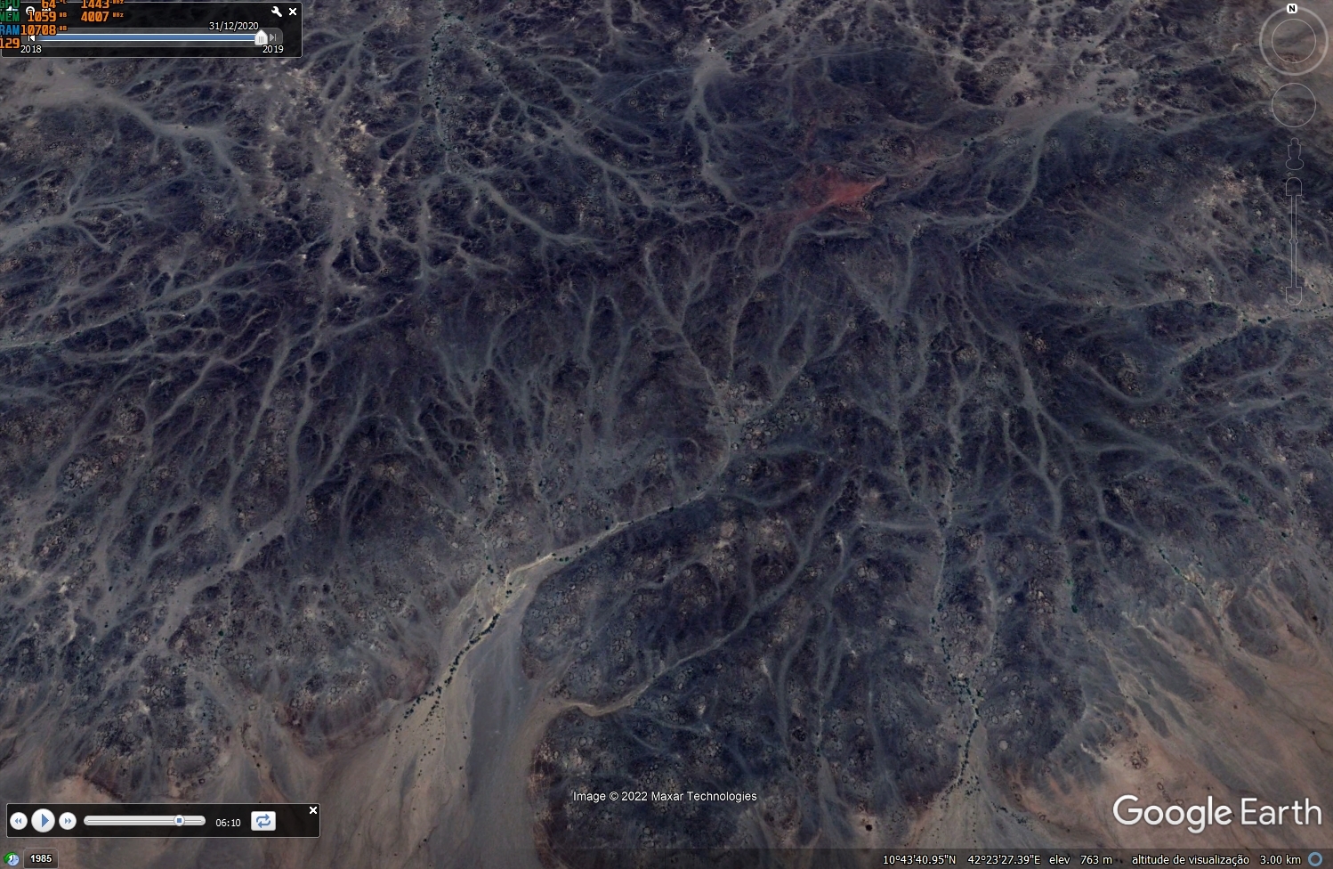 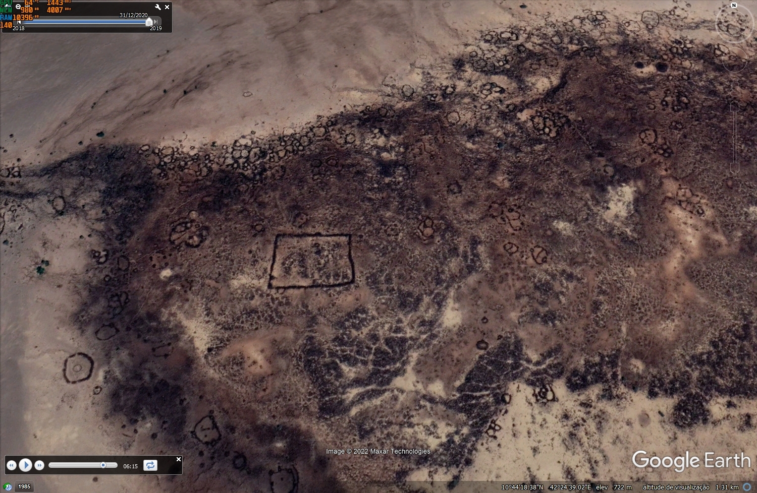 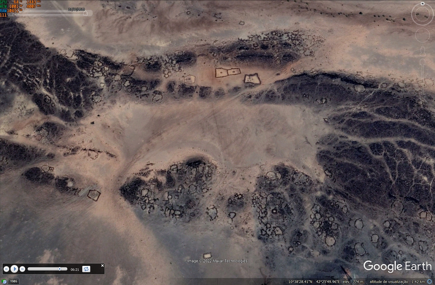 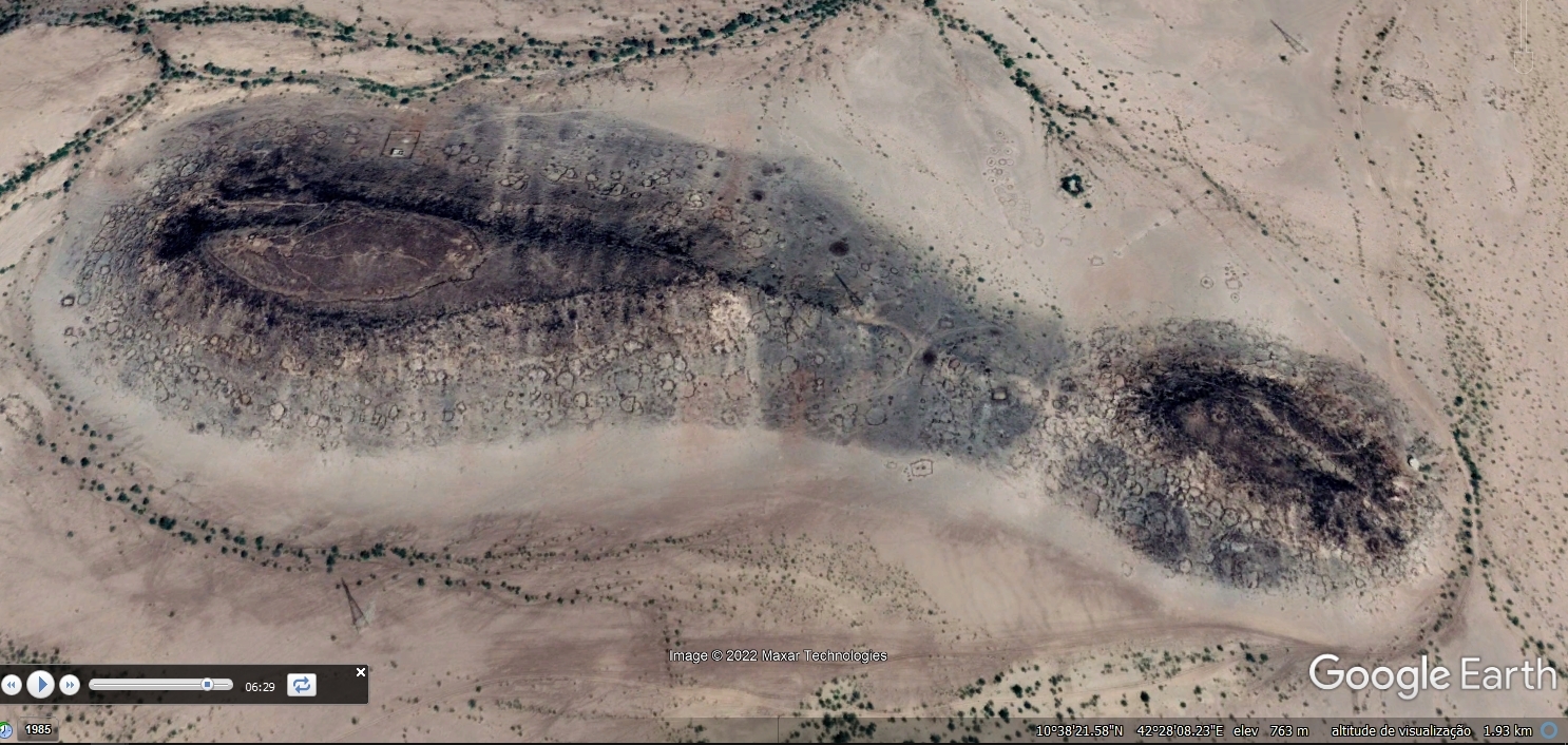 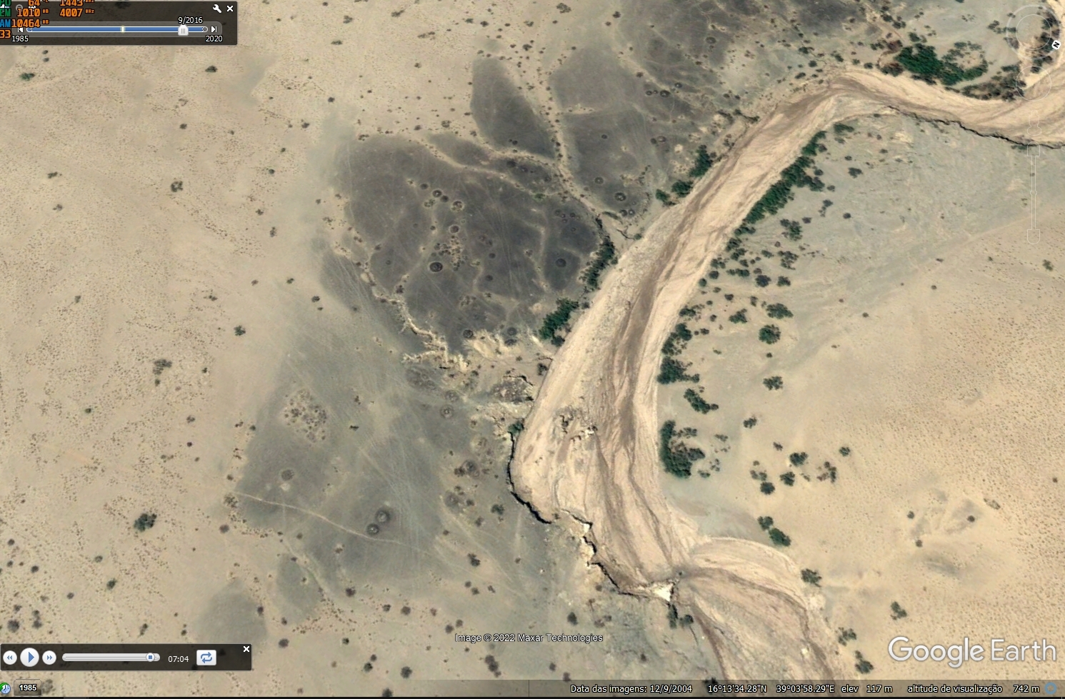 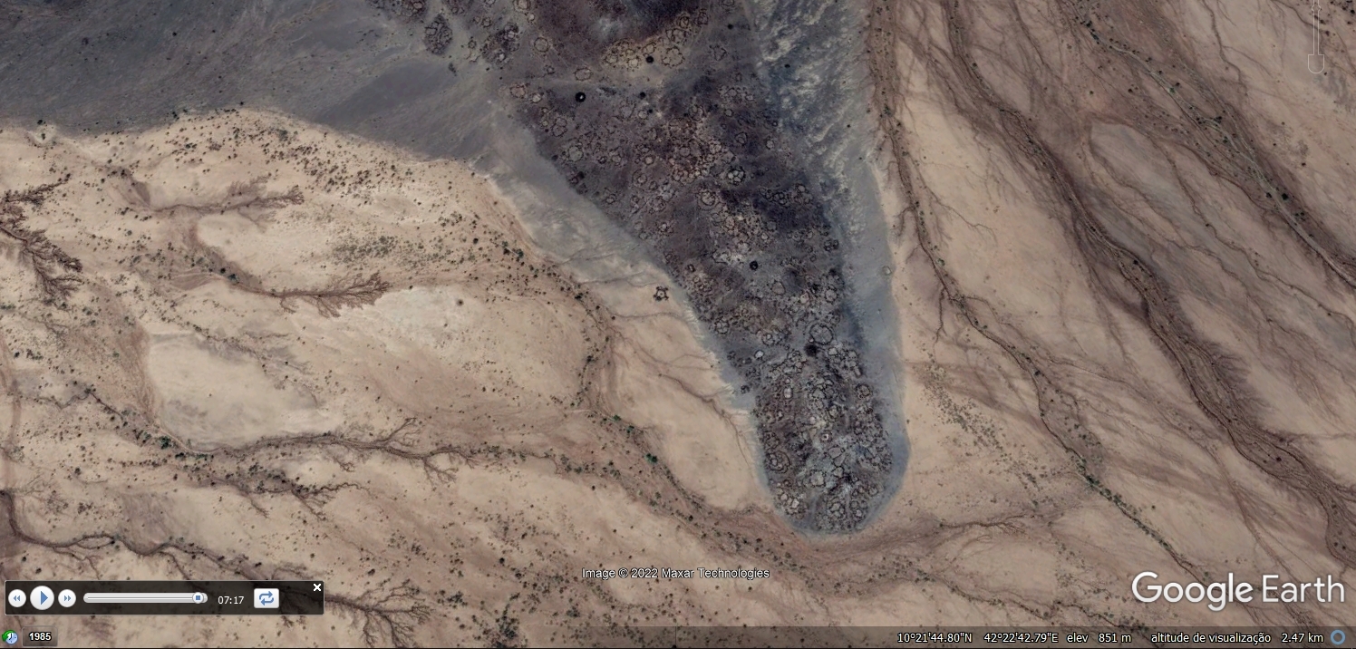 All this is to be found in here: 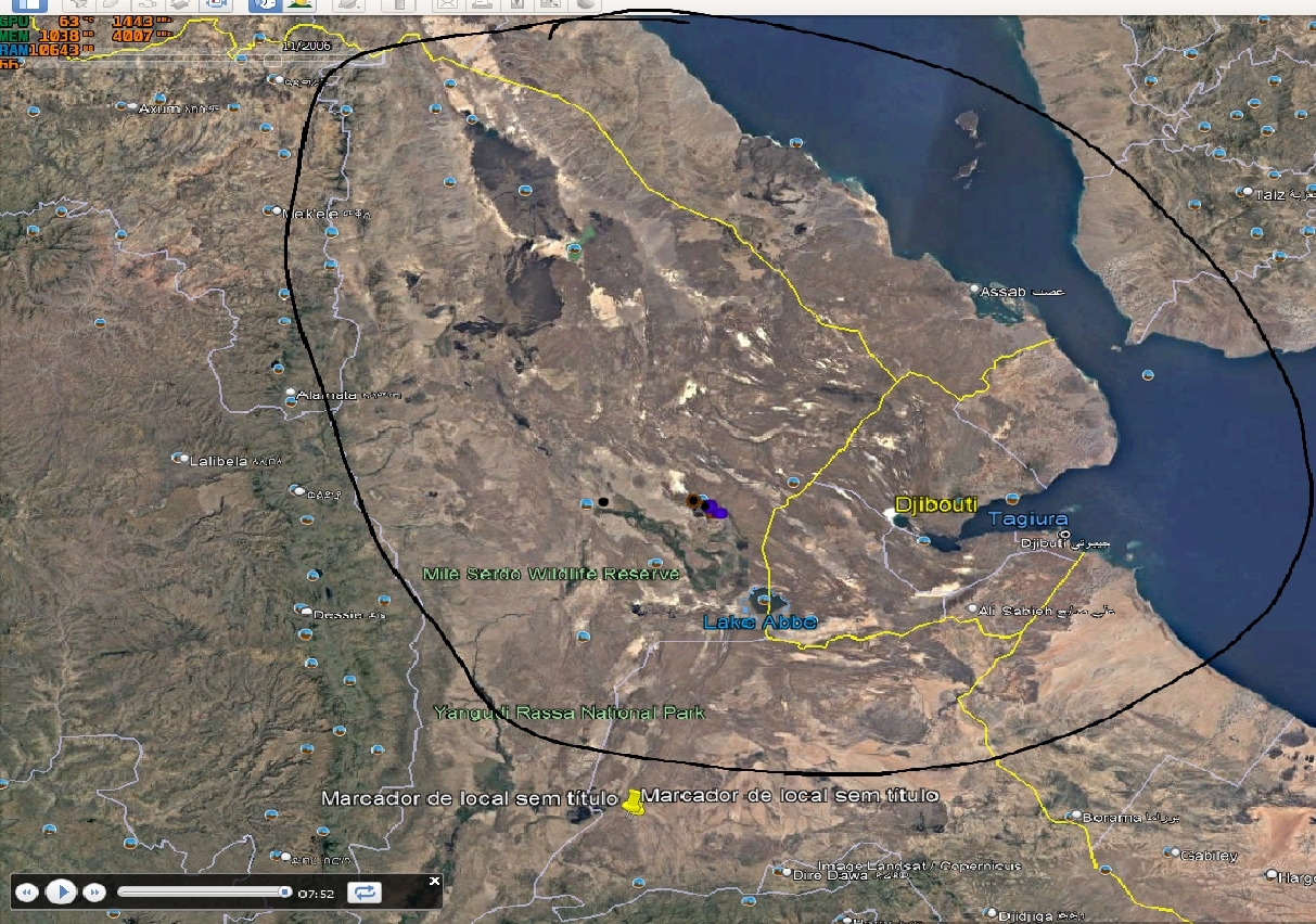 What's your thoughts on this? By the way, I have to thank an anonymous person who believes that that's Adam & Eve kissing each other (thank you pareidolia), otherwise I would've never zoomed in in this region. Can someone take me there? I'm just an amateur lover of all that is "knowledge", I don't have the credentials! ahahah Hope you enjoyed! Let me add the two surviving markers! 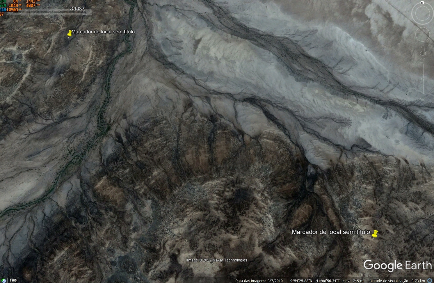 |
|
Full Member
November 2020 - Jul 30, 2023 7:53:54 GMT
|
Post by bemerkenswelt on Jul 16, 2022 18:15:49 GMT
Yes, I agree with you.
I would be happy to read the first excavation report. Unbelievable, that nobody did this until now. Because of the mounds I would guess that this are tombs.
This is an amazing region with so many ancient structures, that it doesn't make any sense to mark single ones of them. Just mark the whol region as a world heritage area.
|
|
Junior Member
July 2022 - Jul 25, 2022 1:19:35 GMT
“ The past is made up of legends and myths „
|
Post by ancientdelta on Jul 16, 2022 19:23:26 GMT
Yes, I agree with you.
I would be happy to read the first excavation report. Unbelievable, that nobody did this until now. Because of the mounds I would guess that this are tombs.
This is an amazing region with so many ancient structures, that it doesn't make any sense to mark single ones of them. Just mark the whol region as a world heritage area.
Your website is amazing!!! I searched so much the web for something about this and never found anything... Until now! It's, as you say, unbelievable. I guess it's too much to be handled. This would completely rewrite things. This is also the place where Lucy was found, but it can't be that old... I guess! There must've been so much water in there... |
|
Full Member
November 2020 - Jul 30, 2023 7:53:54 GMT
|
Post by bemerkenswelt on Jul 16, 2022 19:52:08 GMT
If you like to have all my marks of that area, see link:
|
|
Full Member
November 2020 - Jul 30, 2023 7:53:54 GMT
|
Post by bemerkenswelt on Jul 17, 2022 19:07:12 GMT
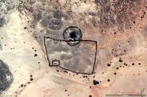
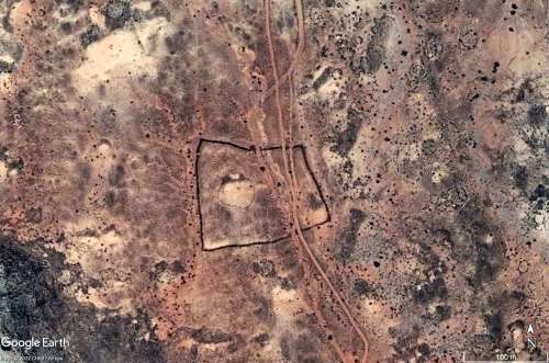
In order to slowly approach the incredibly large number of structures, I made the strange rectangles today. Although you can't tell their age from the satellite imagery, I think I can at least say they're old. This is indicated by the damage that watercourses have caused to the structures over time.
|
|
Junior Member
July 2022 - Jul 25, 2022 1:19:35 GMT
“ The past is made up of legends and myths „
|
Post by ancientdelta on Jul 17, 2022 20:56:20 GMT
In order to slowly approach the incredibly large number of structures, I made the strange rectangles today. Although you can't tell their age from the satellite imagery, I think I can at least say they're old. This is indicated by the damage that watercourses have caused to the structures over time.
See here the brand new website that I made on that subject >
If by any chance this happens to be the fabled Land of Punt, then all those small circles are houses, which according to egyptians were like this: 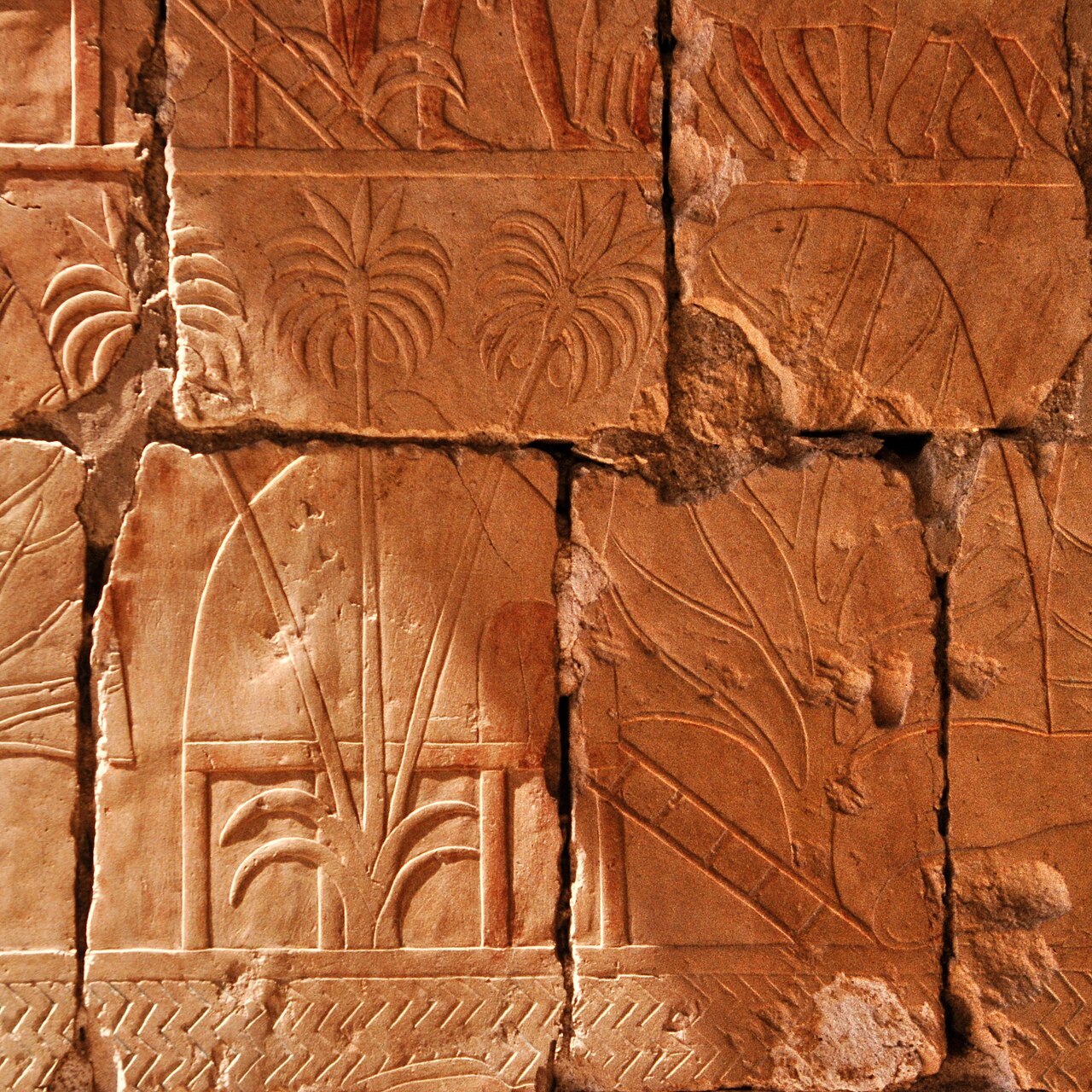 If they were in fact houses, they amount to millions... By that logic there must've been many watercourses probably coming from the southern lakes or from craters. This must be really old... The end of the Ice Age must've had implications on this region. The high mountains of Ethiopia may have had lots of snow by that time. I'll dig into whatever I can find online on egyptian accounts of Punt. 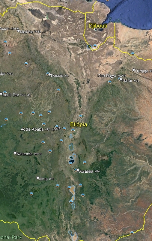 |
|
Full Member
November 2020 - Jul 30, 2023 7:53:54 GMT
|
Post by bemerkenswelt on Jul 18, 2022 19:24:13 GMT
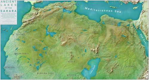
Don't forget, that in earth history have been long periods, when Sahara and the whole north Africa was green and full of lakes and watercourses.
The last of that humid periods ended about 5,000 to 3,000 years ago. That's in arcaeological terms not so long ago.
I also don't belive in the stories that in those times there lived only little groups of hunters and gatherers. What we see in Google Earth tells us a different story. The population density in that whole region must have been much higher than previously thought. I don't know if there were megacities there, six or seven thousand years ago, but certainly nothing that fits the popular theories of roving small groups of herders, hunters and gatherers.
|
|
Junior Member
July 2022 - Jul 25, 2022 1:19:35 GMT
“ The past is made up of legends and myths „
|
Post by ancientdelta on Jul 20, 2022 1:54:37 GMT
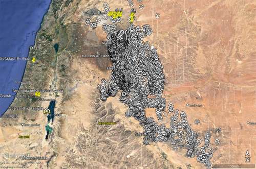
Those kites, tombs and all, they extend to Syria at least. Check out, once again, that volcanic zone. There's just too many kraals, kites, tombs, etc. 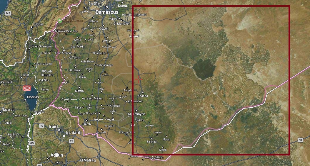 I have a kmz file with a few locations but I don't know how to post it. Just zoom in and there it'll be. Just visited the "enigmatic wheels" on your website. You already know about it eheh |
|
Full Member
November 2020 - Jul 30, 2023 7:53:54 GMT
|
Post by bemerkenswelt on Jul 20, 2022 9:08:23 GMT
After exploring that region for many years, I think I know almost everything in that area. But it's too much there, that I didn't mark any single mound or wheel (kraal?) or what ever.
This was the area I started with, many years ago. For me, as a graphic designer, the shapes of the desert kites had been very attracting. In the very beginning I did not know much about the scientific things, I was interested at first in the bizarre looking. Everything else came later when I got in contact with scientist who teached me a lot about.
You can insert a downloadlink for placemarks via the button [Insert Image/Video] at the upper right edge.
Instead of a picture or video simply drop the kmz-file.
To see more, here two links to my website:
But all this doesn't fit into "The Danakil "Civilization" / The Land of Punt ?" You should open a new topic related to the near east region.
|
|
Full Member
January 2020 - Jan 5, 2024 10:40:59 GMT
|
Post by leong on Jul 23, 2022 6:49:18 GMT
The google earth images are unlikely to show any particularly old structures. Not impossible, but unlikely.
Reason being, its all been inhabited in the time inbetween, and there's been plenty of rain and wind to decay things too, so then anything that remained of a structure would be demolished and recycled into a new one.
Evidence, the buildings used by people at and around the pyramids don't exist any more, the pyramids form most of the top 20 eldest structures in North Africa still standing to a reasonable extend, eg a wall.. not just rubble in archeological digs. There is one mud brick wall that is older than the pyramids, the eldest, but its a cemetery/funeral site and preserved by Egyptian civilisation..
Archeological excavations do find evidence of these sorts of structures and they can know that "in the Mesolithic period, Capsian culture dominated the eastern part of North Africa with Neolithic farmers becoming predominant by 6000 BC. " ... So by 6000 BC most peoples were sedentary farmers, thus building the farm structures.. a house , animal enclosures, dam, irrigation ... domesticated animals, but gathering wild seed and vegetables . These sedentary, structure building, neolithic farmers are not considered a bronze age civilisation.
|
|
Full Member
January 2020 - Jan 5, 2024 10:40:59 GMT
|
Post by leong on Jul 23, 2022 9:18:56 GMT
|
|