Newbie
November 2021 - Sept 4, 2022 3:48:57 GMT
|
Post by maphound on Nov 18, 2021 0:11:23 GMT
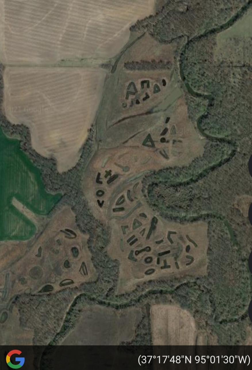
This is an area of Kansas that has been heavily strip mined however, these "shapes" appeared between September 2010 and September 2011. They are symbols and letters covering about 1/2 square miles. Does anyone know anything about these? The coordinates are 37deg 17 min 34 sec N & 95deg 01min 3sec.
|
|
Master Cartographer
April 2015 - Nov 21, 2024 8:06:11 GMT
|
Post by syzygy on Nov 18, 2021 20:05:42 GMT
Great!  >>37.29378472, -95.02601769<< Nothing I can dig up at the moment, but I think your question is at the right place here to be answered in a while. Welcome around! ( : |
|
Master Gamer
April 2018 - Nov 20, 2024 20:32:38 GMT
|
Post by willi1 on Nov 19, 2021 14:36:23 GMT
In another forum we had discussed this place, but apart from wild theories, no conclusive interpretation could be found. Maybe someone here has an explanation.
|
|
Master Cartographer
April 2015 - Nov 21, 2024 8:06:11 GMT
|
Post by syzygy on Nov 19, 2021 17:30:10 GMT
On property seller pages as zillow.com pretty cool aerial shots, but not a single word about these strange pools. It is a "recreational area" as they mention the property on these sites. ... |
|


