Cartographer
April 2015 - Nov 12, 2024 14:28:33 GMT
“ Armchair Traveller - Love to Roam Google Streets - 8 Star Local Guide of Google Maps „
|
Post by CuriousJM on Aug 25, 2021 9:32:07 GMT
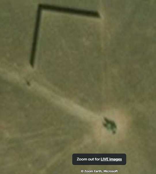
Looks like a cylindrical object In the middle of nowhere with radial lines emanating from it. It could be water tank or a silo. Also check out the right angled object in the north-west. It could be either water storage pond or camera glitch. These were not visible in GE imagery till August 5, 2013 May be the experts here will throw some light on these two objects.  View larger image View larger image
Attachments:water-tank.kmz (722 B)
|
|
Master Gamer
April 2018 - Dec 3, 2024 20:45:44 GMT
|
Post by willi1 on Aug 25, 2021 14:57:34 GMT
My opinion: cattle troughs (there are more in the area). I interpret the rectangular object as a water reservoir. Attachments:Tank2.kmz (692 B)
|
|
Cartographer
April 2015 - Nov 12, 2024 14:28:33 GMT
“ Armchair Traveller - Love to Roam Google Streets - 8 Star Local Guide of Google Maps „
|
Post by CuriousJM on Aug 26, 2021 3:21:24 GMT
I agree willi1. It could be a water trough. |
|
Master Cartographer
April 2015 - Dec 4, 2024 7:21:40 GMT
|
Post by syzygy on Aug 26, 2021 15:09:13 GMT
... I interpret the rectangular object as a water reservoir. which one do you mean? - if the black right angle object on CJM's caption, then that is a quite high, right angle-shape fence (yet another thing with unknown function(!)) and its shadow. Probably a shader for animal..? (No faint ideas actually...) Check it by another time stamp on ZoomEarth. But if you mean these, then yeah - these are pools of water (the elongated, white humps next to the ponds are made up of the excavated soil) water tanks and more for CJM.kmz (879 B) |
|
Cartographer
April 2015 - Nov 12, 2024 14:28:33 GMT
“ Armchair Traveller - Love to Roam Google Streets - 8 Star Local Guide of Google Maps „
|
Post by CuriousJM on Aug 26, 2021 17:29:21 GMT
If the black body on top left is not a water source then I think it is camera glitch or rather image stitching problem.
|
|
Master Cartographer
April 2015 - Dec 4, 2024 7:21:40 GMT
|
Post by syzygy on Aug 26, 2021 17:37:19 GMT
How do you say master CJM?! Have you checked ZE link? - other sun angle = other shadow casted by the fence..! (for any purpose) At least it is would be strange from a glitch to appear in two different imageries in quite a different form, does not it?  ... of course it is up also for the water source theory. ( ; Note: measured in US units it is pretty exactly 25 yards long (per side) ... ? |
|
Master Cartographer
April 2015 - Dec 4, 2024 7:21:40 GMT
|
Post by syzygy on Aug 26, 2021 21:11:43 GMT
And the solution for the right angle shade fence: Windbreak for grazing animal. source: Wikimedia Commons*** As far as I suspect it is from the same site, also a twin pair of that you have spotted in north-eastern South Dakota(!) Here we go with other pieces (on (web)GE) from the same area: windbreak_2 at >>45°23'16"N 103°37'17"W<< windbreak_3 at >>45°23'53"N 103°38'19"W<< or check updated kmz folder with a 4th windbreak included: water tanks and more for CJM.kmz (1.41 KB) ... Thread done!  |
|
Cartographer
April 2015 - Nov 12, 2024 14:28:33 GMT
“ Armchair Traveller - Love to Roam Google Streets - 8 Star Local Guide of Google Maps „
|
Post by CuriousJM on Aug 27, 2021 4:37:12 GMT
syzygy Well done  great research. Hats off to you  Last night before going to sleep I had checked imageries from other map providers and had also come to the same conclusion as yours that it is a shadow of some wall or fence. Your research however has proved it beyond any doubt.  Zoom Earth Zoom Earth Yandex Yandex
|
|


 ... of course it is up also for the water source theory. ( ;

 great research. Hats off to you

