Cartographer
April 2015 - Apr 23, 2024 4:32:27 GMT
|
Post by washi on Apr 29, 2015 4:28:19 GMT
I have now completed the first section of this rather long project, which I discontinued when it became likely in my mind that the Google Earth Community would not continue, and which I gave up for lost when that computer crashed. Such backups as I had done were to an internal drive that became corrupted, but I was able to recover the incomplete material from the C: Drive of the crashed computer, and construct a placemark for the Google Earth Community Layer before it was locked, with a link to this post.
Introductory materials are included in the attached file.
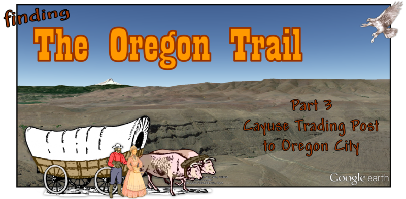
The whole project, if it is completed, is envisioned to look like this:- The Evans map of the route, with alternatives, through the Blue Mountains, with extra material that start the route at Fort Boise, and side roads to the Whitman Mission and the Powder Valley Mines, destinations that mark the beginning and the end of the trail as a route of migration.
- More crudely drawn paths tracing the routes of early explorers through the Bllue Moountains prior to 1842.
- The trail from the foot of the Blues to Oregon City, from materials of varied accuracy.
- Major landmarks on the trail, from Independence to Oregon City.
 Download File Download File
|
|
March 2015 - Jun 1, 2021 12:34:27 GMT
|
Post by NormB on May 1, 2015 11:51:41 GMT
Excelent move :-) You can Also Slave the Drive to your Current Desktop (Of Course if you use a Laptop you would need the USB External Case)
EDIT MODE... To answer the Question.. The Size of the Balloon Width wise is fine with the Placemark Icon at the Left of the Balloon.
Great History back in those Very Early years..
|
|
Cartographer
April 2015 - Apr 23, 2024 4:32:27 GMT
|
Post by washi on May 28, 2015 12:28:50 GMT
Part Two Early Routes Through the Blue Mountains 1811 - 1843
Download File |
|
March 2015 - May 1, 2023 4:20:37 GMT
|
Post by diane9247 on Jun 5, 2015 4:08:34 GMT
Washi, I am so glad you are doing this! I have tried tracing the original trail on GE, visible some places, but mostly not. Naturally, much of it was plowed under by farmers ages ago. I'm looking forward to more additions, here.
|
|
Cartographer
April 2015 - Apr 23, 2024 4:32:27 GMT
|
Post by washi on Sept 12, 2015 4:29:03 GMT
The paths that I have drawn in this file are done with varying degrees of accuracy. The least reliable section is the first. I could find no maps and no written descriptions of the specific route of the trail between Cayuse Trading Post (the point where Jack Evans' map ends, and the lower Umatilla crossing near Echo. This segment is entirely my imagination. I located the first ford of the Umatilla at the Round Up grounds in Pendleton because that seemed as good a place as any to cross the stream, and it was adjacent to a place that afforded an easy climb to the plateau above the river. My path along this high ground follows the crest of the ridge, and seen in the topographical map overlay. I suspect that the actual route taken by most emigrants was much straighter, and dipped up and down as it crossed the upper parts of the drainages to the north. Indeed, the Oregon Trail was never anything more than a generalized route. People followed the tracks of previous travelers when that seemed more efficient, and struck out on a new one whenever it seemed faster, easier, or even (remember the ever present dust) more comfortable. I dare say that no two wagons ever took exactly the same route to Oregon.
The second section is probably the most reliable. Except for a short section where I had to connect two segments, it was produced entirely by tracing the route from USGS topo maps.
The route from the Barlow Cutoff to the The Dalles is based on written descriptions of the route. From Biggs Junction onward, the trail route is covered with water, so there seemed little point in doing anything but tracing the modern highway.
The Barlow Road Cutoff (shown in the image above) is likewise based on written descriptions. I frankly had difficulty believing that anyone could find a way to cross the Deschutes River canyon with a prairie schooner drawn by oxen, and I never did find verification that the canyon that must be Buck Hollow actually is. The path I have drawn is the least difficult way I could find to descend into the canyon, ford the river, and climb out again.
I drew two paths for the route from The Dalles to Tygh Valley. I decided that the one I have included in this file is probably the older.
The route I have shown for the Barlow Road is probably not the exact path cleared by Sam Barlow and Phillip Foster. I say that because I found, on a USGS map, a short segment running parallel to it, labeled the Old Barlow Road. I suspect, like all other sections of the trail, travelers made their own improvements as they went along. (I included this path, but it is not enabled, so if you wish to see it, please click it on.) One thing worth noting, because it took me some while to realize it, is that the chutes on Laurel Hill, monumentally difficult as they were, were at least covered with soil (which has since eroded away), and were not the jagged rocks and boulders that we see today.
Even allowing for the likelihood of multiple paths, I have little doubt that this presentation is fraught with errors. I suspect that there are sources available in the U. S. that I cannot access from here in Japan, which would provide a more correct picture. If anyone has access to such knowledge, please contact me and I will make the corrections. Download File |
|
March 2015 - May 1, 2023 4:20:37 GMT
|
Post by diane9247 on Sept 12, 2015 7:35:52 GMT
Do you have access to any of these MAPS? Your work on this is impressive, washi. |
|
Cartographer
April 2015 - Apr 23, 2024 4:32:27 GMT
|
Post by washi on Sept 12, 2015 7:56:48 GMT
Thanks, Diane.
Yes, of course I did an internet search for relevant maps, but none of the ones I found had anywhere near the level of precision I was hoping for. I hope the paths I have drawn are at least more precise than overlaying any of the maps I found.
|
|
Cartographer
April 2015 - Apr 23, 2024 4:32:27 GMT
|
Post by washi on Sept 13, 2015 15:35:48 GMT
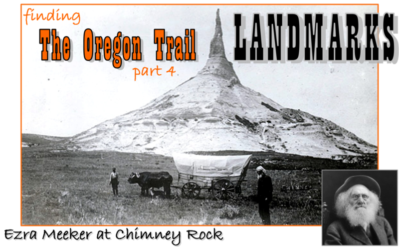
Unable to produce an accurate path, I instead elected to create a simple tour of the major landmarks that the emigrants would have passed. It takes 12 minutes to run, and contains no information (although most of the images in the placemarks, when clicked, link to information about the place). For me, the tour provides a feel for the monumental scope of the journey. I hope it does for you as well.
To run the Tour:
- Close this balloon.
- Double click on the KMZ globe icon in Temporary Places.
- Double click on the Oregon Trail Landmarks Tour camera icon.
Download File |
|


 Norm - Christchurch, New Zealand.