Master Cartographer
April 2015 - Nov 24, 2024 10:38:40 GMT
|
Post by syzygy on Nov 20, 2019 13:28:20 GMT
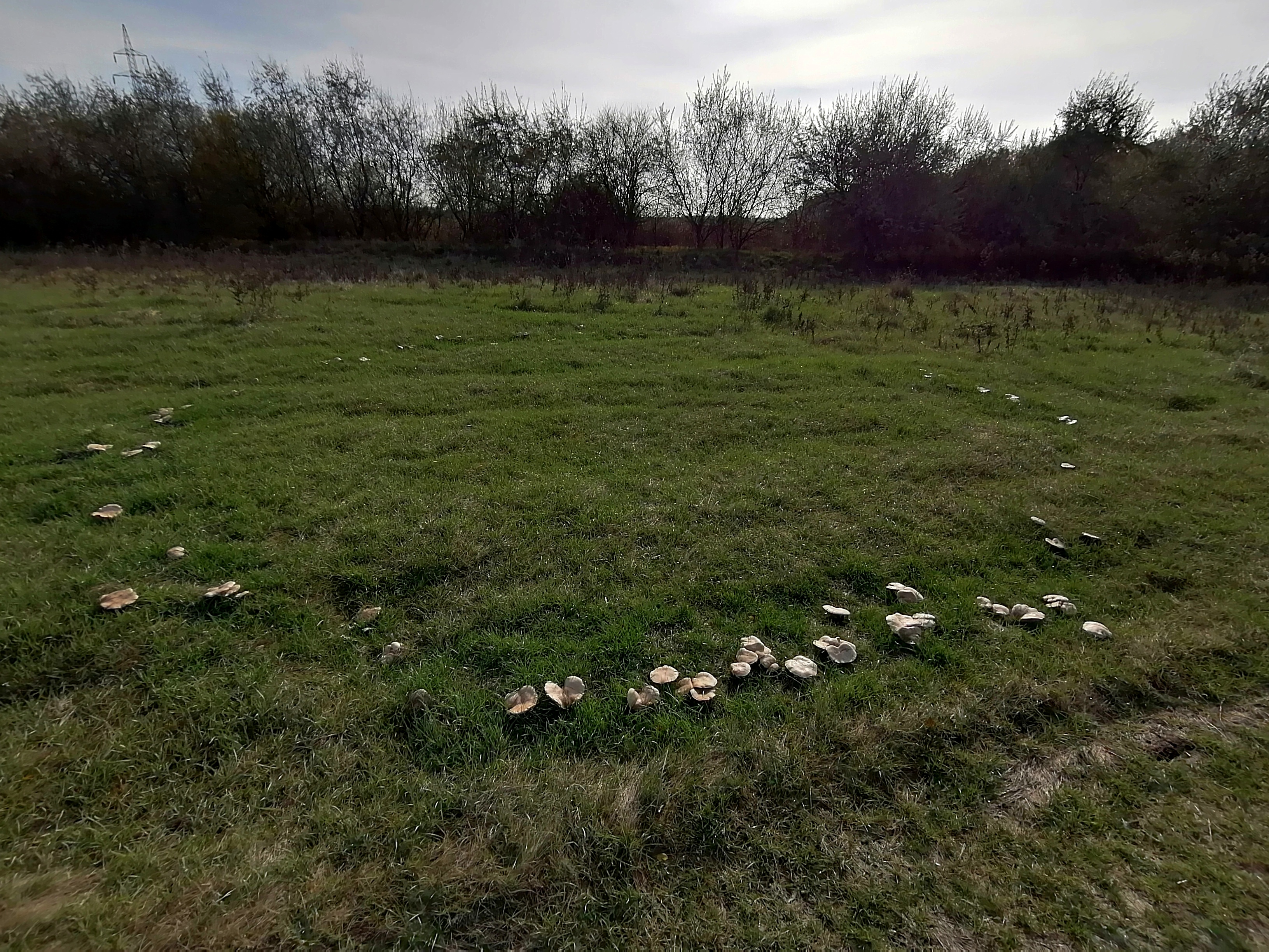
Hi All! Sorry for the duplication, as already have posted parts of this below to the members' photography thread, but meanwhile I could locate another site, and hope this could become a good solo-thread for the subject! *** Perfect circle of mushrooms I have found from around Algyő:  GMaps link GMaps link and if it would not work, the coordinates are >>46.321434, 20.160346<< Also have placemarked some further rings from the site, which are also visible on imagery (note: different imagery date for the one I have photographed) ... Read some about this interesting natural phenomenon on Wikipedia... Still I keep trying to locate the moss site on Iceland...! *** ...Well not that from Iceland, but the one from Australia, mentioned in the Wikipedia article I could locate easily.  By set kmz imagery date (I think) I can see the circle. *** By last update 4 sites from 4 countries with GE imagery reference attached: Fairy Rings.kmz (2.43 KB) |
|
Master Cartographer
April 2015 - Nov 24, 2024 10:38:40 GMT
|
Post by syzygy on Nov 22, 2019 11:59:08 GMT
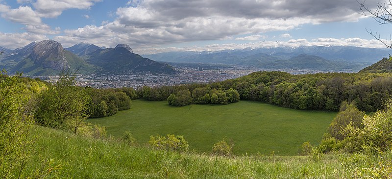
another wikimedia photo, now from France with visible GE imagery reference:  ring feature is clearly visible at >>45.175152, 5.666101<< on 9/28/2018 GE imagery updated kmz file attached to OP. |
|
Master Cartographer
April 2015 - Nov 24, 2024 10:38:40 GMT
|
Post by syzygy on Dec 9, 2019 14:20:47 GMT
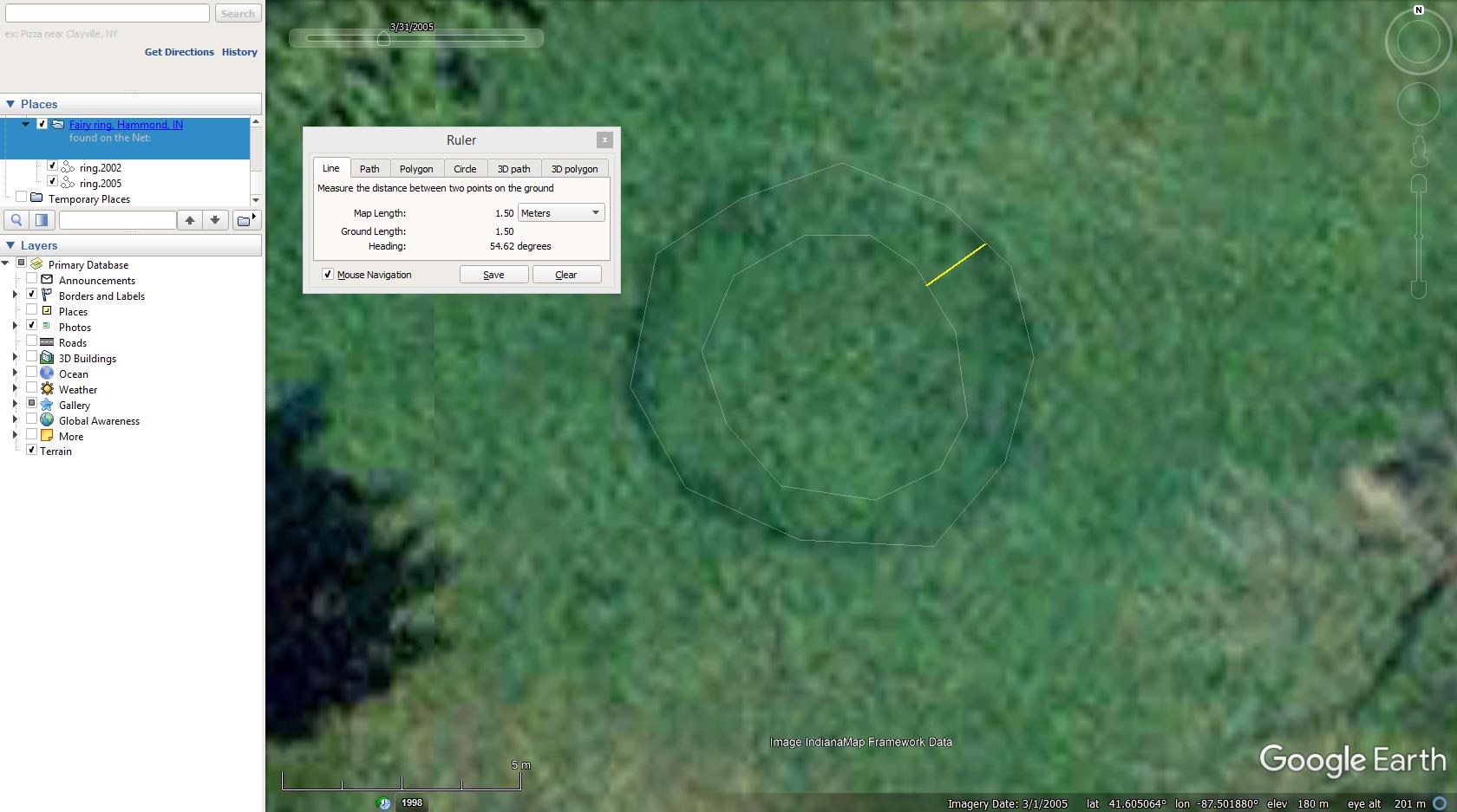
I have found spot on the Net (thanks indianamushrooms.com!), however made my own addition by checking historical imagery. Two imagery dates are perfectly fit by coordinates, where the fairy is visible, so speed of growth easily can be detected. In this case it was approx. 1,5 meters in 3 years (2002-2005), that means an approx. growth velocity of 1.38 millimeters/day. (:  >>41.605058, -87.501891<< *** Double click on each line-element brings you to proper imagery dates. - Updated kmz attached to OP. |
|


