Post by frankmcvey (Angel) on Mar 27, 2015 18:25:43 GMT
The Shipping Forecast 1.kmz (22.35 KB)
THE SHIPPING FORECAST
The Shipping Forecast is a much-loved feature of British life; so much so, that it was used in the Opening Ceremony of the 2012 London Olympic Games to symbolise our island heritage. The familiar litany and distinctive sound of these broadcasts has led to their attracting an audience much wider than that directly interested in maritime weather conditions. Many listeners find the measured cadence and repetition of the names of the sea areas to be evocative, comforting and almost hypnotic, particularly during the night-time broadcast at 0048 UK time.
The Shipping Forecast is a daily series of BBC Radio broadcasts of weather reports and forecasts for the waters around the coast of the British Isles. They are compiled by the Met office and transmitted by BBC Radio 4 on behalf of the Maritime and Coastguard Agency. Radio 4 is used because it still transmits on the Long Wave band - this can be heard more reliably at longer distances.
The Shipping Forecast is broadcast four times per day, at 0048, 0520, 1201 and 1754, although gale and storm warnings are transmitted as needed throughout the day, usually as a postscript to a news bulletin.
The Forecast sticks to a strict format, little changed since the radio forecasts were introduced in 1911, their continuity broken only by the two World Wars.
By 1949, the sea areas we now know were largely defined with only a few minor alterations since. There are 31 sea areas, although Trafalgar - off the west coast of Spain - is only included in the 0048 broadcast.

The broadcast is always delivered by the BBC duty continuity announcer. It is a model of economy and follows an unvarying and precise pattern. Excluding the introduction, the maximum allowed is 370 words, except for the 0048, when the BBC allow a further 10 words to allow Sea Area Trafalgar to be included. The Shipping Forecast takes the following format:
Introduction:
"And now the Shipping Forecast, issued by the Met Office on behalf of the Maritime and Coastguard Agency at xxxx today." (some announcers also give the date instead of "today")
Any Gale or storm warnings
Any gale or storm warnings will be broadcast first, before the main body of the forecast. For example:
There are warnings of gales in Rockall, Malin, Hebrides, Bailey, and Fair Isle
General Synopsis
This is followed by a General Synopsis - a big picture, if you like, giving any significant areas of high or low pressure in the region of the British Isles and the direction in which they are moving. The figures give the barometric pressure in millibars. For example:
Low, Rockall, 987, deepening rapidly, expected Fair Isle 964 by 0700 tomorrow.
The General Synopsis is a vital part of the forecast - by using it in conjunction with the detail given later in the Area Forecasts and Coastal Reports, a competent sailor can compile and interpret a complete pressure chart for the whole coastal area of northwest Europe.
The Area Forecasts
Then follows the Area Forecasts, the main body of the bulletin. These give a very brief description of the situation in each area, which are always listed in the same order, although several areas may be grouped together if their weather conditions are similar. The dictation-speed delivery is slow and measured, to allow listeners to write down the details, giving a poetry-like quality to the broadcasts.
For each area in turn, the announcer gives: the area name(s); wind direction and strength (on the Beaufort Scale); precipitation (if any); visibility. If there is a risk of icing, it comes last, following visibility. So some examples could be:
Humber, Thames. Southeast veering southwest 4 or 5, occasionally 6 later. Thundery showers. Moderate or good, occasionally poor...
Rockall, Malin, Hebrides. Southeast gale 8 to storm 10, backing east, severe gale 9 to violent storm 11. Rain, then squally showers. Poor, becoming moderate...
Southeast Iceland. North 7 to severe gale 9. Heavy snow showers. Good, becoming poor in showers. Moderate icing...
The forecast follows in the strict order shown in the list below. It starts at Sea Area Viking and goes round the British Isles in an approximately clockwise direction, concluding with Southeast Iceland. The one exception is Sea Area Trafalgar, which is only given in the 0048 broadcast.
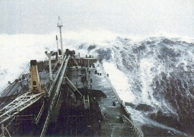
The numbers shown in the example above are the wind force on the Beaufort Scale - this is an empirical scale, which can be assessed by looking at the sea conditions. The Scale runs from force 0 (calm) to force 12 (Hurricane). A link to the full Scale is given below.

Force 12 (Hurricane force) on the Beaufort Scale
Tiree Automatic. East backing South 6. Light rain. 1 mile. 1019, falling slowly.
Inshore Waters
Additionally the extended forecasts also include conditions for the inshore waters (up to 12 miles from land). This would start with a General Situation, followed by the inshore area reports in order as shown below. The format follows that of the main Sea Areas forecasts. The inshore areas are shown as green dots and the format of the forecast would read
Cape Wrath to Rattray Head. Southeast 4. Slight rain. Moderate
Rattray Head to Berwick upon Tweed. South, 3. Occasional showers. Good.
The Sea Areas (in order of broadcast)
Viking
North Utsire
South Utsire
Forties
Cromarty
Forth
Tyne
Dogger
Fisher
German Bight
Humber
Thames
Dover
Wight
Portland
Plymouth
Biscay
Trafalgar (0048 forecast only)
Fitzroy
Sole
Lundy
Fastnet
Irish Sea
Shannon
Rockall
Malin
Hebrides
Bailey
Fair Isle
Faeroes
Southeast Iceland
The Coastal Weather Stations (in order of broadcast)
Tiree Automatic
Stornoway
Lerwick
Wick Automatic (00:48 only)
Aberdeen (00:48 only)
Leuchars
Boulmer (00:48 only)
Bridlington
Sandettie Light Vessel Automatic
Greenwich Light Vessel Automatic
St. Catherine's Point Automatic (00:48 only)
Jersey
Channel Light Vessel Automatic
Scilly Automatic
Milford Haven (00:48 only)
Aberporth (00:48 only)
Valley (00:48 only)
Liverpool Crosby (00:48 only)
Valentia
Ronaldsway
Malin Head
Machrihanish Automatic (00:48 only)
The Inshore Waters (in order of broadcast)
Cape Wrath to Rattray Head
Rattray Head to Berwick-upon-Tweed
Berwick-upon-Tweed to Whitby
Whitby to Gibraltar Point
Gibraltar Point to North Foreland
North Foreland to Selsey Bill
Selsey Bill to Lyme Regis
Lyme Regis to Land's End
Land's End to St David's Head
St David's Head to Great Orme's Head
Great Orme Head to Mull of Galloway
Isle of Man
Lough Foyle to Carlingford Lough
Mull of Galloway to Mull of Kintyre
Mull of Kintyre to Ardnamurchan Point
Ardnamurchan Point to Cape Wrath
The Beaufort Wind Scale is named after the Irish Royal Navy officer who devised it in 1805. A full description, with pictures can be seen here
Notes:
1. The limit of 370/380 words is set by the BBC, this being about the maximum number of words that the announcer can read at dictation speed in the allotted 3 minutes. For that reason, although the Met Office have been issuing Sea State reports (rough, calm, moderate, etc) for each Sea Area since 2006 - information which might conceivably be handy for a mariner to know - there is no room in the tight structure to fit it in. Sea State information appears on the internet or other comms devices such as NavTex, but not on Radio 4!
2. The Sea Area boundary lines shown on my GE map attached below are fairly accurate; however, if you need to know the precise lat/long boundaries of each area, you'll find them here, as well as lots of other good information on The Shipping Forecast. Alternatively, you can see them individually by double-clicking on any of the Sea Area Titles in the GE Viewer sidebar.
3. An equivalent Google Maps version of the map can be found here
4. If you're British, or if you're a sailor from Europe, you'll already have heard the Shipping Forecast. If you're not, then you can listen to it here courtesy of BBC Radio 4. To get the full effect, listen to the 00.48 broadcast; you really need to be safely tucked up in a nice warm bed on a freezing winter's night, with a nice warm drink, having just listened to a story on Book of the Week, with a howling gale lashing outside. Then you can feel properly sorry for all those trawlermen off Southeast Iceland in a Force Ten Nor'Easter, catching the cod that you'll be having at the weekend.

The Solway Harvester - Wikipedia

The wreck of the Solway Harvester, Douglas Harbour, Isle of Man. She was scrapped in May 2013.
Introduction:
"And now the Shipping Forecast, issued by the Met Office on behalf of the Maritime and Coastguard Agency at xxxx today." (some announcers also give the date instead of "today")
Any Gale or storm warnings
Any gale or storm warnings will be broadcast first, before the main body of the forecast. For example:
There are warnings of gales in Rockall, Malin, Hebrides, Bailey, and Fair Isle
General Synopsis
This is followed by a General Synopsis - a big picture, if you like, giving any significant areas of high or low pressure in the region of the British Isles and the direction in which they are moving. The figures give the barometric pressure in millibars. For example:
Low, Rockall, 987, deepening rapidly, expected Fair Isle 964 by 0700 tomorrow.
The General Synopsis is a vital part of the forecast - by using it in conjunction with the detail given later in the Area Forecasts and Coastal Reports, a competent sailor can compile and interpret a complete pressure chart for the whole coastal area of northwest Europe.
The Area Forecasts
Then follows the Area Forecasts, the main body of the bulletin. These give a very brief description of the situation in each area, which are always listed in the same order, although several areas may be grouped together if their weather conditions are similar. The dictation-speed delivery is slow and measured, to allow listeners to write down the details, giving a poetry-like quality to the broadcasts.
For each area in turn, the announcer gives: the area name(s); wind direction and strength (on the Beaufort Scale); precipitation (if any); visibility. If there is a risk of icing, it comes last, following visibility. So some examples could be:
Humber, Thames. Southeast veering southwest 4 or 5, occasionally 6 later. Thundery showers. Moderate or good, occasionally poor...
Rockall, Malin, Hebrides. Southeast gale 8 to storm 10, backing east, severe gale 9 to violent storm 11. Rain, then squally showers. Poor, becoming moderate...
Southeast Iceland. North 7 to severe gale 9. Heavy snow showers. Good, becoming poor in showers. Moderate icing...
The forecast follows in the strict order shown in the list below. It starts at Sea Area Viking and goes round the British Isles in an approximately clockwise direction, concluding with Southeast Iceland. The one exception is Sea Area Trafalgar, which is only given in the 0048 broadcast.
The numbers shown in the example above are the wind force on the Beaufort Scale - this is an empirical scale, which can be assessed by looking at the sea conditions. The Scale runs from force 0 (calm) to force 12 (Hurricane). A link to the full Scale is given below.

Force 12 (Hurricane force) on the Beaufort Scale
The term "veering" means that the wind direction is shifting clockwise; the term "backing" means that it is shifting in a counter-clockwise direction.
The descriptive terms used in the visibility category are also precisely defined:
Good means that visibility is greater than 5 nautical miles.
Moderate means that visibility is between 2 and 5 nautical miles.
Poor means that visibility is between 1000 metres and 2 nautical miles.
Fog means that the visibility is less than 1000 metres.
Precise definitions of all the other qualifying terms used (rough, imminent, rising quickly etc) can be found here.
Extended Shipping Forecasts
Coastal Area Reports
The broadcasts at 0048 and 0520 are extended by also giving weather conditions at the Coastal Weather Stations - these are shown on the GE map as red dots. Although a few of them have the suffix "Automatic" attached to their names, in practice most of these stations are automatic (ie unmanned) nowadays. The format of the forecasts follows that of the main sea areas, except that visibility distances are given in miles, and there is an added category :- following visibility, the barometric pressure for that station is given in millibars and whether it is rising or falling. So an example would be:
Tiree Automatic. East backing South 6. Light rain. 1 mile. 1019, falling slowly.
Inshore Waters
Additionally the extended forecasts also include conditions for the inshore waters (up to 12 miles from land). This would start with a General Situation, followed by the inshore area reports in order as shown below. The format follows that of the main Sea Areas forecasts. The inshore areas are shown as green dots and the format of the forecast would read
Cape Wrath to Rattray Head. Southeast 4. Slight rain. Moderate
Rattray Head to Berwick upon Tweed. South, 3. Occasional showers. Good.
The Sea Areas (in order of broadcast)
Viking
North Utsire
South Utsire
Forties
Cromarty
Forth
Tyne
Dogger
Fisher
German Bight
Humber
Thames
Dover
Wight
Portland
Plymouth
Biscay
Trafalgar (0048 forecast only)
Fitzroy
Sole
Lundy
Fastnet
Irish Sea
Shannon
Rockall
Malin
Hebrides
Bailey
Fair Isle
Faeroes
Southeast Iceland
The Coastal Weather Stations (in order of broadcast)
Tiree Automatic
Stornoway
Lerwick
Wick Automatic (00:48 only)
Aberdeen (00:48 only)
Leuchars
Boulmer (00:48 only)
Bridlington
Sandettie Light Vessel Automatic
Greenwich Light Vessel Automatic
St. Catherine's Point Automatic (00:48 only)
Jersey
Channel Light Vessel Automatic
Scilly Automatic
Milford Haven (00:48 only)
Aberporth (00:48 only)
Valley (00:48 only)
Liverpool Crosby (00:48 only)
Valentia
Ronaldsway
Malin Head
Machrihanish Automatic (00:48 only)
The Inshore Waters (in order of broadcast)
Cape Wrath to Rattray Head
Rattray Head to Berwick-upon-Tweed
Berwick-upon-Tweed to Whitby
Whitby to Gibraltar Point
Gibraltar Point to North Foreland
North Foreland to Selsey Bill
Selsey Bill to Lyme Regis
Lyme Regis to Land's End
Land's End to St David's Head
St David's Head to Great Orme's Head
Great Orme Head to Mull of Galloway
Isle of Man
Lough Foyle to Carlingford Lough
Mull of Galloway to Mull of Kintyre
Mull of Kintyre to Ardnamurchan Point
Ardnamurchan Point to Cape Wrath
The Beaufort Wind Scale is named after the Irish Royal Navy officer who devised it in 1805. A full description, with pictures can be seen here
Notes:
1. The limit of 370/380 words is set by the BBC, this being about the maximum number of words that the announcer can read at dictation speed in the allotted 3 minutes. For that reason, although the Met Office have been issuing Sea State reports (rough, calm, moderate, etc) for each Sea Area since 2006 - information which might conceivably be handy for a mariner to know - there is no room in the tight structure to fit it in. Sea State information appears on the internet or other comms devices such as NavTex, but not on Radio 4!
2. The Sea Area boundary lines shown on my GE map attached below are fairly accurate; however, if you need to know the precise lat/long boundaries of each area, you'll find them here, as well as lots of other good information on The Shipping Forecast. Alternatively, you can see them individually by double-clicking on any of the Sea Area Titles in the GE Viewer sidebar.
3. An equivalent Google Maps version of the map can be found here
4. If you're British, or if you're a sailor from Europe, you'll already have heard the Shipping Forecast. If you're not, then you can listen to it here courtesy of BBC Radio 4. To get the full effect, listen to the 00.48 broadcast; you really need to be safely tucked up in a nice warm bed on a freezing winter's night, with a nice warm drink, having just listened to a story on Book of the Week, with a howling gale lashing outside. Then you can feel properly sorry for all those trawlermen off Southeast Iceland in a Force Ten Nor'Easter, catching the cod that you'll be having at the weekend.
This post is respectfully dedicated to the memory of the crew of the Solway Harvester. She was lost with all hands in heavy seas off the Isle of Man on 11th January, 2000.

The Solway Harvester - Wikipedia

The wreck of the Solway Harvester, Douglas Harbour, Isle of Man. She was scrapped in May 2013.

