Newbie
June 2019 - Jun 25, 2019 20:39:59 GMT
|
Post by 2view on Jun 25, 2019 2:33:23 GMT
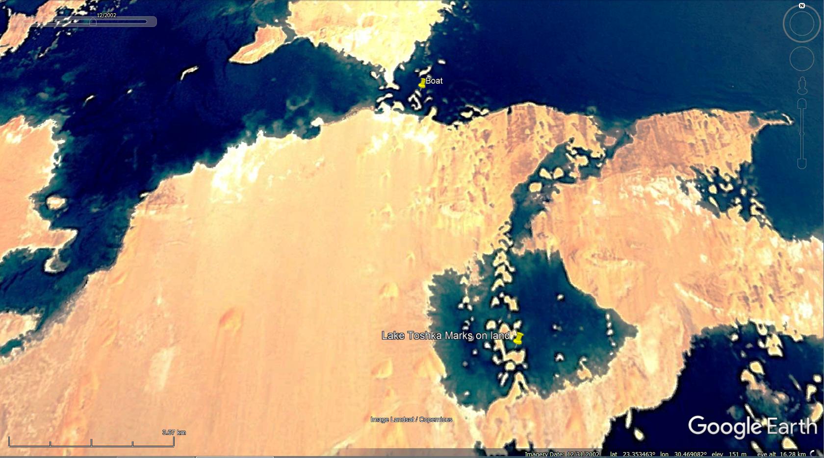
I was curious to see why there was a lake in the middle of the desert and happen to see this. If you look at the historical images one can only see the dunes. The dunes must have "Dissolved" (washed away) during the flooding.
I have email this possible find to people in UK, Egypt etc but no one responds back.
I also found a boat in the middle of nowhere. It was obviously uses while the lake was full and got stranded. Will be cool to see it in real life.
|
|
Master Cartographer
April 2015 - Nov 29, 2024 19:51:05 GMT
|
Post by syzygy on Jun 25, 2019 5:53:03 GMT
... Will be cool to see it in real life. how much great would it be! so many times also I have wandered...!: cool spottings! - will try to find out some in the afternoon... see you! g |
|
Master Cartographer
April 2015 - Nov 29, 2024 19:51:05 GMT
|
Post by syzygy on Jun 25, 2019 13:44:23 GMT
after construction of the Aswan dam water periodically can rush into this endorheic basin leaving nice linear pattern on the limestone plateu behind when water level falls and water runs off the depressions. - that cob-web pattern you have mentioned thus have no artificial, but natural origin made by water-flows and (quick) drying-out. (note this depression was flooded only once in 2002, probably that is why the line contours sharper than by the others) and yep; the boat must have been stranded at a high-water period (2002 imagery date fits again):  |
|
Newbie
June 2019 - Jun 25, 2019 20:39:59 GMT
|
Post by 2view on Jun 25, 2019 20:38:28 GMT
Thanks for the reply.
In the last year since nobody replied to my observation I thought that what is the chances that this area, thousands of years ago i.e 10000 BC or so received more rain than lately and that this area was always flooded and somehow this area could be flooded using a gate between this area and the rest of the lake. It could have been that this area is slightly lower than the rest of the lake and an irrigation system was possible.
A lot of those lines are just so perfectly formed and square. I showed it to friends and they are like. What. It looks like an old city.
Just due south by 80km is Nabta Playa - (10 000bc Solar temple). There is a documentary on it somewhere in the internet
|
|
Master Cartographer
April 2015 - Nov 29, 2024 19:51:05 GMT
|
Post by syzygy on Jun 25, 2019 22:05:17 GMT
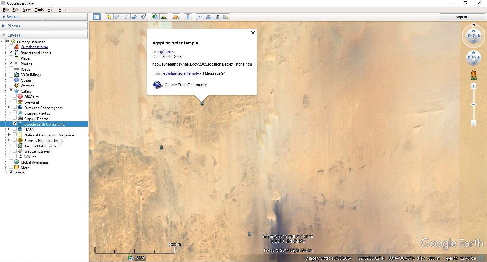
...due south by 80km is Nabta Playa - (10 000bc Solar temple). There is a documentary on it somewhere in the internet not a documentary, but tons of GSearch finds around the internet!(; whaz more! - if you check GE GEC layers, 3 posts appearing and the first poster, DjSmoke (oGEC) uses same "solar temple" expression as you for Nabta Playa archaeological site complex:  Dj also has given a link for us in 2005: sunearthday.nasa.gov/2005/locations/egypt_stone.htmwas not that the "documentary" on the net you have mentioned? ( edit: probably it was not ...: it says that the site "is between 6,000 and 6,500 years old" - not 10.000 as you say) *** thanks for stirring stagnant water up, anyhow!(: |
|
Full Member
January 2020 - Jan 5, 2024 10:40:59 GMT
|
Post by leong on Jan 18, 2020 11:02:04 GMT
The lake could always be filled by rain water from the north and local catchment, without the Aswan Dam being filled, as it has done since "like forever"
But the Lake Nasser can now spill over to this lake, perhaps in a hurry when they want to create reserve capacity in the Lake Nasser, as letting it down the Aswan dam would contribute to flooding.
|
|
