Trusted Member
Master Gamer
April 2015 - Sept 7, 2024 14:50:29 GMT
|
Post by hhgygy on Apr 2, 2019 19:11:07 GMT
Everything is in the title. Just saw this fairly short video and instantly thought of making a puzzle from it. First a screenshot from the video: 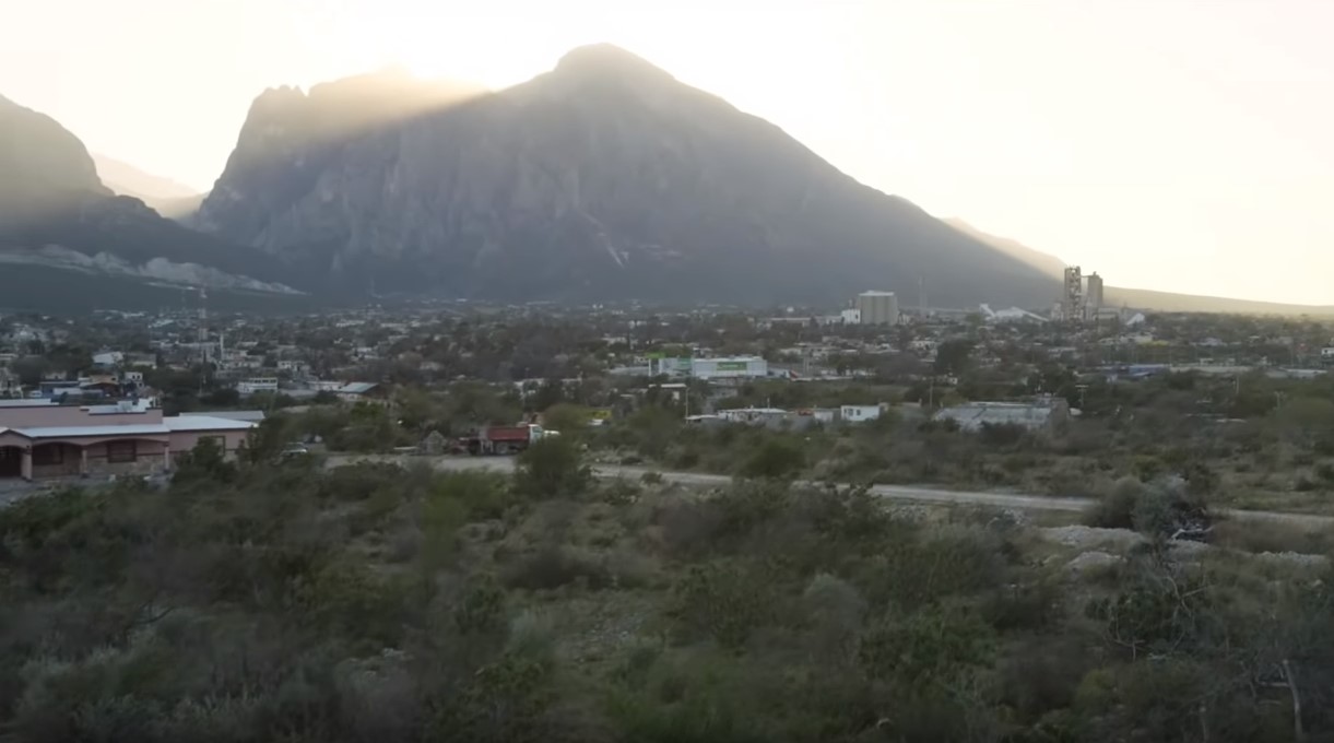 And then the approximate location in Google Street View 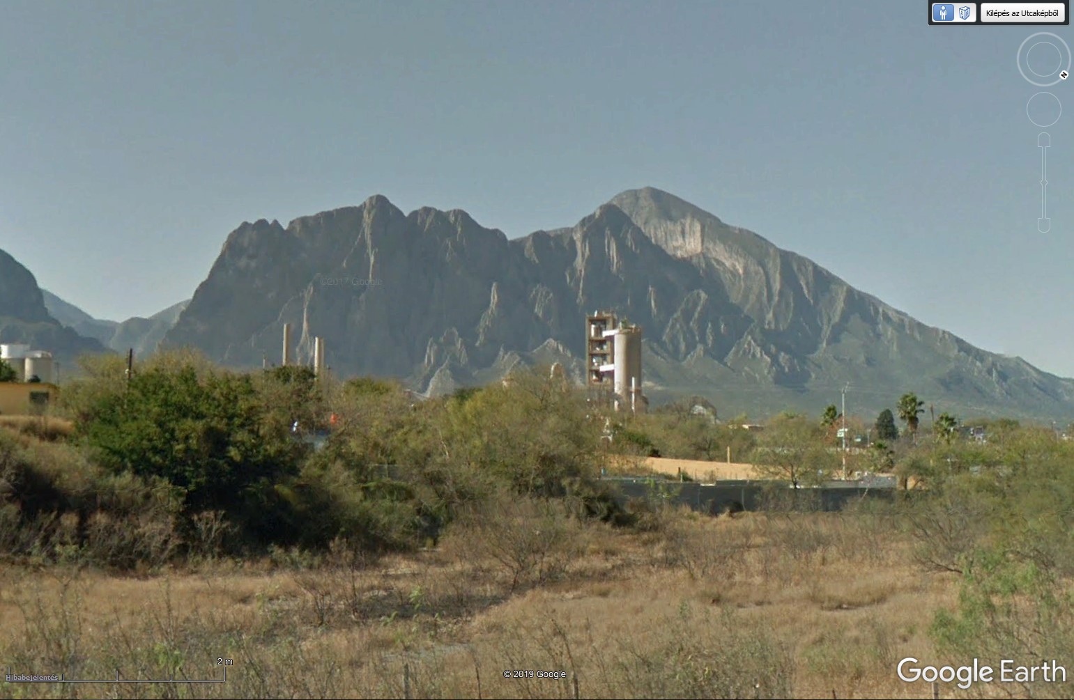 GSV please |
|
Trusted Member
Master Gamer
April 2015 - Sept 6, 2024 12:50:38 GMT
|
Post by ndrqu on Apr 3, 2019 7:52:40 GMT
Had some luck guessing the nation  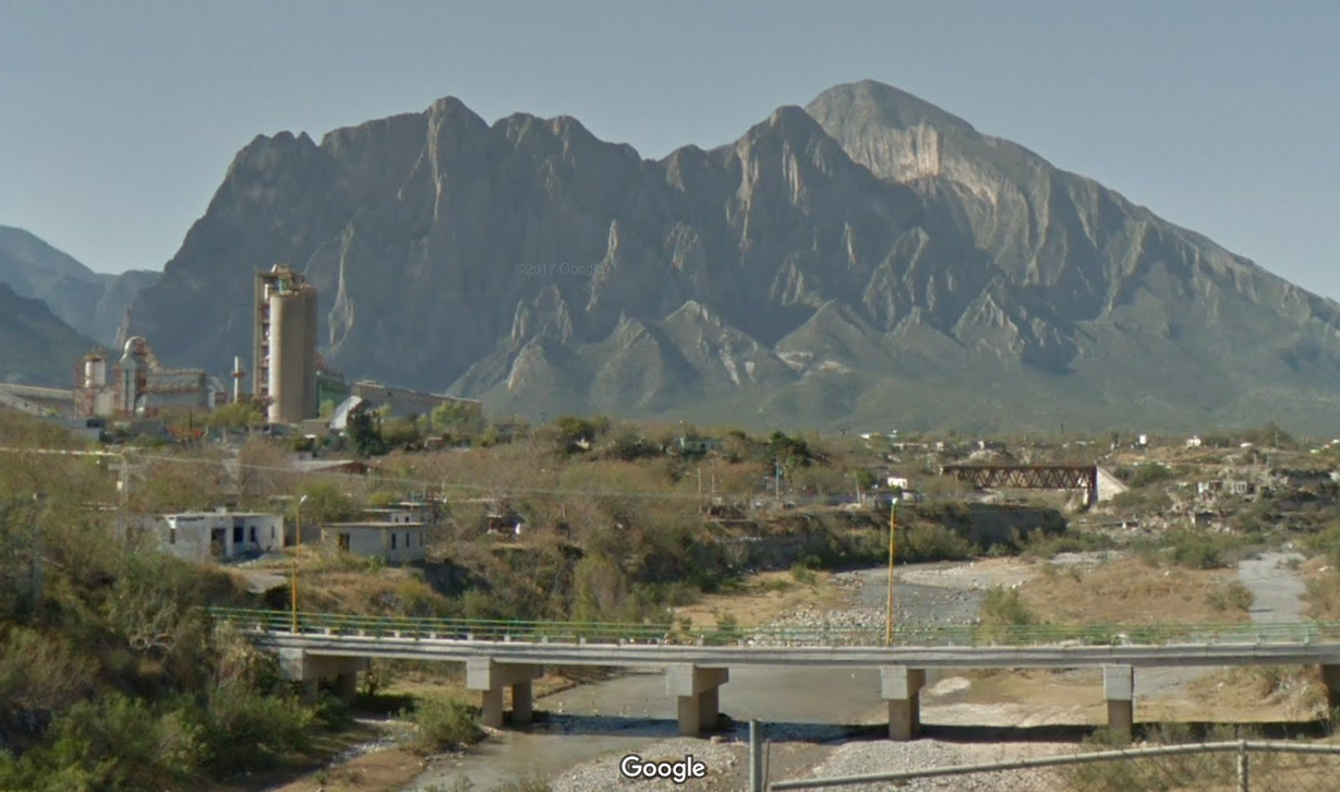 |
|
Trusted Member
Master Gamer and Scrutiniser
April 2015 - Sept 8, 2024 8:18:14 GMT
|
Post by krenek on Apr 3, 2019 8:52:03 GMT
|
|
Master Gamer
April 2015 - Sept 8, 2024 5:59:05 GMT
|
Post by Walter_V_R on Apr 3, 2019 11:11:38 GMT
|
|
Trusted Member
Master Gamer
April 2015 - Sept 7, 2024 14:50:29 GMT
|
Post by hhgygy on Apr 3, 2019 21:49:52 GMT
CLUE
Look for the Shining Path
(Not in politics)
|
|
Trusted Member
Master Gamer
April 2015 - Sept 7, 2024 14:50:29 GMT
|
Post by hhgygy on Apr 6, 2019 8:46:35 GMT
CLUE 2 The same guy who soloed El Capitan |
|
Trusted Member
Master Gamer
April 2015 - Sept 7, 2024 14:50:29 GMT
|
Post by hhgygy on Apr 10, 2019 18:21:14 GMT
ANSWER On January 15, 2014, Alex Honnold free-soloed El Sendero Luminoso (The Shining Path) in El Portrero Chico, Mexico in a little over 3 hours. The climb rises 2,500 feet to the summit of El Toro. It could be the most difficult rope-less climb in history. Here is a breathtaking video of the climb
Coordinates: 25°57'4.75"N 100°28'57.31"W |
|


