Newbie
March 2019 - Mar 14, 2019 5:10:32 GMT
|
Post by cish on Mar 14, 2019 4:52:31 GMT
Hi,
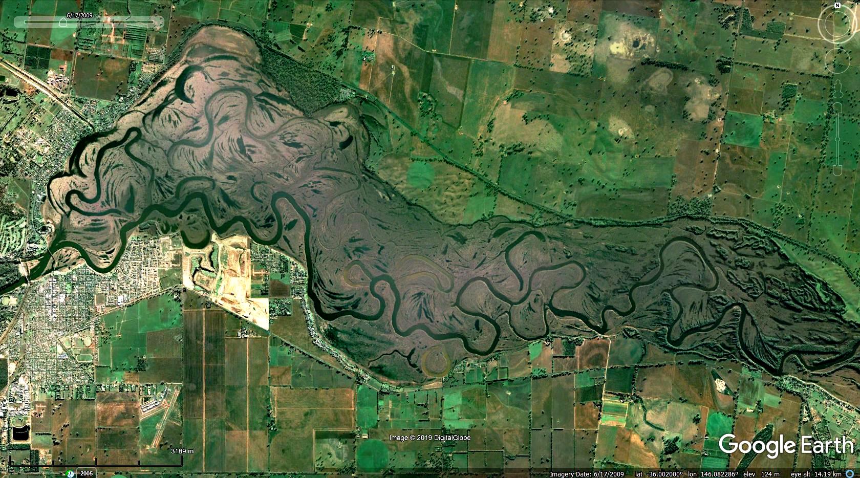
I am in desperate need of the google earth map of Lake Mulwala (NSW, Australia) during its draw down (emptied). It occurred in June 2018 and also back in 2009 if that helps.
Many thanks!!!
|
|
March 2015 - Jan 23, 2023 9:58:32 GMT
|
Post by Admin on Mar 14, 2019 6:57:48 GMT
You can see it by using the time scale in the desktop version. Download HERE |
|
Master Cartographer
April 2015 - Nov 16, 2024 0:46:11 GMT
|
Post by syzygy on Mar 14, 2019 7:22:27 GMT
hi and welcome! I have seen, you already have "liked" a thread on topic, where I already put up screenshot of the only available GE image of the 2009. low-level period:  most recent imagery has not changed since and is from 8/26/2018 when water level was still high. ...if it was... (?!):
article from Jun.06.2018 shares aerial photos said to be taken a week before that date and show drying-up reservoir bed around Mulwala-Yarrawonga bridge... (!?) this way you have made me* to point out an interesting contradiction between local aerial photo report and GE imagery data display, that should be resolved! ... only an advice for best forum-response results: next time if you find some forum-thread for your interest, do not set up a new one for a question, but put up as a reply to the "original". this way author and repliers who bookmarked, will read your question by better chance, also this reply would have been added to an already existing bouquet of informations. best! g --- p.s.: *with your question also you have made me to do this 1000 th posting of mine around here on nGEC Forums! - I am thankful to staff to make this available and to you -dear forumer in general-, making the situation! |
|


