Master Cartographer
April 2015 - Nov 21, 2024 8:06:11 GMT
|
Post by syzygy on Jan 5, 2017 8:40:20 GMT
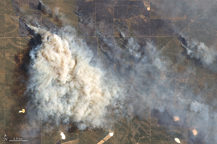
Multiple Fires Blaze in Argentina - January 5, 2017 download large image (10 MB, JPEG, 3608x6817) Dense smoke rose above a rash of wildfires in the Pampas region of Argentina in late December 2016 and early January 2017. Over the past month, roughly two dozen fires have spread across the rural landscape. The blazes were likely started by thunderstorms that followed a stretch of hotter-than-average weather, according to Clarín, a South American news site. In mid-December 2016, news reports showed heavy smoke billowing from the undergrowth. At that point, fires south of Bahía Blanca had consumed at least 40,000 hectares (nearly 100,000 acres). Despite rain in the final days of December, a handful of hot spots persisted. By early January 2017, fires in Argentina had devoured 300,000 hectares, an area roughly 15 times larger than the city of Buenos Aires, noted Clarín. The Operational Land Imager (OLI) on the Landsat 8 satellite captured a natural-color image (above) of a smoke plume south of Río Colorado on December 29, 2016. ... read full article at earthobservatory.nasa.govPampa Fires 2017. - overlay.kmz (1.25 KB)
|
|


