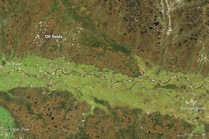
The Moderate Resolution Imaging Spectroradiometer (MODIS) on NASA’s Aqua satellite acquired the image on September 30, 2016.
"The Ob River runs a course through the middle of Russia’s largest and most important gas and oil region. The West Siberian Basin, a vast region of tundra and taiga in north-central Russia, contributes about two-thirds of the country’s crude oil and natural gas output. ... While the fossil fuels in the West Siberian Basin have been an economic boon for Russia, they also have had a significant impact on the environment. In June 2015, a leak in an oil pipeline blackened the Ob River and contaminated tap water in the city of Nefteyugansk."
Opening attached kmz you get into a close view of an oil (or gas) flare. Doubleclick on the line feature in folder: view moves to a higher altitude from where you see a large, continuous section of this huge industrial network (needlessly) outlined.
First relevant Community-layer mark 150 kms E - old forum member; spotter2 spotted several other flares.
Gratis: off-topic, History Illustrated cathegory oGEForum thread by Tom. (blue "i" layer mark nearby) (The Vitus Bering expeditions - GE presentation by TomKjeldsen)
All kmz content I share were created with Google Earth (PC-version). All my artistic GE shots on Instagram >> @syzygy426 << All of my nGEC forumthreads All about my avatar kml2xls