

Post by washi on Jul 9, 2016 10:38:22 GMT
I've recently created videos of Google Earth Tours of a couple of my daily bicycle rides, and I've posted them on You Tube. I have my You Tube account set to share posted videos on Google +, and one got a comment from a voice from the past, Kite Surfer of old Google Earth Community fame. I'm posting my reply to him here, and will send him a link to it on Google +.
Thanks, Kite (nice to use that name again).
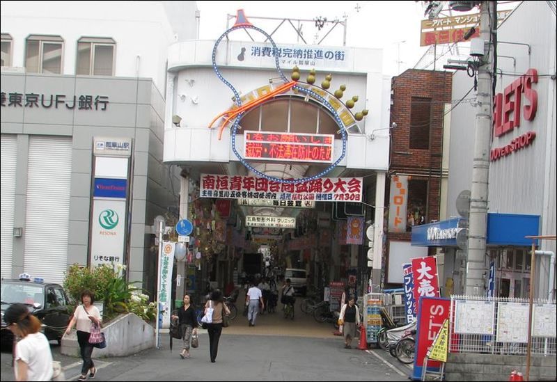
The covered shopping street that you see that you see at the beginning of the video is Kaneoka Shotengai. (金岡or "Gold Hill" is the name of the plantation that was established in the old Yamato River bed in that area, when the river was rerouted in 1704. The road that passes through it is the old highway from the area of Osaka Castle to the old village of Yao.
I hate to exercise for its own sake, but if I can do it in the process of seeing something new and interesting, I don't mind it too much. My bike ride this Friday took me through a much more interesting shotengai, one that covers over 360 meters of a road that is at least 1000 years old, and quite possibly more than twice that. The road still has the designation of National Route 170, but is also called Higashi Kōya Kaidō, a name that suggests that it was first given in the Heian Period, when the huge temple complex was established on Mt. Kōya and many people traveled to and from there and Kyoto. I'm confident that the road is much older. It appears on an area map of the 5th century, and since the region between the Yamato River Delta and Lake Kawachi on the west, and the mountain range on the west has been inhabited since the most ancient of times, movement of these people to the north and south would have taken place at least somewhere close to the location of the road as it has survived in modern times. I've attached a tour of the area I rode through, between the point where it crossed the Yamato River and the place where I turned back toward home, where the expressway enters the tunnel under Mt. Ikoma. I've followed this road in some sections south of the river, and perhaps someday (when the weather cools a bit) I'll pick it up again going north.
After you click on the link to download the tour, you'll need to stop it and follow the directions if you want to see it displayed over the overlaid map of the Osaka area in the 5th century.
To download the tour file, click >>HERE<<.

