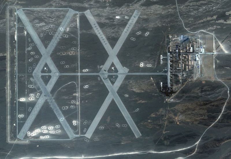
Well, Washi, I couldn't let a challenge like that go unanswered! It's certainly an enigma at first sight, that's for sure, and it cost me some puzzling.
Yaerbashi Air Base.kmz (838 B)
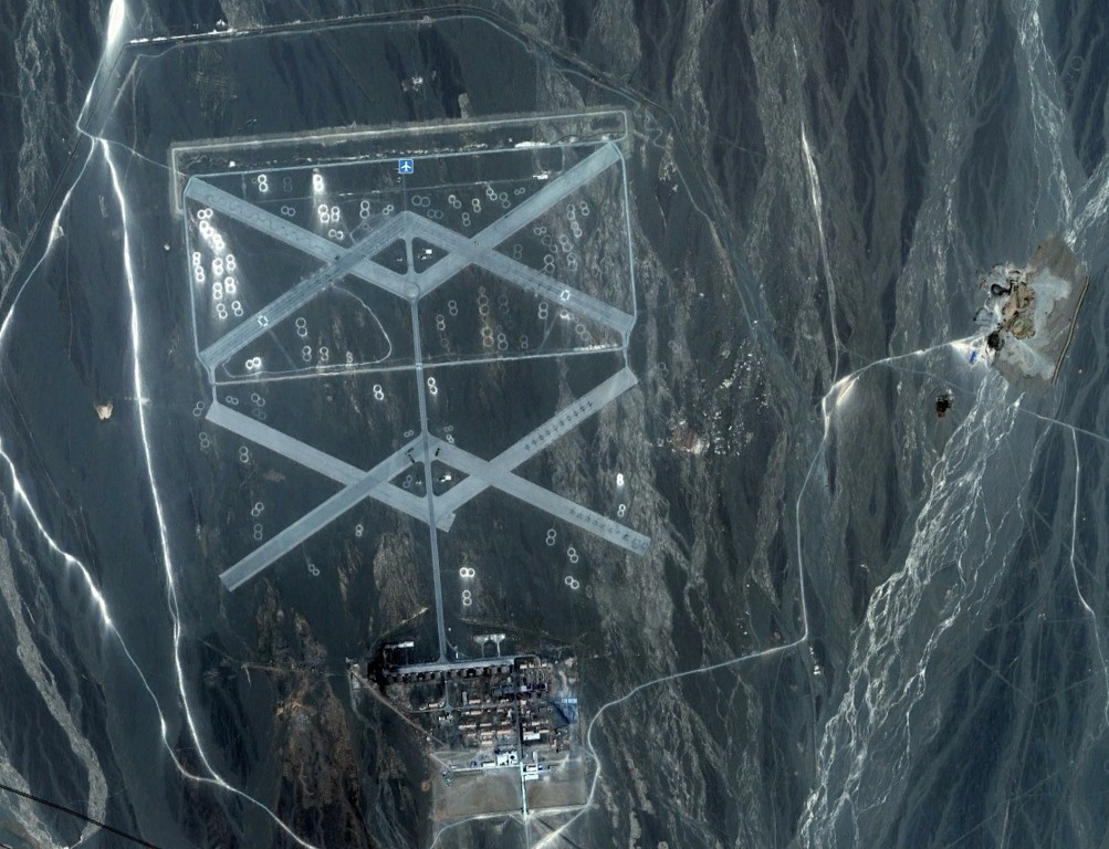
To analyse the place it's probably best to put it into historical context.
For centuries, the Chinese had feared the warrior hordes pouring down from the north. So much so, that they built the Great Wall of China, the longest building on Earth, running for nearly 4000 miles, which passes through this region a couple of hundred Klicks south of here.
China eventually triumphed and annexed Mongolia and ruled it for around 200 years. However, the ruling dynasty in China collapsed in 1911 and the Republic of China was formed and Mongolia cosied up to Russia and declared its independence from China. China invaded and was driven out by White Russian Forces, which, in turn were driven out by the Red Army, and the Republic of Mongolia was formed in 1924.
The Japanese invasion of China distracted them for a few years, and, by the end of WW2, China was forced to accept the fait accompli under Soviet pressure and signed a treaty in 1949. However a schism developed between China and Russia and China felt threatened by Mongolia (not a part of the USSR, but certainly a protege), so there was a de facto state of Cold War along the China/Mongolia border.
This small outpost came about as a result of that suspicion and is only one of the many defensive facilities along China's northern border. You could think of it as a latter-day augmentation of the Great Wall.
So what is it? Well, it's an airfield, as you might guess, and I think it was designed and optimised for QRA (Quick Reaction Alert), the objective being to get as many fighters in the air as quickly as possible in the event of a surprise attack. It's well-sited and you'd have sufficient warning - you're around 120 miles from the border, so in the event of a surprise air attack, your ground radar would give you around 15 minutes warning of an incursion across the border.
I've seen some posts objecting - as you did - to the shortness of the runways. Yup, at around 900-1000 yards long, they're certainly far too short to handle commercial jets, long-range bombers or even modern heavily-loaded fighter-bombers. But if you consider the lightly-loaded gunfighters of the early jet era - aircraft like the MiG-15 and Mig-17 - which could take off in around 2000 feet and land in 2700 feet, the short runways were quite adequate. Even if you did overrun the runway on landing due to brake failure, the overrun areas are pretty flat and you'd do little damage and, what the hell, you're pretty expendable anyway.
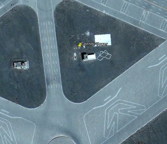
So why 8 runways? Parallel processing, I'd guess - instead of a long serial string of 20 or so fighters queuing up to use one runway, they'd practice using multiple runways for a full scramble. That's why there's 2 control towers, one for the northern set of runways, and one for the southern. I would guess that even in its heyday there would only have been 2 runways of the northern complex and 2 runways of the southern in normal day-to-day use. If you look closely at the control towers, there's a small white symbol beside each one showing what 2 runways that tower is controlling.
Aircraft, while landing, don't mind how hard the wind is blowing, as long as it's blowing straight in their face, but they're very susceptible to crosswinds, particularly light aircraft like the Mig-15 and -17 with huge tail fins that act like weathercocks and always try to turn you into wind. And that's why, at most airfields, you'll have two runways at different headings. The prevailing winds here are pretty much westerly, so the chances are that if the crosswind is too strong on one runway, they'll be able to use one of the runways angled in the opposite direction.
 MiG-17 showing large tailfin. Photographer unknown, courtesy aircraft-list.com
The four remaining runways - 2 in each complex - are, I'd suggest, simply there for redundancy. Why not - they ain't going to take up any more real estate than the existing 4 runways; they give you a fallback if one or more of your runways is out of action due to a crashed aircraft or a bomb crater, and they give the enemy twice as many problems if he's trying to take out the whole airfield by bombing or artillery.
As for the rest of it, we can see many of the same facilities that you'd expect to see at any other cold war airfield near to the front line. There are 14 hardened aircraft shelters, very much in vogue in the 70s - they'd survive a near miss from a 1000lb bomb. However, the majority of them are neatly lined up like ducks in a row, greatly increasing the chances of a bomb hitting at least one of them - on most Western airfields , the HASs are dispersed randomly.
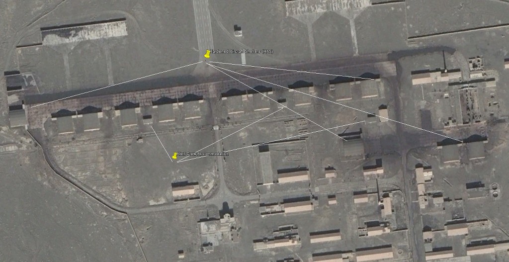
In these days of smart weapons they're actually pretty useless and all they do is to confine 1-2 aircraft, their aircrew and ground crew, weapons and ground equipment into one neatly-parcelled up little package to be annihilated by one laser-guided bomb. Blast-proof walls are great if you and the bomb are on different sides of the wall - they're lethal if the bomb happens to be in the same room as you!
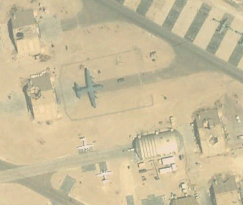 Damaged HASs at Al Salem AB, Kuwait post Gulf War 1
Because of the short warning time, the aircraft would have been kept fully fuelled and armed and hooked up to the electrical starter trolley, with the groundcrew and aircrew living in the HAS with their aircraft. They'd have been rolling within 3 minutes of the klaxon going, and airborne in less than 8, conservative estimates. Been there, done that. This vid shows a MiG-15 startup and even at the leisurely pace these guys are working at, he's rolling in about 3.5 minutes
The HASs themselves look pretty small, but the Mig-15 has a small wingspan (33ft) so the shelters are big enough to take 2 aircraft each:
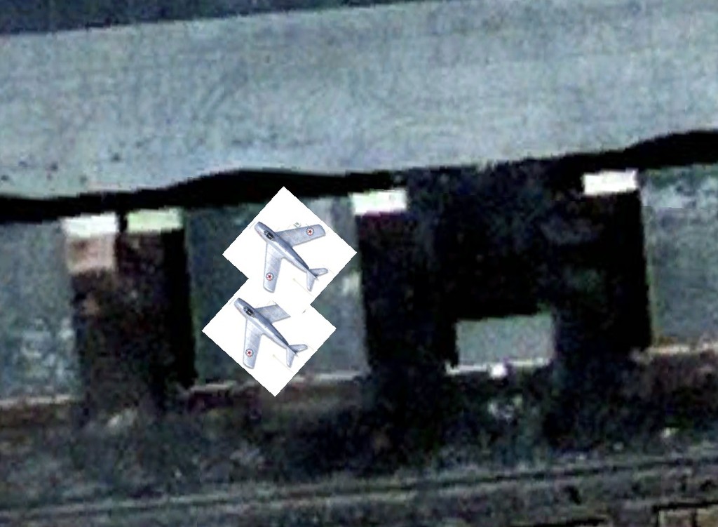
I've indicated the other facilities in GE and they're pretty much self-explanatory. There doesn't seem to be much evidence of permanent SAM or AAA defences, so I'd guess that mobile AAA would have been deployed in the event of an alert.
So, there we have its original use; a Cold War QRA airfield. A bit of a one-trick pony, but very well designed for a specific job at a specific time using specific aircraft against a specific enemy. And very survivable for at least long enough for the rest of China to wake up to what's happening. Well, if it's such a great design, why didn't they use it all along the border? Perhaps they did, but I've only come across one other, at Yandung, about 75 miles down the road. There may be others, but I haven't had time to look.
Yandung.kml (950 B)
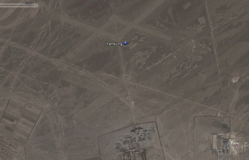
Yandung looks derelict and abandoned; if fact it looks as if the PLA have been trying out their runway denial weapons on it, same as we did at RAF North Luffenham, only these are smaller, almost like cluster bomblets.
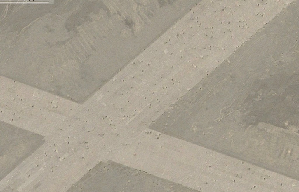
Anyway, come the end of the Cold War and China formally recognises Mongolia's right to exist as an independent state. China is burgeoning as a military power - they've always had the men, but now they've got the money and hardware as well. There is no longer a perceived threat from Mongolia - they'd be daft to try a sneak attack on China now, in any case.
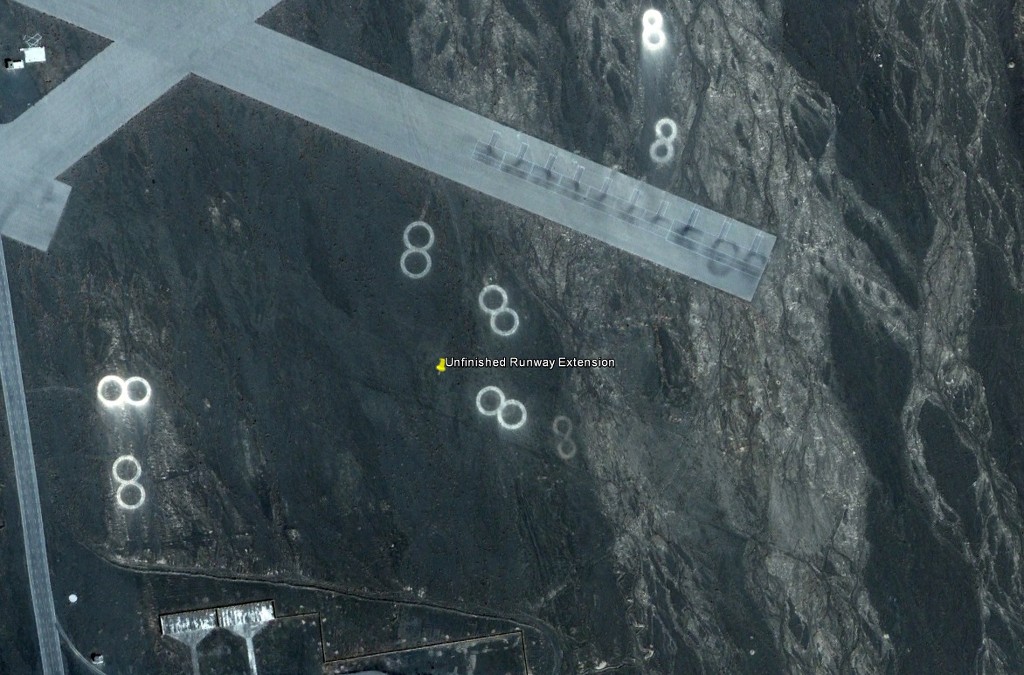
So our little QRA airfield at Yaerbashi is now redundant - there's only one trick it was good at, and the need for that trick has disappeared. So let's convert it to a normal airport by extending one of the runways. So we get our grader and we grade the southeast end of the southeast-most runway. The someone asks "Why are we doing this? All we've got here is a bloody big coalmine and a bloody big watermelon farm, and the railway takes care of those! And, in any case, we've got a also got a bloody big modern airport at Hami, 50 miles down the road." So the project is abandoned, but you can still see where the grader has done his work - there's the ghost of a runway still there to this day.
So what now? Well, I've seen speculation in the internet that it became a missile base. That certainly happened to a number of UK ex-WW2 airfields in the 60s and 70s, such as North Luffenham and Woolfox Lodge; in some cases for point-defence SAM sites and in others for (very short-lived!) ballistic missiles. These, however, both leave very definite footprints, and I see no evidence of missile pads at Yaerbashi. If it was a missile site subsequent to its demise as an airfield, then they must have been mobile, and perhaps it was indeed used as a forward base for missile launchers and that's what the parking bay markings on most of the runways were for. Naturally, the launchers would have been dispersed in time of tension. If that was the case, it could have accommodated a LOT of launchers.
Winding the clock forward to the present day (well, to 2010 at least, since that's the latest imagery we have), we can see that Yaerbashi has recently been extended and that there's now a bunch of hieroglyphics on the main runways. To anyone who's seen an aerial shot of a military driving school, it's immediately obvious that's what it is, as if the 36 trucks lying neatly about the runways didn't give you a clue!`
The 2 northernmost runways are laid out with figure 8s, zig-zags, bends and crossroads as well as angled parking bays and T-junctions.
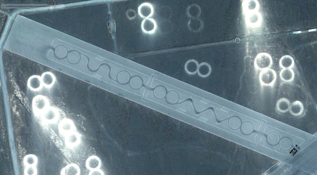
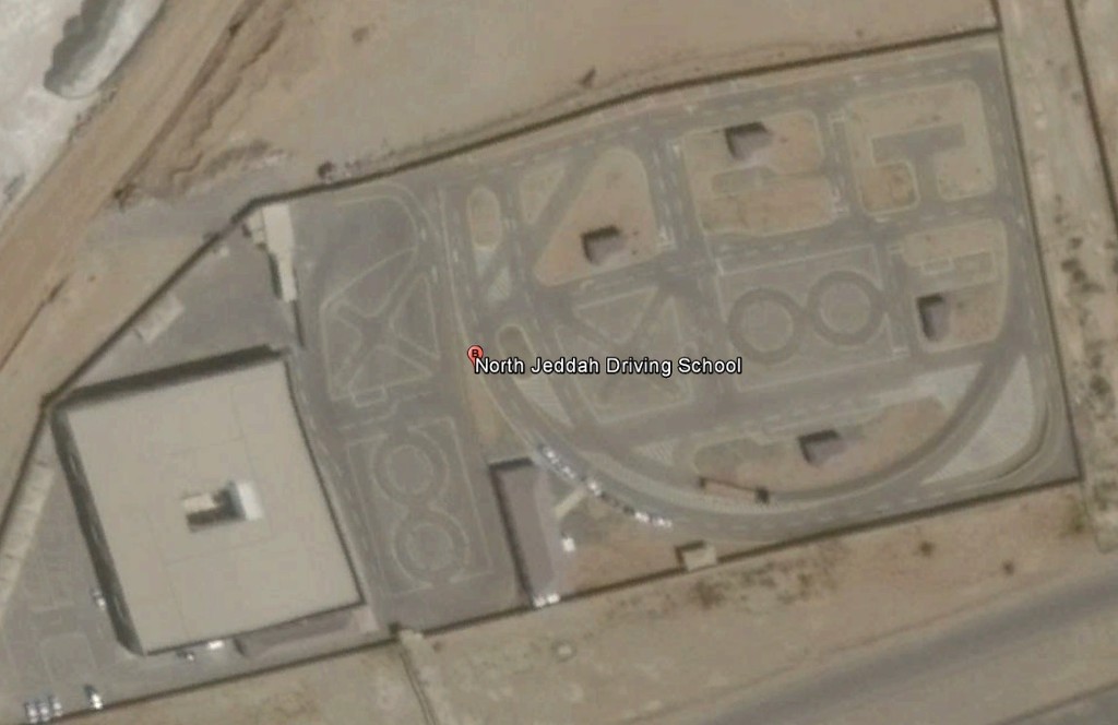
Compare this with the Dallah Driver Training School in Jeddah:
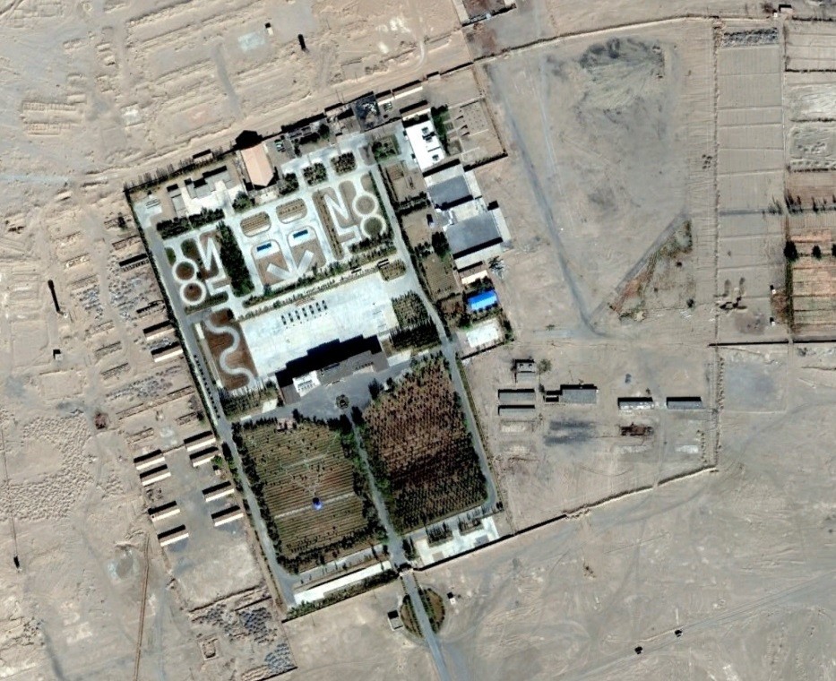
Or this one in Buge Yin a Rila, aslo in China:
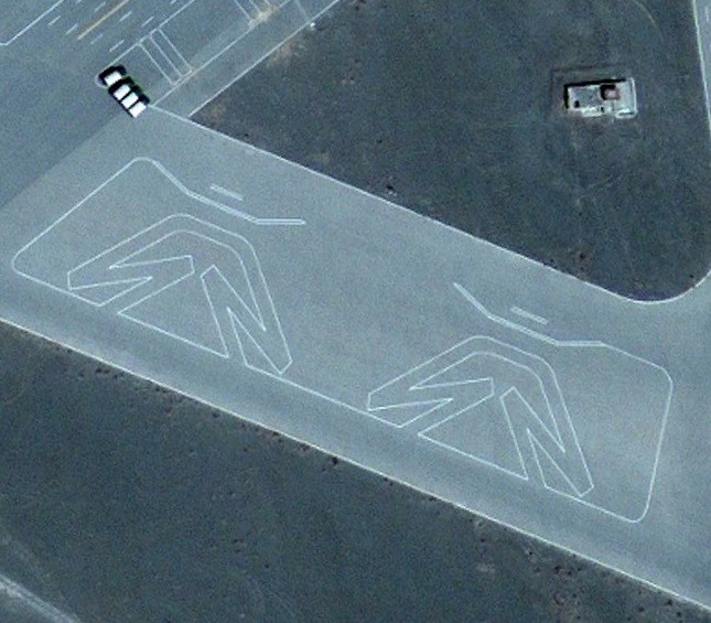
Back at Yaerbashi, on the innermost parts of these same 2 runways, there are weird-looking angular figures, which, I believe, are designed to test both forward and reverse manoeuvering in a tight area.
The two northern perimeter roads running east-west have plenty of hazards and obstacles on them.
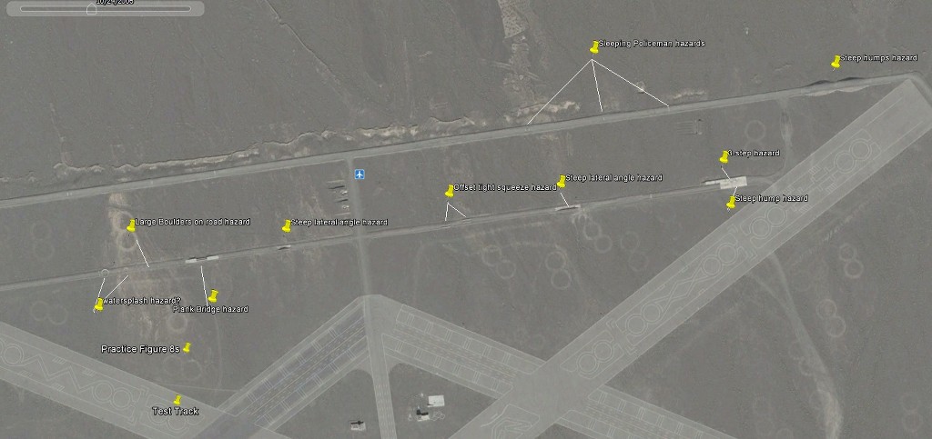
On the lower one of the two from the east, we have what looks like a concrete humped ramp with an optional set of 3 large steps, followed by a white section of road which looks as if one side of the road is sunken, putting a steep lean on the vehicle as you go through it. This is followed by two very narrow sections giving very little clearance for a truck, and some fiendish person has built them offset, so you have to realign your truck after you've cleared the first one. This is followed by another, even steeper, leaning section, followed by a "plank" bridge. Then comes a number of large nasty boulders in the road - there's no way to avoid them, so these are going to violently swing the truck from side to side as well as wrenching your arms out of their sockets if the trucks - as is likely - don't have power steering. Not too sure of the function of the two different-sized circles, but they could be water splashes with steps up and down into them. This goes on all round the road that forms the perimeter of the northmost 4 runways, with spots where you have to squeeze two trucks past each other etc.
I was greatly puzzled at first by the large number of figure 8s all over the place. Some surmise that it was because the 8th Field Academy was here! However, if you look closely at them, you'll see that the majority of them are pretty much the same size as the figure 8s on the test track we spoke of, and they're not just tyre marks in rough ground. There are one or two improvised ones which look a bit distorted, but the majority of them have been graded, metalled and accurately constructed as two adjoining perfect circles. These aren't simply student graffiti!
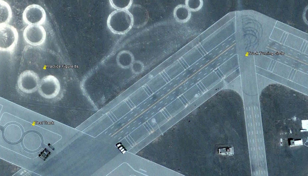
Let me go back to my time as a technical instructor. We would often find ourselves in the situation where we were teaching a class of 10 people on a highly complex integrated suite of avionics equipment. Fine when you're in the classroom, but when it comes to training them individually hands-on on the equipment, you come up against budget constraints. The training rig - which simulates a complete Tornado aircraft cockpit and avionics systems - costs several million pounds and takes up a whole building by itself. You can't afford 10 of them - you only have one. So you have to take your class on to the rig, 2 at a time, for an hour or so. By the time you've worked your way through the class, it's taken you all day to do 1 hour's effective work, and each member of the class has spent 1 hour working and the rest of the day sitting around waiting. Not an efficient use of time or manpower.
And I think that's exactly the situation our Chinese instructors have found themselves in. There are only 2 test tracks, and if you're doing timed runs, you'll only use a track for one student at a time. You've got 36 trucks available, so I'm guessing that the class sizes here will be 30 guys or so, leaving a few spares for breakdowns. You don't want 28 of them sitting around unproductively while you have 2 guys on the real test tracks, so you give them each a truck and you make them go away to a spare Figure 8 and do figure 8-shaped doughnuts for hours on end. The Figure 8s are exactly the same size as those on the test track, so you're giving them good valid practice for their final test. They're also pretty much the same diameter as the full lock turning circle of the truck, so the poor student is going from full left lock to full right lock every few seconds and if, as I suspect, these don't have power steering, it's also going to give the students a great upper-body workout as they're practicing. Fiendish, eh? And probably pretty practical if you're teaching a grunt advanced HGV driving on rough unmade roads.
Don't believe me? Then let's take another look at the Buge Yin a Rila driving school pictured above:
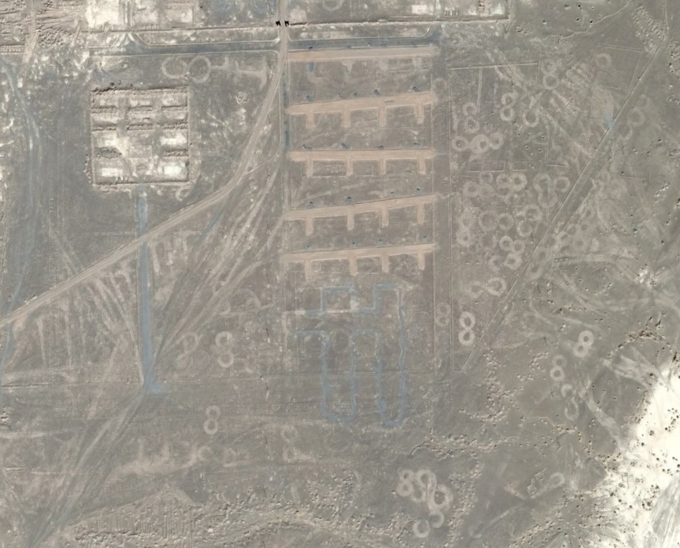
This GE screenshot shows the area just to the NE of the driver's practice camp shown above, showing the same Figure 8s.
To be continued....