Newbie
April 2016 - Apr 21, 2016 21:24:54 GMT
|
Post by breeze on Apr 21, 2016 21:24:54 GMT
I tried putting in the legal description of some land I just inherited and the system did not recognize the request.
This is it. "The SW Quarter of the NE Quarter of Section 13, Township 7 North, Range 20 East, Haskell County,Ok.
Any ideas on how to do it, Thanks.
|
|
Cartographer
April 2015 - Nov 3, 2024 2:30:25 GMT
|
Post by washi on Apr 22, 2016 0:27:14 GMT
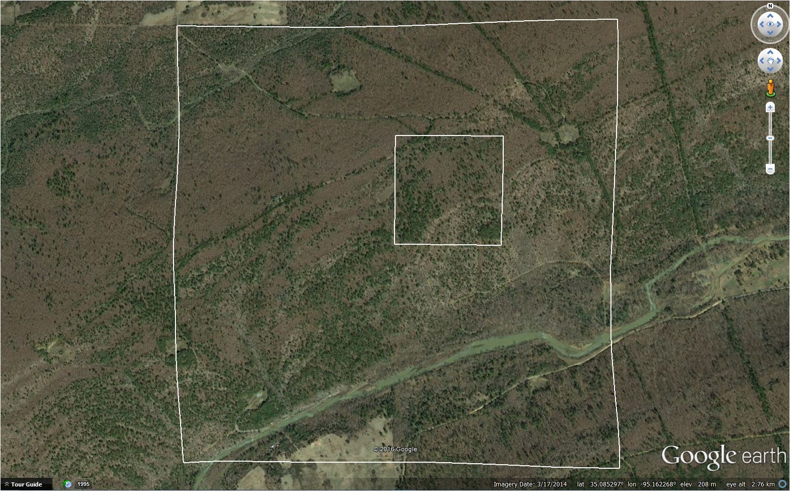
Hi Breeze, I don't think it is possible to use the search feature in GE to find a legal description. If you're interested, I found your new property. It doesn't look like you're a whole lot richer. I can't see any oil rigs or shopping centers on the property, anyway.  I used a USGS .kmz file overlay to find the section. It's difficult to find township and range marked on the map I used, so I overlaid a map of Haskell County to mark the approximate location. When you use the USGS map I did, you must first zoom way out, and then slowly move in through several layers of maps of increasingly higher resolution. None of this is very precise. Your plot should be 40 acres, but the square I marked is a couple of acres short, as measured by GEPro. You'd have to go there and run the lines (I don't see any fences) to find out how many new trees you own, but at least one section corner is well defined by a road intersection. |
|


