Newbie
February 2016 - Feb 11, 2016 10:06:16 GMT
|
Post by harmhofstede on Feb 11, 2016 9:50:19 GMT
Hi there, is it possible to find out the "height above or under sealevel" in Google Earth? In The Netherlands we call that NAP (Nieuw Amsterdams Peil)? Hope you guys understand my question? |
|
March 2015 - Jan 23, 2023 9:58:32 GMT
|
Post by Admin on Feb 11, 2016 10:16:57 GMT
Hi and welcome, as far as I know, the answer is no. But be patient, a more learned member may come and prove me wrong (they often do  ) |
|
Master Guide
March 2015 - Mar 28, 2023 13:20:41 GMT
|
Post by Noisette on Feb 11, 2016 15:19:56 GMT
harmhofstede also posted this question in the help forum here. |
|
Master Guide
March 2015 - Apr 14, 2022 20:01:57 GMT
|
Post by frankmcvey (Angel) on Feb 15, 2016 11:06:32 GMT
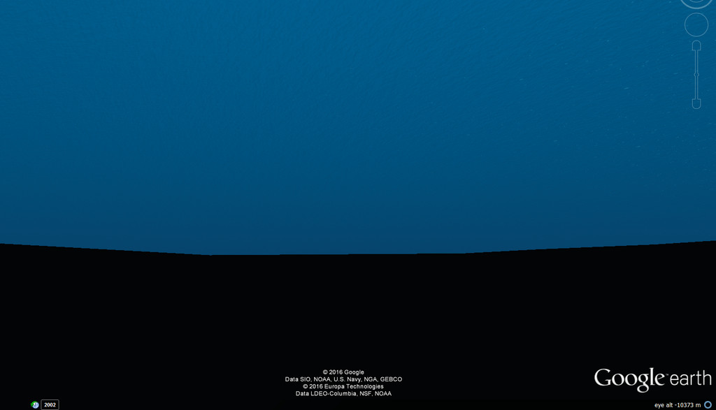
Well, after a fashion you can. Simply pick the area of sea bed where you wish to find the depth, and drop Pegman on to the place as if you were entering Street View. You'll zoom in on the spot, all the way to the sea bed, and the altitude readout on the lower right of the viewer will show as a negative "altitude" below MSL. For example, this image shows the sea bed at the Challenger Deep, the deepest bit of sea in the world:  As you can see, the Eye Altitude readout shows as -10373m. Carry out the same procedure for the Dogger Bank in the North Sea, and the depth shows as -22m. Standing on the beach at the southern end of the Dead Sea (the lowest spot on land) shows an altitude of -413m. Assuming the depth resolution to be the same as normal elevation, it's only accurate to around 30m (90 feet-ish). Cheers, Frank |
|


 )
)
