Post by TomKjeldsen on Sept 27, 2015 13:15:25 GMT
The Mississippi River is the largest river in North America. "Mississippi" is a Ojibwa (Chippewa) Indian / Native Americans / First Nations word "misi-ziibi" or "gichi-ziibi" meaning great river, big river, gathering of water. The river is the major river of the eastern half of North America, flowing through the USA states of Minnesota, Wisconsin, Iowa, Illinois, Missouri, Kentucky, Tennessee, Arkansas, Mississippi and Louisiana. From the spring in it's northern Minnesota headwaters, it flow south for more than 2320 miles (3730 km) to the Mississippi River Delta at the Gulf of Mexico.
The river's original major silt deposits posed the Mississippi River Valley as a very fertile agricultural region, which contributed and resulted in the river's famous 19th century steamboat era. The decades following has seen the construction of massive engineering works such as levees, locks and dams, which has formed the river to it's present flow.

bigger picture
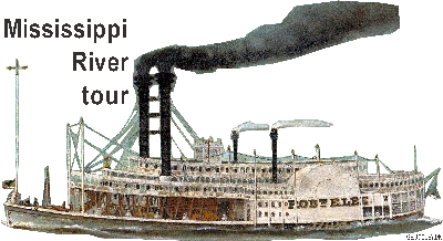
"New Orleans", on it's maiden voyage in 1811 from Pittsburgh to New Orleans, was the first steamboat on the Mississippi and Ohio River. Since then several steamboats were built over the next few years, including the "Comet" (1813), the "Vesuvius" (1814), the "Enterprize" (1814) and "Washington" (1817). Around 1817, with 12 steamboats on the western rivers, steamboat navigation where generally accepted, and within two years, there were over 60 steamboats on the western waters. In 1826 there were 143 steamboats on the river, and a total of 233 had existed up to that time. Around 1856, steamboats began to see competition from the railroads and declined. The steamboat era culminated in 1870 with the famous steamboat race from New Orleans to St. Louis between the Natchez VII steamboat and the Mississippi paddle steamer, the Robert E. Lee ("Monarch of the Mississippi"). Freight transportation on the Mississippi River saw huge growth via barge traffic through the 20'th century.
Location along the main channel of the river is denoted by river miles, starting with mile 0 at Head-of-Passes in the Mississippi River Delta and proceeding 953.8 river miles upstream to the mouth of the Ohio River (A track/path is supplied in this collection). Mileages are indicated as AHP (Above Head of Passes) or BHP (Below Head of Passes). Numbering of river miles starts again at 0 at the mouth of the Ohio River and continues up the Mississippi River to the spring at Lake Itasca.
About the "The Mississippi River tour": Take a tour along the entire Mississippi River with more than 900 placemarks between the spring and the estuary. Find most/all major bridges, dams, lakes, islands and river tributaries pinpointed along the Mississippi River. All divided and sub-divided into folders of the wide areas of the upper Mississippi, the central middle Mississippi and the lower Mississippi River. Tour creator: Tom Kjeldsen, created November 2013 to January 2014. Recommended to be viewed as a "Play tour" in Google Earth with 3D Buildings layer enabled.
Download a identical copy of the attached file below from here (suitable for non Google Earth Community members)![]()

This post is a re-post of this original 2014-01-30 Google Earth Community post![]()

The river's original major silt deposits posed the Mississippi River Valley as a very fertile agricultural region, which contributed and resulted in the river's famous 19th century steamboat era. The decades following has seen the construction of massive engineering works such as levees, locks and dams, which has formed the river to it's present flow.

bigger picture
"New Orleans", on it's maiden voyage in 1811 from Pittsburgh to New Orleans, was the first steamboat on the Mississippi and Ohio River. Since then several steamboats were built over the next few years, including the "Comet" (1813), the "Vesuvius" (1814), the "Enterprize" (1814) and "Washington" (1817). Around 1817, with 12 steamboats on the western rivers, steamboat navigation where generally accepted, and within two years, there were over 60 steamboats on the western waters. In 1826 there were 143 steamboats on the river, and a total of 233 had existed up to that time. Around 1856, steamboats began to see competition from the railroads and declined. The steamboat era culminated in 1870 with the famous steamboat race from New Orleans to St. Louis between the Natchez VII steamboat and the Mississippi paddle steamer, the Robert E. Lee ("Monarch of the Mississippi"). Freight transportation on the Mississippi River saw huge growth via barge traffic through the 20'th century.
Location along the main channel of the river is denoted by river miles, starting with mile 0 at Head-of-Passes in the Mississippi River Delta and proceeding 953.8 river miles upstream to the mouth of the Ohio River (A track/path is supplied in this collection). Mileages are indicated as AHP (Above Head of Passes) or BHP (Below Head of Passes). Numbering of river miles starts again at 0 at the mouth of the Ohio River and continues up the Mississippi River to the spring at Lake Itasca.
About the "The Mississippi River tour": Take a tour along the entire Mississippi River with more than 900 placemarks between the spring and the estuary. Find most/all major bridges, dams, lakes, islands and river tributaries pinpointed along the Mississippi River. All divided and sub-divided into folders of the wide areas of the upper Mississippi, the central middle Mississippi and the lower Mississippi River. Tour creator: Tom Kjeldsen, created November 2013 to January 2014. Recommended to be viewed as a "Play tour" in Google Earth with 3D Buildings layer enabled.
Download a identical copy of the attached file below from here (suitable for non Google Earth Community members)

This post is a re-post of this original 2014-01-30 Google Earth Community post


