Post by TomKjeldsen on Sept 18, 2015 13:09:46 GMT
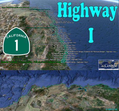
The Highway 1 (The Pacific Coast Highway, PCH, State Route 1) is a more than 650 miles (1050 km) long road following the Pacific coast of the U.S. state of California. Originally being constructed from 1919 the name California Highway 1, or just California 1 was first used in 1934 and finally stated in 1964. The trip along California 1 is considered one of the prettiest rides in the world. Many scenic views can be seen along this highway, including Los Angeles and San Francisco coastlines, the Big Sur area, hundreds of small coastal settlements and several areas with a diverse wildlife.

bigger picture
About "The Highway 1 tour": Check the more than 350 placemarks along the Californian Coast from Legget in north to Dana Point in south. Consider also to try the almost 5 hour long detailed track/path of the entire (734 mi / 1181 km) route passing every turn and intersection along the Highway 1 from the start in south at the Interstate 5 intersection to the end in the north at the Route 101 intersection. Note that this track/path is very long and detailed, hence displaying it can be hard to many computers since the path consist of more than 10000 handmade coordinates.
Specific about "The Highway 1 track/path": Do not use this as a detailed navigational aid! :-) Allthough rather precise at many points and areas it is still approximations of the PCH road lanes and the general road course. Altitude above ground is set to 16 feet (5 meter) for best view when 'playing tour' like "driving along the road", the "green path". If a more "flyover" experience is preferred, 2 extra paths, identical to the previous, but at an altitude of 290/1800 feet (88/550 meter) above ground is supplied, "the yellow and red paths". These paths are especially suitable for crossing high structures like the Golden Gate Bridge. Consider in general along the entire tour to adjust the GE 'Camera tilt angle' to 80 degrees or above for better display when playing tracks/paths.
Here are selected areas and their approximately "minute start" on a "play track/path/tour": Newport Beach area (5) - Long Beach area (12) - Redondo Beach area (21) - Los Angeles area (23) - Malibu area (29) - Mugu area (40) - Ventura area (44) - Carpinteria area (55) - Santa Barbara area (60) - Gaviota area (71)- Pismo Beach area (100) - San Simeon area (120)- Big Sur area (140) - Monestary, Monterey Bay area (159) - Santa Cruz (170) - Half Moon Bay area (195) - Devils Slide area (200) - Pacifica area (203) - San Francisco area (206) - Stinson Beach (217) - Point Reyes area (222) - Point Arena area (255) - Fort Bragg area (275) - Leggett area (290).
Tour creator: Tom Kjeldsen, created december 2010. Recommended to be viewed as a 'Play tour' in Google Earth with terrain and 3D Building layer enabled.
California State Highway 1 Costal Drive from San Francisco to Los Angeles (Dec 2011)
Download a identical copy of the attached file below from here (suitable for non Google Earth Community members)![]()

This post is a re-post of this original 2010-12-12 Google Earth Community post![]()


bigger picture
About "The Highway 1 tour": Check the more than 350 placemarks along the Californian Coast from Legget in north to Dana Point in south. Consider also to try the almost 5 hour long detailed track/path of the entire (734 mi / 1181 km) route passing every turn and intersection along the Highway 1 from the start in south at the Interstate 5 intersection to the end in the north at the Route 101 intersection. Note that this track/path is very long and detailed, hence displaying it can be hard to many computers since the path consist of more than 10000 handmade coordinates.
Specific about "The Highway 1 track/path": Do not use this as a detailed navigational aid! :-) Allthough rather precise at many points and areas it is still approximations of the PCH road lanes and the general road course. Altitude above ground is set to 16 feet (5 meter) for best view when 'playing tour' like "driving along the road", the "green path". If a more "flyover" experience is preferred, 2 extra paths, identical to the previous, but at an altitude of 290/1800 feet (88/550 meter) above ground is supplied, "the yellow and red paths". These paths are especially suitable for crossing high structures like the Golden Gate Bridge. Consider in general along the entire tour to adjust the GE 'Camera tilt angle' to 80 degrees or above for better display when playing tracks/paths.
Here are selected areas and their approximately "minute start" on a "play track/path/tour": Newport Beach area (5) - Long Beach area (12) - Redondo Beach area (21) - Los Angeles area (23) - Malibu area (29) - Mugu area (40) - Ventura area (44) - Carpinteria area (55) - Santa Barbara area (60) - Gaviota area (71)- Pismo Beach area (100) - San Simeon area (120)- Big Sur area (140) - Monestary, Monterey Bay area (159) - Santa Cruz (170) - Half Moon Bay area (195) - Devils Slide area (200) - Pacifica area (203) - San Francisco area (206) - Stinson Beach (217) - Point Reyes area (222) - Point Arena area (255) - Fort Bragg area (275) - Leggett area (290).
Tour creator: Tom Kjeldsen, created december 2010. Recommended to be viewed as a 'Play tour' in Google Earth with terrain and 3D Building layer enabled.
California State Highway 1 Costal Drive from San Francisco to Los Angeles (Dec 2011)
Download a identical copy of the attached file below from here (suitable for non Google Earth Community members)

This post is a re-post of this original 2010-12-12 Google Earth Community post


