Post by TomKjeldsen on Sept 17, 2015 14:26:15 GMT
The Panama Canal is a 48 mile (77 km) canal that joins the Atlantic Ocean and the Pacific Ocean, through the Isthmus of Panama. The canal has had an enormous impact in the 20'th century shipping between the two oceans, mainly replacing the long route south of Cape Horn at the southernmost tip of South America. In avarage allmost any long sailing route which involve passing the Americas can be shortened by up to and more than 10000 km (6200 mi) not having to travel south around South America or north around North America by traveling through the Panama Canal.

bigger picture
The canal was built from 1904 to 1914. In August 15, 1914, the Panama Canal was officially opened. It's one of the largest and most difficult engineering projects completed, initially started at the end of the 19'th century and completed in the beginning of the 20'th century. The Panama Canal consist of 3 sets of locks, The Gatun Locks, The Pedro Miguel Locks and The Miraflores Locks. The artificial Gatun Lake, 26 m above sealevel, created by the Gatun Dam on the Chagres River connects the Gatun Locks with the city of Gamboa. From here the Gaillard (Culebra) Cut leads through the continental divide ending up at the Pedro Miguel Locks. 27000 tonnes of dynamite was used to excavate over 76 million cubic metres of material at the 12,6 km (7.8 mi) long Gaillard (Culebra) Cut.
The idea of a canal near Panama dates back to the early 16'th century. The first attempt constructing a canal began in 1880 under French leadership, but was abandoned after 21900 workers died, largely from landslides and disease, particularly malaria and yellow fever. The United States launched a second effort, claiming further 5600 deaths but succeeding in opening the canal in 1914. U.S.A. controlled the canal and the canal zone surrounding it, until 1977. The Torrijos-Carter Treaties provided the foundation for the transition of control to Panama. From 1979 to 1999 the canal was under joint U.S. and Panamanian administration, and from 31 December 1999 command of the waterway was assumed by the Panama Canal Authority, an agency of the Panamanian government.
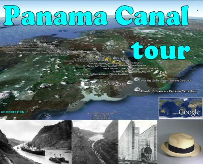
About the "Panama Canal tour": A tour crossing between 2 oceans, the Pacific and the Atlantic. Checkout the 2 tracks/paths which will take you on a "sailing trip" through the entire canal from east (Atlantic) to west (Pacific) or back. The Panama Canal actually goes from North-West to South-East. So when you are 'going west', you are actually sailing on an south east bound course in most of the canal and of course vice versa. Consider in general along the entire tour to adjust the GE 'Camera tilt angle' to 80 degrees or above for better display when playing tracks/paths. Tour creator: Tom Kjeldsen, created december 2010. Recommended to be viewed as a 'Play tour' in Google Earth with terrain and 3D Building layer enabled.
Panama Canal Timelapse - HD
Download a identical copy of the attached file below from here (suitable for non Google Earth Community members)![]()

This post is a re-post of this original 2010-12-12 Google Earth Community post![]()


bigger picture
The canal was built from 1904 to 1914. In August 15, 1914, the Panama Canal was officially opened. It's one of the largest and most difficult engineering projects completed, initially started at the end of the 19'th century and completed in the beginning of the 20'th century. The Panama Canal consist of 3 sets of locks, The Gatun Locks, The Pedro Miguel Locks and The Miraflores Locks. The artificial Gatun Lake, 26 m above sealevel, created by the Gatun Dam on the Chagres River connects the Gatun Locks with the city of Gamboa. From here the Gaillard (Culebra) Cut leads through the continental divide ending up at the Pedro Miguel Locks. 27000 tonnes of dynamite was used to excavate over 76 million cubic metres of material at the 12,6 km (7.8 mi) long Gaillard (Culebra) Cut.
The idea of a canal near Panama dates back to the early 16'th century. The first attempt constructing a canal began in 1880 under French leadership, but was abandoned after 21900 workers died, largely from landslides and disease, particularly malaria and yellow fever. The United States launched a second effort, claiming further 5600 deaths but succeeding in opening the canal in 1914. U.S.A. controlled the canal and the canal zone surrounding it, until 1977. The Torrijos-Carter Treaties provided the foundation for the transition of control to Panama. From 1979 to 1999 the canal was under joint U.S. and Panamanian administration, and from 31 December 1999 command of the waterway was assumed by the Panama Canal Authority, an agency of the Panamanian government.
About the "Panama Canal tour": A tour crossing between 2 oceans, the Pacific and the Atlantic. Checkout the 2 tracks/paths which will take you on a "sailing trip" through the entire canal from east (Atlantic) to west (Pacific) or back. The Panama Canal actually goes from North-West to South-East. So when you are 'going west', you are actually sailing on an south east bound course in most of the canal and of course vice versa. Consider in general along the entire tour to adjust the GE 'Camera tilt angle' to 80 degrees or above for better display when playing tracks/paths. Tour creator: Tom Kjeldsen, created december 2010. Recommended to be viewed as a 'Play tour' in Google Earth with terrain and 3D Building layer enabled.
Panama Canal Timelapse - HD
Download a identical copy of the attached file below from here (suitable for non Google Earth Community members)

This post is a re-post of this original 2010-12-12 Google Earth Community post


