Master Cartographer
April 2015 - Dec 4, 2024 20:55:47 GMT
|
Post by syzygy on Feb 13, 2020 12:46:18 GMT
"Pareidolia in Google Earth... on Toasts" ... and Stones...? Here you are: Or it is just me who see a reptile head-like carving on the stone in the center of phone-screnshot below? Do you see the pretty evil cobra-head? (Probably its better if rotated.)  link to GMaps-BlueDotFunny, I have spotted this stone at first, then browsed through all image for another example of carvings with no success. It seems, there is no even one more piece of stone with only a slash of anything, that would look alike some artistic workmanship...(!) That is why I think it is only pareidolia, otherwise I would bravely say; it is a carved reptile motif, I have found amongst scattered stones of this one-time beautiful building complex. If anyone can spot another carved (looking) stone, then it is probably no pareidolia. ... |
|
Full Member
January 2020 - Jan 5, 2024 10:40:59 GMT
|
Post by leong on Feb 13, 2020 13:47:03 GMT
That is why I think it is only pareidolia, otherwise I would bravely say; it is a carved reptile motif, I have found amongst scattered stones of this one-time beautiful building complex. If anyone can spot another carved (looking) stone, then it is probably no pareidolia. ... Since its the ruins of buildings, or at least a collection of material for building, the existence of some other carved feature on a rock is not much, it would have to be a preponderance of the similar style of carving. But also how about look at ability and motive (no pun intended). Ability ... so what might be a drawing is lines in a light coloured rock, showing a darker rock below. the lines of are of uniform depth. How could a person that sees the light covered surface know that by cutting a line into the light right, they would reveal the dark rock below ? Natural occurance.. the interface of the darker rock and lighter rock had the line in it , and that interface is what lets the light rock fall away, so as to ensure the line is of uniform depth. Motive.. its a pile of rocks used to build walls. Why would someone carve into the roughest surface of a random boulder , to make art, when all around there are rocks with much flatter surfaces, and the rectangular prism rocks can be placed onto a plinth , table, or part of the building, for display. It makes no sense that an ugly piece of rock would be worked on, without some effort to clean it up for beauty and practicality. There's no shortage of two tone rocks, you'd be able to find some that had the colour that you could carve into , with uniform depth of carving, to reveal another color.. the two tone artwork. The rock has other features, which are random blobs that your brain says "if I look at it from a different angle, I might see it as something I recognise". Its a naturally occuring design that happens to look like what you could intentionally create if you were making a reptile/serpent/dragon head. |
|
Full Member
January 2020 - Jan 5, 2024 10:40:59 GMT
|
Post by leong on Feb 13, 2020 13:55:41 GMT
Did you notice that 3 rocks to the right, the rock has a flat surface with a fish head like effect in it,
and part of the flat surface has the lip like it might be part of a footstep or framed area.
Its possible the surface was smoothed off by man, or maybe natural, as the quarrying methods aimed to produce rectangular prisms , but I think the fishhead is just a random feature .. (perhaps due to collision with another rock.. the collision is a random process even if a human threw the rock.)
|
|
Master Cartographer
April 2015 - Dec 4, 2024 20:55:47 GMT
|
Post by syzygy on Mar 1, 2020 20:50:06 GMT
|
|
Master Cartographer
April 2015 - Dec 4, 2024 20:55:47 GMT
|
Post by syzygy on Mar 6, 2020 12:26:27 GMT
finally have found this old, small, framed screenshot of some natural aerial land-art found by me 10+ years ago, pity location remains unknown since oGEC disappeared... 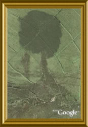 *** (it is a duplicate crosspost from Hill's Beautiful Earth thread.) |
|
Master Cartographer
April 2015 - Dec 4, 2024 20:55:47 GMT
|
Post by syzygy on Mar 18, 2020 8:22:16 GMT
...and suddenly I have felt, something was watching me amongst the reed- a Pitbull or Staffordshire Terrier was hiding in the swamps: 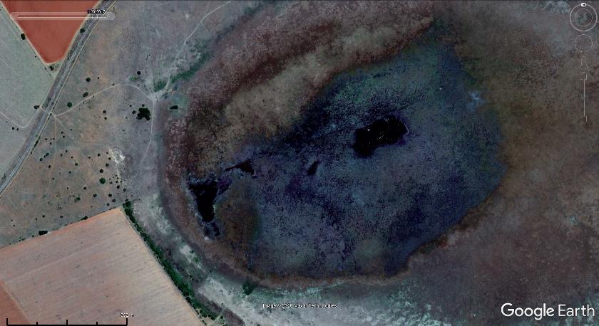 Proper satellite imagery only on desktop GE @ >>-26.4255946, 26.1861402<< pitbull pareidolia swamp South-Africa.kmz (848 B) |
|
Master Cartographer
April 2015 - Dec 4, 2024 20:55:47 GMT
|
Post by syzygy on Jun 29, 2020 12:36:59 GMT
I see contours of a (young, short haired) woman here in the desert sand, somewhere in the Malian Sahara: (map crosshairs points to the right elbow) 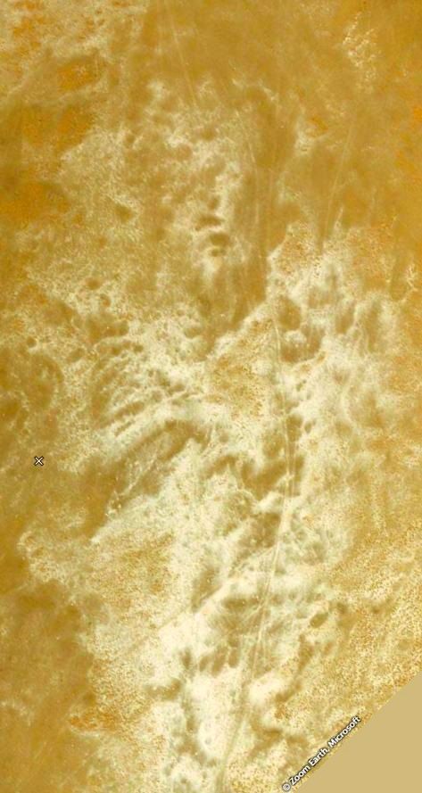 No good resolution imagery on GE at >>20.669872, 0.600509<<, so check location on ZoomEarth! Opening map-link above, you'll find crosshairs pointing to the "neck of the woman". The "body" tilts to the right (compass set to North - cannot be adjusted in ZE). Besides the lips, the nose, the eyes are obvious, I think I can even see her bent right arm and half-bent left arm with the fingers on this latter... *** Does anyone else see what I see? - Hope, at least some not disappointed...! (; |
|
Master Cartographer
April 2015 - Dec 4, 2024 20:55:47 GMT
|
Post by syzygy on Jul 6, 2020 7:21:15 GMT
Pareidolia wolf-head from Mauritania: 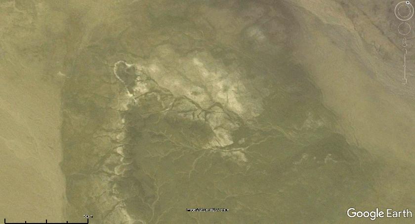 >>25.1946261,-5.5537754<< wolfie.kmz (763 B) --------------------------- EDIT: with these pale outlines it definitely looks like a waving bear: 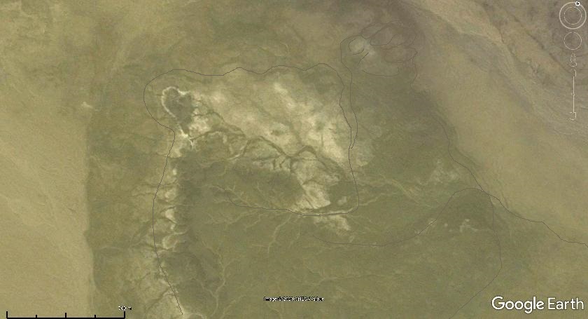 Better resolution imagery on Zoom Earth. |
|
Master Gamer
April 2018 - Dec 4, 2024 20:57:55 GMT
|
Post by willi1 on Aug 4, 2020 9:01:57 GMT
Pareidolia wolf-head from Mauritania And a fox-head from Spain. 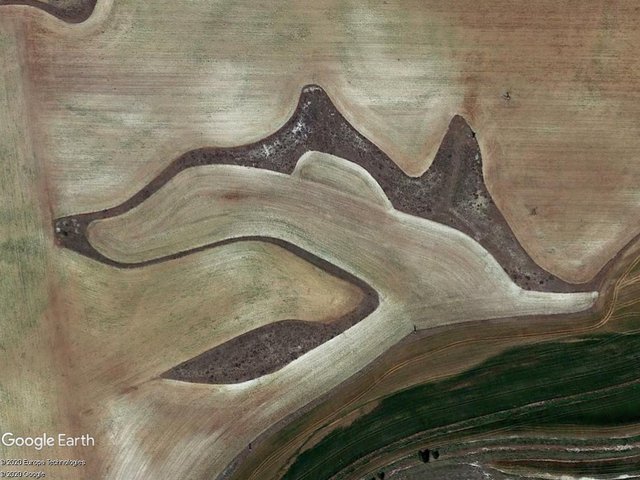 Attachments:Fox.kmz (682 B)
|
|
Master Gamer
April 2018 - Dec 4, 2024 20:57:55 GMT
|
Post by willi1 on Oct 10, 2020 10:57:24 GMT
A fetus in green. (Córdoba, Spain)
Attachments:Fetus.kmz (792 B)
|
|
Master Gamer
April 2018 - Dec 4, 2024 20:57:55 GMT
|
Post by willi1 on Nov 8, 2020 9:54:27 GMT
|
|
Master Cartographer
April 2015 - Dec 4, 2024 20:55:47 GMT
|
Post by syzygy on Nov 8, 2020 15:48:06 GMT
great example! - a cool Dracula face right there! ( : |
|
Master Cartographer
April 2015 - Dec 4, 2024 20:55:47 GMT
|
Post by syzygy on Jan 6, 2021 21:10:43 GMT
|
|
Master Cartographer
April 2015 - Dec 4, 2024 20:55:47 GMT
|
Post by syzygy on Jan 27, 2021 13:20:47 GMT
|
|
Master Gamer
April 2018 - Dec 4, 2024 20:57:55 GMT
|
Post by willi1 on Feb 1, 2021 9:15:04 GMT
|
|
Master Cartographer
April 2015 - Dec 4, 2024 20:55:47 GMT
|
Post by syzygy on Jul 8, 2021 21:39:30 GMT
|
|
Master Gamer
April 2018 - Dec 4, 2024 20:57:55 GMT
|
Post by willi1 on Aug 22, 2021 9:23:23 GMT
|
|
Master Cartographer
April 2015 - Dec 4, 2024 20:55:47 GMT
|
Post by syzygy on Aug 24, 2021 17:01:15 GMT
... From a Hieronymus Bosch painting?  ( : |
|
Master Cartographer
April 2015 - Dec 4, 2024 20:55:47 GMT
|
Post by syzygy on Aug 24, 2021 17:13:13 GMT
Frightening multi-faces enigma 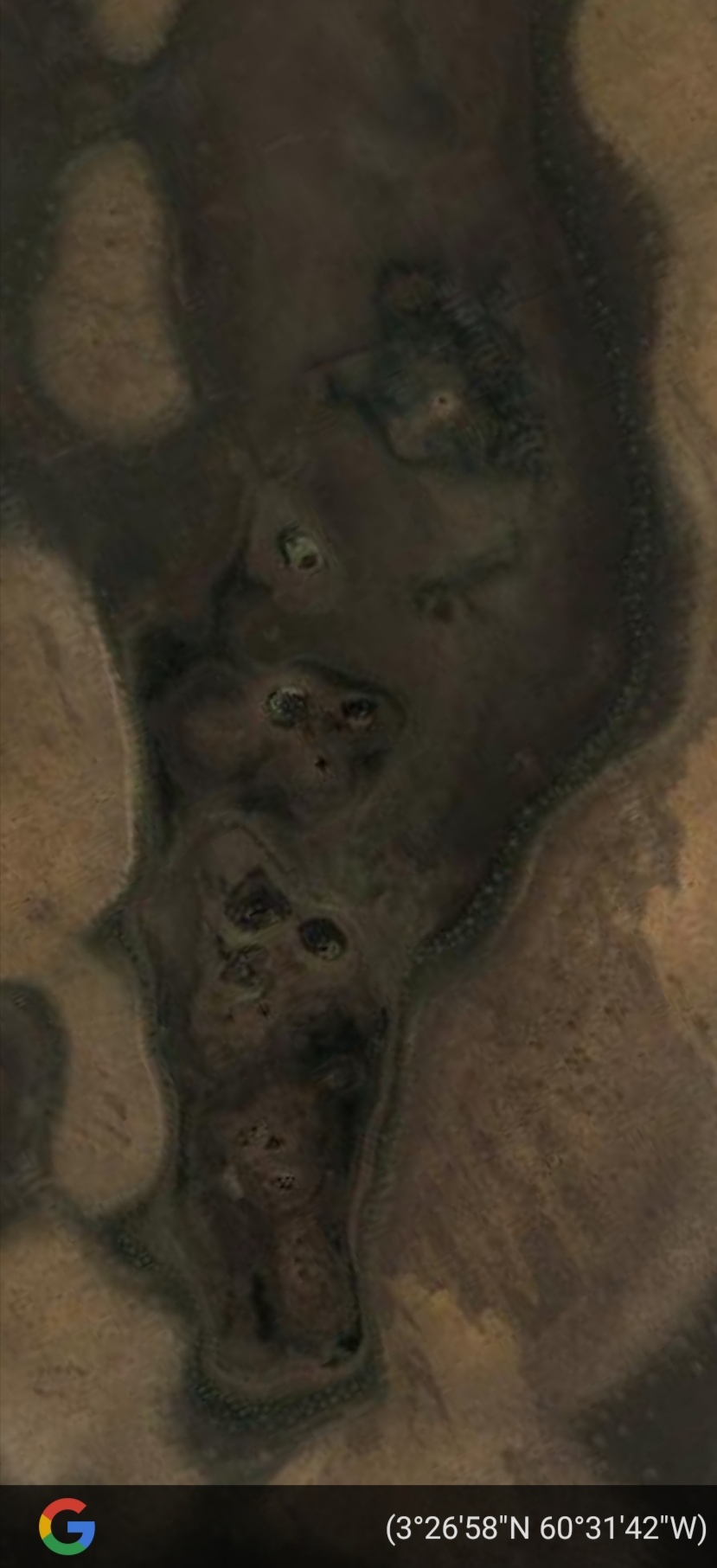 Angry demons of the killed jungle Or can this be naturally such a barren place? GE(web) link (if it works by anyone on any device) |
|
Full Member
Explorer
April 2015 - Jul 31, 2024 11:32:00 GMT
|
Post by TomKjeldsen on Aug 25, 2021 19:46:26 GMT
Please dont take this Pareidolia fun tour into a too serious analysis.
Keep the focus, be skeptical and factual and look at it as funny, we imagine, from time to time, data changing.
Check it out at any time, and keep changing your point of view, whatever U zoom into in this great GE application.
Your posts/replys are great, nice to view and enjoyable - keep them coming :-)
Best Tom
|
|
Cartographer
April 2015 - Nov 12, 2024 14:28:33 GMT
“ Armchair Traveller - Love to Roam Google Streets - 8 Star Local Guide of Google Maps „
|
Post by CuriousJM on Sept 6, 2021 15:36:57 GMT
A disfigured face, Shelonsky Islands, Laptev Sea, Sakha Republic, Russia. 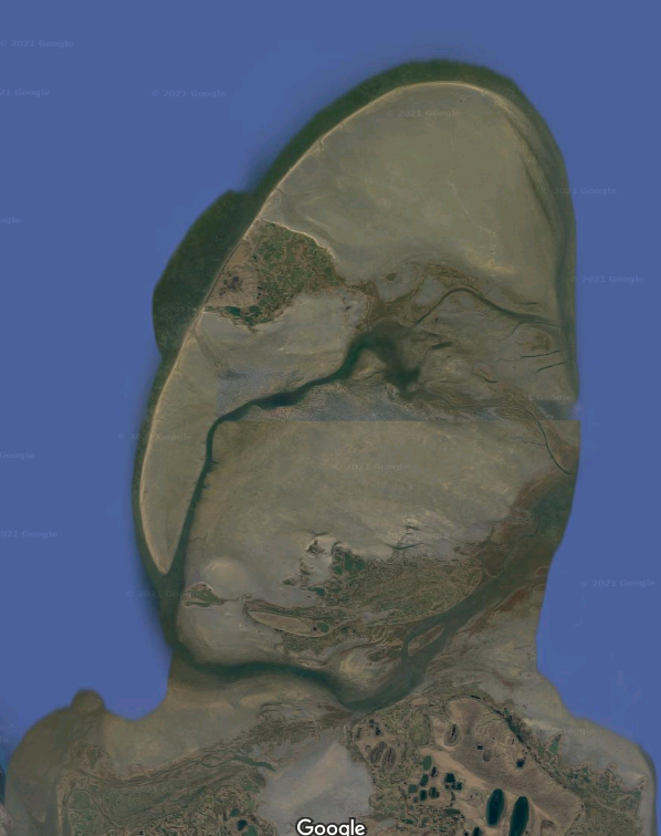 Coordinates: 71.768142,138.693621 GMAttachments:Disfigured face.kmz (705 B)
|
|
Trusted Member
Master Gamer
April 2015 - Nov 11, 2024 15:26:59 GMT
|
Post by ndrqu on Sept 9, 2021 10:44:53 GMT
The highest mountain of central Italy is called Gran Sasso, which is also known as The Face of the Giant because it looks like the face of a person laying down: 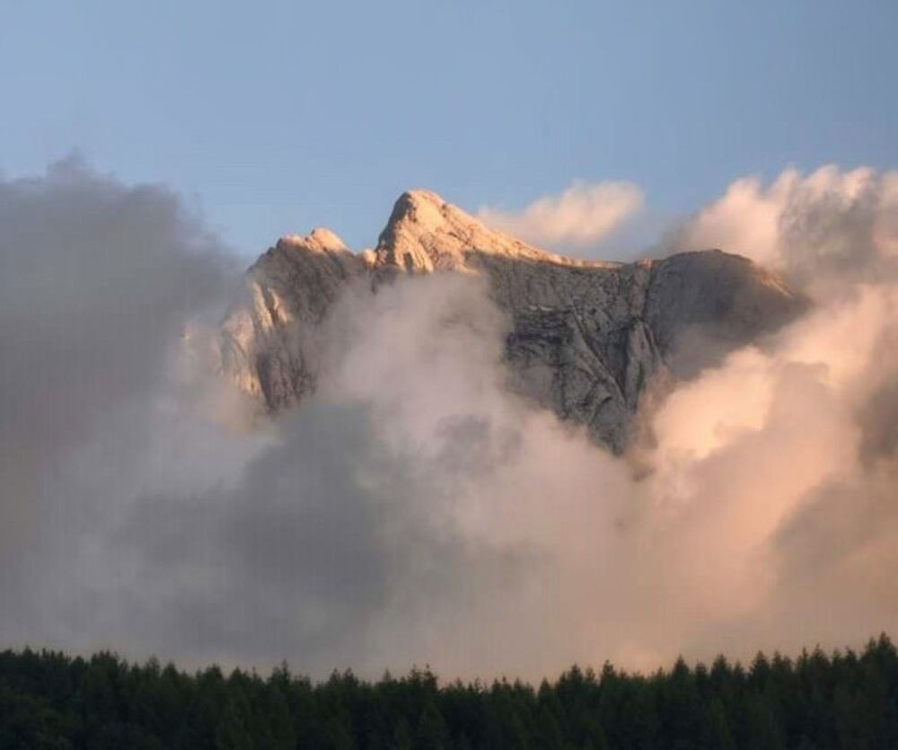 Credits: Ugo di Giammarco www.instagram.com/digiammarcougofoto/?hl=it |
|
Master Cartographer
April 2015 - Dec 4, 2024 20:55:47 GMT
|
Post by syzygy on Sept 9, 2021 14:58:31 GMT
Brilliant photo ndrqu! The clouds, the pine forest, the lights... - really great shot! I see no link, no photo credit - was it made by you? |
|
Trusted Member
Master Gamer
April 2015 - Nov 11, 2024 15:26:59 GMT
|
Post by ndrqu on Sept 9, 2021 15:08:34 GMT
Brilliant photo ndrqu ! The clouds, the pine forest, the lights... - really great shot! I see no link, no photo credit - was it made by you? No, unfortunately it's not my photo  the author is Ugo di Giammarco: www.instagram.com/digiammarcougofoto/?hl=it |
|
Master Gamer
April 2018 - Dec 4, 2024 20:57:55 GMT
|
Post by willi1 on Oct 5, 2021 11:59:51 GMT
A lamb with a corona mask
Attachments:Lamb.kmz (797 B)
|
|
Master Cartographer
April 2015 - Dec 4, 2024 20:55:47 GMT
|
Post by syzygy on Dec 1, 2021 7:27:30 GMT
|
|
Master Cartographer
April 2015 - Dec 4, 2024 20:55:47 GMT
|
Post by syzygy on Jan 3, 2022 13:15:40 GMT
... a find from Libya by Thomas S. and it is astounding! Sad, even not a coordinate given to screenie...:  well, a try to find anyone? -I have already given up. At last I have bumped into the oGEC layer mark on GE! ( : *** Face in the DesertBy: Thomas S.
Date: 2011-05-17 This is an extraordinarily spuky face of a haunted man in the middle of Libya.
From: A face in the desert - 6 Message(s)
Google Earth Community
*** Imagery date: 6/2004 (It can be seen by various (all) imagery dates, also great "face-view" on ZoomEarth) Coordinates: >>29.25186,16.43036<<
|
|
Master Cartographer
April 2015 - Dec 4, 2024 20:55:47 GMT
|
Post by syzygy on Jan 24, 2022 12:23:06 GMT
Have spotted this cloud face with sunglasses enigma, browsing Zoom Earth HD imagery in an early afternoon hour, 21. january 2022. 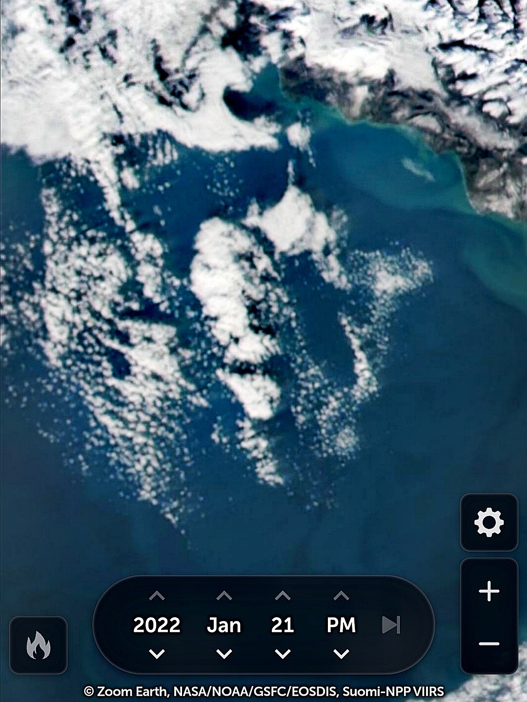 Coordinates: >>42.3719, 40.1445<< I have saved screenie and link as usual every time I spot some worthy, but checking location in the next day's morning I was rather surprised to see the face gone... If you check the (saved) ZE map link you will see a slightly different imagery for the same date displayed. The bunch of clouds still recognizeable only seem to be a bit away in time. I have asked ZoomEarth about this oddity and they have answered as: "Imagery from the HD Satellite layer is updated in a polar orbit, which overlaps at the poles. So sometimes the imagery is replaced during another later orbit. Hope that makes sense!"... Well, that was the way how this poor, low-res ZE frame became a rare and unique example of pareidolia on satellite imagery, regardless it's not even a very good one. Hope you like it though...!  |
|
Master Cartographer
April 2015 - Dec 4, 2024 20:55:47 GMT
|
Post by syzygy on Nov 9, 2022 15:43:56 GMT
Meanwhile I collected few other pareidolia sites which I have already posted on Instagram --> @syzygy426 Here is a special favorite of mine from my recent Iran Series: "The Old Hippie" Location: Urmia Lake, Iran Location: Urmia Lake, IranCoordinates: >> 37.47612, 45.55392<< Dimensions: 5,3 X 3,9 kilometers Imagery date: 2/2014 Edited Google Earth Image / 2022 CNES/Airbus |
|
Master Gamer
April 2018 - Dec 4, 2024 20:57:55 GMT
|
Post by willi1 on Sept 12, 2023 19:58:18 GMT
The head of a turtle
31.365844° -91.707554° |
|


 ( :
( :


 the author is Ugo di Giammarco:


