Full Member
Explorer
April 2015 - Jul 31, 2024 11:32:00 GMT
|
Post by TomKjeldsen on Aug 16, 2015 15:53:15 GMT
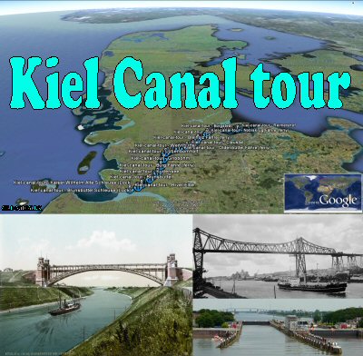
The Kiel Canal (German: Nord-Ostsee-Kanal), until 1948 known as the Kaiser-Wilhelm-Kanal, is an approximately 100 kilometer (62 mile) long canal in the German Bundesland Schleswig-Holstein that links the North Sea at Brunsbüttel to the Baltic Sea at Kiel-Holtenau.  Based on the old Eider Canal, open in 1784, from Holtennau, following the Eider River from Rendsburg, the Nord-Ostsee-Kanal, the Kiel Canal, with it's present route opened in 1895. In 1914 widening of the canal took place. An average of 250 nautical miles (463 kilometers, 288 miles) is saved by using the Kiel Canal instead of going around the Danish Jutland peninsula. This not only saves time but also avoids potentially dangerous storm-prone seas. The Kiel Canal is the most heavily used artificial seaway in the world. Excluding sporting boats and other small boats, an average of 117 ships per day used the canal in 2008. About the Google Earth "Kiel Canal tour": Take this tour on, The Kiel Canal, from the Kiel bay at the Danish/German part of the baltic sea through the German marsh land to the North Sea at the estuary of the River Elbe. Tour creator: Tom Kjeldsen, created december 2007. Kiel Canal - 9 min - timelapse:
view direct at youtube
Download a identical copy of the attached file below from here (suitable for non Google Earth Community members) ![]() 
This post is a re-post of this original 2007-12-28 Google Earth Community post ![]() 
Attachments:Kiel-canal-tour.kmz (111.59 KB)
|
|


