Full Member
Cartographer
May 2015 - Oct 6, 2022 0:44:12 GMT
“ Fellow Royal Canadian Geographical Society „
|
Post by jeanthie on Aug 16, 2015 1:40:16 GMT
This is a fascinating visualization of the growth of Amsterdam in its Golden Age between 1600 and 1700. You almost get the feeling that you you are looking at an historical Google Earth 17th century fly-over. Amserdam Golden Age.kmz (1014 B) The way it is now: I marked the location of my former High School- Lely Lyceum. Kiezersgracht 177. With Street view you will see that now Amnesty International is using the building   |
|
Cartographer
April 2015 - Apr 23, 2024 4:32:27 GMT
|
Post by washi on Aug 16, 2015 4:15:23 GMT
Thanks for posting this, Jean. The video is jaw-droppingly wonderful. Probably because of my default color scheme, I had a little trouble spotting the link. Anyway, hard to see or not, instead of linking to the video, why not take advantage of the capacity of this forum to embed videos in a post.
I'd never looked at Amsterdam in 3D before, and hadn't spent much time in Street View, either. Your post lead me to the happy experience of doing both.
|
|
Full Member
Cartographer
May 2015 - Oct 6, 2022 0:44:12 GMT
“ Fellow Royal Canadian Geographical Society „
|
Post by jeanthie on Aug 17, 2015 2:19:20 GMT
Thanks Washi for your suggestion. I have embedded the video and this makes it much easier to access. Actually I never realized it was so easy to do this. Yes, Street view is amazing on its own. The Netherlands are extremely well covered, (and even in Northern Canada I use it sometimes as 'ground truth' in satellite interpretations) and it was interesting to see my old high school again. Amazingly, the urinoir in the foreground is a real antique! It was there when I went to school there.  Turning 180 degrees you would see the lineups for the Anna Frank House. This Streetview image is taken from the Prinsengracht and still shows in the distance, just a stone's throw away the Lely Lyceum.  |
|
Full Member
Cartographer
May 2015 - Oct 6, 2022 0:44:12 GMT
“ Fellow Royal Canadian Geographical Society „
|
Post by jeanthie on Aug 18, 2015 2:21:12 GMT
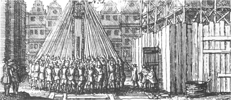
This visualization/ animation of the growth of Amsterdam is the sequel to the first one posted. Both video animations show a dominantly green landscape surrounding the city. Most of it is peat with very high water levels. The unstable soil is too soft to build on, which is why houses are built on piles driven deep into the ground until they reach a solid layer of firmer sand, or compacted clay. Nowadays reinforced concrete piles are used, but the vast majority of buildings in the city’s historic center rest on timber piles — trees of about 12 to 20 meters long. These piles were driven into the ground about 80 cm (31.5 inch) apart. Foundation beams were placed on top and then the house was built. To avoid rotting of the piles the water level has to be carefully maintained. LINK
 |
|
Trusted Member
Master Gamer
April 2015 - Sept 6, 2023 12:33:10 GMT
|
Post by bridgeplayer on Aug 19, 2015 22:16:29 GMT
It's great to see how the city grew in those three centuries. The videos hold special interest for me, because I live 620 metres from your old school (I measured that in GE).  |
|
Full Member
Cartographer
May 2015 - Oct 6, 2022 0:44:12 GMT
“ Fellow Royal Canadian Geographical Society „
|
Post by jeanthie on Aug 24, 2015 1:30:45 GMT
Just a few hundred meters distance from the Westerkerk on the Prinsengracht the canals of Amsterdam are celebrated annually with a classical concert. In 2013, The 32nd edition of the Prinsengracht concert celebrated the 400 years of the Amsterdam Canals and the 125th anniversary of the Royal Concertgebouw Orchestra. The canal is then filled with hundreds of boats with spectators as this closing video of the 2013 concert shows: The Prinsengracht at night without the concert:  With Google Streetview a less glamorous image of Prinsengracht 299  |
|


