Cartographer
April 2015 - Nov 3, 2024 2:30:25 GMT
|
Post by washi on Aug 6, 2015 23:24:33 GMT
The Phillips Creek Fire in NE Oregon is nowhere as big and destructive as the Rocky Fire and other recent fires, but it is near my hometown, and while the area where it is burning is not one for which I had any direct responsibility in the 7 summers I spent in fire control in the 1960's, I am (or at least was) familiar with it. Just as I often wish I'd had a word processing program when I was a student, I often marvel at what an amazing tool Google Earth is for fire suppression and reporting, and wish I could send it back to myself then. From what I can gather, the fire should shortly be controlled. I've been following news reports and (as I often do with news stories) referencing them on Google Earth. I decided to share what I've been doing this time, not because it is particularly newsworthy, but because my little efforts suggest what a valuable tool Google Earth has become in not only assessing potential burning conditions in the fire's path, but also the often tedious process of mapping the fire (and other complex reporting) done long after the last smoke is extinguished. Note that I used Google Earth Pro tools to measure the fire perimeter and area. My map is a crude one, and if it were being done seriously, the map could and would be done more accurately. Attachments:Phillips Creek Fire.kmz (18.32 KB)
|
|
Senior Member
Backyard Astronomer
April 2015 - Jan 25, 2016 4:03:31 GMT
“ Languishing in Twentynine Palms „
|
Post by Gregg1956 on Aug 7, 2015 5:22:51 GMT
Check out this web site: InciWeb. They have perimeter kml's ready made. Click here for your fire perimeter. It's very similar to yours but a bit bigger in spots (newer update). I found it recently when a California fire got pretty close to this area. You can pick the state and fire at top right corner of web page. |
|
Cartographer
April 2015 - Nov 3, 2024 2:30:25 GMT
|
Post by washi on Aug 7, 2015 7:25:42 GMT
Thanks, Gregg.
Actually, I used your first site at some point in my exploration.
I didn't worry too much about the accuracy of my polygon. I was more interested in comparing how much work it would be to use GEPro to calculate a fire size, as opposed to the very crude and time-consuming way it was done back in my day. Back then, we had to pace around the perimeter, and then whip out the chart in our wallets which gave approximate acreage for a variety of shapes. We wouldn't do that, of course, until the fire was out and we were writing a report. (My fires were always smaller after they were out, than the size I had estimated while they were burning.) For bigger fires, it was more a matter of using a pencil on a topo map while consulting aerial photos a decade or two old, counting whole square mile sections and estimating the acreage of partial sections

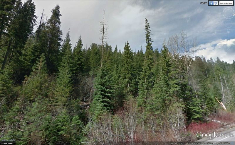
The reports indicate that a lot of the work going on now involves getting rid of the fuel close to the fire line and near highway 205. I went along the highway in Street View and saw a lot of hazards like the screenshot above. There are at least 2 tamarack (western larch) snags, which will need to be felled (hopefully, without the chain saw shaking lose any of the branches), plus a lot of other heavy fuel, both standing on the ground.
Attachments:Snags.kmz (792 B)
|
|
March 2015 - May 1, 2023 4:20:37 GMT
|
Post by diane9247 on Aug 13, 2015 23:13:48 GMT
All but a handful of wildfires in the US are in California, Oregon and Washington. The biggest ones are in No. California and are not under control by any means. I, too, have been following the fire news daily and judging by air quality where I live (So. Oregon), I can say this isn't getting much better as the days roll on. Most have been caused by lightning, only a few are human-caused.
|
|
Cartographer
April 2015 - Nov 3, 2024 2:30:25 GMT
|
Post by washi on Aug 14, 2015 5:26:38 GMT
This post has nothing to do with the Phillips Creek fire. I think you must have intended to update your post on the California fires.
|
|


