Junior Member
November 2019 - Sept 7, 2020 20:27:04 GMT
|
Post by bryanlettner on Nov 22, 2019 23:02:15 GMT
|
|
Trusted Member
account is disabled
“ Google Maps | Google Sky | Google Mars „
|
Post by ET_Explorer on Nov 23, 2019 1:37:44 GMT
Hi and welcome,  To Google Earth Community Forums |
|
Master Gamer
April 2018 - Nov 20, 2024 20:32:38 GMT
|
Post by willi1 on Nov 23, 2019 15:48:52 GMT
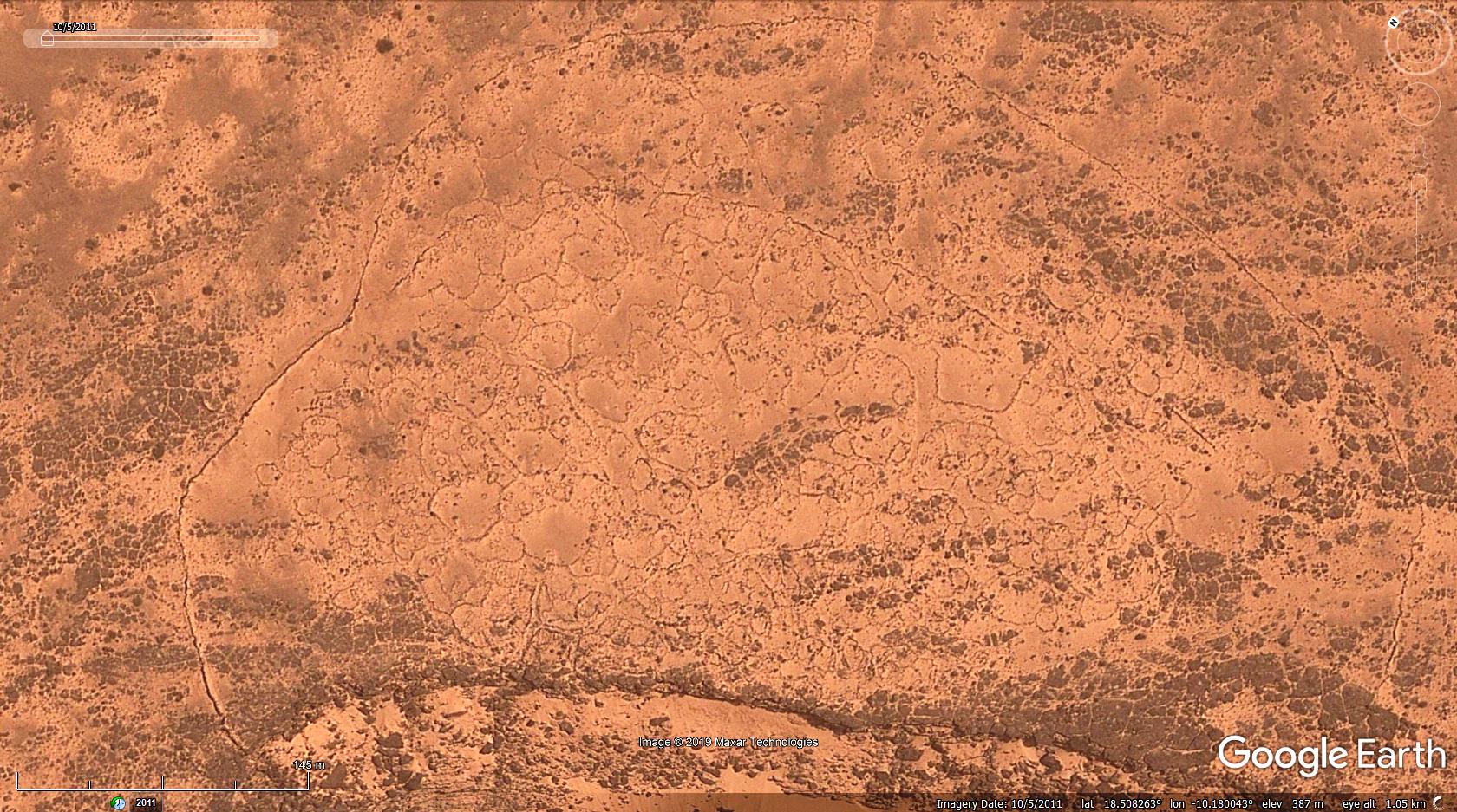
Hello Bryan and welcome to the forum. Interesting places in Mauritania. Statements will probably only can make a user with geological knowledge. For me it looks like rifts and folds. Unfortunately, GE is not helpful with the altitude profiles there, as it is probably too coarse in the raster. Example: Attachments:Rift.kmz (591 B)
|
|
Master Cartographer
April 2015 - Nov 21, 2024 8:06:11 GMT
|
Post by syzygy on Nov 24, 2019 0:24:07 GMT
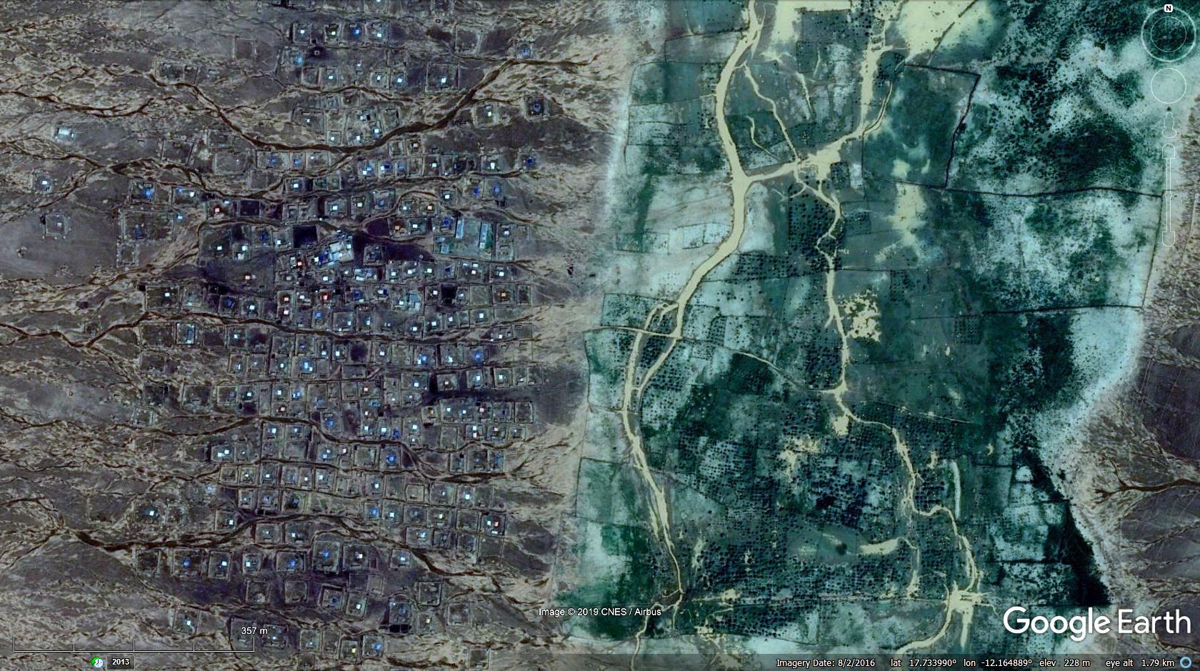
Hi Bryan! Thanks for sharing your find (to find out) - that is the reason why we all around! (: Interesting spotting... probably features of some kind of a vault system...?  ... Well I think, I bookmark this thread and will wait for some more detailed explanation. ... Browsing around there I just have already found this "miraculous" settlement, seems to be in perfect integration with its natural surroundings:  "Balanced Integration" @ 17°44'02"N 12°09'53"W And another settled site with giant linear surface features at >>17.786685,-12.169750<< *** Also you have made me to set up a new "Mauritania" folder for my Ancient African Stone Structures tribute-thread. Here I attach some v0.1 version, with 170+ marks I have done in a 4 hours GE ride: Mauritania.kmz (15.38 KB) Thousands of such old sites can be find out there:  "Fortified by Nature" Ending an example of a multi-walled enclosure of enclosures:  Thank you driving my attention to these! Welcome around! G |
|
Full Member
January 2020 - Jan 5, 2024 10:40:59 GMT
|
Post by leong on Jan 24, 2020 5:33:46 GMT
The larger structures are not man made. There was one red dot in the followup KMZ which pointed at a man made animal pen fence structure. What looks like walls , in the black rock, are dykes. The large flat areas of black rock look like shield volcanos or lava fields, but they are probably sills of the magma, which are horizontal gaps in the rock stratra filled with magma. The magma also fills vertical faults to create dykes .. A dyke is a dutch word meaning wall.. The mountain /hil above his since eroded away, but the igneous rock is hard and resists eroding. Mauratania has a large part of the West African Craton . The West african craton is 2 billion years old. Other parts of africa near it are younger. The craton appears to have been affected by a very large magmatic event that also created such areas in parts of the pre-cambrian (pre-Pangea) supercontinent that were near the west africa craton. Pangea existed only 300 million years ago. the previous supercontinent (s) existed 1 - 2 billion years ago. See www.sciencedirect.com/science/article/pii/S0024493712003040You will see the "town" "village" "housing" like structures are restricted to the igneous rock of the same age. Not that the structures look like they were anything but brandnew... if they are not brand new, then the sands and the erosion.. well why is there no history of destroyed sections and overlapping development of new and old ? Why were humans judging their choice of building material based on age, to choose exactly same age , like, 1300 million years old rock ? whats wrong with older or younger ? whats wrong with sandstone.. thats easier to shape ! And that is why the man made fence was made of red rock. They skipped the black rock, its far to heavy to lift and hard to shape, when there was red rock nearby.. So what are the black rock structurs ? domes.. where lava bubbles ... or the underground equivalent, Sills. Just like an above ground volcano, or undersea volcano, there can be the same thing as an underground volcano . Its just called a flow of magma.. but if it has enormous pressure, it can create a new horizontal layer inside the old rock ... just as a shield volcano or lava flow can create a flat strata on the surface of the ground .. The sill can form a dome shape, so the sill can turn into what looks like the remnant of a dome.. Leon Bachelor of Engineering. |
|
Master Cartographer
April 2015 - Nov 21, 2024 8:06:11 GMT
|
Post by syzygy on Jan 24, 2020 7:02:31 GMT
... Well I think, I bookmark this thread and will wait for some more detailed explanation. ... Done, and did worth the time! (: Thanks Leon ( leong) - Bachelor of engineering for the detailed explanation and other fertile thoughts! - seems I have said well; you must be fondled as Léon the Professional! (: How did you find us? I see some Aussie links in your replies - are you from Down Under? |
|
