Master Cartographer
April 2015 - Nov 21, 2024 8:06:11 GMT
|
Post by syzygy on Jan 14, 2020 14:37:19 GMT
clue? - can our structure be built up like this one?:  source: telegraph.co.uk - Mistype Alert! - It is in Niger, not in Chad. (follow thread) ... And the description, huh? (!) I cannot find the location of this, others might have better luck! * solved |
|
Full Member
Collection Editor
April 2015 - Oct 20, 2024 12:04:54 GMT
|
Post by Neil on Jan 14, 2020 22:47:40 GMT
Thank you Neil for detailed and thought awakening response! Nor the faintest idea I have about "false-bomb" testing (dropping the bombs without nuclear warheads), but not only the impact itself should to make deep scars (crater) enough to remain visible by this resolution of imagery? - As far as I know nuclear bombs are not small anyway. (?) But... What if those bombs yet were equiped with live warheads, only for above-ground detonations tests and not for impacts? When testing a new free fall bomb they are filled with something inert, like concrete. It could be 1 solid piece or several chunks. As long as the weight and centre of gravity is the same as the designed weapon. The Royal Navy has concrete in it's 4.5" shells for the Mk8 4.5" gun. Such bombs, missiles and shells have either a blue band (HE (High Explosive) is yellow) or wholly painted blue. www.google.com/search?q=inert+bombs&sxsrf=ACYBGNQ81MZSKyvzpnnT-XFAFwCB8Z7cWQ:1579040968714&source=lnms&tbm=isch&sa=X&ved=2ahUKEwiVopqAkoTnAhVvThUIHem9AEEQ_AUoAnoECAwQBA&biw=1920&bih=937When you are checking accuracy when designing a new weapon, either conventional or nuclear, the last thing needed is the vast expense and safety worries of live weaponry. Inert ammunition is also used extensively in training too for individuals or crews, whether that would be a new or experienced pilot, Weapons Drills or Principle Warfare Officer Training (We called them PWO firings and extensively ran out of Gibraltar for a few weeks, but that's a different story!). This is what the French would have been testing in the 50's when Mauritainia was still a French Colony - en.wikipedia.org/wiki/AN-11_bomb |
|
Trusted Member
Gamer
April 2015 - Nov 20, 2024 16:34:25 GMT
|
Post by why2k on Jan 15, 2020 4:07:01 GMT
Hi All,
I rotated the image 221 degrees to move the text horizontally. I gray scaled & cropped the image. This is the result.
Someone with better vision may be able to read the text better than I, but it appears to be a date. Either 9/2003 (I think this is correct) or possibly 9/2008. That's all I have so far. Please tell me your opinion.
|
|
Master Cartographer
April 2015 - Nov 21, 2024 8:06:11 GMT
|
Post by syzygy on Jan 15, 2020 7:03:35 GMT
Hi why2k ! Thanks joining thread with such a brilliant contribution! Of course I have missed to check it rotated upside down - really this way these are seem to be numbers. I am however infected with my french-colony concept enough to se something like: 9/21/43 (and 43 is "for sure" by me) Now I think will spend few days googleing on with some additional date numbers in key-words...(: *** Neil ! Thanks for great tutorial on inert bombs and for the AN-11! With its 1500 kilograms AN-11 is a good example to confirm my doubts about air to ground tests - or would not a 1,5 tons inert-bomb (of steel and concrete) make a pretty crater as it slams into the ground? Then we should to see at least smaller scars, dim dots or something around, but the whole area is smooth and clear as a baby's ass! (: |
|
Trusted Member
Master Gamer
April 2015 - Nov 11, 2024 15:26:59 GMT
|
Post by ndrqu on Jan 15, 2020 9:46:09 GMT
I have to be honest here guys, I don't see any text or numbers there... just random erosion happened and our brains try to see stuff in everything...  just my opinion! |
|
Master Gamer
April 2018 - Nov 20, 2024 20:32:38 GMT
|
Post by willi1 on Jan 15, 2020 10:16:04 GMT
I found this website that shows a similar arrangement in Niger. Thereafter, they are landmarks for French aviation from the 1930s. The word "FACHI" is the name of the hamlet nearby. About 90 miles NW another circle. Attachments:Circle 2.kmz (683 B)
Circle 1.kmz (680 B)
|
|
Trusted Member
Master Gamer
April 2015 - Nov 11, 2024 15:26:59 GMT
|
Post by ndrqu on Jan 15, 2020 10:34:47 GMT
I found this website that shows a similar arrangement in Niger. Thereafter, they are landmarks for French aviation from the 1930s. The word "FACHI" is the name of the hamlet nearby. About 90 miles NW another circle. Oh, mistery solved then... it also has the four "L" |
|
Master Cartographer
April 2015 - Nov 21, 2024 8:06:11 GMT
|
Post by syzygy on Jan 15, 2020 23:09:32 GMT
Yeah, congrats willi1 ! Same size (50m diameter), similar (offset) L-shapes and text within your circle1 are convincing enough, that this is the kind of artifact what we are looking for. (Thread title and OP edited.) - Thanks for the link wizard! (: It is a well GE layered location: 2 relevant GEC- and more cool photos layer marks can be found around the oasis. As if I would remember of the post by RC: Probably that is why it looked familiar from the beginning ...  ZE linkOne thing still is up: ZE linkOne thing still is up: got to know what is inside the double ring from OP! (There is no oasis nothing around, why2k might have given some clue...(?)) *** Now about your circle2: (Attention: Contradiction!) This is the one, I have posted a photo and caption about few replies before... ... in Niger... About 90 miles NW another circle. ... and yes; the same background hills on GE screenie from Niger and on the photographer's shot, but hey... they have written, it was from Chad...! circle2 in Niger: 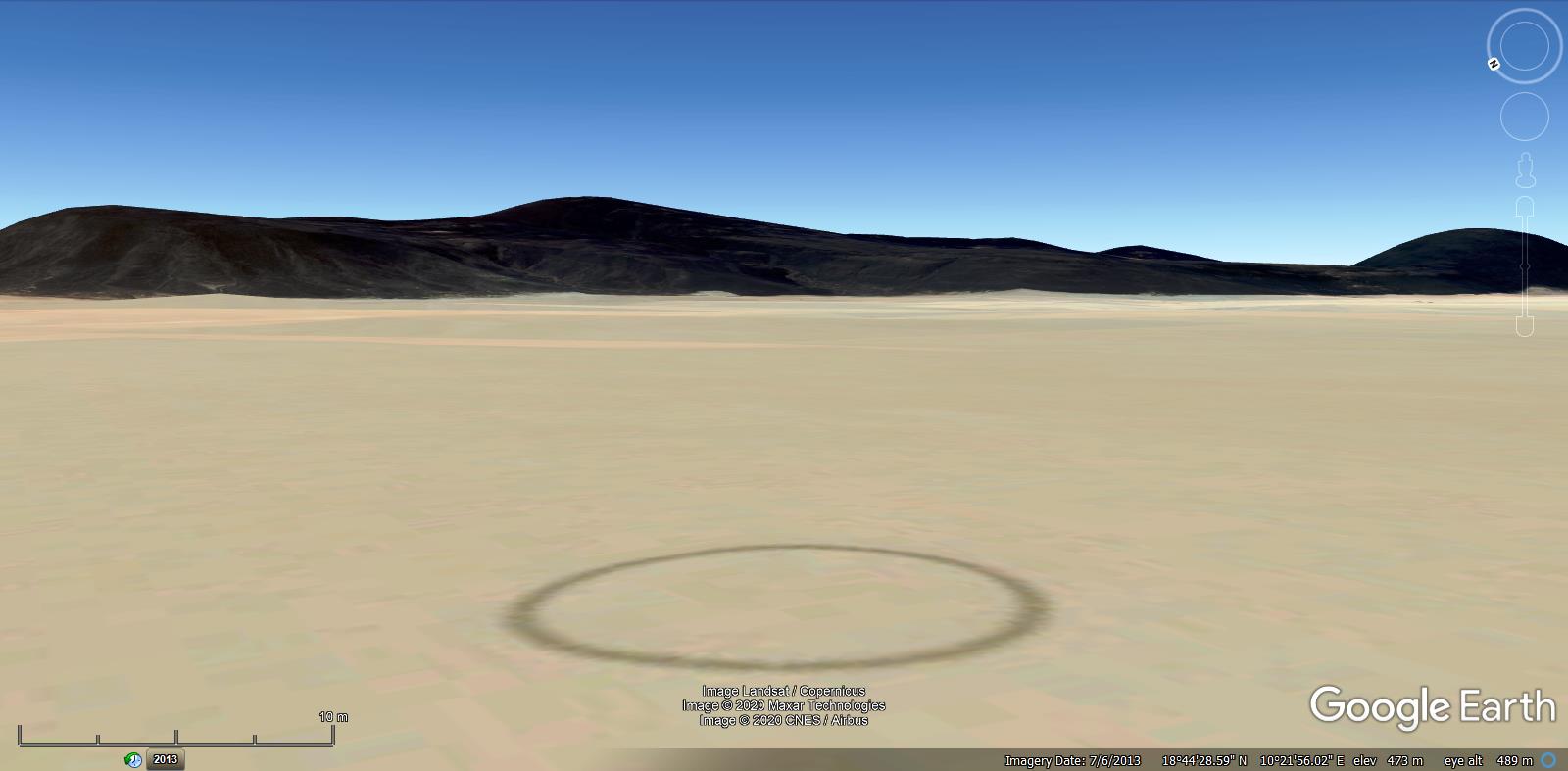 source: Google Earth circle2 in Chad:  source: telegraph.co.uk ...  ---------------------------------------------------- Acknowledgment: Thanks all of you guys for all efforts trying to find out the truth about this most recent random find of mine! - It was a great adventure! ... |
|
Full Member
Collection Editor
April 2015 - Oct 20, 2024 12:04:54 GMT
|
Post by Neil on Jan 18, 2020 16:22:23 GMT
Most excellent.
|
|
Trusted Member
Gamer
April 2015 - Nov 20, 2024 16:34:25 GMT
|
Post by why2k on Jan 18, 2020 18:59:46 GMT
"I am however infected with my french-colony concept enough to se something like: 9/21/43 (and 43 is "for sure" by me)" Hi syzygy, After letting my eyes rest, for a few days, to get away from the computer glare I agree with the text reading 9/21/43. What was the final solution for the circle? |
|
Master Cartographer
April 2015 - Nov 21, 2024 8:06:11 GMT
|
Post by syzygy on Jan 19, 2020 10:52:33 GMT
Hey why2k ! willi1 was who could dig up a source page of other similar structures - these are French aviation signs from the 1930's. No "final solution" for my find from OP yet - I mean for the "text" inside. Finding better resolution aerial imagery, photos or any written source still is up! |
|
Master Cartographer
April 2015 - Nov 21, 2024 8:06:11 GMT
|
Post by syzygy on Feb 14, 2020 11:09:49 GMT
Meanwhile 4 more sites added from Niger Chirfa, Seguedine, Dirkou and (no illustration screenshot for) Aney: (still no one more from Mauritania) 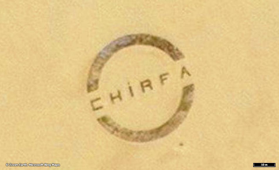 ,  ,  Also outlines for the built structures given: (example site: the Fachi landmark with the "frame" and landing strip features) 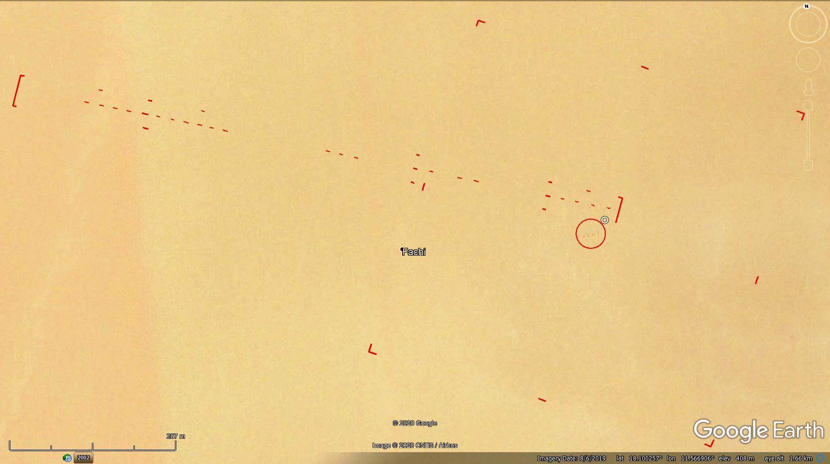 *** Updated (collection) kmz file attached to OP! |
|
Master Cartographer
April 2015 - Nov 21, 2024 8:06:11 GMT
|
Post by syzygy on Feb 14, 2020 20:12:20 GMT
So there was the one next to Aney I have missed to illustrate by last update, also since I have spotted the 7th of a sequence from Niger. It signs Oasis Agadem. 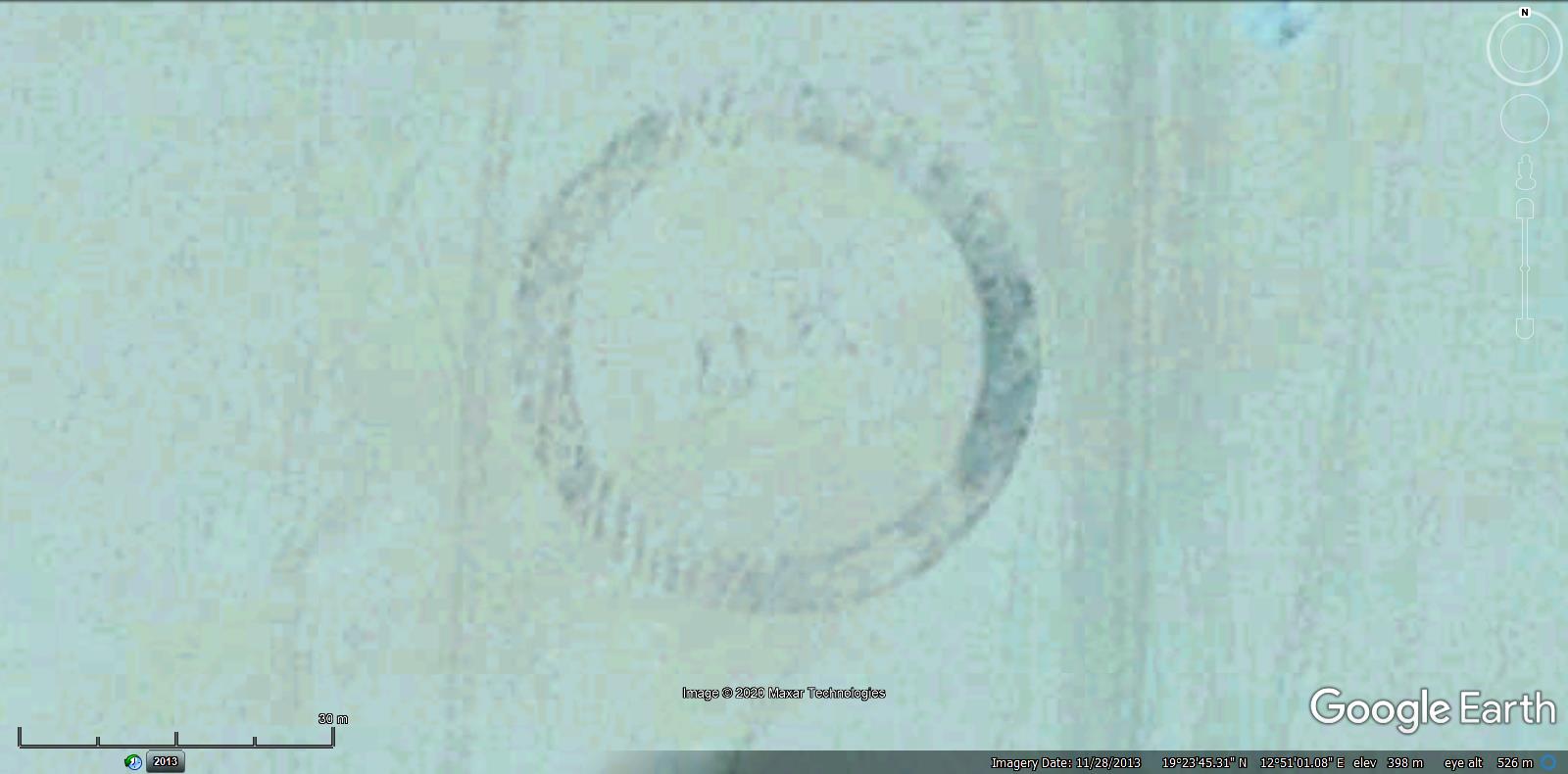 , 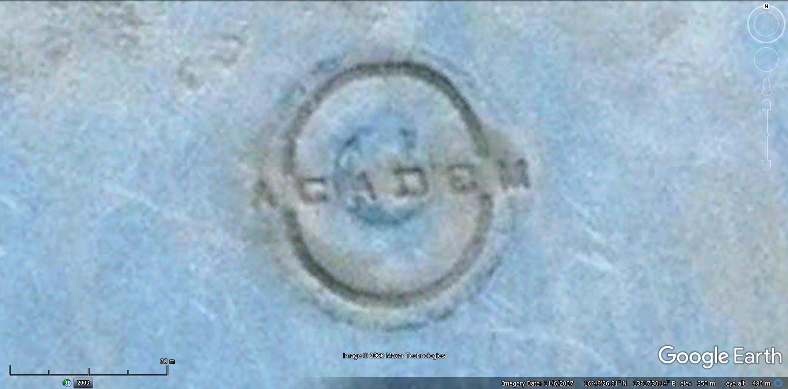 It seems these landmarks -except the "empty"(!) circle2- are to sign oases here in Niger: 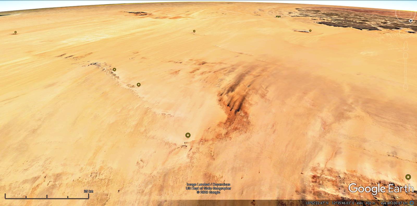 ..and the more it is plausible, that the one from my first post in Mauritania might have signed some temporary settlement - a base or something - as it has been mentioned before by someone in this thread. *** Updated kmz file attached to OP. |
|
Trusted Member
account is disabled
“ Google Maps | Google Sky | Google Mars „
|
Post by ET_Explorer on Feb 15, 2020 5:05:46 GMT
|
|
Master Cartographer
April 2015 - Nov 21, 2024 8:06:11 GMT
|
Post by syzygy on Feb 15, 2020 8:51:56 GMT
Hi ET_Explorer! At this level of resolution it can be anything. Now I am to look up some better resolution satellite imagery or in-situ documentation to find out. Now I keep seeing 9/21/43 or 9/24/43...? |
|
Junior Member
October 2015 - Oct 31, 2024 19:10:15 GMT
|
Post by JacobBogle on Feb 17, 2020 0:14:42 GMT
Came in late, but going to say this is why I love crowd sourcing & open source intel stuff.
Very good work folks!
|
|
Master Cartographer
April 2015 - Nov 21, 2024 8:06:11 GMT
|
Post by syzygy on Feb 17, 2020 6:39:30 GMT
...I love crowd sourcing... Glad to see you around young friend, JacobBogle - proud editor of the great AccessDPRK project! (; now, with you we have a crowd here in this thread, ... but where is a source? ... also would need some for my other "whaddahecks" as well! (; Welcome back on board! |
|
Master Cartographer
April 2015 - Nov 21, 2024 8:06:11 GMT
|
Post by syzygy on Feb 20, 2020 12:21:23 GMT
Hey-Ho! I just have spotted the 2nd one from Mauritania - of course from the same geomorphological unit: The Oujaf circle: 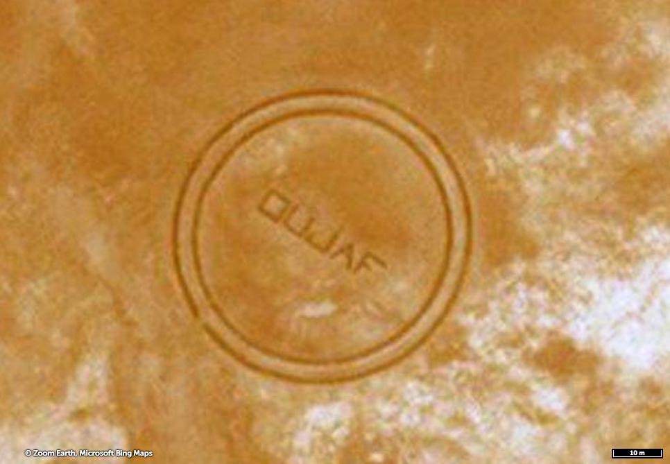 >>17.824415, -7.902450<< ZoomEarth link >> One, probably relevant Google Search result I could find - check GBook /Afrique de l'Ouest: Introduction Géologique et Termes Stratigraphiques By J.M. Bertrand, J. Bertrand-Sarfati, B. Bessoles/ As I could solve Oujaf is a Cambro-Ordovician gelogical formation, besides Oujaf is listed in the Geographical Names database as a Well. (wells can be spotted at >>17.853719, -7.919868<<) It also has the double circle and "frame" L-shapes features as the one from original post, BTW "date number inside theory" is in danger now... and even more it is...: The circle itself is in good resolution on GE imagery, but the old fort-ruins 1 kilometer to NE are not:  Just not an old, French fort from the colonial era...? Phew; still it is so exciting...(; ... Later in the afternoon I have spotted the 10 th piece of this collection, the 3 rd from Mauritanie, now from a different region: The Idjil Circle: next to F'Dérik: >>22.674429, -12.727632<< *** updated kmz folder attached to OP. |
|
Master Cartographer
April 2015 - Nov 21, 2024 8:06:11 GMT
|
Post by syzygy on Mar 5, 2020 14:09:22 GMT
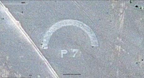
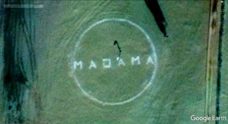
Still nothing to add to the original question, however 3 more sites have been found since last reply, No11.: # The same 50 meters diameter circle with unreadable text inside at a drinkwater well, No.12.: # Toueirma half-circle from Mauritania and No.13.: # The Madama circle from Niger: *** Finally I could spot at least a little something, not too far from the original landmark; a small ruin-site of an ancient village and some burial mounds 3,5-4 kilometers to NE. Position of archaeological sites (black: mounds, brown: ruins) and our circle in question, also an uplclose of the ruins (2 nd mark from below): 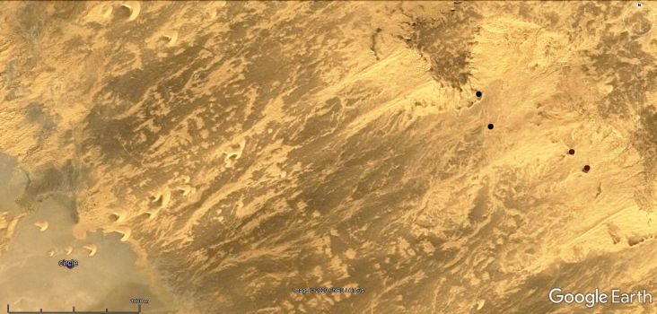 , 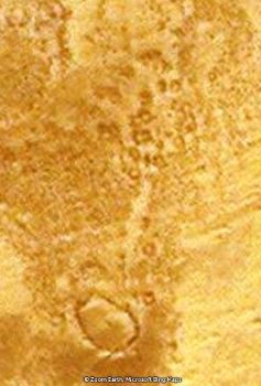 *** Gratis: I have started to play around with landmark signs, lines and directions: (check with original kmz) Line set for aviation signs post.kmz (808 B) Probably simple coincidence but it seems, connecting Toueirma-circle and corner-landmark next to it, also extended line connecting the mid-point of Idjil-circle and bullseye landmark next to it points to our discussed circle...(!) Even if inscription angle would something to do with it...(?) ... desperate tries from me, buddies...! (: And... As a surprise for the ending: by last updated BingMaps imagery overlay included into kmz file attached to OP. |
|
Master Gamer
April 2018 - Nov 20, 2024 20:32:38 GMT
|
Post by willi1 on Mar 5, 2020 14:15:35 GMT
I spent a lot of time looking for French websites that contain the topic. I found - nothing. Strange. But my knowledge of French is also zero.
|
|
Master Cartographer
April 2015 - Nov 21, 2024 8:06:11 GMT
|
Post by syzygy on Mar 5, 2020 14:32:07 GMT
Glad you are interested, thank you trying to find out some closer! I have already got in contact with the only French acquaintances that I have, and they said to be with response later...(; ... p.s: as time rolls the more links I insert in my replies to various further forum postings of mine... ending all my reply-texts will be patched up of off-topic links...(: |
|
Junior Member
May 2015 - May 7, 2024 20:41:22 GMT
|
Post by OldNPIC'er on Mar 19, 2020 22:54:40 GMT
Don't know if this contributes:
Chirfa is a very nice desert village; built from mudbricks with maybe a few hundred inhabitants. Almost each house has its own well and in the walled gardens vegetables and maize are grown. All other needs come from Libya. Djado, Djaba and Orida In Chirfa we hired a …
Mauritania
|
|
Master Cartographer
April 2015 - Nov 21, 2024 8:06:11 GMT
|
Post by syzygy on Mar 30, 2020 6:51:49 GMT
Thanks to the guys around TSGE Forums (the "french GEC"), great topographic maps of African countries were come up. Browsing these, I could find one more landmark at Letfatar, which seems to be out of maintenance, "text inside" and landing strip fetures are slightly visible: 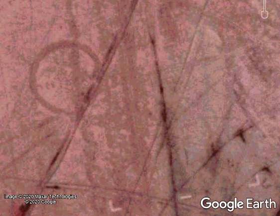 With this one there are 14 sites of such landmarks in updated kmz file attached to original post. ***Essential information about my first finding also has been provided this way - the name of the site is: Boû Dhib (or Boû Dîb) and signed as a landing site. 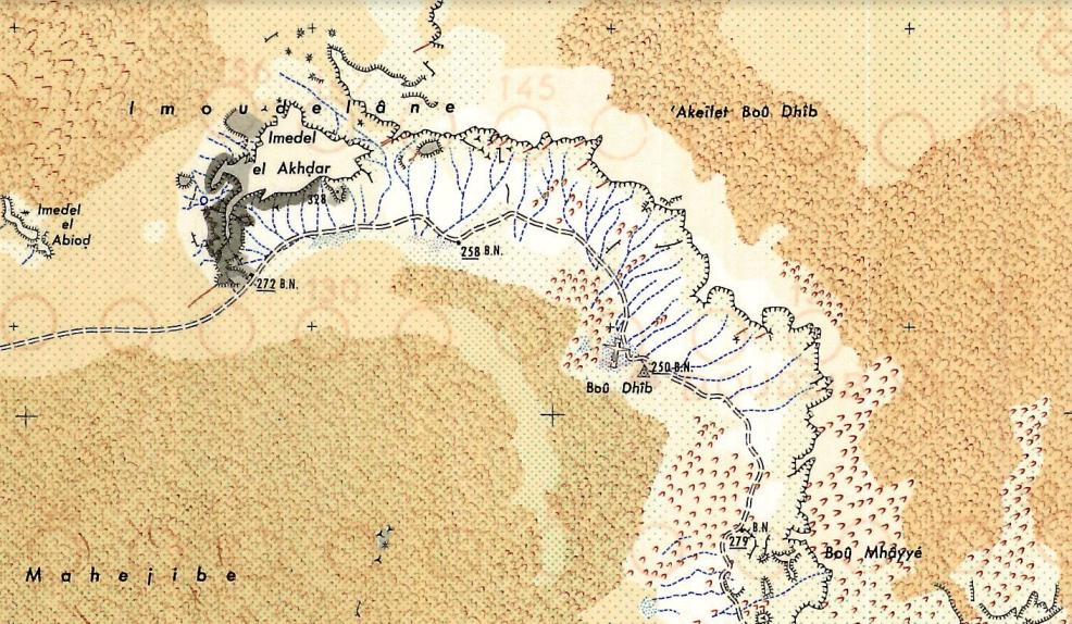 source: jemecasseausoleil.blogspot.com/2013/04/cartes-de-la-mauritanie.html (section: Nr.:68.) Also on geonames-database it is listed as a well, and however now there is no sign of active wells around the location we can be sure, there were once - and this also makes sense of it's existence at last! Now really, only one more question remains; the text - if you agree with me, not "Bou Dhib" can be read inside... 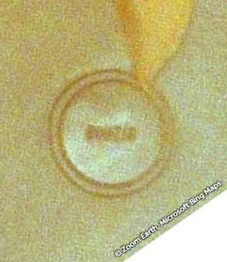 I do not want permanently reject the " date-concept" by why2k , but can it be probably some other alternate name...? BOUDIB, BOUTIB, BOUZIB, or .ZIS ?!*&@?!, ... ehh - resolution does not let us closer... ... |
|
Junior Member
September 2015 - Feb 7, 2022 16:28:59 GMT
|
Post by siggi on Mar 30, 2020 13:15:02 GMT
Great find!
I came six hours too late. Had the same idea. Looking at detailed maps of Mauritania and checking if there is an airfield marked. I remember, the website you name has very detailed maps of the country.
Here the internet is very slow, but regarding Niger it may be worth checking this:
Best Wishes
|
|
Master Cartographer
April 2015 - Nov 21, 2024 8:06:11 GMT
|
Post by syzygy on Mar 30, 2020 14:00:35 GMT
... regarding Niger it may be worth checking this:... Done! ...and Dao Timmi circle from Niger included! (; >>20.56417, 13.52325<< 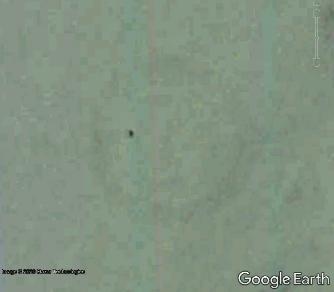 (it is out of maintenance and pretty hard to see, but the same 50 meters diameter circle for sure.) - updated kmz file attached to OP. Thank you for the links! Best! G ... Edit - 2020.03.31.: Tessalit, 1 st one from Mali included. >>20.2426064, 0.9813041<< 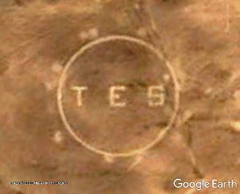 |
|
Master Cartographer
April 2015 - Nov 21, 2024 8:06:11 GMT
|
Post by syzygy on May 7, 2020 15:32:41 GMT
Landmark No.17 at Oued Rkeiz - Mauritania included. 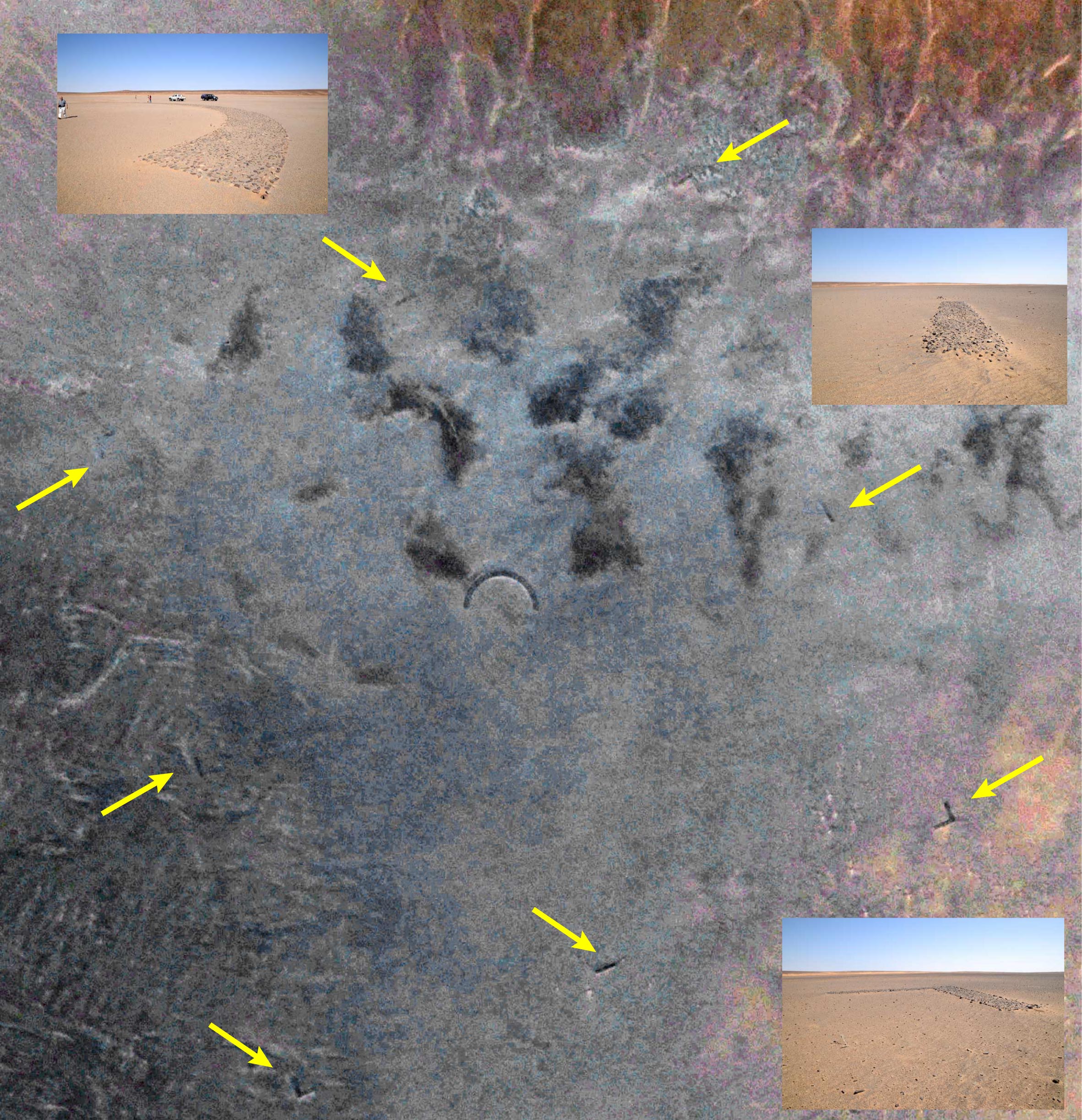 Half circle with full set of "frame" features. - Credit: Yves Gauthiere (2016.nov.) I am thankful to Mr. Gauthier, who sent me his data to share! They have accidentaly bumped into it whilst some special rock art tour in november 2016. ... Updated kmz file attached to original post. |
|
Master Cartographer
April 2015 - Nov 21, 2024 8:06:11 GMT
|
Post by syzygy on Jun 20, 2020 21:55:33 GMT
No.18.: Chegga - MauritaniaClassic circle sign and airstrips: 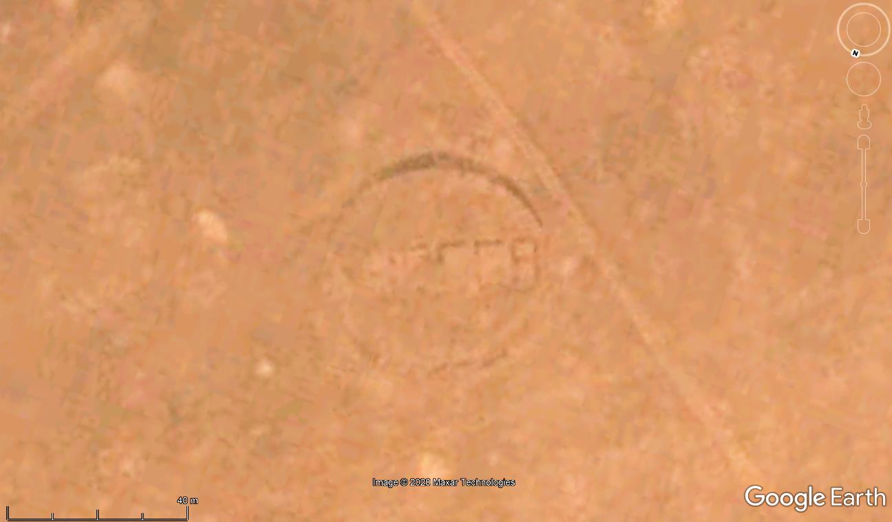 *** No.19.: Rather small, 15 m diameter circle near to modern age earthworks scars, platform and road - nearest map reference: Glebet Atores - Mountain peak. Tindouf, Algeria (5 kilometers to N) 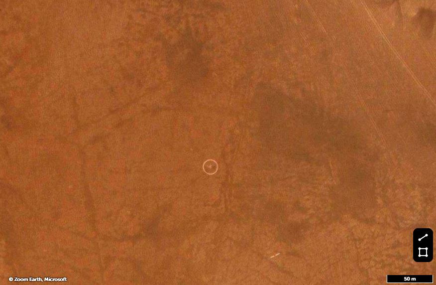 I am thankful to Yves Gauthier for this one again, who sent me the coordinates. ... Updated kmz file attached to original post.
|
|
Junior Member
February 2021 - Feb 5, 2021 9:41:19 GMT
|
Post by chriss on Feb 5, 2021 10:03:37 GMT
Interesting thread. Here’s another aviation marker a mate just spotted in northern Mali. 19.454552, -0.422082 The locality is know as Timetrine.  Don't know why he was lurking way out there, but this happens to be one of the many remote or hidden places where AQIM and similar Islamist groups temporarily kept western hostages for years at a time. Some are still out there. At Timetrine the ‘L’s or cardinal point arrows (as on the Madet circle which I write about here) are oddly spaced, but perhaps the unusually rectangular clay pan made a distinctive landmark on a direct line from Timbuktu to Tessalit (the main settlement in far north Mali). Overall, I go with the pre-War aviation marker explanation, as Yves Rohmer’s website suggested. But why bother with Adrar Madet circle when the linear massif itself is a much clearer marker in the expanse of the Tenere desert? As you’ll see on my link, others speculate that Adrar Madet circle is exactly halfway along a prime, 'ancient Egyptian' meridian. The coincidence is remarkable, but to me, that’s all it is. Fyi:‘Idjil’ relates to Kedia Idjil, the name of the iron ore mountain (and highest point in Mauritania) which F’derik (formerly: Fort Gouraud) was built to mine. It's still the country's main commodity today. Stencilling in stone is a similar practice I’ve seen in Morocco, where desert garrisons paint rocks on stony hillsides. Assa, on the edge of Western Sahara, is a good example. 28.601930, -9.437050 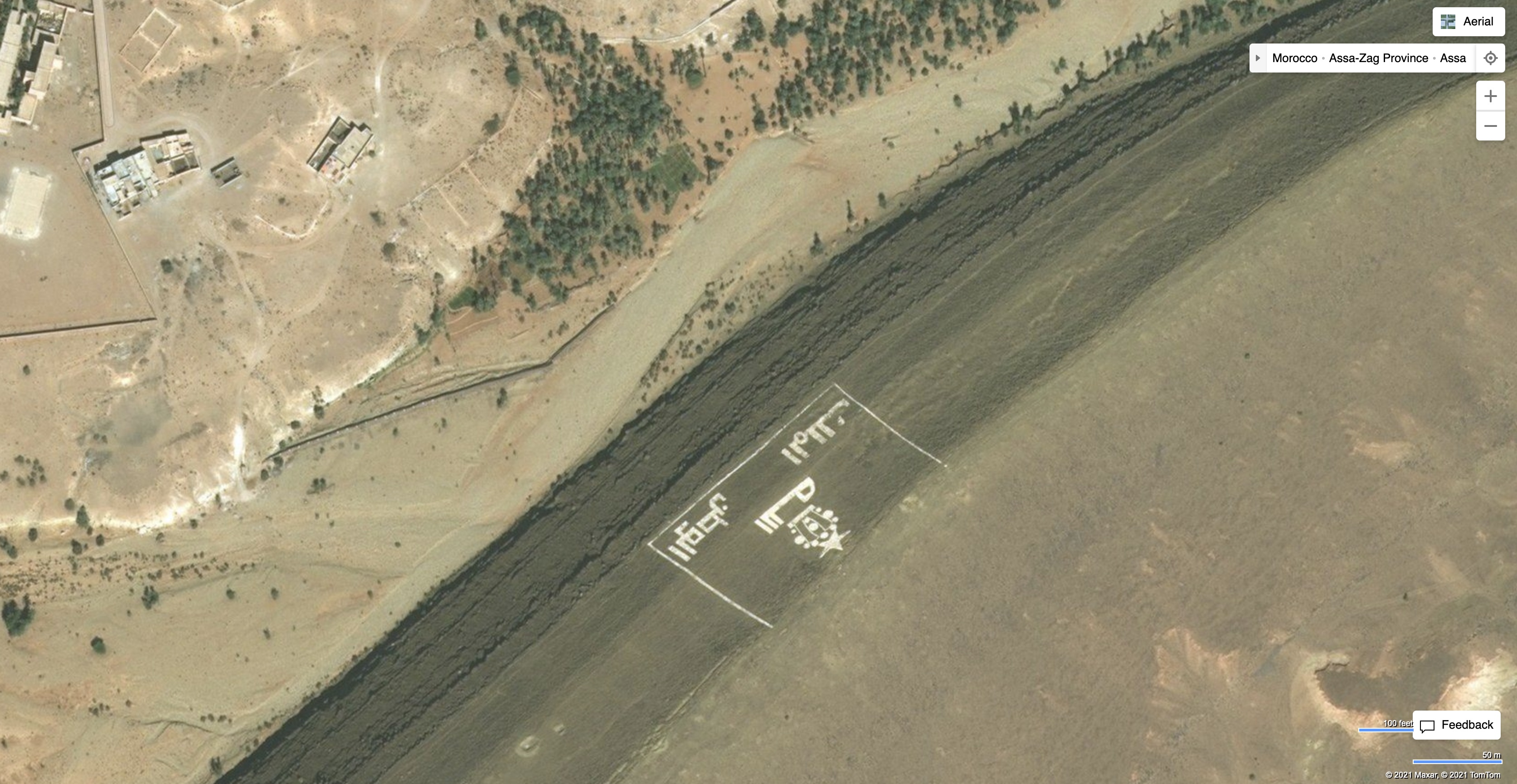 Looks like a brigade insignia, but as much for visibility at ground level. It wouldn't surprise me if they picked up this idea from the French or Foreign Legion. But I’ve also come across smaller cobbled stone circles in southern Algeria (Hoggar; Tassili N’Ajjer and in between the two). They’re only some 10m across (hard to see on a sat) and seem too small to be aviation markers (considering other much more prominent natural landmarks). But they’re not typical pre-Islamic tombs either. From the condition and build, they look recent. Who knows.    |
|
Master Cartographer
April 2015 - Nov 21, 2024 8:06:11 GMT
|
Post by syzygy on Feb 5, 2021 11:54:18 GMT
Hi chriss ! Many thanks (your mate too) for this new landmark, also for the cool photos and all the other interesting additional informations! Congrats on SaharaOverland and for all the good work! If you have find this one interesting, probably you'll also like other threads from my Africa selection as well! I have listed them at the end of this introductions post of mine. ( ; Welcome around! P. S. : could you give position of those circles photographed above? Would be interesting to look'em up on satellite imagery by any means. |
|
Junior Member
June 2021 - Oct 18, 2022 21:20:39 GMT
|
Post by tafrawti on Jun 15, 2021 13:54:51 GMT
"Stencilling in stone is a similar practice I’ve seen in Morocco, where desert garrisons paint rocks on stony hillsides.
Assa, on the edge of Western Sahara, is a good example.
<pic snipped> Looks like a brigade insignia, but as much for visibility at ground level.
It wouldn't surprise me if they picked up this idea from the French or Foreign Legion.
But I’ve also come across smaller cobbled stone circles in southern Algeria (Hoggar; Tassili N’Ajjer and in between the two).
They’re only some 10m across (hard to see on a sat) and seem too small to be aviation markers (considering other much more prominent natural landmarks).
But they’re not typical pre-Islamic tombs either. From the condition and build, they look recent. Who knows." Good to see you here Chris - your Overland book has been my bible for decades. I've just signed up for these forums myself so I hope that this, my first post here, is legible - I find the edit box a little bamboozling  The Moroccan words are transliterated as Allah, al-Watan, al-Malik - meaning God, Homeland and King - motto of the Moroccan Armed Forces. Funny you should mention the Legion, because the cobbled circles you provide pics for definitely remind me of a Légion étrangère / Goumier/ French flagpole surround on a parade area and could well be about the right size. The Légion étrangère especially like to make their camps nice and neat, often painting stones white and marking pathways between building and to parade areas. Such traditional "corvée" tasks, as they are known, are ordered to prevent the legionaires becoming idle or bored when in garrison. I wonder if these small cobbled circles in the Hoggar you go on to mention are 100 to 150 year old examples of such work - especially if there are any signs of a camp nearby, often a triangular (early or temporary example) or square (later) fort ground traces, the larger ones sometimes with foundations of smaller square buldings on inner walls as barracks. I recall an author, possibly Michael Asher? stating in a book I read many years ago that on a camel expedition he came across a circle marked out with stones and with the name across the centre - it was certainly an airfield / landing ground marker and I believe in the Mauritania/Mali area. As the thread has already noted, circles with the name of the airstrip picked out in stones across the centre were very common across north Africa. In busier inhabited areas urban sprawl tends to overrun older airstrips, though more remote ones survive rather well. At modern airstrips with surfaced runways), small circular features are more likely to be a NDB radio mast enclosure or simply surrounding a windsock, or possibly a VOR beacon at larger airports. |
|


 just my opinion!


 ,
,  ,
, 

 ,
, 


 ,
,  ,
, 
 ,
, 


