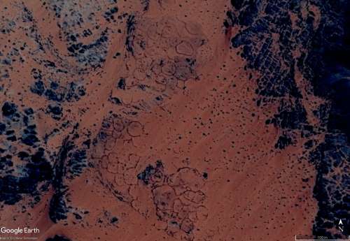
How about these three "antennae" that are in a line, each has a distinctly different orientation, though they are facing East. Each of them are around 700' at the sides. They are in order N to S, the first faces slightly to the SE, the second almost due E, third, slightly NE... in a line with that big one, the largest "mts" of all, which I call "Ishmael" (posted earlier) ... forgive me if you've seen these already
"Anyone know what the deal is with these fortress-like things around the Richat?"
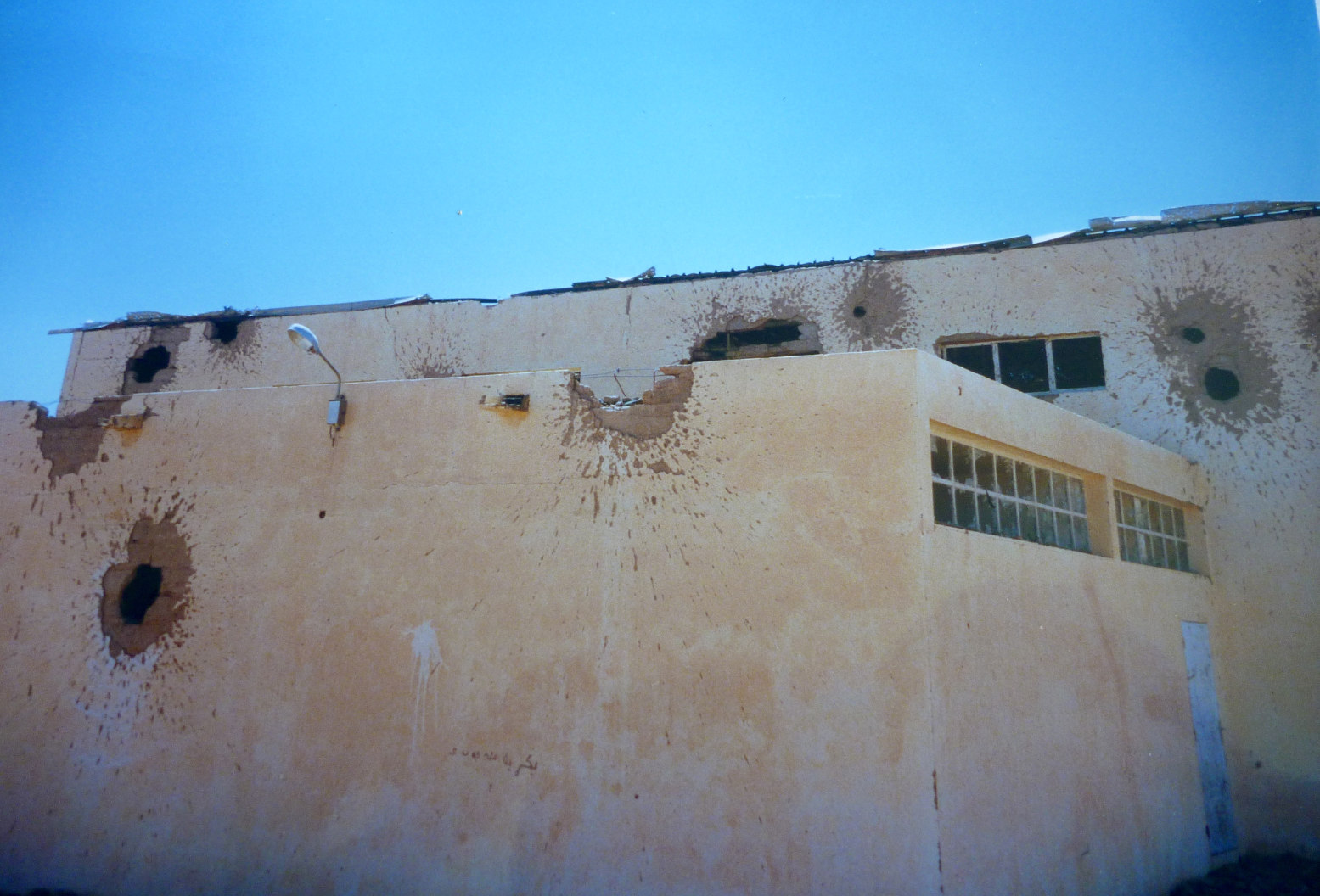
If this is Richat in Mauritania then I think forts are exactly what they are - similar to other Sahara 'bordj' and maybe relics from the 1980s Polisario war when Mauritania was fighting the Polisario with the Algerians for a few years. I recall our guide warning of landmines south of Richat when we were there in 99, and nearby Chinguetti was shot up during a Polisatio raid.
How about these three "antennae" that are in a line, each has a distinctly different orientation, though they are facing East. Each of them are around 700' at the sides. They are in order N to S, the first faces slightly to the SE, the second almost due E, third, slightly NE... in a line with that big one, the largest "mts" of all, which I call "Ishmael" (posted earlier) ... forgive me if you've seen these already
One can speculate that antennas face the sunrise. However, I am not aware of any studies that prove this in any way.
As far as I know, as much as nothing is known about antenae except that they exist and a few datings. All far too little to make any clear statements.
.
These three V antennas are a good example of always finding something new in the Sahara. Because of the proximity to the big "master" keyhole, I had searched the area particularly well (I thought). Still, I had overlooked them. Of course, this can also be due to the fact that there are always new pictures with better resolution.
Last Edit: Nov 30, 2022 9:47:56 GMT by bemerkenswelt
"One can speculate that antennas face the sunrise. However, I am not aware of any studies that prove this in any way. As far as I know, as much as nothing is known about antenae except that they exist and a few datings. All far too little to make any clear statements." .
bemerkenswelt - It's just a guess, but it seems that ancient peoples everywhere were concerned with astronomy, or at least marked the passage of the solstices and equinoxes. One way to find out is to get orientation data on all of them and compare... there may be some correlation, cross-referenced with condition or apparent age, style, etc.
Those antennae I overlooked many times also, one is very faint. There is one more of that style, just a little further due South along that same ridge-line. The antennae are shorter, but same overall design. It's funny, isn't it? I often go over places I've already looked twice and three times, only to be surprised at what's still there. In my youth, there were these books called "Where's Waldo?" where you have to find this Waldo character, which is like looking for a "needle in a haystack". It's is a bit like that here, isn't it, only more fun
What about this place in Mauritania - some attractive "natural?" geology here, and if ships could sail on sand, this would be one hell of a harbor..
bemerkenswelt - It's just a guess, but it seems that ancient peoples everywhere were concerned with astronomy, or at least marked the passage of the solstices and equinoxes. One way to find out is to get orientation data on all of them and compare... there may be some correlation, cross-referenced with condition or apparent age, style, etc. Right! I think this has just started and is in the very beginning. It will take some decades until there is more data and more evidence.
.
Those antennae I overlooked many times also, one is very faint. There is one more of that style, just a little further due South along that same ridge-line. The antennae are shorter, but same overall design. It's funny, isn't it? I often go over places I've already looked twice and three times, only to be surprised at what's still there. In my youth, there were these books called "Where's Waldo?" where you have to find this Waldo character, which is like looking for a "needle in a haystack". It's is a bit like that here, isn't it, only more fun Right! I feel exactly the same way. I always find something new in areas I've been searching already two or three times.
. What about this place in Mauritania - some attractive "natural?" geology here, and if ships could sail on sand, this would be one hell of a harbor.. I wouldn't go so far as to use my imagination to see a harbor there. But with my eyes I see some settlement remains there.
If you look at the Tassili N'Ajjer region, you can see I've spent a lot of time there, logging now (they are all numbered on the map in the order they were found) almost 1700 of the "burial mounds with entryway" - to me they look like a mushroom - and if you know the famous cave paintings of Tassili N'Ajjer, it's a UNESCO heritage site that features "The Mushroom Man" and some wild drawings of strange creatures, but representations of mushrooms appear quite a lot.
Looks like a great location to film the epic tale of an advanced civilization that meets its end by nature's wrath and sends the survivors on a one-way trip to the stone age. Love it. Wish I had George Lucas on speed dial. He's not been busy for a while... Think Planet of the Apes meets Waterworld meets Dune meets Conan the Barbarian. An epic with such EPIC proportions that tears will roll during this film! There will be crying in the streets! Almost as if it triggers the trauma of a long distant memory... You see, my imagination requires a significant cash injection. But hey, anything is possible! That's my realm, not in what is "right" but what is possible. Understanding changes and conditions can change, though we may be unaware of the mechanism behind it. This can be true in the life of one like myself, or an entire city, continent, or planet. There's a Chinese proverb that says "bend and you will be whole" -from the Tao Te Ching: "that which is soft and supple belongs to the land of the living; that which is withered and dry belongs to the realm of the dead. Bend and you will be whole." The mantra of flexibility... Fixation on what "is" or "isn't" feels a bit dry, like the realm of the dead, while fixation on what "could be" feels more lively, even if it's also the realm of Saturday morning cartoons. I hope to find the balance someday... At any rate, the Sahara sure gives off realm of the dead vibes. Solve the puzzle, and we might just survive...
Post by buildsancient on May 11, 2023 14:40:45 GMT
UPDATE ON TICHIT REGION Mauritania
Hey guys. Just a quick update on this region: Aoukar is a geological depression area of southeastern Mauritania, located between Kiffa and Néma, south of the Tagant Plateau. It is a dry natural region of sand dunes and salt pans fringed by escarpments on its northern and eastern sides. There was once a vast reed-covered endorheic lake in the area, but it no longer exists. The former lake of Aoukar extended towards the area of Tichit, bordering the southern edge of the Tagant Plateau. From east to west, Dhar Néma, Dhar Walata, Dhar Tichitt, and Dhar Tagant form a semicircular shape around the Hodh/Aoukar Depression, which, prior to 4000 BCE, was an area with lakes of considerable size, and, after 1000 BCE, was an area that had become increasingly dried.
Dhar Tichitt is a Neolithic archaeological site located in the southwestern region of the Sahara Desert in Mauritania's Tagant Region. It is one of several settlement locations along the sandstone cliffs in the area. The Tichitt tradition is associated with the site, which is characterized by agro-pastoralism. The site has been excavated, and most of the archaeological evidence has come in the form of ceramics, cattle remains, and stonework present on the Northern border of the known Middle Niger boundaries. The earliest Tichitt assemblages present in this region have been dated to around 1300 BCE. The site is one of the two main archaeological sites discussed in the study of spatial organization and socio-economic differentiation at Dhar Tichitt in southeastern Mauritania.
The artifacts found at Dhar Tichitt are from the Neolithic period, which lasted from around 4500 BP until around 2300 BP, or approximately 2500 to 500 BCE. The cliffs were inhabited by farmers and pastoralists during this period. The site was first discovered in the 1910s as a result of an expedition by the French Colonel Charles Roulet during the colonization of the region. The area is one of the oldest known archaeological occupation sites in West Africa, and about 500 stone settlements littered the region.
So, there you go! I pulled the description off of Perplexity.ai, so there might be mistakes. However, there is a great article over HERE about it. I'm kind of thinking that it might be a little older though. There are some more settlements further in along old river beds that go quite deep into the desert before they fade out.
A few more Sahara ants for you, Mr bemerkenswelt, near the Oued Chbika collection but not on your current G map. A friend drove past there a few days later to take some drone shots.
I could not see how to attach a kml here so I sent you an email