Master Cartographer
April 2015 - Nov 21, 2024 8:06:11 GMT
|
Post by syzygy on Nov 27, 2018 9:08:46 GMT
only 76 new sites added, so here two causes, why I needed to do a reply post instead of a silent update: 1.: rather artistic alignment of burial mounds which could represent the universe (Russia, Altai Republic): Sun and Moon at the center, planets -the giant could be Jupiter- in the inner ring and the outer "sphere" for the stars.  -------------------------------------------------------------------------------------------------------------------------------------------------------------------------------------------------------- 2.: examples of the misterious, cultic/funeral sites of the Bronze-age Mongolia; Khirigsuurs firstly have been added to this collection. 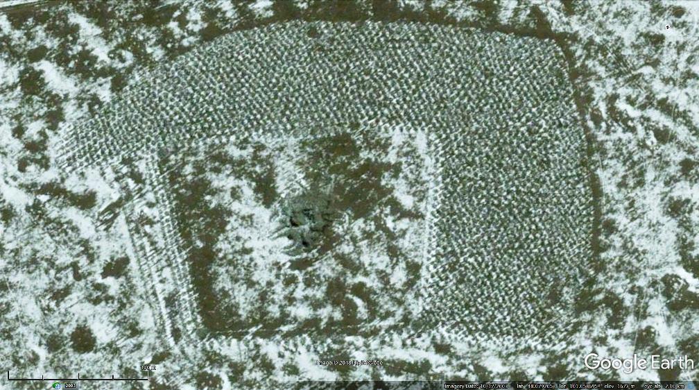 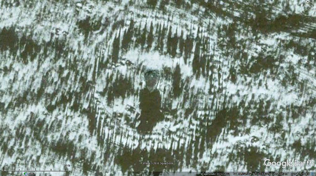 updated KMZ file attached to OP. |
|
Master Cartographer
April 2015 - Nov 21, 2024 8:06:11 GMT
|
Post by syzygy on Feb 28, 2019 14:31:09 GMT
Just another unique site from around the Globe, the 4000 years old burial field of the Dilmun culture in Bahrain:  sources: en.wikipedia.org # edition.cnn.comCheck GE Photo- and GEC layers whole around Bahrain for further credit! Updated kmz file attached to OP. |
|
Master Cartographer
April 2015 - Nov 21, 2024 8:06:11 GMT
|
Post by syzygy on Mar 18, 2019 8:37:18 GMT
at first I have thought, only my eyes made tricks on me:  then (130 kilometers away) came these: 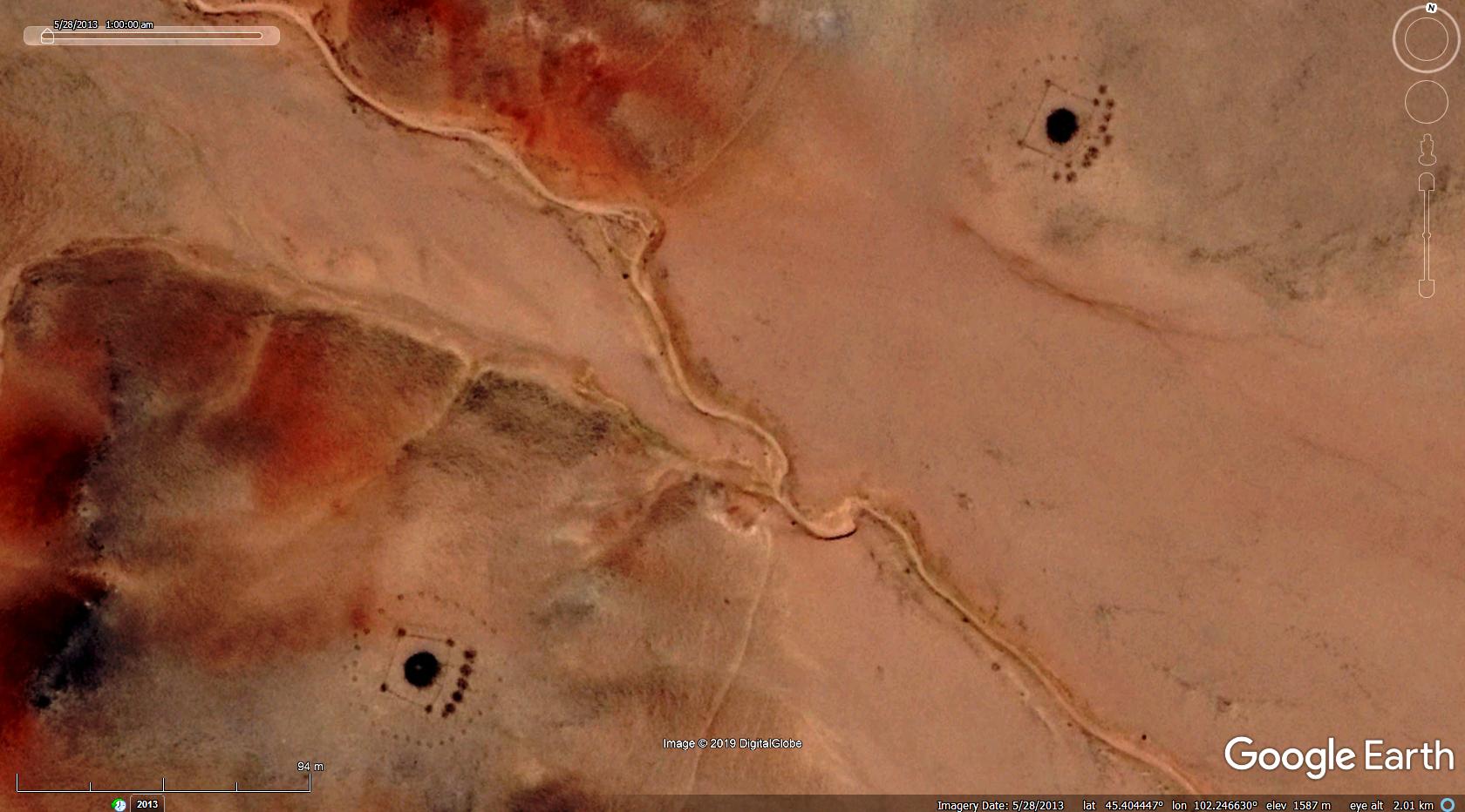 and suddenly the whole screen went to dots, squares and circles -usual frames of khirigsuurs-, but...  it is the first time I have found such bouquet of designs with those small, "dot-cornered square frames", also another new feature; "arches" appearing: 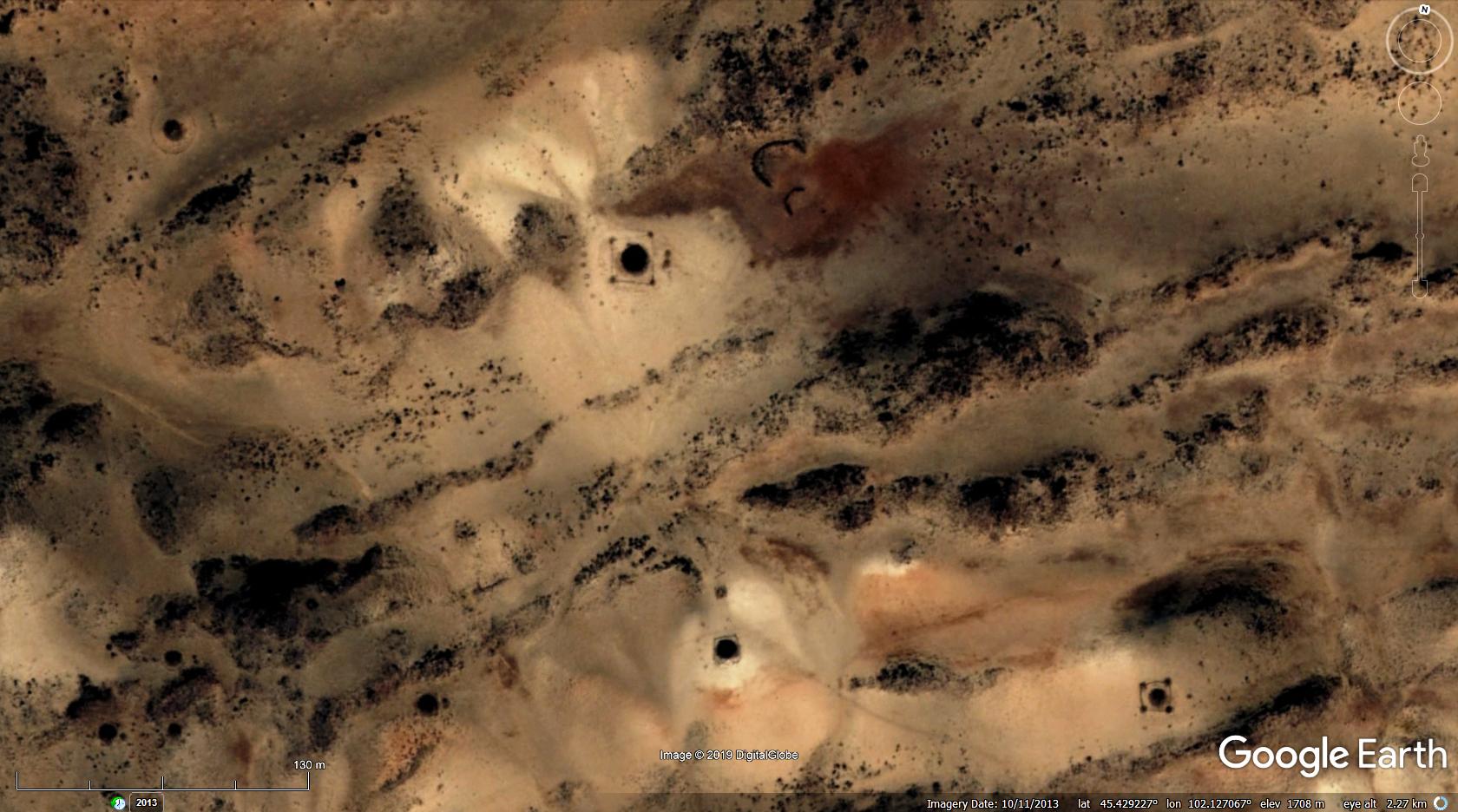 only I note, that these are situated around Khangai mountains, thousand kilometers far from the mentioned khirigsuurs of the Mongolian Altay. any further info on these would be fine! thanks! g updated kmz file attached to OP. |
|
Master Cartographer
April 2015 - Nov 21, 2024 8:06:11 GMT
|
Post by syzygy on Mar 23, 2019 23:00:23 GMT
omega shaped earthworks and burial mounds sequence: 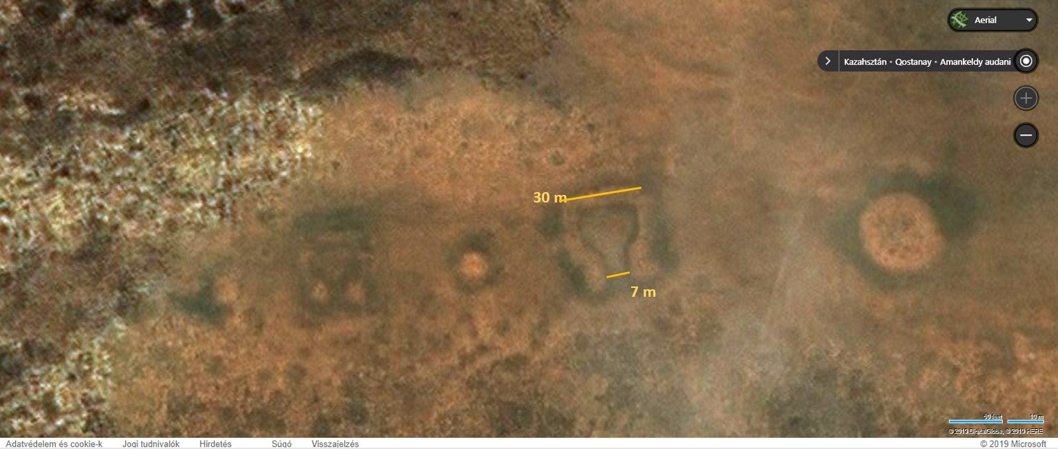  a smaller (15m) rectangular and further linear (80 an120 meters) structures, 360 meters to N:  check all these on ZoomEarth! >>49.115768, 66.064164<< I have never seen such "omega" or "earphone" or "musical note" or "dub as you wish" looking structures, which I think are not remnants of pens or other buildings. Fallen debrish would have made less regular shapes with much more blurred edges. I am not an expert however, so must not exclude any "foundations" theories, still strange that these are aligned in sequence with mound structures, if circular features are burials at all. any explanation or ideas, what these could be? (GE imagery cannot be used here however, updated kmz file still attached to OP.) |
|
Master Gamer
April 2018 - Nov 20, 2024 20:32:38 GMT
|
Post by willi1 on Jan 22, 2020 15:39:57 GMT
The Gallo-Roman burial mounds "Drie Tommen" near Tienen (Belgium) probably date from the 1st or 2nd century AD. They were examined for the first time in 1892 and valuable discoveries were made. See HERE for details. Attachments:Drie Tommen.kmz (685 B)
|
|
Master Cartographer
April 2015 - Nov 21, 2024 8:06:11 GMT
|
Post by syzygy on Jan 22, 2020 20:29:53 GMT
The Gallo-Roman burial mounds "Drie Tommen" near Tienen (Belgium) ... Even no GEC layer location... Thanks for those! |
|
Master Cartographer
April 2015 - Nov 21, 2024 8:06:11 GMT
|
Post by syzygy on Mar 10, 2020 22:16:58 GMT
The site has already had a placemarker, but only today I have been informed about results of first-level scientific inspection: All signs suggest, that these are sarmathian ring ditched tumuli or mini-kurgans, based on primary fied-work and ID. Special curiosity of the site that it seems was never been studied before. It is the first time when surely a genuine new spotting of this kind of archaeological features has been presented by me. Small, hard-to-notice group of mounds, but I am just the most proud of them! As the discoverer I have already denominated the site.  " syzygy-humps" - sarmathian, ring ditched mini-kurgan group 3 photos taken today morning by scholar friend of mine (yet unnamed): [slide captionposition="1" wrapperstyle="padding:10px 0;border-top:2px solid #eee;border-bottom:2px solid #eee;width:900px;"]https://res.cloudinary.com/syzygy/image/upload/v1583877834/mounds/Bokros_kurg%C3%A1n__1.jpg example 1 res.cloudinary.com/syzygy/image/upload/v1583877834/mounds/Bokros_kurg%C3%A1n__3.jpgexample 2 res.cloudinary.com/syzygy/image/upload/v1583877833/mounds/Bokros_kurg%C3%A1n__2.jpgexample 3[/slide] Since then also I have initiated my membership to the Eagle-eye Brigade...(: Cheers! G |
|
Master Gamer
April 2018 - Nov 20, 2024 20:32:38 GMT
|
Post by willi1 on Sept 10, 2020 8:31:14 GMT
Gaya was a Korean confederation of territorial policies in the South Korean Nakdong Basin and existed from 1st to 5th centuries AD. Throughout the existence of the Gaya Confederation, important personalities were buried in burial mounds. In the 1st and 2nd centuries mainly wooden coffins were buried in it. Graves for rulers and subjects were usually in a single area. In the case of graves for the ruling classes, grave goods were given in a hole under the coffin. In the 3rd and 4th centuries the burial mounds increasingly contained wooden burial chambers. Rulers' tombs were erected on top of hills at a distance from the graves of their subjects. The conquest of Gaya by Silla in 532 put an end to this. So far, around 780 grave mound clusters from the Gaya period have been identified by means of soil analysis. 104 of them have been extensively examined archaeologically. As a result of this research, 20 of them were included in national or local cultural heritage lists because of their importance as testimony to the culture and history of Gaya. The tumuli field by Goryeong Jisandong Daegaya is not listed here, as it is already included in the KMZ at OP.
Attachments:Gaya-Tumuli.kmz (1.21 KB)
|
|
Master Cartographer
April 2015 - Nov 21, 2024 8:06:11 GMT
|
Post by syzygy on Sept 10, 2020 10:28:30 GMT
Thanks for this great contribution willi1 ! At some of the sites cool GE Photos are also available:  GE Photo GE Photo by 이양훈 (Lee Yang-hoon) Many thanks, you do not forget this thread! (; Best! G ... EDIT: Your Gaya Mounds Collection is now included in my kmz, attached to OP! Credit and explanation given to each, plus to the one at Goryeong Jisandong Daegaya. (; |
|
Master Cartographer
April 2015 - Nov 21, 2024 8:06:11 GMT
|
Post by syzygy on Nov 20, 2020 7:08:10 GMT
For a few days I have turned back to Mongolia. Many low resolution imagery areas, but with parallel use of other map engines I can go ahead step by step to find awesome structures, that make me excited even after 15+ years of searching. Here an example, I have spotted yesterday - Gigantic (50m diameter) kurgan with the biggest barred wheel structure (150m diameter!) I have ever seen. This main kurgan has a smaller pair with a somewhat irregular, still huge circle around, also both giants have one, small "satellite mound":  ZoomEarth link ZoomEarth linkThe rectangular structures inside the barred wheel must be younger, additional architectures with yet unknown function. *** Updated kmz file attached to OP. |
|
Master Gamer
April 2018 - Nov 20, 2024 20:32:38 GMT
|
Post by willi1 on Mar 11, 2021 19:22:07 GMT
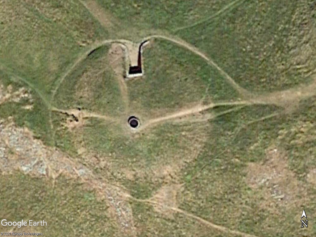
The Tumulus of Xhendremael (locally called Li Tombe di Hên'mâl) is a Gallo-Roman burial mound (dated > 27 B.C.) near Xhendremael in the Belgian province of Liège. This mound probably served as a burial place for residents of an Roman villa, the remains of the villa (bricks and roof tiles) are discovered 1933 between Waroux and Xhendremael.
|
|
Master Cartographer
April 2015 - Nov 21, 2024 8:06:11 GMT
|
Post by syzygy on Mar 11, 2021 21:17:23 GMT
Thanks for strengthening my 'Western Europe' folder with this premium contribution willi1!
Nice to see it had luck to remain intact. So many fell victim of agriculture in my country.
Since 2010 tumuli are protected by law, many ploughed piece had to be withdrawn from production. Slowly these are recovering and natural grassland species return to their slopes.
|
|
Master Gamer
April 2018 - Nov 20, 2024 20:32:38 GMT
|
Post by willi1 on Mar 30, 2021 17:57:34 GMT
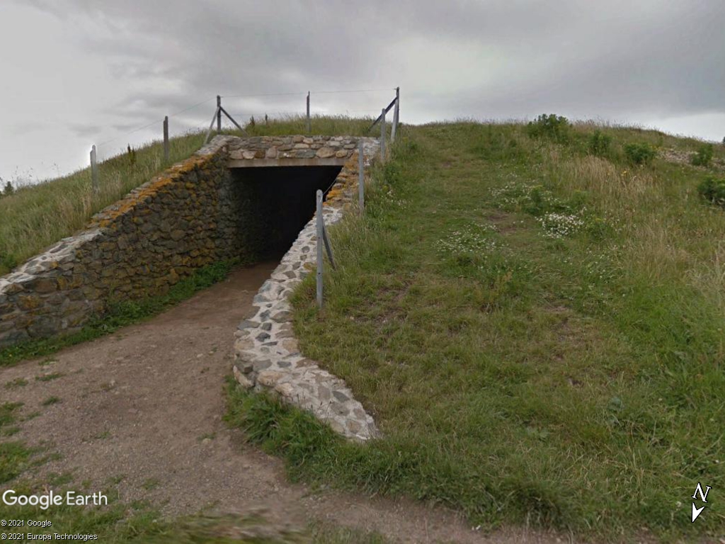
Barclodiad y Gawres (Welsh for "The Giantess's Apronful") is a Neolithic burial chamber between Rhosneigr and Aberffraw on the south-western coast of the island of Anglesey in North Wales. |
|
Master Cartographer
April 2015 - Nov 21, 2024 8:06:11 GMT
|
Post by syzygy on Mar 31, 2021 11:13:51 GMT
In 1996, in my highschool years I have been to Wales with the Town Choir and spent unforgetable days in Caernarfon also been to Anglesey island with Winn, head of our great host family.
Pity that time I did not take much care of ancient burial tumuli... ( : The more to brand new short skirts...! B)
...
Thanks you have made me remember with this interesting piece!
|
|
Master Cartographer
April 2015 - Nov 21, 2024 8:06:11 GMT
|
Post by syzygy on Apr 16, 2021 9:08:58 GMT
Older discovery I have just bumped into has brought a 2nd extraordinary placemark to the Israel subfolder. *** I marked position based on the map from this article, also have left overlays included, as illustrated below:   |
|
Newbie
May 2021 - May 26, 2021 13:10:01 GMT
|
Post by jdavid on May 26, 2021 11:31:13 GMT
syzygy , what a great work! Amazing! To answer your question on the circular or rectangular mounds in Mongolia: the middle mound is the main burial place, whereas the other structures are fence structure and/or stone rings and/or external mounds. The rectangular mounds are tending to be from the bronze age, though this should be still to be verified. Here I attach one image from one publication (and if it will work - one paper). [filelink type="pdf" href="https://drive.google.com/file/d/1c3lF9gUHLNbMgNQ5yV7X0u4tTKJsUKDa/view?usp=sharing"]2008-BRONZEAGEBURIALMOUNDSKHIRGISUURS[/filelink] |
|
Master Cartographer
April 2015 - Nov 21, 2024 8:06:11 GMT
|
Post by syzygy on May 26, 2021 15:04:52 GMT
Hi David! Welcome and much thanks for your comments! ...(and if it will work - one paper). Yes, it works! - Thanks for share! Meanwhile I got to know many things about these (also some more about others) and it seems a lifetime will not be enough to sketch up any universal... ( : If you are interested in topic, please do not forget these structures ( mounds and other earthworks) from Kazakhstan, which are now remaining as some last, big mistery* for me in this thread... besides the few thousand smaller questions of course... so far... ( : (someone has told me that those are "dumbbell mounds" - still I could not find any closer on the web...) Also would recommend these huge structures from Africa to inspect. (in every case burial mounds included) I have corresponded with several experts, but only the big nothing come up yet... (stay tuned!) Useful browsing around and do not hesitate to share both questions and knowledge, anything related to our categories here on GEC Forums! All the best! G P. S. : One question, you're not obliged to answer - how did you find us (and this thread within)? |
|
Master Gamer
April 2018 - Nov 20, 2024 20:32:38 GMT
|
Post by willi1 on Nov 1, 2021 16:30:41 GMT
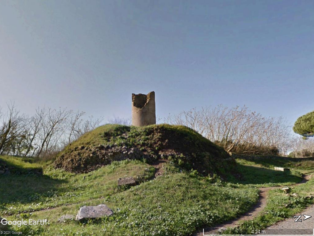
On the Via Appia near Rome, there are the so-called mounds of the Horatii and Curiazi. The name derives from the legend according to which, at the time of King Tullio Ostilio, Rome came into conflict with Alba Longa and the armies met right here, where the border between the two states was then marked by a moat (the Fossae Cluiliae). To avoid the massacre between peoples of the same blood, a duel challenge was decided between three Romans and three Albans: the brothers Orazi and Curiazi. Only one of them survived, a Horace who managed to kill all three enemies with a ruse and gave the victory to Rome. Since ancient times it has been believed that the circular mounds on the side of the Appian Way were the tombs of these famous characters, but archaeologists now agree on a chronology that disproves the tradition. In fact, these are three tombs consisting of a circular drum covered by an earthen mound, datable to the late Republican-Augustan age. The first, called "dei Curiazi", was covered in marble and has a cylindrical element at the top which in the past was interpreted as a medieval turret, but which today we tend to think was a support for a statue relating to the sepulcher. The other two tombs, which are located 300 m further and are close together, are the so-called mounds of the Horatii, and were covered respectively in peperino (grey volcanic tuff) and travertine. |
|
Master Cartographer
April 2015 - Nov 21, 2024 8:06:11 GMT
|
Post by syzygy on Feb 18, 2022 11:03:11 GMT
Recently have spotted this totally excavated, magnificent burial complex in Southern Kazakhstan at coordinates >> 44.265082, 63.663426<< (slightly modified BingMaps screenshot below)  Image Copyrights: Zoom Earth / Bing Maps - ⒸMicrosoft, ⒸMaxar, ⒸTomTom - 2022 Image Copyrights: Zoom Earth / Bing Maps - ⒸMicrosoft, ⒸMaxar, ⒸTomTom - 2022Check it on ZoomEarth or on BingMaps satellite imagery. At the very moment I have got in contact with one of my archaeo-friends around the board; catzilla who immediately could provide the explanation. - Many thanks for that! -- Google-Translation to english - (fragments) from the german wikipedia article: -- * Updated kmz file attached to OP * |
|
Master Cartographer
April 2015 - Nov 21, 2024 8:06:11 GMT
|
Post by syzygy on Mar 8, 2022 16:14:34 GMT
Reason of the bump is this unique funerary structure, recently I have spotted in Eastern Kazakhstan. 3 mounds and some "crescent" stone alignment, that quite common amongst pre-islamic burial structures of the Sahara(!) ...  BingMaps link BingMaps link / coordinates: >>48.491883, 78.721907<< (ZoomEarth imagery has changed) Length of the "antennae" is cca. 100 meters. Not the very best sure whether it is purely a burial monument or has this something to do with other functional roles? (hunting, herding, defense) As an example of what I mean just think of desert kites - stone structures of animal traps with corridor walls and killing pits. Similar structures can be found both in Africa and Eurasia.(!) Still I am closer to accept the funerary monument theory of burial mounds with attached artistic elements. Edit: A 2nd site with two such kinds of structures:  BingMaps link BingMaps link / coordinates: >>49.093185, 78.541623<< (ZoomEarth imagery has changed) Considering presence of wheeltracks on both sites may support that these are known structures also might be used as waypoints for navigation on the vast, roadless Kazakh steppes... (?) Any comments welcome...! -- Edit: Mistery solved! These are "kurgans with whiskers" - check attached paper! [filelink type="pdf" href="https://drive.google.com/file/d/1o-v5ctypvX4KDfFhtj6Ip4zoXRczyZhM/view?usp=sharing"]Plekhanova 2014_Eurasian Journal of Soil Sc...[/filelink] Or follow THIS LINK to paper on Academia.edu! --
Updated kmz file attached to OP. (New 'purple star' placemark for these.) |
|
Master Cartographer
April 2015 - Nov 21, 2024 8:06:11 GMT
|
Post by syzygy on Apr 19, 2022 12:55:52 GMT
Some 240 kilometers to WNW of the westernmost placemark by archaeo I have spotted "my" first Kazakh Steppe Geoglyph on BingMaps imagery at >>49.667894, 59.402170<<  Slightly modified BingMaps screenshotImage © 2022 Maxar, TomTom Slightly modified BingMaps screenshotImage © 2022 Maxar, TomTomThis is another cross structure built up of numerous small mounds and situated right next to a longer chain of burial mounds and other archaeological structures. Being my first own spotting of this kind of steppe geoglyphs I thought to celebrate it with this 50th reply post, that finally has sat this thread on fire! ( : -- Updated kmz file attached to OP! |
|
Full Member
November 2015 - Nov 27, 2015 21:55:18 GMT
|
Post by archaeo on Sept 17, 2023 14:19:25 GMT
Gaya was a Korean confederation of territorial policies in the South Korean Nakdong Basin and existed from 1st to 5th centuries AD..... BREAKING NEWS today! New inscription on the @unesco #WorldHeritage List: Gaya Tumuli, #RepublicOfKorea 🇰🇷. Congratulations! 👏👏 35.54658, 128.5059 |
|
Master Gamer
April 2018 - Nov 20, 2024 20:32:38 GMT
|
Post by willi1 on Nov 28, 2023 12:39:20 GMT
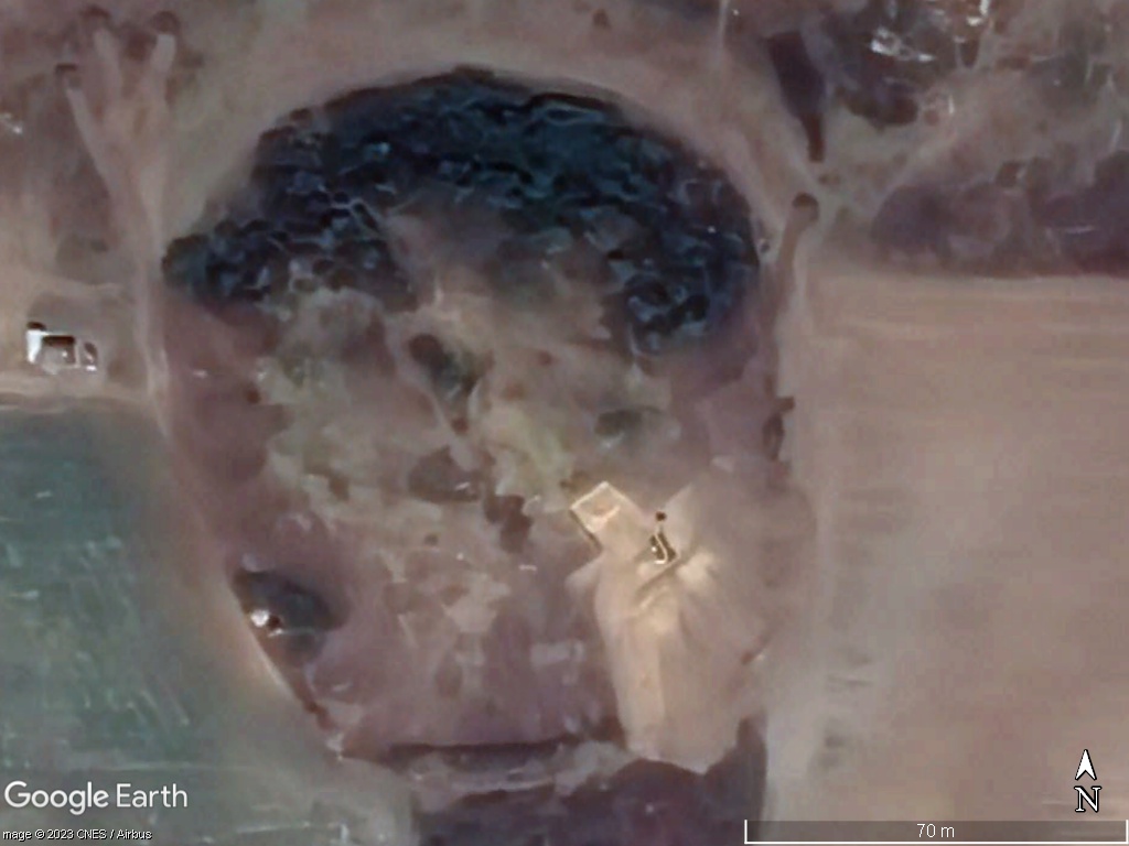
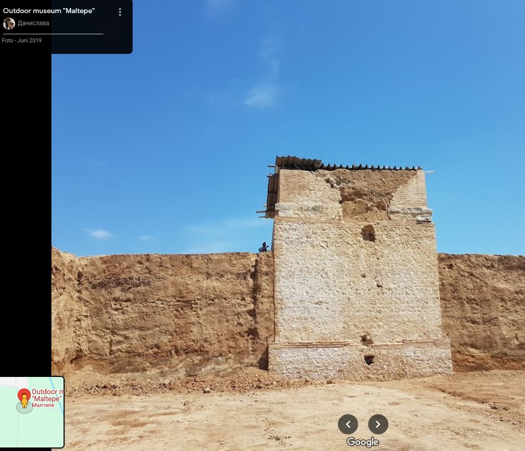
The Maltepe Mound is already present in the collection, but only with a marking without a legend. But it deserves to be described in more detail because it is a rarity. Located in the village of Manole near Plovdiv, it is the largest hill in Bulgaria with a height of 26 meters and a diameter of 140 meters. The size of Maltepe suggested that it is the tomb of a very important Thracian noble. In the 2010s it was decided to excavate the mound, which took place in 2016. What was discovered actually made headlines and was a surprise that no one was prepared for. The 80,000 cubic meter Maltepe Mound contains no graves, grave goods or human remains. Instead, there is a massive structure made of stones in the middle. Its size is remarkable: it is 23 meters high and each side of its square base is 9 meters long. No such structure has ever been found in an ancient Thracian hill. Suddenly, the identity and intentions of Maltepe Mound's creators became a mystery. The structure in the middle of Maltepe Hill is not a tower. It does not contain any rooms. Instead, the entire massive structure is filled with stones. Archaeologists have discovered about a dozen pits dug into the mound containing artifacts dating back to the 3rd century AD that were likely placed there as part of religious rituals. A two meter high wall of stones surrounded the hill and ensured its stability. According to the most plausible explanation, the stone structure was the foundation of a gigantic sculpture that once stood on the top of Maltepe. 42.174374° 24.938832°
|
|
Master Cartographer
April 2015 - Nov 21, 2024 8:06:11 GMT
|
Post by syzygy on May 15, 2024 10:33:57 GMT
Major updates on Kazakhstan, Russia, China (NEW - Chinese Pyramids subfolder with 388 placemarks), Mongolia and England also a few more additions to Hungary and Serbia.
9510+ placemarks added
--
Updated kmz file attached to OP.
|
|
Junior Member
September 2021 - Sept 23, 2024 14:04:01 GMT
|
Post by buildsancient on Sept 23, 2024 14:04:01 GMT
Will have a gander. KAZ is always good fun.
|
|


