Trusted Member
Master Gamer
January 2021 - Sept 16, 2024 14:34:07 GMT
|
Post by dagger66 on Jul 19, 2024 19:48:15 GMT
A city and municipality where Four major battles were fought, and Three Battles were given the area's name. Two in the 1600's, one in the 1700's and another which was a tank battle in WWII southwest of the city. One of these battles led to the permanent loss of the Austrian Netherlands and to the destruction of the Dutch Republic.
Street View.
|
|
Master Gamer
April 2015 - Sept 16, 2024 19:16:53 GMT
|
Post by Walter_V_R on Jul 19, 2024 20:08:25 GMT
|
|
Trusted Member
Master Gamer and Scrutiniser
April 2015 - Sept 16, 2024 19:43:53 GMT
|
Post by krenek on Jul 19, 2024 20:32:26 GMT
|
|
Cartographer
April 2015 - Sept 15, 2024 17:25:13 GMT
“ Armchair Traveller - Love to Roam Google Streets - 8 Star Local Guide of Google Maps „
|
Post by CuriousJM on Jul 20, 2024 9:49:40 GMT
|
|
Trusted Member
Master Gamer
January 2021 - Sept 16, 2024 14:34:07 GMT
|
Post by dagger66 on Jul 22, 2024 13:38:04 GMT
CLUE
{Spoiler} Church in the city. 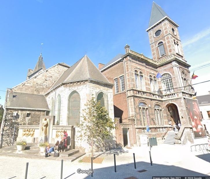 |
|
Trusted Member
Gamer
April 2015 - Sept 16, 2024 17:21:45 GMT
|
Post by why2k on Jul 22, 2024 16:23:19 GMT
|
|
Trusted Member
Master Gamer
January 2021 - Sept 16, 2024 14:34:07 GMT
|
Post by dagger66 on Jul 28, 2024 12:35:08 GMT
ANSWER
{Spoiler}
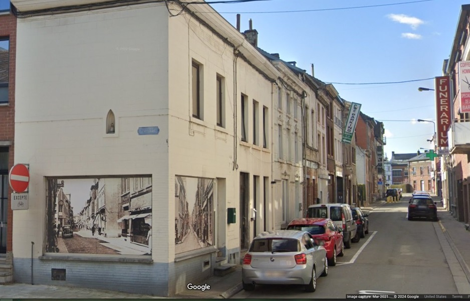
Corner of Rue de la Station and Rue des Rabots
N567 70, 6220 Fleurus, Belgium
50°28'59.1"N 4°32'49.2"E
Besides the WWII tank battle there are:
The Battle of Fleurus (1622) in the Thirty Years' War.
The Battle of Fleurus (1690) in the Nine Years' War.
The Battle of Fleurus (1794) in the French Revolutionary Wars
|
|