Master Cartographer
April 2015 - Nov 21, 2024 8:06:11 GMT
|
Post by syzygy on Dec 5, 2019 11:32:47 GMT
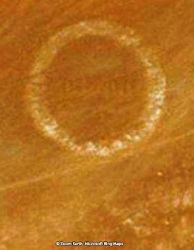
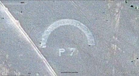
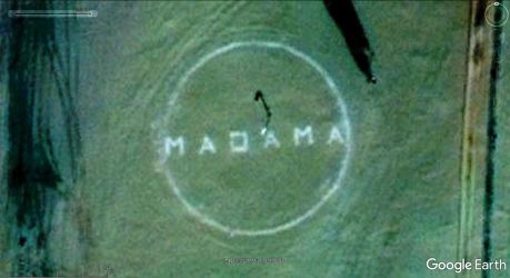
Original thread: "Unexplained sign buried under desert sand" Another strange spotting from the Mauritanian desert - I have pulled this one from the collection to discuss in a solo posting. Good (better) resolution imagery by BingMaps:  (Placemark for this one named "circle - Bou Dhib" included in attached kmz folder.) Any ideas, what the heck is this carved into (or piled onto) the bedrock under desert sands? (also note nice Barchan dunes around! One of the sand-pacmans is just about to consume the sign) (: (Really; the dune moves in the sign's direction to hide it for a while, until another sandstorm, that makes dune to step off the sign and to settle SW of it - only for a while again) It is far too perfect circle to be made by neolith guys, besides I cannot find any explanation for a modern origin either... - An ancient symbol, left here by aliens? Also even if I have already seen such somewhere... ah, mean not the power-button, ha ha ha! - Now really, what do you think? (No military target explanations, only if have proof please!) (: One thing makes suspicious, that it is some modern age structure - it's dimensions are round numbers in meters: diameter: 50 meters, central stripe: 20 meters. (probably some satellite calibration sign?) Thanks! g edit: By best bet now, it could have signed some landing area of a military base or training site around some (meanwhile dried out) water source and some of us started to see 9/21/43 inside, however followings might not affirm this. This is the last thing up; find a better resolution orto / aerial and solve inscription inside this first-find circle at Bou Dhib, Mauritania. Some info on what purpose it was built also would be fine! / Edit: - here some! (; Edit: Full explanation with printed proof here in this thread. - It is: BOU ZIBRead all thread for your pleasure, it was a thrill for all of us who have participated! *** Explanation: These are (were) navigational landmarks from the dawn of aviation in (French) colonial Africa.Most of the circles from Niger are next to Oases, where in each case name of the Oasis (settled site) can be read within the circles. These are Chirfa, Seguedine, Aney, Dirkou, Agadem and Fachi. The one at Adrar Madet Massif is the only exception, which is an empty circle (with compass-frame). [slide captionposition="1" wrapperstyle="padding:10px 0;border-top:2px solid #eee;border-bottom:2px solid #eee;width:650px;"]https://res.cloudinary.com/syzygy/image/upload/v1581674150/chirfa.circle_hvffex.jpg Chirfa res.cloudinary.com/syzygy/image/upload/v1581675543/seguedine.circle_zbswkf.jpgSeguedine res.cloudinary.com/syzygy/image/upload/v1581705688/aney.circle_qhw0uq.jpgAney res.cloudinary.com/syzygy/image/upload/v1581678155/dirkou.circle_vj1jwj.jpgDirkou res.cloudinary.com/syzygy/image/upload/v1581705998/agadem.circle_omd1ho.jpgAgadem res.cloudinary.com/syzygy/image/upload/v1582925305/fachi.circle.w_wgrbdz.jpgFachi res.cloudinary.com/syzygy/image/upload/v1582925306/ardar.madet.compass.per_dajhr2.jpgAdrar Madet Compass[/slide] *** Update 2020.02.20: 2 more from Mauritania has been spotted. [slide captionposition="1" wrapperstyle="padding:10px 0;border-top:2px solid #eee;border-bottom:2px solid #eee;width:650px;"]https://res.cloudinary.com/syzygy/image/upload/v1582199185/oujaf.circle_pcbgl5.jpg Oujaf res.cloudinary.com/syzygy/image/upload/v1582211233/idjil.circle_trfk5o.jpgIdjil[/slide] Update 2020.03.02: No11.: # The same 50 meters diameter circle with unreadable text inside at a drinkwater well, No.12.: # Toueirma half-circle from Mauritania and
No.13.: # The Madama circle from Niger: Update 2020.03.30.: Letfatar - Mauritana, Dao Timmi - Niger, + Gratis: 2 interesting landing strips Update 2020.03.31.: Tessalit - Mali Update 2020.04.14.: Bou Jertala - Mauritania (Off topic landing strip, built around 2010-2011, the site is a tourist attraction for quad (other desert vehicle) driving.) Update 2020.05.07.: Oued Rkeiz - Mauritania (Half circle with full set of "frame" features. - Credit: Yves Gauthiere) Update 2020.06.20.: Chegga - Mauritania (Classic sign and airstrips) and a small, 15 m diameter circle near to modern age earthwork scars, platform and road from Algeria (Nearest map reference 5 kilometers to N: Glebet Atores - Mountain peak. Tindouf, Algeria) - Credit: Yves Gauthiere Update 2021.02.05.: Timétrine - Mali (smaller, 20 meters diameter circle with dot at center, and the usual "off position" nav. markers) - Credit: chriss (check this post in this thread) Update 2021.06.29.: Many thanks for tafrawti and chriss , new Morocco folder added! 3, classic circle markers for Icht, Mirleft and Taroudant, the Akka airstrip and an unexplained '32' marker. *** Recent stage of updates: 25 landmark sites with outlined built structures (landing strip and other navigational signs) attached:KMZ download: >>> Aviation landmarks - Africa.kmz (44.1 KB) Attached kmz file only available here on the every-time "Live" GE Community Forums, which is now self-sponsored.If You make good use of this dataset, please donate our community! Thank You! |
|
|
Master Cartographer
April 2015 - Nov 21, 2024 8:06:11 GMT
|
Post by syzygy on Dec 5, 2019 21:01:40 GMT
As I keep staring this, the more I see characters inside and the more I become curious, whadda round hell is it...!? 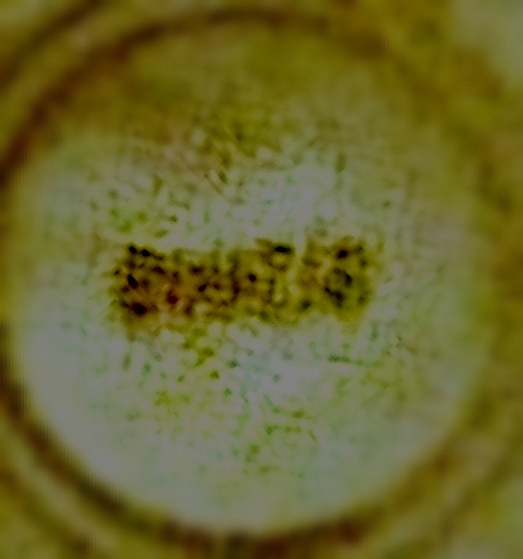 |
|
Master Gamer
April 2018 - Nov 20, 2024 20:32:38 GMT
|
Post by willi1 on Dec 5, 2019 21:23:48 GMT
Strange, very strange ! It's not a image error, I think. And it's artifical, I'm sure. Satellite calibration sign I exclude, too much sand drifting there. Currently not idea, may be tomorrow.
|
|
Master Cartographer
April 2015 - Nov 21, 2024 8:06:11 GMT
|
Post by syzygy on Dec 10, 2019 9:28:46 GMT
still nothing, only have checked ArcGIS imagery where crescent dune already has passed the sign:  also I keep this post "bumped" this way - sorry; I need to know, what it is....! (: |
|
Master Gamer
April 2018 - Nov 20, 2024 20:32:38 GMT
|
Post by willi1 on Dec 10, 2019 12:10:27 GMT
Since the barkhan dune have wandering over it, I also exclude fragile constructions such as animal enclosure. The light distribution could point to a flat dome. But what is he doing here? Of course, can also be fooled. And the structure in the circles remember of Chinese characters ?  |
|
Trusted Member
account is disabled
“ Google Maps | Google Sky | Google Mars „
|
Post by ET_Explorer on Dec 17, 2019 11:36:14 GMT
|
|
Master Cartographer
April 2015 - Nov 21, 2024 8:06:11 GMT
|
Post by syzygy on Dec 17, 2019 12:16:00 GMT
I believe its a stamp on the image that wasn't removed... it appears on various satellite imageries provided by various satellite companies. - It is visible by various imagery dates, on various map engines. - Barkhan dunes come and go and it stands still...!? Also notice dune horn and arch is (slightly) overlaps it on Bing and ArcGIS images, thus it cannot be a stamp or any additional marking on imagery. *** Thanks for response anyway! - I just cannot sleep well since I have bumped into this... ... instant edit:4 th map engine with one another imagery. Considering dune position -as it overlaps sign a bit more-, it must have been taken not long before the ArcGIS image. - YandexMaps link Does it look convincing enough for you to drop stamp concept? |
|
Trusted Member
account is disabled
“ Google Maps | Google Sky | Google Mars „
|
Post by ET_Explorer on Dec 17, 2019 15:02:39 GMT
I have ask somebody on Facebook who may be from this region what this could be? Here is a Zoom Earth Link without going to Bing of this anomaly > Zoom Earth |
|
Master Cartographer
April 2015 - Nov 21, 2024 8:06:11 GMT
|
Post by syzygy on Dec 17, 2019 17:03:45 GMT
ZoomEarth time-slider gives more great images of the sign and dune movements. - Check october 2016 (!) Thanks ET_Explorer sheding light on this other great map tool! In the unedited previous reply of mine I wrote an asking for you and Admin to put this out on the fresh air on Facebook, now I glad to see, you have thought the same. - Great chance for it can only be solved by some "in-situ" information... *** Instant edit:ET might have served some solving! (?) I have made a screenshot sequence GIF, or you just click through all dates and see: the sign is in the very center of each image! Does not that mean, it is a satellite reference point?! (Also diagonal bar or text inside as a direction indicator?) At least damn good to study dune dinamics around...! illustration gif: (dune velocity approx.: 25 meters / year)  gif credit: ezgif.com # maps credit: ZoomEarth(tiny oscillation is due to my freehand cuts of frames) *** also check dune migration around the location on GE Timelapse |
|
Master Cartographer
April 2015 - Nov 21, 2024 8:06:11 GMT
|
Post by syzygy on Dec 18, 2019 22:09:20 GMT
Also right now I have noticed two other permanent, artificial features - the two, small "L" shapes (one is mirrored) or "frame corners" on the right and left side of the image:  Now are we closer to the solution with these...?  |
|
Master Gamer
April 2018 - Nov 20, 2024 20:32:38 GMT
|
Post by willi1 on Dec 19, 2019 11:29:33 GMT
Yeah right. On the top left is another such marker (built from loose rubble?), The fourth is probably covered with sand. The geometry is not very exact. I guess these markers are used to find the target when it is buried in the sand. Until 1958, Mauritania was still part of the French West Africa colony. Can this be a starting point?Assumptions on my part: nuclear weapons test site, repository for nuclear waste ... |
|
Master Cartographer
April 2015 - Nov 21, 2024 8:06:11 GMT
|
Post by syzygy on Dec 19, 2019 13:13:48 GMT
and HERE (ZoomEarth link) all 4 corner marks are visible!  still no regular geometry, nor the sign is in center... also I do not think it would be a result of "misengineering"...! ...even before 1958 (, even it probably been made by french...*) (; ... p.s.: *Sorry for bad joke! - I do appriciate french engineering. ...at least they have did some better work in Paris than this one from Csongrád:  see "Eiffel Tower" of the Csongrád Coast Guards on GMapsSV (: |
|
Master Gamer
April 2018 - Nov 20, 2024 20:32:38 GMT
|
Post by willi1 on Dec 19, 2019 13:51:09 GMT
|
|
Master Cartographer
April 2015 - Nov 21, 2024 8:06:11 GMT
|
Post by syzygy on Dec 19, 2019 14:00:48 GMT
yep, ...probably ...only it is less than half in diameter, even does not looks a "buit-in" structure for me... and the "text" of the diagonal bar? - if I would set up a nuclear repository, than no way I would label it...! (: ... |
|
Master Gamer
April 2018 - Nov 20, 2024 20:32:38 GMT
|
Post by willi1 on Dec 19, 2019 14:20:55 GMT
There is also the variant of an unearthly letter ... 
|
|
Trusted Member
Master Gamer
April 2015 - Nov 11, 2024 15:26:59 GMT
|
Post by ndrqu on Jan 6, 2020 15:01:48 GMT
I got the PM, it's the first time I read this topic, I may know what that is. But I am on my phone so I am not able to do an accurate checking. I have seen something similar in North Africa times ago, there were many similar marks carved in the desert, after some researching it came out they were artificial markers for parachuting training. This is a bit different because it's just one big marker, and it has the others "L" additionally marking it, but the same concept came to mind. So my take is: it could be a marker for a landing site of aerial delivery... The marker is clearly carved in solid rock while sand dunes eventually cross onto it As I said I can't do any research now but maybe I give you an idea 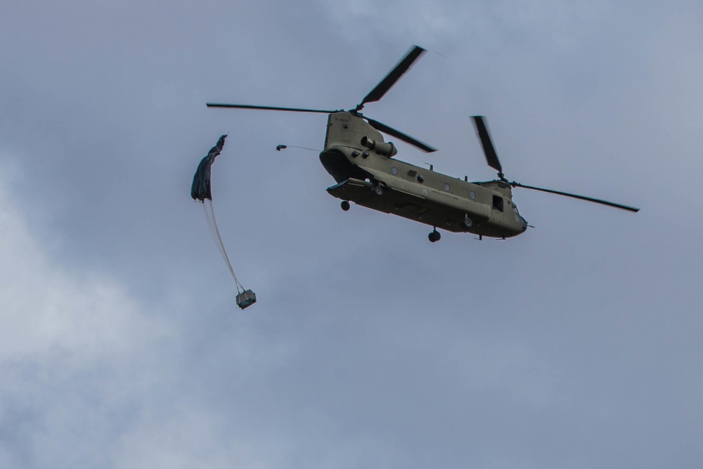 |
|
Master Cartographer
April 2015 - Nov 21, 2024 8:06:11 GMT
|
Post by syzygy on Jan 7, 2020 8:04:30 GMT
... it could be a marker for a landing site of aerial delivery... hi! thanks for calling in! Well, there is a signed road on several maps, NE of the sign and really, section of a path is visible one kilometers to NE, however I have seen less signs of human presence in the wider area for whom any goods could be delivered... (next "bigger" populated places are Tichit and Walatah, cca. 150-150 kms to W and SE) 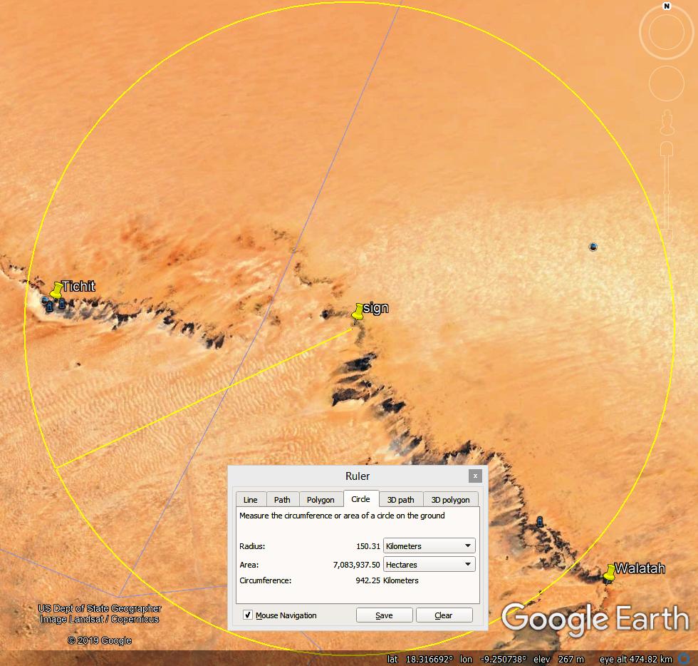 ...eh! I look at its dimensions and "design" (the "text"(?) inside), the barren and remote location, and just cannot imagine all this fuss would be needed for such an aerial delievery point right there... with the targeting "L"-s and the road nearby still your concept makes sense - thanks for response! |
|
Trusted Member
Master Gamer
April 2015 - Nov 11, 2024 15:26:59 GMT
|
Post by ndrqu on Jan 7, 2020 9:07:32 GMT
You are right, the distance from the closest village is too much for humanitarian delivery. But perfect for military training. It could also be a one-time airdrop training. mr.usembassy.gov/flintlock-2019-announced/I have found this "Flintlock mission" which is a african-led conjointed training of forces of many african countries, with the support of Unites States and other western countries. This mission is annual ( still didn't understand when it started UPDATE: since 2005 ) and every year it's made in different countries. Mauritania could may be the host some years in the past. The traning includes airdrop missions, you can find the proof here: commons.wikimedia.org/wiki/Category:Flintlock_2017Flintlock in 2017 was made in Chad and it included airdrop training in the desert, you can see the picture of it. Still can't find the definitive proof but I am confident this is the correct path to the solution Do we know when the symbol first appeared?  UPDATE 2: UPDATE 2: I have found this wikipage with all the list of Flintlock trainings: commons.wikimedia.org/wiki/Category:Flintlock_(military_exercise) I will investigate those as soon as I can! Have a look in the meanwhile if you wish |
|
Master Cartographer
April 2015 - Nov 21, 2024 8:06:11 GMT
|
Post by syzygy on Jan 7, 2020 10:14:53 GMT
...Do we know when the symbol first appeared?... proper resolution imagery available from 2012 on ZE (ZoomEarth) and still I could not find any alternative imagery source... do not know why, but I think its somewhat older and one should find the answer on the "French colony era" line... (mentioned by willi1) I was not been a soldier, but I think a military training site should to have other identifieable features around, than a "simple" parachute target, does not it? (much more tracks and other surface distrurbances, ranks, buildings, etc...) (?) (probably these are has gone with the wind meanwhile) ... |
|
Trusted Member
Master Gamer
April 2015 - Nov 11, 2024 15:26:59 GMT
|
Post by ndrqu on Jan 7, 2020 10:26:53 GMT
...Do we know when the symbol first appeared?... proper resolution imagery available from 2012 on ZE (ZoomEarth) and still I could not find any alternative imagery source... do not know why, but I think its somewhat older and one should find the answer on the "French colony era" line... (mentioned by willi1 ) I was not been a soldier, but I think a military training site should to have other identifieable features around, than a "simple" parachute target, does not it? (much more tracks and other surface distrurbances, ranks, buildings, etc...) (?) (probably these are has gone with the wind meanwhile) ... I don't believe that symbol dates to the French colony era. It's a flat, windy and sandy desert (deflation zone: erosion is very high at this conditions en.wikipedia.org/wiki/Aeolian_processes ), and the symbol is still very sharp. In 70 years I would expect it to be atleast eroded a bit... In my opinion this isn't older then 20 or 15 years. But still have no proof supporting this, just opinions. Regarding the military structures, that's not mandatory. If it's a one time training for parachuting / airdrop, there's no need for an effort like that. It's just an airdrop training, any structure is temporary. Disturbances on the ground, wheel paths, etc, if made 20 years ago, are long gone... |
|
Master Cartographer
April 2015 - Nov 21, 2024 8:06:11 GMT
|
Post by syzygy on Jan 7, 2020 11:37:39 GMT
thanks for all efforts ndrqu trying to put things right around this one! - quite acceptable reasonings and good detective work there! ... now I think it can only be an entrance to an underground UFO base made by aliens and it opens wide as "text" turns parallel to the equator! ...(: ... phew... whether we could get any sharper view of that...! |
|
Trusted Member
Master Gamer
April 2015 - Nov 11, 2024 15:26:59 GMT
|
Post by ndrqu on Jan 7, 2020 11:42:09 GMT
thanks for all efforts ndrqu trying to put things right around this one! - quite acceptable reasonings and good detective work there! ... now I think it can only be an entrance to an underground UFO base made by aliens and it opens wide as "text" turns parallel to the equator! ...(: No problem! I like investigating these things. I'm open for other explaination if anyone has an idea  Nice idea the underground UFO base... but maybe it's just the World's bathtub drain hole?  |
|
Master Cartographer
April 2015 - Nov 21, 2024 8:06:11 GMT
|
Post by syzygy on Jan 7, 2020 11:45:14 GMT
... maybe it's just the World's bathtub drain hole?... yeah, I have noticed similarity too! (: ... phew... whether we could get any sharper view of that...! |
|
Master Gamer
April 2018 - Nov 20, 2024 20:32:38 GMT
|
Post by willi1 on Jan 7, 2020 12:16:45 GMT
The annual exercises of the United States Africa Command take place in the Sahel Zone (light blue in the overlay). Our mysterious place is on the edge of this. Could fit. Flintlock 2019 took place in Mauritania. A military maneuver could be as follows: Airborne parachutists and loads in the target area. Task: to get to the next bigger place (Nema, about 200 km as the crow flies). There is a well-developed airfield there. Return from Nema (maybe to Nuakschott). But it's just a thesis of mine. Attachments:Nema.kmz (700 B)
|
|
Master Cartographer
April 2015 - Nov 21, 2024 8:06:11 GMT
|
Post by syzygy on Jan 7, 2020 12:35:00 GMT
however "text" direction does not fit direction to Néma, still it is a good thesis willi1 ! (; - thanks for digging deeper in the sand!(:  ... somewhat spooky, that hungarian word Néma means Mute (person, unable to speak)...! oh-ooh...(: |
|
Master Gamer
April 2018 - Nov 20, 2024 20:32:38 GMT
|
Post by willi1 on Jan 7, 2020 12:48:57 GMT
however "text" direction does not fit direction to Néma Does not have to be text. Maybe a camp ? |
|
Master Cartographer
April 2015 - Nov 21, 2024 8:06:11 GMT
|
Post by syzygy on Jan 7, 2020 21:57:00 GMT
Did another try with the "text-camp", pity both resolution and my photo editor skills are on low level enough, not to get any closer...) ;  Only if that now the more I think, "this is written". (: |
|
Cartographer
April 2015 - Nov 3, 2024 2:30:25 GMT
|
Post by washi on Jan 8, 2020 2:57:08 GMT
I didn't so much as "find" the "Post No Bills" image on Mars, as I created it for those unwilling to apply Occam's Razor. Anybody who doubts that should carefully examine the KMZ that contains the placemark, or more simply examine the site without the KMZ enabled. |
|
Full Member
Collection Editor
April 2015 - Oct 20, 2024 12:04:54 GMT
|
Post by Neil on Jan 12, 2020 15:54:14 GMT
I'm impressed with the work that you have all put in to this "unknown" in the desert.
So I thought I would go down a different route after a bit of elimination.
Temples/Burial Mounds - Many examples can be found most in a ruinous state and as such they do not form perfect shapes any more. There is always signs of the building so just seeing perfect foundations is most unlikely. There are a few examples of mud buildings that were built on a concrete (yes the word has been around a long time) foundations. But none this large or perfectly round.
Then there s the Royal Mausoleum of Mauritania (Actually in Tunisia) That is built on a square foundation but is a round dome like structure. The base however is only just wider than the diameter of the dome. The "L" corners are far larger than our circle.
Interestingly if you drew a diagonal line through the square base, then it is only slightly off the line in our circle!
Ksouls and villages built around them. - These are along the old Saharan Trade Routes and again mostly ruins with a few modern structures. These feature walled individual compounds, and whilst many do not have perfectly Square or Rectangular walled enclosures, none are as big as ours or containing anything remotely circular.
They also predominantly have buildings that utilise the walls of the compound. Ours only has "L" markers and neither the remains of a wall or remains of any other buildings.
What I know of 60, 70 and 80's Satellite Calibration - If it was required and the location of it was not directly under the path of the satellite, then that might explain the slightly misshape of the rectangle when the "L's" are joined up. However that would also mean that the circle would be elliptical to counter the angle of view from said Satellite. Here we have a perfect circle.
So ruins are out, memorial/burial monument/mound is out (Circle to clean) and Satellite calibration is, for me anyway, out. More modern satellites have far more complicated certification markings that leaves us with something that is not ancient but not new.
I also did a quick search or Forts. Whilst many contain circular towers and walled sections, none are round! It certainly seems like the Legion were not fond or rounds ones.
I would like to rule out aliens as they only seem to like to kidnap stupid subjects and do crop circles. Not make perfect circles with uneven L marker boundaries.
What others have ruled out are, Military Jump Sites, military camps and humanitarian efforts.
So my conclusion is Target.
Specifically Nuclear Bomb target. These are not live warheads and the tests are solely used to determine guidance accuracy.
My proof is non existent but hopefully these points will clarify my thinking.
Remoteness - In the early days of accuracy it was, well, not accurate. Here there is very little chance of hitting anything other than sand and rock. It also helps that no-one will see what you are doing.
In the 50's the only Nuclear weapons that France possessed were air dropped bombs. This location makes for an ideal location.
A target that will last - Carving a target in rock (proof by the dune movement) means that it will remain in place for quite some time and survive multiple hits.
Monitoring the accuracy - The team of scientists/engineers could arrive by road and then travel a short(ish) distance off road. Set up camp and monitor the drop(s) and then pack up and leave again. No permanent camp to draw attention to the tests.
However I can't explain the angle of the line within the circle but the outlying "L's" could have been added as a makeshift addition at a later date for reasons that might not be immediately apparent an also explain the lower accuracy! Maybe!
Well that is my tuppence worth.
One final point when it came to French ICBM re-entry testing in the 60's and 70's, Mauritania had already gained independence, so I'm also ruling that out!
|
|
Master Cartographer
April 2015 - Nov 21, 2024 8:06:11 GMT
|
Post by syzygy on Jan 12, 2020 21:57:52 GMT
Thank you Neil for detailed and thought awakening response! Nor the faintest idea I have about "false-bomb" testing (dropping the bombs without nuclear warheads), but not only the impact itself should to make deep scars (crater) enough to remain visible by this resolution of imagery? - As far as I know nuclear bombs are not small anyway. (?) But... What if those bombs yet were equiped with live warheads, only for above-ground detonations tests and not for impacts? (see: Air burst on wikipedia) For all the time I have the feel that as if all this double ring and diagonal "text" within once were molten and roasted crispy... ? ... I'm impressed with the work that you have all put in to this "unknown" in the desert. ... I have never learned to stay calm when finding no-info-oddity on imagery, but the level of curiosity by this one really is surprising me. (as if it would became an obsession) I have put aside all my mayor GE stuff and my only goal right now is to find something for sure about this site, "read the text" (get hi-res image of the something somehow) inside the circle and brake the seal of mistery at last...! O: ...(: thanks all efforts guys! |
|

 ,
,  ,
, 

 ,
,  ,
, 


