Master Cartographer
April 2015 - Nov 21, 2024 8:06:11 GMT
|
Post by syzygy on May 18, 2018 11:22:24 GMT
next to the site where MV Smart sank, I have spotted a row of underwater sources emitting some "other stuff" than simple disposed sewage. strange phenomena can be seen by various imagery dates from 2005 up to 2015. Richards Bay diffuser (South Africa) - an example GE screenshot by a maximum level of emission:  what it is? -can be pollutant? -sewage? -or some harmless sediment departure process from the heavily shipped bay-waters? -have never seen such before... ...amongst the many other things...(: *** After some search on the net turned out, that these are Marine outfalls - diffusers - check thread below for more in update posts! All the further GE locations contributed I will add to kmz folder attached to this original posting (OP). Recent stage of updates: 8 locations of emission Marine Outfalls Diffusers.kmz (4.59 KB) |
|
Master Gamer
April 2018 - Nov 20, 2024 20:32:38 GMT
|
Post by willi1 on May 18, 2018 11:55:38 GMT
Could the sunken part of the MV Smart cause? But not before 2015. Strange.
|
|
Master Cartographer
April 2015 - Nov 21, 2024 8:06:11 GMT
|
Post by syzygy on May 22, 2018 8:10:14 GMT
I think have find something: sapeolple.com article reports South-African sewage problems while describes underwater sewage outfalls or diffuser ports. I have placemarked 3 more sites of emission by Cape Town coast, also included OP's site as it seems to fit into story, all set to best imagery dates. T able Bay Diffuser is one of them:  ... updated kmz folder attached to OP.*** instant edit:Two more sources ( PDF.file#1 from a lecture on lth.se // PDF.file#2 on springer.com) convinced me, question mark can be omitted, and PressReader.com article has put it to an end with further sites along South Africa coast, Richards Bay included. This latter source gives also measures and details of the waste water spilled in the ocean (domestic/oil-industry/chemical/etc.): Only "the city of Cape Town marine outfalls can discharge up to 55 million litres of waste water a day."
Longer list of Marine outfalls worldwide on Wikipedia. Further locations are welcome in this thread! Thanks! g |
|
Master Cartographer
April 2015 - Nov 21, 2024 8:06:11 GMT
|
Post by syzygy on Apr 18, 2019 12:32:50 GMT
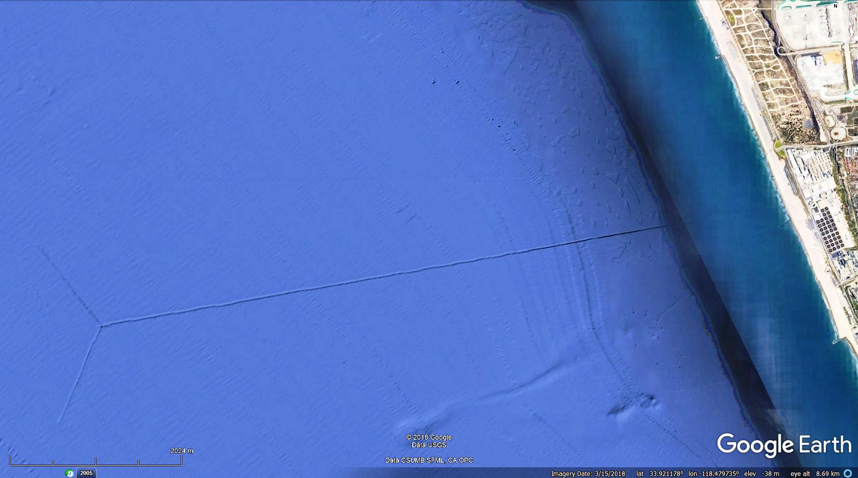
Cool link (about a system inspection from 2006), for the Santa Monica "Hyperion" Outfall System: sccoos.ucsd.edu/projects/hyperion/Giant Y structure of the new pipeline: (parameters in "lines" subfolder)  Cloaca Santa Monica: Cloaca Santa Monica:
 ... updated kmz folder attached to OP. |
|
Master Cartographer
April 2015 - Nov 21, 2024 8:06:11 GMT
|
Post by syzygy on Apr 25, 2019 8:34:55 GMT
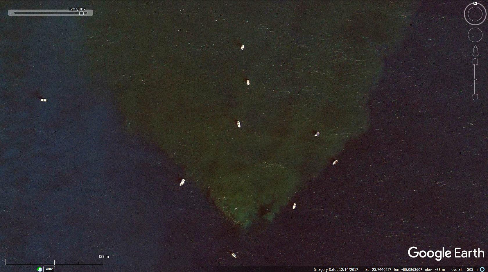
Some 5700 meters offshore Virginia key, Miami - marine outfall keeps spilling sewage into the ocean. Note group of fishing-boats around the sewage upstream! -Why? Better catch? Brrr...!   Do not forget to check GE Timeslider! - The upstream and the boats are visible by several imagery dates. Also one can count the 5 diffuser-heads (pipe-ends) at 4/11/2012 imagery date:  further read: flccim.com
... updated kmz folder attached to OP. |
|
Master Cartographer
April 2015 - Nov 21, 2024 8:06:11 GMT
|
Post by syzygy on Apr 25, 2019 12:39:39 GMT
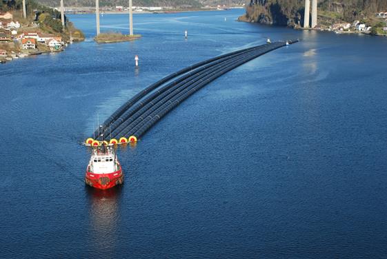
outfall pipeline under construction (GE imagery, 6/29/2018):  read full article at anthonybates.co.uknow only one thing is missing to set up a perfect post: tow should to be spotted on GE! (: ... updated kmz folder attached to OP. |
|
Master Cartographer
April 2015 - Nov 21, 2024 8:06:11 GMT
|
Post by syzygy on Mar 9, 2022 16:07:52 GMT
File updated with monster emitters of Callao - Lima, Peru. High performance diffuser 3.5 kilometers off the shores and numerous "smaller" outfalls placemarked. (double click on each brings you to a proper imagery date)  -- Updated kmz file attached to OP. |
|


