

Post by washi on Apr 13, 2015 2:09:13 GMT
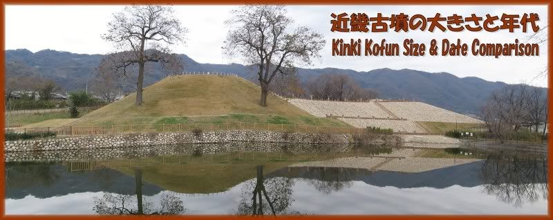
Kofun are the monumental mausolea constructed for the leaders in ancient Japan. These enduring structures continue to dot the landscape throughout most of Japan, and nowhere are there more than in the Kinki Area (Nara-Osaka-Kyoto) where I live. They are usually not high on the "things to see" lists of foreign visitors, but for many Japanese living among them they are a fact of daily existence. I suppose many people take no more note of them than features of the natural environment, but many others have a keen interest, consuming countless books on the subject and creating rather splendid internet sites. (I like to call these people "kofunies," but I believe the correct Japanese term is "kofun-baka".) As a foreigner, I may never become a true kofun-baka, but I have to confess to a fascination with these enduring structures that I live among and which reveal so much about the roots of the Japanese nation.
This file grew out of my desire to understand a size and construction date chart made by one of Japan's most eminent archeologists and copied from a recently published book. I have translated and slightly modified this chart, and used it as a departure point from which to visit each of the tombs listed. I am always interested in exploring the potential of the Google Earth tool in displaying complex information, and I believe the format I have used may be a model for constructing a kind of visual database, although the data displayed in this case is minimal.
The file was made on my Windows computer, using a wide-screen monitor. I am uncertain that it will work equally well on all platforms, but I am willing to try to make adjustments if anyone will send me feedback about problems they encountered and what platform they were using. (Specifically, I know that the "fly to" feature that is essential to the use of this file works on some Macintosh computers, but not on others, but I don't have access to a Mac and I don't understand why it fails on some.)
I wish to thank Mr. Yukishige Hirose, curator at the Osaka Chikatsu Asuka History Museum, who took time from his busy schedule to answer many questions, and especially my friend Mr. Toshiyuki Yoneda and GEC moderator Noisette, both of whom I pestered constantly throughout the making of this file with questions and requests for help and advice.
This video was made for people who are unfamiliar with Google Earth Pro. Experienced users will find much of the presentation tedious, but may find the section on how to use the Navigation Guide and the Chart (5:50 - 14:50) helpful in understanding some of the features of this file.
 EnglishJapanese
