Master Cartographer
April 2015 - May 7, 2024 20:50:16 GMT
|
Post by syzygy on Apr 5, 2016 9:04:19 GMT
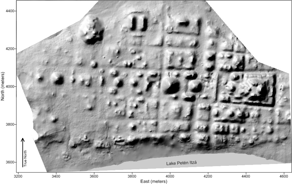 Archaeologists have mapped an early Mayan city, revealing the city used a rigid grid system with the main ceremonial way aligned east to west. Credit: Image courtesy Timothy Pugh An ancient Mayan city followed a unique grid pattern, providing evidence of a powerful ruler, archaeologists working at Nixtun-Ch'ich' in Petén, Guatemala, have found. The city, which contains flat-topped pyramids, was in use between roughly 600 B.C. and 300 B.C., a time when the first cities were being constructed in the area. No other city from the Maya world was planned using this grid design, researchers say. This city was "organized in a way we haven't seen in other places," said Timothy Pugh, a professor at Queens College in New York. "It's a top-down organization," Pugh said. "Some sort of really, really, powerful ruler had to put this together." The ancient Mexican city of Teotihuacan also used a grid system. But that city is not considered to be Mayan, and so far archaeologists have found no connections between it and the one at Nixtun-Ch'ich', Pugh said. People living in the area have known of the Nixtun-Ch'ich' site for a long time. Pugh started research on it in 1995 and has been concentrating on Mayan remains that date to a much later time period,long after the early city was abandoned. However, in the process of studying these later remains, his team has been able to map the early city and even excavate a bit of it. read full article at livescienceMayan city - Lake Petn Itz Guatemala.kmz (744 B) another great article at archaeology.org |
|

