

Post by washi on Apr 19, 2015 18:28:38 GMT
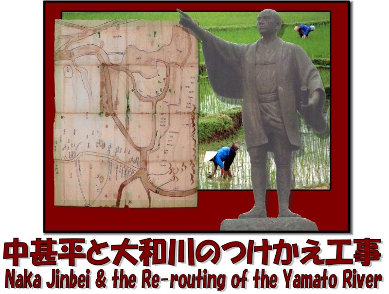
Naka Jinbei (pronounced “Jeem bei”) (1634 – 1730) was commissioned by the shogunal government to design and execute a project to re-route the Yamato River, which had flowed through the Kawachi area east of Osaka. This was done to prevent flooding and to bring new land under cultivation. He accomplished this remarkable feat in just 8 month, in 1704, when he would have been about 70 years old. (Let's hear it for the senior citizens!) This post illustrates that undertaking. It contains outline maps of the 40 large parcels of land, acquired mostly by wealthy businessmen living in the merchant city of Osaka.
The re-routing of the Yamato Delta had large historical consequences. It did, indeed, reduce flooding in the low-lying areas of Osaka and the Kawachi area, which was the stated reason for undertaking the project. Many of the investors in the newly opened land increased their vast fortunes. I have no proof (but little doubt) that the shogunal officials who authorized the project were also sufficiently rewarded by the investors for their favorable decision. An important transportation corridor was lost to the people in northern Kawachi, and eventually, one of Japan's most important deep water ports was silted up. The small streams that replaced the rivers became much easier to ford and bridge, thus increasing the intercourse between the opposite sides. Cotton production and manufacture became the major economic force in the area for the next two centuries, and the estates themselves became not only economic centers, but cultural centers as well. The investors in many of these estates went on to establish banks, which in turn invested in companies, some of which have become global economic powers with names most users will recognize. hosting.photobucket.com/images/gg546/ge-washi/NakaJinbeiTitle.png
This presentation is mostly material I edited out of my post Kō no Ike Shinden Kaishō. It was not posted in the GEC Layer (except for a couple of placemarks from which it could be downloaded) because its principal content, the mapping of the 40 shinden, would not have appeared in the GEC Layer anyway, and most of the placemarks are merely labels for the maps I have drawn. Those that have labels in colored letters have additional content, which may be read by clicking on the map.
As I could not see anything that needed particular updating, I have not revised the attached file. Obviously, when one zooms in on the 3D Buildings imagery, the lines are sometimes difficult to see, but I couldn't see the point of going to considerable trouble of revising it just to remind the user to turn off the buildings.
 Download File
First posted November 11, 2007. Post last revised March 11, 2023.

