Cartographer
April 2015 - Apr 8, 2024 10:55:39 GMT
|
Post by washi on Apr 5, 2015 17:51:39 GMT
Because the map overlaid here is fairly accurate, many of the known locations line up with considerable accuracy. The map resolution is not too good, so I can't make out many of the geological label, and probably wouldn't much understand them if I could. Perhaps someday I may tackle the difficult job of making a further translation.
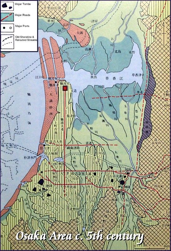
Several things interest me about the map. One is the extreme changes in the hydrology of the area. Another is the ancient roads, some of which still essentially exist, and which I have traveled.
The assistant priest at Tamatsukuri Shrine told me that the Tamatsukuri palace of the (probably 5th century) Emperor Nintoku is thought to be on the same Hōenzaka site as the later 7th and 8th century capitals, and that matches up perfectly. Other features like the kofun tombs of the Mozu and Furuichi Groups and Sayama Ike (Pond) are pretty much spot on, which gives me confidence that other things shown on the map that no longer exist (like the ports, for example) are accurately placed.

|
|


