Cartographer
April 2015 - Apr 8, 2024 10:55:39 GMT
|
Post by washi on Oct 24, 2015 14:06:38 GMT
Many years ago (in the old old GEC, I think) someone once posted an overlay which could be aligned by dragging the four corners independently. Until today, I never saw another example. (Even Hill, whose overlays are always impressive, said something once that made me think that he, too, was unfamiliar with the technique.)
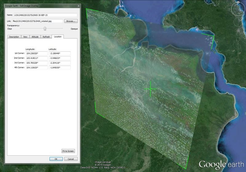
The Google Earth Blog published on September 23, 2014, Working with Landsat imagery, contains links to a KMZ file (bottom of blog) that has 3 overlays which are aligned by dragging the four corners. Using this method, one can better adjust the overlaid image to fit distortions in the GE imagery or get a closer approximation in overlaying a historical map (like Rumsy Historical Maps in the GE Gallery Layer). One can either copy one of the overlays into a text editor and substitute one's own data, or one can tick Properties, drag the original overlay to the location of the overlay you are creating, and enter the new title and the link to the new overlaid image.
|
|
Master Guide
March 2015 - Mar 28, 2023 13:20:41 GMT
|
Post by Noisette on Oct 26, 2015 22:51:56 GMT
Hi Washi,
When you create a new overlay, there is an option in the Location tab to "Convert to LatLonQuad". Is that what you mean? In fact the GEB post mentions it.
|
|


