Master Cartographer
April 2015 - Nov 24, 2024 12:20:42 GMT
|
Post by syzygy on Jul 4, 2017 13:06:08 GMT
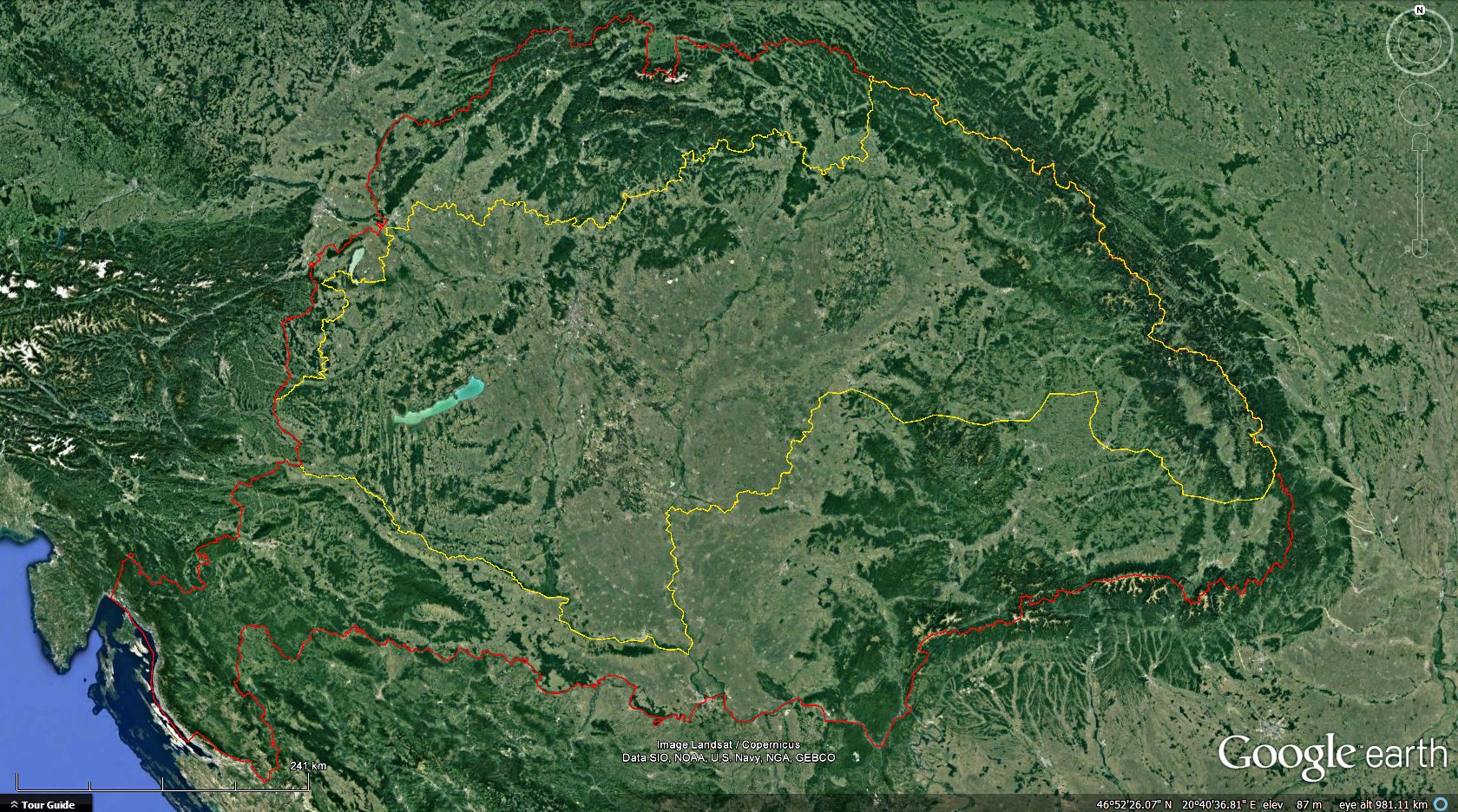
Advise to use this border line set for all
GE presentations about Historical Hungary. (Illustration screenshot image)Red line: (Illustration screenshot image)Red line:
borders of the 1000 years old Hungary. (Countries of the Holy Crown)  Image source: wikimedia commons by Hugo_Gerhard_StröhlThree lion heads: Dalmatia (upper left corner), Red-white squares: Croatia (Upper right corner), Image source: wikimedia commons by Hugo_Gerhard_StröhlThree lion heads: Dalmatia (upper left corner), Red-white squares: Croatia (Upper right corner),
Hexagram, two rivers, ferret: Slavonia (Left under), Sun and Moon, Turul bird, Seven fort: Transylvania (Right under),
Two headed bird: Fiume (Bottom), Árpád stripes, three mounds with crown based double cross: Hungarian Little Coat of Arms (Center)
Orange line:
borders of the Vienna awards, 1938-44. (accuracy not best in Transylvania)
also worth compare with distribution maps of the Hungarians.
Red border line sections are from a presentation by Szerémy Tamás
and shared on the former GEC forums by permission of him.
Last update of his kmz presentation (Hungarian)
could be downloaded as attachment of
THIS YouTube video by him.
Dataset might contain inaccurances. All feedback welcome!
Borders of Historical Hungary.kmz (55.43 KB) Attached kmz file only available here on the every-time "Live" GE Community Forums, which is now self-sponsored.If You make good use of this dataset, please donate our community! Thank You!
|
|
|
Newbie
September 2021 - Sept 25, 2021 15:20:09 GMT
|
Post by beizhen on Sept 24, 2021 16:11:29 GMT
thats very good
|
|


