Master Guide
March 2015 - Jan 20, 2022 4:27:51 GMT
|
Post by Hill on Mar 25, 2015 16:48:37 GMT
The "reality" series Ice road Truckers first made this mode of transportation widely known. The easiest and sometimes only way to move heavy loads to remote areas in places like Canada is to wait for lakes to freeze over with a thick layer of ice. Then without having to carve roads, which would become seas of mud in summer and need to be plowed over in winter, roads are created on the many lakes to move those loads relatively easily. Landsat Image Gallery provides downloadable imagery which could be used to create overlays. A a piece of the road is attached below. A kml file of a much larger area is accessible below the image.
 Segment of an ice road between Yellowknife and diamond mines in NWT, Canada (Landsat Image Gallery) Segment of an ice road between Yellowknife and diamond mines in NWT, Canada (Landsat Image Gallery)
Ice Roads in Canada.kmz (1.53 KB)
|
|
Master Guide
March 2015 - Jan 20, 2022 4:27:51 GMT
|
Post by Hill on Apr 8, 2015 21:43:47 GMT
Made much more well known by the documentary/"reality" TV show Ice Road Truckers, ice roads across Arctic lakes are visible in the screen capture. One is very wide and constructed for very heavy duty hauling of mining equipment that weighs too much or is far too bulky to get to the mines by air. A smaller narrower one wends its way south to the bottom edge of a single tile of satellite data captured during winter months.  Google Earth screen capture 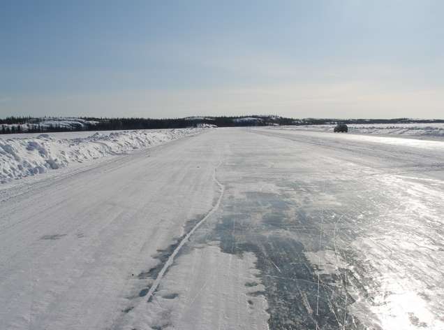 A Panoramio layer image of the 2008 Detah to Yellowknife ice road by rileyinyellowknife. This post has a good map of the route used during the first season of Ice Road Truckers. This is a copy of a post I made in oGEC in 2009 |
|


