Newbie
April 2016 - Apr 11, 2016 14:40:17 GMT
|
Post by jking on Apr 8, 2016 16:48:21 GMT
I have been trying to find an answer to this question for a while now, what i am looking for is to know if there is a way to export the "3D Buildings > Photorealistic" layer out of Google Earth so that it can be used in other 3D modeling software.
I work for a Civil Engineering firm and we create 3D Models of our projects regularly and the models are always missing the existing 3D features such as surrounding structures and vegetation. I am trying to find a way to get type of information from a software such as Google Earth so that i can use it in our models. I have tried to go the other way by bringing our proposed development layout into Google Earth, but as far as i know you can not edit the existing topology in Google Earth to show any proposed changes to the grade on a site.
If i should post this somewhere else on this forum, please let me know i would by happy to move my question if needed.
Thank you for any help you can provide,
Jking
|
|
March 2015 - Jan 23, 2023 9:58:32 GMT
|
Post by Admin on Apr 8, 2016 17:08:56 GMT
Hi, the short answer is no, you cannot download any of the layers. Even if you could it would be a breach of copyright. Sorry.
|
|
Cartographer
April 2015 - Apr 8, 2024 10:55:39 GMT
|
Post by washi on Apr 8, 2016 23:25:10 GMT
Hi jking, It's probably too obvious to be of any help, but you can change the grade, as long as it's higher, and your modeled structure is as well. I made this model before the days of the new 3D Photorealistic Layer, raising the grade so the higher elevation east pond would appear (as I suppose it once was) as a continuous moat. As you can see, it is high enough to cover the pond, and the trees on the sight as well. 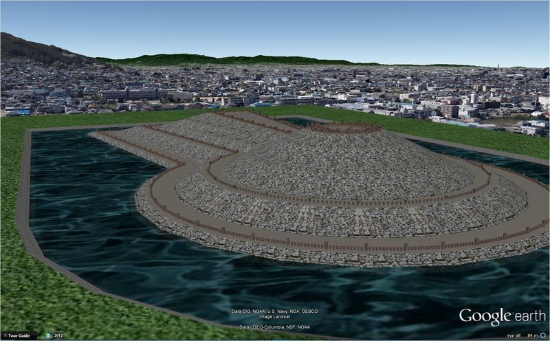 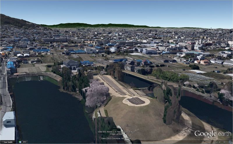 I believe, if I were you, I'd explore Photo Shopping a shot of the model into a screen shot of the GE 3D imagery. I suppose with appropriate attribution, that would not violate the Terms of Use of GE. washi |
|


